
List of prehistoric scheduled monuments in Powys (Montgomeryshire) facts for kids
}} Powys is the biggest county in Wales. It covers a huge part of eastern Wales. Powys is known for its wild uplands, small population, and no coastline. This area has been home to people for thousands of years. We can still see signs of their lives today!
This page is all about the amazing ancient sites found in Montgomeryshire. Montgomeryshire is the northern part of Powys. These special places are called scheduled monuments. They are protected by law. This means no one can disturb them.
There are 950 scheduled monuments in Powys. That's a lot! So, they are split into lists for different historic counties. This list focuses on the prehistoric sites in Montgomeryshire. Out of 303 scheduled monuments in Montgomeryshire, 190 are from prehistoric times.
- Only two are from the Neolithic period (New Stone Age).
- A huge 117 are from the Bronze Age. These are mostly burial sites. They also include standing stones and stone circles.
- There are 70 Iron Age hillforts, which were defensive forts.
The lists of scheduled monuments in Powys are:
- List of prehistoric scheduled monuments in Powys (Brecknockshire) (254 sites)
- List of Roman-to-modern scheduled monuments in Powys (Brecknockshire) (135 sites)
- List of prehistoric scheduled monuments in Powys (Radnorshire) (139 sites)
- List of Roman-to-modern scheduled monuments in Powys (Radnorshire) (119 sites)
- List of prehistoric scheduled monuments in Powys (Montgomeryshire) (190 sites - shown below)
- List of Roman-to-modern scheduled monuments in Powys (Montgomeryshire) (113 sites)
Scheduled monuments are protected by law. It is against the law to dig into the ground or move any old remains. Cadw Welsh Historic Monuments helps create this list. They are an agency of the Welsh Government. The information below comes from Cadw, RCAHMW, and Clwyd-Powys Archaeological Trust.
Contents
Discovering Ancient History in Montgomeryshire
Montgomeryshire is full of clues about how people lived long, long ago. These clues are called scheduled monuments. They help us understand the past.
What Kinds of Ancient Sites Can You Find?
People in prehistoric times built many different types of structures. Each one tells us a bit about their lives.
Burial Mounds: Barrows and Cairns
Many sites are burial places.
- A barrow is a mound of earth built over a burial.
- A cairn is a mound of stones.
- Round barrows and round cairns are circular. They were used for burials, often for important people.
- Long barrows are longer mounds. They are usually from the Neolithic period.
- Ring cairns are circular banks of stones. They might have been used for burials or ceremonies.
- Kerb cairns have a ring of stones around the base.
Mysterious Stone Circles and Standing Stones
These stone structures are very old.
- Stone circles are rings of standing stones. We think they were used for special ceremonies or to track the sun and moon.
- Standing stones are single, tall stones placed upright. Their exact purpose is often a mystery. They might have marked important places or routes.
- Stone alignments or stone rows are lines of standing stones. They could have been for rituals or to mark boundaries.
Ancient Homes: Hut Circles and Enclosures
These sites show us where people lived.
- A hut circle is the circular foundation of an ancient house. It shows where a round hut once stood.
- An enclosure is an area of land surrounded by a ditch or bank. People lived inside these areas. They also kept animals there.
Strongholds: Iron Age Hillforts
During the Iron Age, people built large, strong forts on hills.
- A hillfort is a large, fortified settlement on a hilltop. They had strong walls and ditches for protection. People lived inside them, and they were safe places during times of trouble.
Exploring the List of Sites
The list below shows many prehistoric sites in Montgomeryshire. It is sorted by how old the site is, then by the local community. This helps you find sites of similar age and location.
| Name | Site type | Community | Location | Details | Period |
|---|---|---|---|---|---|
| New House 'Long Barrow' | Long barrow | Churchstoke | 52°34′10″N 3°02′00″W / 52.5694°N 3.0332°W, SO300973 |
This was thought to be a Neolithic long barrow. But digging in 2012 showed it was a natural rock with some quarrying. No burials were found, but it is still a protected site. | Prehistoric /Modern |
| Cursus, Llwyn-Wron | Cursus | Welshpool | 52°38′07″N 3°09′33″W / 52.6353°N 3.1593°W, SJ216047 |
This site was found from pictures taken from the air. It shows a circular ditch about 20 meters wide. | Prehistoric (Bronze Age) |
| Careg Lwyd 800m ESE of Bwlch-y-Ffridd | Boundary stone | Aberhafesp | 52°32′52″N 3°21′30″W / 52.5478°N 3.3582°W, SO080953 |
Prehistoric |
|
| Llyn y Tarw Ritual Complex | Stone circle | Aberhafesp | 52°34′02″N 3°26′21″W / 52.5673°N 3.4393°W, SO025975 |
Prehistoric |
|
| Pen y Groes Uchaf Cairn | Round cairn | Aberhafesp | 52°34′27″N 3°25′48″W / 52.5743°N 3.43°W, SO031983 |
Prehistoric |
|
| Boncyn y Llwyn round cairn | Round cairn | Banwy | 52°41′07″N 3°31′11″W / 52.6853°N 3.5198°W, SH973108 |
Prehistoric |
|
| Cae'r Lloi Round Barrow | Round barrow | Banwy | 52°42′05″N 3°33′03″W / 52.7013°N 3.5508°W, SH953126 |
Prehistoric |
|
| Cae'r-Mynach Round Cairn | Round cairn | Banwy | 52°43′22″N 3°25′27″W / 52.7228°N 3.4242°W, SJ039148 |
Prehistoric |
|
| Llechwedd Du Round Cairn | Round cairn | Banwy | 52°44′03″N 3°31′49″W / 52.7341°N 3.5304°W, SH967162 |
Prehistoric |
|
| Mynydd Dyfnant Stone Alignment | Stone alignment | Banwy | 52°43′48″N 3°30′15″W / 52.7299°N 3.5042°W, SH985157 |
Prehistoric |
|
| Pencad Cymru Cairn | Round cairn | Banwy | 52°40′20″N 3°29′46″W / 52.6722°N 3.4961°W, SH989093 |
Prehistoric |
|
| Tryfel Cairns and Stone Setting | Round cairn | Banwy | 52°43′59″N 3°31′37″W / 52.733°N 3.5269°W, SH969161 |
Prehistoric |
|
| Dyffryn Lane Ring Ditches & Pit Alignments (Formerly Dyffryn Lane Round Barrow) | Round barrow | Berriew | 52°36′21″N 3°10′34″W / 52.6057°N 3.176°W, SJ204015 |
Prehistoric |
|
| Maen Beuno | Standing stone | Berriew | 52°36′13″N 3°10′43″W / 52.6036°N 3.1785°W, SJ202012 |
Prehistoric |
|
| Afon Hyddgen stone row | Stone row | Cadfarch | 52°29′21″N 3°47′49″W / 52.4892°N 3.797°W, SN780894 |
Prehistoric |
|
| Banc Llechwedd-mawr round cairns | Round cairn | Cadfarch | 52°29′33″N 3°48′19″W / 52.4926°N 3.8052°W, SN775898 |
Prehistoric |
|
| Carn Gwilym Round Cairns | Round cairn | Cadfarch | 52°30′07″N 3°46′50″W / 52.5019°N 3.7805°W, SN792908 |
Prehistoric |
|
| Craig y Dullfan ring cairn | Ring cairn | Cadfarch | 52°28′58″N 3°48′39″W / 52.4829°N 3.8109°W, SN771887 |
Prehistoric |
|
| Esgair y Ffordd ring cairn | Ring cairn | Cadfarch | 52°30′56″N 3°46′58″W / 52.5155°N 3.7829°W, SN791923 |
Prehistoric |
|
| Foel Fadian Round Barrow | Round barrow | Cadfarch | 52°32′43″N 3°43′21″W / 52.5454°N 3.7226°W, SN832955 |
Prehistoric |
|
| Carreg Hir Standing Stone | Standing stone | Caersws | 52°33′38″N 3°27′21″W / 52.5606°N 3.4557°W, SO014968 |
Prehistoric |
|
| Craig y Llyn Mawr platform cairn and standing stone | Platform Cairn | Caersws | 52°33′50″N 3°28′26″W / 52.5638°N 3.4738°W, SO001972 |
Prehistoric |
|
| Craig y Llyn Mawr Round Cairn | Round cairn | Caersws | 52°34′20″N 3°28′39″W / 52.5722°N 3.4774°W, SN999981 |
Prehistoric |
|
| Lluest Uchaf Cairns and Stone Row | Stone row | Caersws | 52°34′25″N 3°28′35″W / 52.5736°N 3.4763°W, SO000983 |
Prehistoric |
|
| Llyn y Tarw Cairn | Round cairn | Caersws | 52°34′00″N 3°26′48″W / 52.5668°N 3.4467°W, SO020975 |
Prehistoric |
|
| Nant Cwm Gerwyn Cairns | Kerb cairn | Caersws | 52°34′34″N 3°29′01″W / 52.5762°N 3.4835°W, SN995986 |
Prehistoric |
|
| Ring Cairn 540m SW of Llyn y Tarw | Ring cairn | Caersws | 52°33′43″N 3°27′23″W / 52.5619°N 3.4564°W, SO013969 |
Prehistoric |
|
| Blaen y Cwm Ring Cairn | Ring cairn | Carno | 52°34′35″N 3°30′14″W / 52.5765°N 3.5038°W, SN981986 |
Prehistoric |
|
| Blaen y Cwm Round Cairns | Round cairn | Carno | 52°33′04″N 3°35′32″W / 52.5511°N 3.5922°W, SN921960 |
Prehistoric |
|
| Bryn y Gadair Round Cairn | Round cairn | Carno | 52°32′06″N 3°31′50″W / 52.535°N 3.5306°W, SN962941 |
Prehistoric |
|
| Bryn yr Aran Ring Cairn and Ritual Platform | Ring cairn | Carno | 52°32′58″N 3°34′34″W / 52.5495°N 3.5761°W, SN932957 |
Prehistoric |
|
| Bryn yr Aran Stone Setting | Stone setting | Carno | 52°32′53″N 3°34′19″W / 52.5481°N 3.572°W, SN934956 |
Prehistoric |
|
| Carreg Lwyd Ritual Complex | Stone row | Carno | 52°32′55″N 3°35′43″W / 52.5487°N 3.5952°W, SN919957 |
Prehistoric |
|
| Esgair Draenllwyn Round Cairn I | Round cairn | Carno | 52°32′14″N 3°35′03″W / 52.5371°N 3.5843°W, SN926944 |
Prehistoric |
|
| Esgair Draenllwyn Round Cairn II | Round cairn | Carno | 52°32′27″N 3°34′47″W / 52.5407°N 3.5797°W, SN929948 |
Prehistoric |
|
| Esgair Draenllwyn Stone Setting | Stone setting | Carno | 52°32′34″N 3°34′44″W / 52.5428°N 3.5789°W, SN930950 |
Prehistoric |
|
| Corndon Hill Round Cairns | Round cairn | Churchstoke | 52°33′51″N 3°01′16″W / 52.5643°N 3.0211°W, SO309967 |
Prehistoric |
|
| Round Barrow on Saddle to E of Corndon Hill | Round barrow | Churchstoke | 52°33′52″N 3°02′03″W / 52.5644°N 3.0342°W, SO299967 |
Prehistoric |
|
| Mynydd Bwlch-y-gors Standing Stone | Standing stone | Dwyriw | 52°34′36″N 3°25′36″W / 52.5768°N 3.4267°W, SO034986 |
Prehistoric |
|
| Mynydd y Gribin kerb cairn | Kerb cairn | Dwyriw | 52°36′33″N 3°27′06″W / 52.6091°N 3.4518°W, SJ017022 |
Prehistoric |
|
| Pen y Groes Isaf Round Cairn | Round cairn | Dwyriw | 52°34′39″N 3°25′28″W / 52.5775°N 3.4244°W, SO035986 |
Prehistoric |
|
| Y Capel Stone Circle | Stone circle | Dwyriw | 52°35′22″N 3°28′43″W / 52.5894°N 3.4785°W, SH999000 |
Prehistoric |
|
| Trelystan Church House Round Barrows | Round barrow | Forden with Leighton and Trelystan | 52°38′13″N 3°05′39″W / 52.6369°N 3.0941°W, SJ260049 |
Prehistoric |
|
| Moel Eiddew platform cairn | Platform Cairn | Glantwymyn | 52°37′55″N 3°40′40″W / 52.6319°N 3.6779°W, SH865051 |
Prehistoric |
|
| Moelfre round barrow | Round barrow | Glantwymyn | 52°34′15″N 3°42′04″W / 52.5708°N 3.7011°W, SN848983 |
Prehistoric |
|
| Rhos-Dyrnog Standing Stone | Standing stone | Glantwymyn | 52°35′25″N 3°43′55″W / 52.5903°N 3.7319°W, SH827005 |
Prehistoric |
|
| Barrow west of Cae-Betin Wood | Round barrow | Kerry | 52°28′09″N 3°17′18″W / 52.4692°N 3.2884°W, SO125864 |
Prehistoric |
|
| Block Wood Round Barrow | Round barrow | Kerry | 52°28′06″N 3°14′56″W / 52.4683°N 3.2488°W, SO152863 |
Prehistoric |
|
| Bryn Cwmyrhiwdre Round Barrow | Round barrow | Kerry | 52°26′44″N 3°21′19″W / 52.4456°N 3.3552°W, SO079839 |
Prehistoric |
|
| Crugyn Round Barrows | Round barrow | Kerry | 52°27′48″N 3°19′11″W / 52.4632°N 3.3196°W, SO104858 |
Prehistoric |
|
| Glog Round Barrows | Round barrow | Kerry | 52°27′31″N 3°20′15″W / 52.4587°N 3.3374°W, SO092853 |
Prehistoric |
|
| Kerry Hill Stone Circle | Stone circle | Kerry | 52°27′58″N 3°14′29″W / 52.4661°N 3.2413°W, SO158861 |
Prehistoric |
|
| Round Barrow S of Ciderhouse Wood | Round barrow | Kerry | 52°26′48″N 3°18′52″W / 52.4467°N 3.3145°W, SO107840 |
Prehistoric |
|
| Site 450m NW of Glan Mule (revealed by aerial photography) | Ring ditch | Kerry | 52°30′26″N 3°13′50″W / 52.5073°N 3.2306°W, SO165906 |
Prehistoric |
|
| Two Tumps Round Barrows | Round barrow | Kerry | 52°27′24″N 3°17′59″W / 52.4567°N 3.2998°W, SO118851 |
Prehistoric |
|
| Bryn y Fedwen Round Barrows | Round barrow | Llanbrynmair | 52°32′37″N 3°42′40″W / 52.5435°N 3.711°W, SN841953 |
Prehistoric |
|
| Ceffig Caerau Stone Circle | Stone circle | Llanbrynmair | 52°35′29″N 3°37′16″W / 52.5913°N 3.621°W, SH902005 |
Prehistoric |
|
| Ffridd Cwm y Ffynnon round barrow | Round barrow | Llanbrynmair | 52°37′54″N 3°35′59″W / 52.6318°N 3.5997°W, SH918049 |
Prehistoric |
|
| Ffridd yr Ystrad Cairns | Round cairn | Llanbrynmair | 52°34′43″N 3°35′49″W / 52.5787°N 3.5969°W, SN918990 |
Prehistoric |
|
| Lled Croen-yr-Ych Stone Circle | Stone circle | Llanbrynmair | 52°35′30″N 3°37′09″W / 52.5918°N 3.6193°W, SH904005 |
Prehistoric |
|
| Mynydd Lluest Fach barrow cemetery | Ring cairn | Llanbrynmair | 52°39′35″N 3°37′47″W / 52.6596°N 3.6297°W, SH898081 |
Prehistoric |
|
| Twr Gwyn Mawr Round Cairn | Round cairn | Llanbrynmair | 52°33′01″N 3°35′49″W / 52.5504°N 3.597°W, SN918959 |
Prehistoric |
|
| Yr Allor Cairn | Ring cairn | Llanbrynmair | 52°35′25″N 3°37′39″W / 52.5903°N 3.6274°W, SH898004 |
Prehistoric |
|
| Allt Gethin Round Cairn | Round cairn | Llandinam | 52°28′33″N 3°25′18″W / 52.4757°N 3.4216°W, SO035873 |
Prehistoric |
|
| Bryn Hafod Standing Stone | Standing stone | Llandinam | 52°24′14″N 3°26′42″W / 52.404°N 3.445°W, SO017794 |
Prehistoric |
|
| Crugyn Llwyd | Round barrow | Llandinam | 52°24′21″N 3°26′10″W / 52.4059°N 3.4361°W, SO024796 |
Prehistoric |
|
| Domen Ddu Round Barrow | Round barrow | Llandinam | 52°26′04″N 3°26′19″W / 52.4345°N 3.4386°W, SO022828 |
Prehistoric |
|
| Pegwn Bach Round Barrow | Round cairn | Llandinam | 52°24′51″N 3°26′45″W / 52.4143°N 3.4458°W, SO017805 |
Prehistoric |
|
| Pegwn Mawr Round Barrows | Round cairn | Llandinam | 52°25′13″N 3°26′12″W / 52.4204°N 3.4367°W, SO023812 |
Prehistoric |
|
| Polyn y Groes Ddu Round Cairn II | Round cairn | Llandinam | 52°26′32″N 3°25′09″W / 52.4421°N 3.4192°W, SO036836 |
Prehistoric |
|
| Polyn y Groes-Ddu Round Barrow, Waun Lluest Owain | Round barrow | Llandinam | 52°26′31″N 3°25′11″W / 52.4419°N 3.4196°W, SO036836 |
Prehistoric |
|
| Gelli Gethin Round Cairn | Round cairn | Llanfair Caereinion | 52°38′33″N 3°24′59″W / 52.6426°N 3.4163°W, SJ042059 |
Prehistoric |
|
| Cil Haul Barrow | Round barrow | Llanfyllin | 52°46′57″N 3°23′04″W / 52.7826°N 3.3844°W, SJ067214 |
Prehistoric |
|
| Carn Bwlch y Cloddiau, Esgair Wen | Round cairn | Llangurig | 52°23′39″N 3°41′09″W / 52.3942°N 3.6859°W, SN853786 |
Prehistoric |
|
| Carn Fach, Esgair Wen | Round cairn | Llangurig | 52°23′57″N 3°40′52″W / 52.3991°N 3.6812°W, SN857792 |
Prehistoric |
|
| Craig y Lluest cairn cemetery | Round cairn | Llangurig | 52°22′07″N 3°41′27″W / 52.3687°N 3.6909°W, SN849758 |
Prehistoric |
|
| Domen Glw Cairn | Round cairn | Llangurig | 52°25′24″N 3°36′33″W / 52.4233°N 3.6091°W, SN906818 |
Prehistoric |
|
| Craig Ty Glas Kerb Cairn | Kerb cairn | Llangynog | 52°50′14″N 3°26′15″W / 52.8371°N 3.4375°W, SJ032275 |
Prehistoric |
|
| Cwm Rhiwiau Stone Circle | Stone circle | Llangynog | 52°51′51″N 3°23′56″W / 52.8643°N 3.3988°W, SJ059305 |
Prehistoric |
|
| Pen Cerrig Standing Stone | Standing stone | Llangynog | 52°50′19″N 3°28′49″W / 52.8387°N 3.4803°W, SJ003278 |
Prehistoric |
|
| Y Gribin Round Cairn | Round cairn | Llangynog | 52°49′40″N 3°25′47″W / 52.8279°N 3.4297°W, SJ037265 |
Prehistoric |
|
| Carreg Wen Prehistoric Standing Stone | Standing stone | Llanidloes Without | 52°28′56″N 3°43′31″W / 52.4823°N 3.7254°W, SN829885 |
Prehistoric |
|
| Cwmbiga long cairn | Long cairn | Llanidloes Without | 52°29′14″N 3°40′30″W / 52.4873°N 3.675°W, SN863890 |
Prehistoric |
|
| Afon Disgynfa Cairn | Round cairn | Llanrhaeadr-ym-Mochnant | 52°51′25″N 3°22′55″W / 52.8569°N 3.382°W, SJ070297 |
Prehistoric |
|
| Cadair Berwyn, round cairn on N ridge of | Round cairn | Llanrhaeadr-ym-Mochnant, (also Ceiriog Ucha), (see also Wrexham) | 52°53′32″N 3°22′11″W / 52.8923°N 3.3697°W, SJ079336 |
This site was once in historic Denbighshire. | Prehistoric |
| Craig Berwyn Round Barrow | Round barrow | Llanrhaeadr-ym-Mochnant | 52°52′54″N 3°22′52″W / 52.8816°N 3.381°W, SJ071324 |
This site was once in historic Denbighshire. | Prehistoric |
| Glan Hafon Ring Cairn | Ring cairn | Llanrhaeadr-ym-Mochnant | 52°50′19″N 3°22′49″W / 52.8385°N 3.3802°W, SJ071276 |
Prehistoric |
|
| Maes Mochnant Isaf Round Barrow | Round barrow | Llanrhaeadr-ym-Mochnant | 52°48′51″N 3°16′50″W / 52.8143°N 3.2805°W, SJ137248 |
This site was once in historic Denbighshire. | Prehistoric |
| Maes-Mochnant Standing Stone | Standing stone | Llanrhaeadr-ym-Mochnant | 52°48′50″N 3°16′55″W / 52.814°N 3.282°W, SJ136248 |
This site was once in historic Denbighshire. | Prehistoric |
| Moel Sych Round Barrow | Round barrow | Llanrhaeadr-ym-Mochnant, (also Llandrillo), (see also Denbighshire) | 52°52′34″N 3°23′19″W / 52.8761°N 3.3887°W, SJ066318 |
This site was once in historic Denbighshire. | Prehistoric |
| Nant y Gangen Ddu Round Cairns | Round cairn | Llanrhaeadr-ym-Mochnant | 52°49′51″N 3°22′28″W / 52.8309°N 3.3745°W, SJ074268 |
Prehistoric |
|
| Rhos-y-Beddau Stone Circle, Avenue and Cairn | Stone circle | Llanrhaeadr-ym-Mochnant | 52°51′41″N 3°23′59″W / 52.8613°N 3.3996°W, SJ058302 |
Prehistoric |
|
| Y Foel Ddu Round Barrow | Round barrow | Llanrhaeadr-ym-Mochnant | 52°52′37″N 3°17′53″W / 52.8769°N 3.2981°W, SJ127318 |
This site was once in historic Denbighshire. | Prehistoric |
| Ysgwennant Barrow | Round barrow | Llansilin | 52°51′58″N 3°12′19″W / 52.8662°N 3.2052°W, SJ189305 |
This site was once in historic Denbighshire. | Prehistoric |
| Cedig Cairn | Round cairn | Llanwddyn | 52°48′05″N 3°29′08″W / 52.8015°N 3.4856°W, SH999237 |
Prehistoric |
|
| Chambered Cairn above Afon y Dolau Gwynion, NE of Lake Vyrnwy | Chambered round cairn | Llanwddyn | 52°47′45″N 3°27′21″W / 52.7958°N 3.4559°W, SJ019230 |
Prehistoric |
|
| Creigiau'r Llyn cairn cemetery | Round cairn | Llanwddyn | 52°46′52″N 3°32′10″W / 52.7811°N 3.536°W, SH964214 |
Prehistoric |
|
| Croes y Forwyn cairns | Round cairn | Llanwddyn | 52°46′30″N 3°26′39″W / 52.7749°N 3.4442°W, SJ026206 |
Prehistoric |
|
| Maes Dyfnant Round Cairn | Round cairn | Llanwddyn | 52°44′07″N 3°27′38″W / 52.7352°N 3.4606°W, SJ014162 |
Prehistoric |
|
| Clawdd Wood Round Barrow | Round barrow | Meifod | 52°41′23″N 3°14′30″W / 52.6898°N 3.2416°W, SJ161109 |
Prehistoric |
|
| Round Barrow 225m SE of Clwyd-yr-onen | Round barrow | Meifod | 52°42′01″N 3°12′28″W / 52.7003°N 3.2079°W, SJ184120 |
Prehistoric |
|
| Afon y Dolau Gwynion Kerb Cairn | Kerb cairn | Pen-y-Bont-Fawr | 52°47′45″N 3°26′51″W / 52.7959°N 3.4474°W, SJ025230 |
Prehistoric |
|
| Bwlch Sych Round Cairn | Round cairn | Pen-y-Bont-Fawr | 52°48′09″N 3°26′44″W / 52.8024°N 3.4456°W, SJ026237 |
Prehistoric |
|
| Carnedd Cerrig kerb cairn | Kerb cairn | Pen-y-Bont-Fawr | 52°47′47″N 3°26′28″W / 52.7964°N 3.4412°W, SJ029230 |
Prehistoric |
|
| Carnedd Das Eithin Round Cairn | Round cairn | Pen-y-Bont-Fawr | 52°48′15″N 3°24′31″W / 52.8041°N 3.4086°W, SJ051238 |
Prehistoric |
|
| Siglem Las Conjoined Round Cairns | Round cairn | Pen-y-Bont-Fawr | 52°48′01″N 3°26′46″W / 52.8002°N 3.4462°W, SJ025234 |
Prehistoric |
|
| Maen Hir cairn cemetery | Kerb cairn | Rhayader | 52°22′11″N 3°40′46″W / 52.3696°N 3.6794°W, SN857759 |
Prehistoric |
|
| Barrow Group W of Staylittle | Round barrow | Trefeglwys | 52°30′53″N 3°39′23″W / 52.5146°N 3.6563°W, SN877920 |
Prehistoric |
|
| Carn Biga, Pumlumon Farw/Plynlimon | Round cairn | Trefeglwys | 52°29′41″N 3°43′27″W / 52.4947°N 3.7242°W, SN830899 |
Prehistoric |
|
| Carn Fach Bugeilyn | Round cairn | Trefeglwys, (also Blaenrheidol), (see also Ceredigion) | 52°29′55″N 3°43′49″W / 52.4986°N 3.7304°W, SN826903 |
Prehistoric |
|
| Cefn Llwyd Round Barrow and standing stone | Round barrow | Trefeglwys | 52°30′54″N 3°41′57″W / 52.5149°N 3.6993°W, SN848921 |
Prehistoric |
|
| Y Ffridd Round Barrow | Round barrow | Trefeglwys | 52°30′51″N 3°39′51″W / 52.5141°N 3.6641°W, SN871919 |
Prehistoric |
|
| Cefn Llydan Circle | Stone circle | Tregynon | 52°33′52″N 3°23′32″W / 52.5644°N 3.3923°W, SO057972 |
Prehistoric |
|
| Black Bank Camp | Enclosure | Trewern | 52°39′40″N 3°05′24″W / 52.6611°N 3.0901°W, SJ263075 |
Prehistoric |
|
| Knaps Barrows | Round barrow | Trewern | 52°40′37″N 3°02′50″W / 52.6769°N 3.0473°W, SJ293093 |
Prehistoric |
|
| Coed y Dinas Round Barrow | Round barrow | Welshpool | 52°38′45″N 3°08′56″W / 52.6458°N 3.149°W, SJ223059 |
Prehistoric |
|
| Llwynderw Round Barrow | Round barrow | Welshpool | 52°37′30″N 3°10′06″W / 52.625°N 3.1682°W, SJ210036 |
Prehistoric |
|
| Mellington Hill Round Barrow | Round barrow | Welshpool | 52°30′00″N 3°06′36″W / 52.4999°N 3.11°W, SO247896 |
Prehistoric |
|
| Bryn Du hut circle | Hut circle settlement | Aberhafesp | 52°34′14″N 3°26′54″W / 52.5705°N 3.4484°W, SO019979 |
Prehistoric |
|
| Gogerddan Camp | Hillfort | Banwy | 52°41′48″N 3°29′29″W / 52.6967°N 3.4913°W, SH993120 |
Prehistoric |
|
| Maes Llymystyn Camp | Enclosure | Banwy | 52°41′28″N 3°31′32″W / 52.691°N 3.5256°W, SH969114 |
Prehistoric |
|
| Bausley Hill Camp | Hillfort | Bausley with Criggion | 52°43′27″N 3°00′19″W / 52.7243°N 3.0054°W, SJ321145 |
Prehistoric |
|
| Breiddin Hill Camp | Hillfort | Bausley with Criggion | 52°43′19″N 3°02′42″W / 52.7219°N 3.0449°W, SJ295144 |
Prehistoric |
|
| Blackwood Enclosure | Enclosure | Berriew | 52°34′54″N 3°14′25″W / 52.5816°N 3.2403°W, SO160989 |
Prehistoric |
|
| Camp 230m SE of Waen Heilyn (revealed by aerial photography) | Enclosure | Berriew | 52°34′17″N 3°13′37″W / 52.5713°N 3.2269°W, SO169977 |
Prehistoric |
|
| Lower House Camp | Enclosure | Berriew | 52°37′23″N 3°13′39″W / 52.623°N 3.2276°W, SJ169035 |
Prehistoric |
|
| Pen-y-Gaer Camp | Hillfort | Bettws | 52°34′11″N 3°16′15″W / 52.5697°N 3.2707°W, SO139976 |
Prehistoric |
|
| Ucheldre Camp | Enclosure | Bettws | 52°34′43″N 3°16′10″W / 52.5785°N 3.2695°W, SO140986 |
Prehistoric |
|
| Hut Circle Settlement below Foel Isaf, Bugeilyn | Hut circle settlement | Cadfarch | 52°30′19″N 3°45′25″W / 52.5052°N 3.757°W, SN808911 |
Prehistoric |
|
| Gwyn Fynydd Camp | Enclosure | Caersws | 52°31′56″N 3°25′07″W / 52.5321°N 3.4185°W, SO038936 |
Prehistoric |
|
| Round Hut 400m NE of Garreg Hir | Hut circle settlement | Caersws | 52°34′09″N 3°28′49″W / 52.5691°N 3.4803°W, SN997978 |
Prehistoric |
|
| Round Hut 700m NNE of Garreg Hir | Hut circle settlement | Caersws | 52°34′20″N 3°28′53″W / 52.5722°N 3.4813°W, SN997981 |
Prehistoric |
|
| Wyle Cop Camp | Enclosure | Caersws | 52°32′24″N 3°26′29″W / 52.54°N 3.4413°W, SO023945 |
Prehistoric |
|
| Castell Carno | Hillfort | Carno | 52°33′09″N 3°33′05″W / 52.5526°N 3.5515°W, SN949961 |
Prehistoric |
|
| Llanymynech Hill Camp | Hillfort | Carreghofa | 52°47′28″N 3°05′27″W / 52.7912°N 3.0908°W, SJ265220 |
Prehistoric |
|
| Camp 270m SSW of Ty Mawr | Enclosure | Castle Caereinion | 52°37′40″N 3°13′31″W / 52.6279°N 3.2254°W, SJ171040 |
Prehistoric |
|
| Pen y Coed Hillfort, Cyfronydd | Hillfort | Castle Caereinion | 52°39′14″N 3°16′26″W / 52.6538°N 3.274°W, SJ139069 |
Prehistoric |
|
| Pen y Foel Camp | Hillfort | Castle Caereinion | 52°38′41″N 3°12′56″W / 52.6448°N 3.2155°W, SJ178059 |
Prehistoric |
|
| Tan y Clawdd Camp | Hillfort | Castle Caereinion | 52°39′45″N 3°12′01″W / 52.6626°N 3.2002°W, SJ189078 |
Prehistoric |
|
| Y Golfa Camp | Enclosure | Castle Caereinion | 52°39′12″N 3°12′59″W / 52.6534°N 3.2163°W, SJ178068 |
Prehistoric |
|
| Caer-Din | Enclosure | Churchstoke | 52°30′03″N 3°04′19″W / 52.5009°N 3.072°W, SO273897 |
Prehistoric |
|
| Pentre Camp | Hillfort | Churchstoke | 52°30′58″N 3°03′37″W / 52.5162°N 3.0604°W, SO281914 |
Prehistoric |
|
| Roundton Hillfort | Hillfort | Churchstoke | 52°32′53″N 3°02′34″W / 52.5481°N 3.0427°W, SO293949 |
Prehistoric |
|
| Site S of Bagbury (revealed by aerial photography) | Enclosure | Churchstoke | 52°31′47″N 3°00′22″W / 52.5297°N 3.006°W, SO318929 |
Prehistoric |
|
| Beacon Ring Camp (Caer Digoll) | Hillfort | Forden with Leighton and Trelystan | 52°38′42″N 3°05′16″W / 52.6449°N 3.0878°W, SJ264057 |
Prehistoric |
|
| Fron Goch Hillfort | Hillfort | Glantwymyn | 52°35′50″N 3°44′25″W / 52.5973°N 3.7403°W, SH822013 |
Prehistoric |
|
| Camp 350m NW of Varchoel Hall (revealed by aerial photography) | Enclosure | Guilsfield | 52°42′19″N 3°07′33″W / 52.7054°N 3.1258°W, SJ240125 |
Prehistoric |
|
| Cefn-Du Camp | Hillfort | Guilsfield | 52°40′33″N 3°15′29″W / 52.6757°N 3.258°W, SJ150094 |
Prehistoric |
|
| Gaer Fawr | Hillfort | Guilsfield | 52°42′33″N 3°09′00″W / 52.7093°N 3.15°W, SJ224130 |
Prehistoric |
|
| Camp Pen-y-Gelli (revealed by aerial photography) | Enclosure | Kerry | 52°30′40″N 3°12′55″W / 52.5112°N 3.2152°W, SO176910 |
Prehistoric |
|
| Fron Derw Wood Camp | Hillfort | Kerry | 52°29′31″N 3°13′17″W / 52.4919°N 3.2215°W, SO171889 |
Prehistoric |
|
| Great Cloddiau Camp | Enclosure | Kerry | 52°30′35″N 3°14′27″W / 52.5097°N 3.2409°W, SO158909 |
Prehistoric |
|
| Hill Tenement Enclosure | Enclosure | Kerry | 52°29′18″N 3°12′28″W / 52.4884°N 3.2077°W, SO180885 |
Prehistoric |
|
| Sibwll Wood Camp | Enclosure | Kerry | 52°29′51″N 3°12′33″W / 52.4976°N 3.2091°W, SO180895 |
Prehistoric |
|
| Cefn Carnedd Camp | Hillfort | Llandinam | 52°29′56″N 3°27′01″W / 52.499°N 3.4503°W, SO016899 |
Prehistoric |
|
| Waun Lluest Owain Round Hut and Long Hut | Unenclosed hut circle | Llandinam | 52°26′50″N 3°25′07″W / 52.4471°N 3.4185°W, SO036841 |
Prehistoric |
|
| Bryn Mawr Camp | Hillfort | Llandysilio | 52°45′50″N 3°06′41″W / 52.764°N 3.1113°W, SJ251190 |
Prehistoric |
|
| Cefn Llan Hillfort | Hillfort | Llandyssil | 52°32′42″N 3°10′21″W / 52.545°N 3.1726°W, SO205947 |
Prehistoric |
|
| Giant's Bank Camp | Hillfort | Llandyssil | 52°31′19″N 3°15′05″W / 52.5219°N 3.2514°W, SO151922 |
Prehistoric |
|
| Mount Pleasant Enclosure | Enclosure | Llandyssil | 52°32′06″N 3°11′45″W / 52.5349°N 3.1957°W, SO189936 |
Prehistoric |
|
| Gardden Camp & Barrows | Hillfort | Llanerfyl | 52°40′00″N 3°25′50″W / 52.6666°N 3.4305°W, SJ033086 |
Prehistoric |
|
| Moel Ddolwen Camp | Hillfort | Llanerfyl | 52°39′32″N 3°29′46″W / 52.6589°N 3.4962°W, SH989078 |
Prehistoric |
|
| Site 300m SW of Tan-llan (revealed by aerial photography) | Hillfort | Llanfair Caereinion | 52°39′18″N 3°19′23″W / 52.6551°N 3.3231°W, SJ106072 |
Prehistoric |
|
| Allt Dolanog Hillfort | Hillfort | Llanfihangel-yng-Ngwynfa | 52°42′35″N 3°23′11″W / 52.7096°N 3.3865°W, SJ064133 |
Prehistoric |
|
| Pen y Gorddyn Hillfort | Hillfort | Llanfihangel-yng-Ngwynfa | 52°42′57″N 3°21′40″W / 52.7159°N 3.361°W, SJ081140 |
Prehistoric |
|
| Pen-llys Hillfort | Hillfort | Llanfihangel-yng-Ngwynfa | 52°43′32″N 3°19′35″W / 52.7255°N 3.3263°W, SJ105150 |
Prehistoric |
|
| Derwlwyn Coppice Hillfort | Hillfort | Llanfyllin | 52°46′22″N 3°15′39″W / 52.7728°N 3.2607°W, SJ150202 |
Prehistoric |
|
| Llwyn Bryn-Dinas Camp | Hillfort | Llangedwyn | 52°48′49″N 3°13′46″W / 52.8135°N 3.2294°W, SJ172247 |
This site was once in historic Denbighshire. | Prehistoric |
| Plas Uchaf Enclosure | Enclosure | Llangedwyn | 52°48′41″N 3°13′11″W / 52.8115°N 3.2196°W, SJ178244 |
This site was once in historic Denbighshire. | Prehistoric |
| Bryn y Saethau Hillfort | Hillfort | Llangyniew | 52°41′18″N 3°17′59″W / 52.6883°N 3.2998°W, SJ122108 |
Prehistoric |
|
| Ffridd Mathrafal Hillfort | Hillfort | Llangyniew | 52°41′36″N 3°18′18″W / 52.6934°N 3.305°W, SJ119114 |
Prehistoric |
|
| Pentre Camp | Hillfort | Llangyniew | 52°40′36″N 3°18′24″W / 52.6766°N 3.3068°W, SJ117095 |
Prehistoric |
|
| Craig Rhiwarth Ancient Village | Hillfort | Llangynog | 52°49′56″N 3°24′06″W / 52.8323°N 3.4018°W, SJ056270 |
Prehistoric |
|
| Pen y Castell | Hillfort | Llanidloes Without | 52°28′50″N 3°33′13″W / 52.4805°N 3.5537°W, SN945880 |
Prehistoric |
|
| Pen y Clun Camp | Hillfort | Llanidloes Without | 52°28′29″N 3°34′58″W / 52.4746°N 3.5828°W, SN925874 |
Prehistoric |
|
| Pen-y-Gaer Camp | Hillfort | Llanidloes Without | 52°28′08″N 3°36′30″W / 52.469°N 3.6084°W, SN908868 |
Prehistoric |
|
| Llanrhaeadr-ym-Mochnant Crop Marks W of Meusydd Smithy | Enclosure | Llanrhaeadr-ym-Mochnant | 52°49′03″N 3°17′12″W / 52.8176°N 3.2868°W, SJ133252 |
This site was once in historic Denbighshire. | Prehistoric |
| Collfryn Enclosure & Field System | Enclosure | Llansantffraid | 52°44′53″N 3°09′17″W / 52.748°N 3.1548°W, SJ221173 |
Prehistoric |
|
| Soldier's Mount | Hillfort | Llansantffraid | 52°46′38″N 3°09′58″W / 52.7773°N 3.1662°W, SJ214206 |
Prehistoric |
|
| Broniarth Hill Camp | Enclosure | Meifod | 52°41′51″N 3°14′33″W / 52.6974°N 3.2426°W, SJ161118 |
Prehistoric |
|
| Bryngwyn Wood Camp | Hillfort | Meifod | 52°45′06″N 3°12′39″W / 52.7518°N 3.2109°W, SJ183178 |
Prehistoric |
|
| Bwlch-y-Cibau Enclosure | Enclosure | Meifod | 52°44′52″N 3°13′17″W / 52.7477°N 3.2215°W, SJ176173 |
Prehistoric |
|
| Camp 135m SE of Pant Mawr | Enclosure | Meifod | 52°41′45″N 3°13′40″W / 52.6957°N 3.2279°W, SJ171116 |
Prehistoric |
|
| Clawdd Wood Camp | Enclosure | Meifod | 52°41′21″N 3°14′34″W / 52.6891°N 3.2429°W, SJ160108 |
Prehistoric |
|
| Ffridd Faldwyn Camp | Hillfort | Montgomery | 52°33′51″N 3°09′26″W / 52.5642°N 3.1572°W, SO216968 |
Prehistoric |
|
| Bryn Bank Hillfort | Hillfort | Newtown and Llanllwchaiarn | 52°31′28″N 3°18′46″W / 52.5244°N 3.3129°W, SO110926 |
Prehistoric |
|
| Dinas Camp | Hillfort | Trefeglwys | 52°29′16″N 3°36′49″W / 52.4877°N 3.6137°W, SN905889 |
Prehistoric |
|
| Dolgwden Enclosure | Hillfort | Trefeglwys | 52°29′27″N 3°32′23″W / 52.4907°N 3.5396°W, SN955892 |
Prehistoric |
|
| Cefn y Castell | Hillfort | Trewern | 52°42′48″N 3°01′46″W / 52.7134°N 3.0294°W, SJ305133 |
Prehistoric |
|
| Crowther's Coppice Camp | Enclosure | Welshpool | 52°41′38″N 3°06′53″W / 52.6939°N 3.1147°W, SJ247112 |
Prehistoric |
Images for kids
-
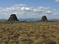
The cairns of Carn Gwilym
-
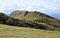
Bausley Hill Camp
-
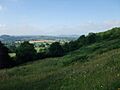
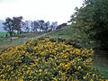
View south-west from Llanymynech Hill
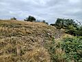
-
Hill fort ramparts at Gaer Fawr
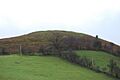
-
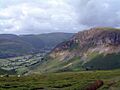
Roundton Hill
-
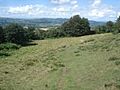
Beacon Ring Fort
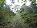
-
Craig Rhiwarth
-
Ffridd Faldwyn
-
Llwyn Bryn-dinas from the north


See also
