
Little Sioux River facts for kids
Quick facts for kids Little Sioux River |
|
|---|---|

The Little Sioux River upstream of Spencer, Iowa
|
|

The Little Sioux River, highlighted on a map of the watershed of the Missouri River
|
|
| Native name | Eaneah-waudepon |
| Country | United States |
| States | Minnesota, Iowa |
| Counties | Jackson County, Minnesota; Iowa: Harrison, Monona, Woodbury, Ida, Cherokee, Obrien, Clay, Buena Vista, Dickinson, Jackson |
| Physical characteristics | |
| Main source | Okabena 43°39′52″N 95°18′53″W / 43.6644052°N 95.3147212°W |
| River mouth | Little Sioux 41°48′11″N 96°03′58″W / 41.803°N 96.066°W |
| Length | 258 mi-long (415 km) |
| Basin features | |
| River system | Missouri River |
The Little Sioux River is a river in the United States. It starts in southwestern Minnesota near the Iowa border. The river then flows southwest for about 258 miles (415 km) across northwest Iowa. It eventually joins the Missouri River at a town called Little Sioux. The Sioux Indians called this river Eaneah-waudepon, which means "Stone River."
Important smaller rivers that flow into the Little Sioux River include the Ocheyedan River, Maple River, and the West Fork of the Little Sioux River. The Little Sioux River is a key part of the Nepper Watershed Project. This project began in 1947 to help control floods and protect the soil in Iowa. Near Turin, Iowa, the river's average flow is about 1,761 cubic feet per second.
Contents
History of the Little Sioux River Valley

The valley of the Little Sioux River has a rich history. In 1857, it was a significant area during events involving the Santee Sioux chief Inkpaduta. He traveled through this valley as far south as Smithland.
The river valley also appears in old stories about a famous person from the 1800s, Jesse James. People say he used the quiet valley, with its many trees and hidden areas, as a place to hide. It was also a route he used to travel north into Minnesota during the 1870s.
How the River Was Formed
The Little Sioux River begins in an area with many "glacial potholes." These are small lakes or ponds left behind by melting glaciers from the Ice Age. This area is close to the "Iowa Great Lakes," which include Spirit Lake and East and West Okoboji.
As the river flows, it passes through rich farmland. Then, it reaches the Loess Hills, which are unique hills made of fine, wind-blown soil. After that, the river flows onto the flat land next to the Missouri River. For much of its middle part, from Linn Grove to Smithland, the Little Sioux is a winding river. It's a great place for canoeing, camping, and fishing. However, from Smithland downstream to where it meets the Missouri River, the river has been straightened by people. This has changed its natural environment.
Flooding and Wildlife
Flooding often happens along the river in early to late spring. This is because heavy winter snow melts and causes the river to rise. This flooding helps create forests of cottonwood trees right next to fertile farmland.
Because of these conditions, hunters can find many animals in the fall hunting season. These include white-tailed deer, rabbits, and pheasants.
Fishing Opportunities
The best time for fishing on the Little Sioux River is in late spring. This is after the floodwaters have gone down. You can often catch tasty gamefish like bullhead and channel catfish with just a hook and a worm. Other fish you might find include northern pike, walleye, and shovelnose sturgeon.
Images for kids
-
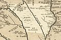
Rivière des Aiaouez meaning "River of the Ioways" is shown on this 1718 French map. The river known today as the Iowa River is also on the map but not labeled.

