Mandi Bahauddin facts for kids
Quick facts for kids
Mandi Bahauddin
منڈی بہاولدین
|
|
|---|---|
|
City
|
|
|
Clockwise from top:
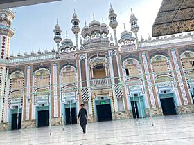
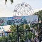
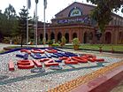
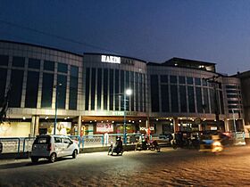
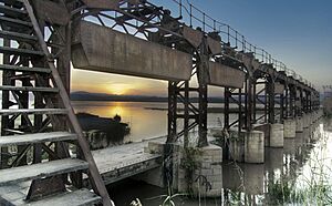
Jamia Masjid Ghausia Rizvia, University of Engineering & Technology, Rasul, Rasul Barrage, Hakim Mall, Jhelum River, Mian Waheed Ud Din Park |
|
| Nickname(s):
منڈی آلے
|
|
|
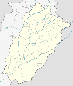
Location in Punjab, Pakistan
|
|
| Country | |
| Province | |
| Division | Gujrat |
| District | Mandi Bahauddin |
| Established | 1506 AD |
| NA/PP | 2/5 N.A (85,86) P.P(65,66,67,68) |
| No. of Towns |
List
Phalia up to p50: for separate parts to be listed-->
|
| Government | |
| • Type | Municipal Committee |
| Elevation | 204 m (669 ft) |
| Population
(2017)
|
|
| • Total | 198,609 |
| • Rank | 41st, Pakistan |
| Demonym(s) | Mandi Aala |
| Time zone | UTC+5 (PST) |
| Postal code |
50400
|
| Dialling code | 0546 |
Mandi Bahauddin (Punjabi: منڈی بہاؤالدین) is an important city in Punjab, Pakistan. It is the main city and capital of the Mandi Bahauddin District. In 2017, it was ranked as the 41st largest city in Pakistan by population. The city is about 220 meters (720 feet) above sea level. It is located between two major rivers: the Jhelum River to the north (about 12 km away) and the Chenab River to the south (about 39 km away).
The city's name comes from two parts. "Mandi" means a market, especially for grains, because it was a busy grain trading center. "Bahauddin" comes from the name of a respected Sufi saint. People sometimes call it the "city of Lions."
Contents
History of Mandi Bahauddin
How the City Started
In 1506 CE, a tribal chief named Bahauddin from the Gondal tribe started a settlement. He named it Pindi Bahauddin after moving from Shahjahanian to this area. The town began to grow a lot in the early 1900s. Business people and landowners from Sikh, Hindu, and Muslim backgrounds came to live there.
A man named John Alam created the map for a village called Chak No. 51. This village became the center of the new town, Pindi Bahauddin. In 1920, because of its famous grain market, Chak No. 51 was renamed Mandi-Bahauddin. By 1923, all the streets and roads were made straight and wide. The Pindi-Bahauddin Railway station was renamed Mandi Bahauddin railway station in 1924.
Mandi-Bahauddin became a town committee in 1937. Then, in 1941, it was given the status of a Municipal Committee. In 1946, nine gates and walls were built around the town as part of a rebuilding plan.
Ancient Times
The history of Mandi Bahauddin goes back to the time of Alexander the Great. About 8 kilometers (5 miles) northwest of the modern city, near the village of Mong, a famous battle took place. This was the Battle of the Hydaspes River in 326 BCE. It was fought between Raja Porus and Alexander the Great.
Raja Porus's kingdom was in the northern Punjab region of what is now Pakistan. This was Alexander's last major battle. His soldiers faced strong resistance from Porus. They also heard about a huge army with 4,000 elephants in the eastern kingdoms. Because of this, Alexander's army refused to march further towards the Ganges Plains. Today, the Sadar Gate, built by the British in 1933, can still be seen here.
City Administration
Mandi Bahauddin is the capital of its district and also the headquarters for its Tehsil (a type of administrative division). In 1941, Mandi Bahauddin became a Municipal Committee. It kept this status after the Punjab Local Government Ordinance of 2001.
The Municipal Committee of Mandi Bahauddin Tehsil is divided into three smaller administrative areas called Tehsils. These Tehsils are further divided into 80 Union Councils.
| Name of Tehsil | Number of Union Councils |
|---|---|
| Malakwal | 20 |
| Mandi Bahauddin | 30 |
| Phalia | 30 |
| Total | 80 |
Population and People
According to the 1998 Census of Pakistan, Mandi Bahauddin city had a population of 99,496 people. By the 2017 Census, the population had grown to 198,609. This shows a big increase of over 99% in just 19 years.
Most people in Mandi Bahauddin follow the Islamic faith. There are also smaller communities of Christians and Hindus.
Geography and Location
Mandi Bahauddin District is located in the middle part of the Chaj Doab. A "Doab" is a piece of land between two rivers. Here, it's between the Jhelum and Chenab rivers. The district is located between 30° 8' to 32° 40' North latitude and 73° 36' to 73° 37' East longitude.
The towns of Phalia and Malikwal, which are also tehsil headquarters, are about 22.5 km (14 miles) and 28.5 km (17.7 miles) away from Mandi Bahauddin city, respectively.
The district is bordered by the Jhelum River to the north, which separates it from the Jhelum district. To the west is Sargodha district. The Chenab River forms the southern border, separating it from the Gujranwala and Hafizabad districts. To the east is Gujrat district. The total area of the district is 2,673 square kilometers (1,032 square miles). The district includes the Mandi Bahauddin, Phalia Tehsil, and Malikwal Tehsil areas.
Weather and Climate
Mandi Bahauddin has a moderate climate. Summers are hot, and winters are cold. In the hottest part of summer, the temperature can reach up to 48°C (118°F) during the day. In the winter months, the lowest temperature can drop below 3°C (37°F). The district gets an average of 388 millimeters (15 inches) of rain each year. The weather is similar to that of Islamabad.
Languages Spoken
The main language spoken in Mandi Bahauddin District is Punjabi. About 97% of the people speak Punjabi as their first language. Other languages spoken include Urdu (2.5%), Pashto (0.5%), and Saraiki (0.5%).
Economy and Industry
One of the biggest sugar factories in Pakistan is located near Mandi Bahauddin. It is called Shahtaj Sugar Mills and is about 2 kilometers (1.2 miles) west of the city.
Transportation
Road Connections
Mandi Bahauddin District has good road connections to other cities. Roads link it to the Lahore–Islamabad Motorway (through the Salam & Bhera Interchanges). It also has roads connecting to Gujranwala District, Hafizabad, Gujrat, Jhelum, and Sargodha. These roads between districts are maintained by the Provincial Highways Department.
Railway System
From Lalamusa, a standard-gauge railway line goes west through Punjab. This line serves Mandi Bahauddin District with stations at Chak Sher Muhammad railway station, Chillianwala, Mandi Bahauddin, and Ahla, continuing towards Malakwal.
Helipad Facility
There is also a helipad in Mandi Bahauddin city. This facility is used for very important people (VVIP) movements. The Pakistan Rangers in Mandi Bahauddin maintain it.
Schools and Colleges
Some of the schools and colleges in Mandi Bahauddin city include:
- Beaconhouse School System
- Punjab College of Science
- Punjab Group of Colleges
- The Superior College
Hospitals and Healthcare
The city has important medical facilities for its residents:
- District Headquarter Hospital, Mandi Bahauddin
- Government Children Hospital Mandi Bahauddin
Places to Visit
There are several interesting places to visit in and around Mandi Bahauddin:
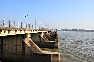
- Rasul Barrage
- Gurudwara Bhai Bannu at Mangat, Distt Mandi Bahauddin
- Mian Waheed-Uddin Park
- Canal View Public Park
See also
 In Spanish: Mandi Bahauddin para niños
 | Selma Burke |
 | Pauline Powell Burns |
 | Frederick J. Brown |
 | Robert Blackburn |


