Maymana facts for kids
Quick facts for kids
Maymana
میمنه
|
|
|---|---|
 |
|
| Country | |
| Province | Faryab Province |
| Area | |
| • City | 35 km2 (14 sq mi) |
| Elevation | 877 m (2,877 ft) |
| Population
(2022 est)
|
|
| • City | 100,650 |
| • Density | 2,880/km2 (7,450/sq mi) |
| • Urban | 149,040 |
| • Ethnicities | Uzbek Pashtun Turkmen |
| Time zone | UTC+4:30 |
Maymana is the capital city of Faryab Province in northwestern Afghanistan. It is located close to the border with Turkmenistan. The city is about 400 kilometers (250 miles) northwest of Kabul, Afghanistan's capital. Maymana sits on the Maymana River, which flows into the Murghab River. In 2015, about 149,040 people lived in Maymana. This makes it one of the biggest cities in northwestern Afghanistan.
On August 14, 2021, Taliban fighters took control of Maymana. This was part of a larger event in 2021. Later, in January 2022, there were reports of protests and fighting in the city.
Contents
Where is Maymana Located?
Maymana is at the northern base of the Torkestan Mountains. It is about 877 meters (2,877 feet) above sea level. The city is on an old part of the Qeysar or Maymana River. This river is a branch of the Murghab River. The Maymana River splits off from the Band-e Turkistan River about 50 kilometers (31 miles) south of the city. The land around Maymana has rich soil. This soil helps with farming activities during different seasons.
How Land is Used in Maymana
Maymana is a key place for trade and travel in northern Afghanistan. More than half of the land (57%) is not built up. This land is mostly used for farming. The central parts of the city (districts 2-5) have more homes and clear road systems. The outer parts of the city (districts 1, 7-10) have more farmland.
Who Lives in Maymana?
In the 1800s, it was thought that 15,000 to 18,000 families lived in Maymana. This was about 75,000 to 95,000 people. People believed it was mostly an Uzbek city because the main language spoken in the market was Chagatai language Uzbek and Pashtun. However, records show that many different groups lived there, including Turkmens and Tajiks.
In 1958, the population was estimated to be 30,000. By 1979, it grew to 38,250. In 1982, it reached 56,973. These numbers might not be exact because there was no official count. In 2004, an estimate suggested 75,900 people lived there, but this was not proven. In 2015, observers supported by the UN estimated the population at 149,040. Maymana has 10 districts and covers an area of 3,461 hectares. There are about 16,560 homes in the city.
Maymana's Long History
Maymana is a very old town. Its main fort, called a citadel, likely dates back to the early Iron Age. Pottery found in a nearby cave shows people lived there even earlier, during the Paleolithic (Old Stone Age) and late Neolithic-Bronze Age.
From 800 B.C. to 700 A.D., Maymana was part of big empires. These included the Median and Persian Empires. It was also part of the Kushanian and Hephtalite empires. Later, Arabs took control during the Islamic Conquest. They used local Iranian rulers to govern the area. In the 600s and 700s, it was home to the Malik of Guzganan. This was the last part of the Kushanian rule. Then, a local family called the Farighunids ruled.
From the 800s to the 1000s, different rulers and families controlled the region. These included the Saffarids, Mihrabanids, and Nasrids from Sistan. After them, the Iranian Samanids and the Irano-Turkic Ghaznavid and Khwarizm rulers took over.
In the 1100s and 1200s, nomadic Turks and invading Mongols caused a lot of damage. It took nearly 200 years for the region to recover. The population was small, and trade was weak. But people slowly rebuilt and started farming again. While the city had Iranians and some Arabs, the villages were also owned by Iranians and Arabs. The deserts and open lands were home to wandering groups of Turko-Mongolian and Iranian people.
In the 1500s, the Turkic Uzbek influence came to Maymana. This happened when Muhammad Shaibani invaded Turkistan and Herat. This was another difficult time for the region. However, Shaibani was defeated by the Iranian Saffavids. But the Uzbek people remained important in the region from then on.
In the 1700s and 1800s, Maymana became the center of the Maimana Khanate. It was a vital place for trade and a link between Turkistan, Herat, and Iran. It was a major cultural and trade hub, connecting different states and peoples. Under Uzbek rule, the city grew and became strong again. This lasted until the Pashtuns took control of the region. In 1876, under Sher Ali Khan, the city became part of the kingdom of Kabul. It faced a very difficult period. Many people died or left the city after this event.
In the 1900s, Maymana used to have strong, thick walls and towers with a moat around it. But by the 20th century, these were mostly gone. In 1934, the city began to be rebuilt. In 1949, the northern parts of the old city were made new. The old city fort was turned into a park. Maymana was the main city of Meymaneh Province until that province was divided.
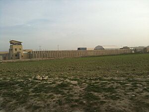
As part of the International Security Assistance Force (ISAF) in Afghanistan, a special team helped rebuild the province. This team was led by Norway and also included troops from Latvia.
Getting Around Maymana
Maymana has an airport. As of May 2014, you could fly directly from Maymana Airport to Herat.
Maymana's Economy
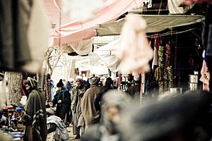
Maymana is important for farming. The Qeysar River provides water for crops. The city also trades in Karakul sheep with nomadic people. Maymana is a key center for livestock in Afghanistan. In the 1970s, the city had a busy wool and cotton processing industry. Today, Maymana is a market for leather goods, silk, carpets, wheat, barley, melons, and grapes.
The airport is about 3.2 kilometers (2 miles) west of Maymana. It is in a valley surrounded by hills and mountains. Some peaks reach 3,658 meters (12,000 feet). The airport is 39 kilometers (24 miles) southeast of the Turkmenistan border. It is also 103 kilometers (64 miles) south of Andkhoy. The runway is made of gravel.
Maymana is also home to Radio Quyaash. This is a radio station run by women. It started in February 2005. Maymana is the eighth-largest Afghan city to have such a station. Other cities with similar stations include Kabul, Kandahar, Herat, Mazar-i-Sharif, Jalalabad, Kunduz, and Ghazni.
Maymana's Climate
Maymana has a hot-summer Mediterranean climate. This means it has hot, dry summers and cold, wet winters.
| Climate data for Maymana | |||||||||||||
|---|---|---|---|---|---|---|---|---|---|---|---|---|---|
| Month | Jan | Feb | Mar | Apr | May | Jun | Jul | Aug | Sep | Oct | Nov | Dec | Year |
| Record high °C (°F) | 25.3 (77.5) |
27.5 (81.5) |
32.6 (90.7) |
35.3 (95.5) |
39.8 (103.6) |
42.5 (108.5) |
44.5 (112.1) |
40.5 (104.9) |
38.3 (100.9) |
35.1 (95.2) |
30.6 (87.1) |
27.6 (81.7) |
44.5 (112.1) |
| Mean daily maximum °C (°F) | 7.4 (45.3) |
9.2 (48.6) |
14.0 (57.2) |
20.8 (69.4) |
27.1 (80.8) |
33.7 (92.7) |
35.9 (96.6) |
33.9 (93.0) |
28.9 (84.0) |
22.2 (72.0) |
15.5 (59.9) |
10.6 (51.1) |
21.6 (70.9) |
| Daily mean °C (°F) | 2.0 (35.6) |
4.0 (39.2) |
8.4 (47.1) |
15.4 (59.7) |
20.1 (68.2) |
25.5 (77.9) |
27.6 (81.7) |
25.2 (77.4) |
20.5 (68.9) |
14.5 (58.1) |
8.6 (47.5) |
4.7 (40.5) |
14.7 (58.5) |
| Mean daily minimum °C (°F) | −2.2 (28.0) |
−0.2 (31.6) |
3.8 (38.8) |
9.6 (49.3) |
12.7 (54.9) |
16.3 (61.3) |
18.5 (65.3) |
16.6 (61.9) |
12.3 (54.1) |
7.6 (45.7) |
3.5 (38.3) |
0.3 (32.5) |
8.2 (46.8) |
| Record low °C (°F) | −22.5 (−8.5) |
−23.6 (−10.5) |
−12.7 (9.1) |
−3.1 (26.4) |
2.4 (36.3) |
6.1 (43.0) |
10.6 (51.1) |
9.0 (48.2) |
0.2 (32.4) |
−5.8 (21.6) |
−12 (10) |
−18 (0) |
−23.6 (−10.5) |
| Average precipitation mm (inches) | 49.9 (1.96) |
60.5 (2.38) |
82.2 (3.24) |
60.5 (2.38) |
25.6 (1.01) |
1.0 (0.04) |
0.5 (0.02) |
0.0 (0.0) |
0.2 (0.01) |
9.6 (0.38) |
20.9 (0.82) |
44.7 (1.76) |
355.6 (14) |
| Average rainy days | 5 | 7 | 11 | 10 | 4 | 0 | 0 | 0 | 0 | 2 | 4 | 5 | 48 |
| Average snowy days | 6 | 5 | 3 | 0 | 0 | 0 | 0 | 0 | 0 | 0 | 1 | 3 | 18 |
| Average relative humidity (%) | 75 | 73 | 74 | 68 | 53 | 38 | 34 | 34 | 39 | 49 | 61 | 71 | 56 |
| Mean monthly sunshine hours | 136.6 | 117.7 | 169.3 | 195.9 | 306.0 | 370.0 | 381.2 | 352.5 | 303.5 | 237.2 | 159.1 | 137.9 | 2,866.9 |
| Source: NOAA (1964-1983) | |||||||||||||
See also
 In Spanish: Maimana para niños
 | Sharif Bey |
 | Hale Woodruff |
 | Richmond Barthé |
 | Purvis Young |


