Jalalabad facts for kids
Quick facts for kids
Jalalabad
جلالآباد
|
|
|---|---|
|
City
|
|
|
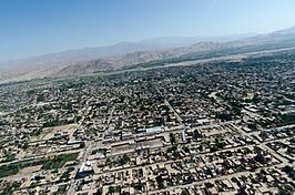
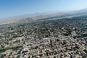
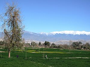
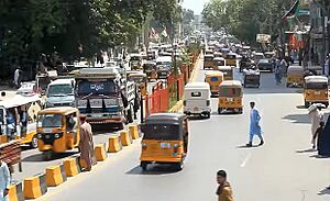
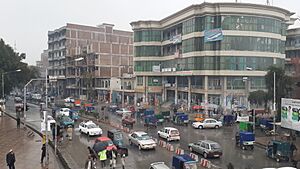
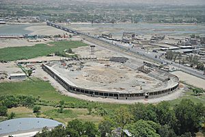
From top counter-clockwise: An aerial view of a section of Jalalabad, Irrigation fields in Jalalabad, Jalalabad Cricket Stadium, Jalalabad in January 2011, Jalalabad Bridge, Governor's House in Jalalabad
|
|
| Country | |
| Province | Nangarhar Province |
| Founded | 1570 |
| Area | |
| • Land | 122 km2 (47 sq mi) |
| Elevation | 575 m (1,886 ft) |
| Population
(2021)
|
|
| • Total | 280,685 |
| Time zone | UTC+4:30 (Afghanistan Standard Time) |
| Climate | BWh |
Jalalabad is the fifth-largest city in Afghanistan. It has a population of about 356,274 people. This city is the capital of Nangarhar Province in eastern Afghanistan. It is about 80 kilometers (50 miles) from Kabul, the capital of Afghanistan.
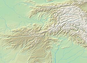
Jalalabad sits where the Kabul River and the Kunar River meet. It is on a flat area south of the Hindu Kush mountains. The city is connected to Kabul by the Kabul-Jalalabad Road. To the east, it links to Peshawar in Pakistan through the Khyber Pass.
The city is a busy place for trade and social activities. This is because it is close to the Torkham border checkpoint, which is about 65 kilometers (40 miles) away. Important industries in Jalalabad include making paper. It also produces farm goods like oranges, lemons, rice, and sugarcane. These crops grow well because of the city's warm weather. Jalalabad is home to Nangarhar University, which is Afghanistan's second-largest school. For many centuries, Afghan kings liked this city. It is also important in Afghan poetry. In the past, Jalalabad was the Afghan winter capital during the rule of Timur Shah Durrani.
Contents
History of Jalalabad
Ancient Times and Early History
Long ago, Jalalabad was known by names like Nagarhara and Adinapur. It was a major center for Greco-Buddhist art around 1,000 years before Christ. Important sites like Ahin Posh were part of this culture.
The first writings about the city come from Chinese Buddhist monks. Around 400 CE, a monk named Faxian visited "Nagarhara." He prayed at holy Buddhist places, including the "Cave of the Buddha's Shadow." Later, in 630 CE, Xuanzang visited "Adinapur" and other nearby areas.
The time of Buddhism began to end after Muslim forces took over the region. This happened in the late 1st Millennium. However, people did not quickly change to Islam. A book from 982 CE, Hudud ul-'alam, mentions a village near Jalalabad. It says the local king had Muslim, Buddhist, and Hindu wives.
The region became part of the Ghaznavid Empire in the 10th century. Sabuktigin took control of land all the way to the west of the Neelum River. Many Afghans and Khiljies who lived in the mountains joined his army. The Ghurids later took over from the Ghaznavids. They expanded the Islamic empire further into India. The area around Jalalabad then became part of the Khalji dynasty and later the Timurids.
Modern History of Jalalabad
It is believed that Jalalabad's first name was Adinapur. The city got its current name in the late 1500s. It was named to honor the Mughal ruler Jalal-uddin Mohammad Akbar. He was the grandson of Babur, who started the Mughal Empire. Babur chose the spot for this city, and his grandson built it in 1560.
Jalalabad was part of the Mughal Empire until about 1738. At that time, Nader Shah and his forces defeated the Mughals. Ahmad Shah Durrani and his Afghan army were with Nader Shah. In 1747, Ahmad Shah Durrani started the Durrani Empire after taking back the area. The Afghan army often used the city when traveling for their military campaigns in India.
In 1834, Dost Mohammad Khan took control of Jalalabad. This was part of his campaign to Jalalabad.
British-Indian forces entered Jalalabad in 1838 during the First Anglo-Afghan War. In 1842, Wazir Akbar Khan surrounded the British troops near Jalalabad. In 1878, during the Second Anglo-Afghan War, the British again came to Jalalabad. They set up camps but left two years later.
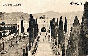
Jalalabad is seen as one of the most important cities for Pashtun culture. The Seraj-ul-Emarat was a home for Amir Habibullah Khan and King Amanullah Khan. It was destroyed in 1929 when Habibullah Kalakani came to power. Other old buildings still show parts of the past. The mausoleum (a grand tomb) of both rulers is in a garden facing Seraj-ul-Emart. The Sulemankhils, a Pashtun family known for their science, are from Jalalabad. Other famous Pashtun families also come from villages near the city.
In the 1960s and 1970s, work began on a new planned city called Reg-e Shamshad Khan.
From 1978 to the early 1990s, the city was important for the Soviet Union-backed government. In March 1989, two rebel groups attacked the city. These groups were supported by Pakistan and the U.S. This was during the Battle of Jalalabad. However, government forces pushed them out within two months. This was a big setback for the rebels. The city was heavily bombed, and many buildings were destroyed.
After President Mohammad Najibullah resigned, Jalalabad quickly fell to rebel groups on April 19, 1992. On September 12, 1996, the Taliban took control of the city. They held it until US-backed Afghan forces removed them in late 2001. Al-Qaeda had built training camps in Jalalabad. The city then returned to Afghan government control under Hamid Karzai.
Jalalabad's economy has grown in the last ten years. Many people in the city joined the Afghan National Security Forces. More buildings have also been built. The Jalalabad Airport has been a military base for NATO forces. In 2011, the U.S. Embassy in Kabul said it planned to open a consulate in Jalalabad.
On August 15, 2021, the Taliban again took control of the city. Its capture cut off the main road from Kabul to the outside world. The city fell later that same day. Three days later, on August 18, protestors took down the Taliban flag. They replaced it with the flag of the previous Afghan government.
People and Land Use in Jalalabad
The city's population was estimated to be 280,685 in 2021. Jalalabad has six districts and a total land area of about 12,796 hectares (31,620 acres). There are 39,586 homes in the city.
Almost all people living in Jalalabad are Muslims, following Sunni Islam. Jalalabad is also a center for the country's Sikhs. However, the Sikh community has become smaller since the wars began. There is also a small Hindu group in the city.
Jalalabad is a main center in eastern Afghanistan, near the border with Pakistan. Farming is the most common use of land, making up 44% of the area. More homes are found in Districts 1-5. Empty land is mostly in District 6. All six districts have a road system like a grid.
Climate of Jalalabad
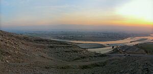
Jalalabad has a hot desert climate. It is one of the hottest places in Afghanistan. The city's weather is very similar to Arizona in the United States. It gets about 152 to 203 millimeters (6 to 8 inches) of rain each year. This rain mostly falls in winter and spring.
Frost is not common in Jalalabad. In summer, the temperature can reach a high of 49 °C (120 °F). The northern and southwestern parts of the city are lower in height. They get cool winds from the north and west in summer. Jalalabad has the highest humidity in summer compared to other Afghan cities.
Because of its mild winter temperatures, many people throughout history chose to live in Jalalabad. It was often the "winter capital" for Afghan rulers. Rich people would move to villas in Jalalabad to avoid the freezing cold in Kabul.
| Climate data for Jalalabad | |||||||||||||
|---|---|---|---|---|---|---|---|---|---|---|---|---|---|
| Month | Jan | Feb | Mar | Apr | May | Jun | Jul | Aug | Sep | Oct | Nov | Dec | Year |
| Record high °C (°F) | 25.0 (77.0) |
28.8 (83.8) |
34.5 (94.1) |
40.5 (104.9) |
45.4 (113.7) |
47.5 (117.5) |
44.7 (112.5) |
42.4 (108.3) |
41.2 (106.2) |
38.2 (100.8) |
32.4 (90.3) |
25.4 (77.7) |
47.5 (117.5) |
| Mean daily maximum °C (°F) | 15.9 (60.6) |
17.9 (64.2) |
22.5 (72.5) |
28.3 (82.9) |
34.7 (94.5) |
40.4 (104.7) |
39.3 (102.7) |
38.0 (100.4) |
35.2 (95.4) |
30.5 (86.9) |
23.3 (73.9) |
17.5 (63.5) |
28.6 (83.5) |
| Daily mean °C (°F) | 8.5 (47.3) |
10.9 (51.6) |
16.3 (61.3) |
21.9 (71.4) |
27.7 (81.9) |
32.7 (90.9) |
32.8 (91.0) |
31.9 (89.4) |
28.1 (82.6) |
22.2 (72.0) |
14.9 (58.8) |
9.5 (49.1) |
21.5 (70.6) |
| Mean daily minimum °C (°F) | 2.9 (37.2) |
5.6 (42.1) |
10.5 (50.9) |
15.3 (59.5) |
19.8 (67.6) |
24.7 (76.5) |
26.7 (80.1) |
26.2 (79.2) |
21.4 (70.5) |
14.4 (57.9) |
6.9 (44.4) |
3.5 (38.3) |
14.8 (58.7) |
| Record low °C (°F) | −14.1 (6.6) |
−9.5 (14.9) |
−1.0 (30.2) |
6.1 (43.0) |
10.6 (51.1) |
13.5 (56.3) |
19.0 (66.2) |
17.5 (63.5) |
11.0 (51.8) |
2.7 (36.9) |
−4.5 (23.9) |
−5.5 (22.1) |
−14.1 (6.6) |
| Average precipitation mm (inches) | 18.1 (0.71) |
24.3 (0.96) |
39.2 (1.54) |
36.4 (1.43) |
16.0 (0.63) |
1.4 (0.06) |
6.9 (0.27) |
7.7 (0.30) |
8.3 (0.33) |
3.2 (0.13) |
8.3 (0.33) |
12.1 (0.48) |
181.9 (7.17) |
| Average rainy days | 4 | 5 | 8 | 8 | 4 | 1 | 1 | 1 | 1 | 1 | 2 | 3 | 39 |
| Average relative humidity (%) | 61 | 60 | 62 | 59 | 47 | 40 | 52 | 58 | 56 | 55 | 58 | 63 | 56 |
| Mean monthly sunshine hours | 180.9 | 182.7 | 207.1 | 227.8 | 304.8 | 339.6 | 325.9 | 299.7 | 293.6 | 277.6 | 231.0 | 185.6 | 3,056.3 |
| Source: NOAA (1964–1983) | |||||||||||||
Plants and Animals
Jalalabad is known for its many fruits. Different types of citrus fruits grow in gardens and orchards. These include oranges, tangerines, grapefruits, lemons, and limes. Orange trees produce fruit only once every three years. The narindj orange is common; it has yellow skin and tastes like a mix of orange and grapefruit. Grapefruits grown here can be eight or nine inches wide.
Each year, Jalalabad produces a lot of fruit. This includes 1,800 tonnes of pomegranates, 334 tonnes of grapes, and 7,750 tonnes of mulberries. These fruits are sold in local markets or sent to Kabul. From Kabul, they are sometimes sent to other countries. The second most common crop is a local type of sugarcane called vatani. It has 15% sugar by weight. Jalalabad also has the largest date farm in Afghanistan.
Getting Around Jalalabad
The Jalalabad Airport is about 3 miles (5 km) southeast of the city center. It is a local airport for people to use. It serves the people of Nangarhar and nearby areas.
There are plans to build a rail network in Afghanistan. This network would connect Jalalabad with Pakistan's railways. This would help increase trade and travel between the two countries.
Jalalabad is connected by main roads to Kabul, Afghanistan's capital. It also connects to Peshawar in Pakistan and other nearby Afghan cities. All trade between Afghanistan and Pakistan goes through Jalalabad. The highway between Jalalabad and Kabul was fixed in 2006. This made travel time between these two important cities shorter. This highway is known as one of the most dangerous in the world due to many accidents. There are also ideas to make the roads between Jalalabad and Peshawar better. This would make the road wider and safer. The goal is to bring more tourists and make trade easier.
Fun Places to Visit
The Ghazi Amanullah International Cricket Stadium is near the Ghazi Amanullah Khan Town. This town is about 15 miles (24 km) southeast of Jalalabad. People from Jalalabad go there for sports, fun, and relaxing. It is especially popular during holidays or when friends and family visit. It's also a favorite spot for people with cars.
- Hotels
- Spinghar Hotel
- Sultan Hotel and Restaurant
- White House Hotel
- Mosques
- Akhunzada Mosque
- Spin Mosque
- Parks
- Abdul Haq Park (next to the city's main stadiums)
- Amir Habibullah Khan Park (across from Siraj-ul-Emarat Park)
- Aryan Park (in the southwest part of the city)
- Farm Hada Park (in the southern part of the city)
- Siraj-ul-Emarat Park (next to the Governor's House)
- Mausoleums (Tombs of important people)
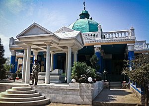
- Mausoleum of King Amanullah Khan (in Siraj-ul-Emarat Park)
- Mausoleum of Khan Abdul Ghaffar Khan
- Mausoleum of Mohammad Gul Khan Momand
- Hospitals
- Al Shifa Modern Hospital
- Bakhtar Hospital
- Baidara Hospital
- Hassanzai Curative Hospital
- Jalalabad Regional Hospital
- Jalalabad Medical Complex
- Khair-un-Nisa Medical Complex
- Spingha Momand Hospital
- Malalai Curative Hospital
- Nangarhar Teaching Hospital
- Naseri Hospital
- Rokhan Hospital
- Universities
- Alfalah University
- Ariana University
- Khurasan University
- Nangarhar University
- Spinghar Higher Education Centre
- Shopping Centers
- Hejaz Super Market
- Jada Super Store
- Nakamura Super Store
Sports in Jalalabad
The Nangarhar province cricket team plays in local cricket games. Hamid Hasan, a player on the national team, was born here. He plays for Afghanistan in international cricket. The Ghazi Amanullah International Cricket Stadium is the first international-level cricket stadium in Afghanistan. It is in the Ghazi Amanullah Town, a new area on the southeast edge of Jalalabad.
Building the stadium started in March 2010. The first part of the project cost $1.8 million and took one year to finish. This included the stadium itself. Future plans include a pavilion, places for players to stay, and office buildings. The stadium can hold 14,000 people. It was ready before the national team and under-19 team left for games in Canada and Ireland. The two teams played the first game there. People hope the stadium will attract international teams to play Afghanistan.
- Professional sports teams from Jalalabad
| Club | League | Sport | Venue | Established |
|---|---|---|---|---|
| Nangarhar Leopards | Afghanistan Premier League | Cricket | Sharjah Cricket Stadium | 2018 |
| Speenghar Tigers | Shpageeza Cricket League | Cricket | Ghazi Amanullah International Cricket Stadium | 2013 |
| De Spin Ghar Bazan F.C. | Afghan Premier League | Football | Nangarhar Football Stadium | 2012 |
- Stadiums
- Ghazi Amanullah International Cricket Stadium (about 15 miles southeast from Jalalabad)
- Nangarhar Football Stadium (next to Abdul Haq Park)
- Behsud Cricket Stadium (next to Abdul Haq Park)
Sister Cities
Famous People from Jalalabad
- Rashid Khan, a cricket player
- Amanullah Khan, a former King of Afghanistan, buried in the city
- Abdul Ghaffar Khan, buried in the city
- Mohammad Gul Khan Momand, buried in the city
- Tetsu Nakamura, who lived and died in the city
See also
 In Spanish: Yalalabad para niños
 | Dorothy Vaughan |
 | Charles Henry Turner |
 | Hildrus Poindexter |
 | Henry Cecil McBay |


