
Mazandaran Province facts for kids
Quick facts for kids
Māzandarān Province
استان مازندران
|
|
|---|---|
 |
|

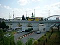
Counties of Mazandaran Province
|
|

Location of Mazandaran Province in Iran
|
|
| Country | |
| Region | ONE 1 |
| Capital | Sari |
| Counties | 20 |
| Area | |
| • Total | 23,833 km2 (9,202 sq mi) |
| Population
(2011)
|
|
| • Total | 3,073,943 |
| • Density | 128.9784/km2 (334.053/sq mi) |
| Time zone | UTC+03:30 (IRST) |
| • Summer (DST) | UTC+04:30 (IRST) |
| Main language(s) | Mazandarani (Tabari) Gilaki |
Mazandaran Province (Persian: استان مازندران Ostān-e Māzandarān) is a special part of Iran. It is located along the southern coast of the Caspian Sea. It also sits next to the central Alborz mountain range in northern Iran.
Mazandaran is one of Iran's most populated provinces. It has many natural resources, like oil and natural gas. The four biggest cities in the province are Sari, Amol, Nur, and Tonekabon. The province was officially created in 1937.
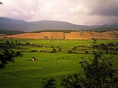
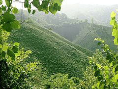
This province has a very diverse landscape. You can find flat plains, green fields, and thick forests. These areas stretch from the sandy beaches of the Caspian Sea to the tall, snowy Alborz mountains. This includes Mount Damavand, which is one of the highest peaks and volcanoes in Asia.
Mazandaran is a big producer of farmed fish. This aquaculture (fish farming) adds a lot to the economy. It works alongside traditional agriculture (farming). Tourism is also very important. Many people from all over Iran love to visit this beautiful area. Mazandaran is also becoming a growing center for biotechnology, which uses living things to make new products.
Contents
History of Mazandaran Province

People have lived in the Mazandaran area for at least 75,000 years. Recent digs at Gohar Tape in Behshahr show that cities existed here over 5,000 years ago. This makes it one of Iran's most important historical sites. It played a big role in the region's cultural and city development.
Mazandaran is one of the oldest areas where people settled down and did not move around a lot. Its native people are the Mazanderanis. They speak an Iranian language called Mazandarani (or Tabari). This language is similar to Gilaki and Sangiseri language. It also has some sounds like Caucasian languages, showing the region's long history.
In the early 1900s, Reza Shah built new roads and railways. This connected the northern Alborz mountains to the southern slopes. Because of this, Mazandaran and Gilan provinces became known as Shomal, which means "the North" in Persian. Mazandaran is a Caspian province in northern Iran. It is on the southern coast of the Caspian Sea. It borders Golestan, Semnan, Tehran, Alborz, Qazvin, and Gilan provinces. Sari is the biggest city and the capital of Mazandaran province.
On June 22, 2014, Mazandaran Province became part of the First Region. This was done to help with coordination and development across Iran's provinces.
Ancient Times in Mazandaran

Before Iranian-speaking people arrived, the native people here were hunters and cattle herders. Old studies in caves in Behshahr show human activity from around 9500 BC. The Amard were a tribe living in the mountains near the Caspian Sea. This area included present-day Amol.
897.12-31.189.jpg)
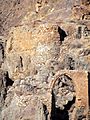
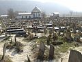
The land of Mazandaran has been ruled by many different groups throughout history. There are still old fortresses from the Parthian Empire and Sasanian Empire. Many old cemeteries are also found across the province. During these times, Mazandaran was part of Hyrcania, an important province.
In 662 CE, a large Muslim army invaded Tabarestan. This was ten years after the last Sasanian emperor died.

When the Sasanian Empire began, the King of Mazandaran (Tabaristan) was Gushnasp. His family had ruled the area since the time of Alexander the Great. From 529 to 536, the Sasanian prince Kawus ruled Mazandaran. The Sasanian king Anushirawan defeated Zarmihr, who claimed to be related to the legendary blacksmith Kaveh. This family ruled until 645 AD. Then, Gil Gilanshah joined Mazandaran to Gilan.
In 651, the Sasanian Empire fell. Most Sasanian lands came under Arab control. However, the Caspian region of Iran, including Tabaristan, remained independent.
Mazandaran After Islam

Tabaristan stayed independent from the Umayyad Caliphate. This caliphate took over the Sasanian Empire in the early 600s. Local Zoroastrian families, like the Bavand and Karen, fought against Islam. A short-lived Shiite state also existed before the Ziyarid princes took over. Mazandaran kept a Zoroastrian majority until the 12th century. This was because of its isolated location and strong people who fought against the Caliph's armies for centuries.
After the Islamic period, local ruling families were of three types. These included old pre-Islamic families, Alid sayyids (descendants of Prophet Muhammad), and other less important local families.
The Bawandids claimed to be descendants of Kawus. They had three ruling periods. The first (665–1007) ended when the Ziyarid Kabus b. Wushmgir conquered Tabaristan. The second ruled from 1073 to 1210. Then, Mazandaran was conquered by 'Ala al-Din Muhammad Khwarzamshah. The third ruled from 1237 to 1349 as helpers of the Mongols. The last Bawandid ruler was killed by Afrasiyab Chulawi.

The Karinids said they were descendants of Karin, brother of Zarmihr. Zarmihr was a ruler before Islam under the Sasanians. Their last ruler, Mazyar, was killed in 839.
The Paduspanids claimed to be from the Dabuyid family. They became important around 660. They were helpers to the Alids. Later, they helped the Buyids and Bawandids, who removed them from power in 1190. The family was restored in 1209-10. They continued to rule until the time of Timur. One branch ruled until 1567, and another until 1574.
Between the 800s and 1000s AD, the Rus' often raided the Caspian Sea coasts of Iran. These were part of the Caspian expeditions of the Rus'. The Rus' first came as merchants in the 800s. They traveled along the Volga trade route, selling furs, honey, and slaves. Small raids happened in the late 800s and early 900s. The first big expedition was in 913. They arrived with 500 ships and raided parts of Gorgan, Mazandaran, and Gilan. They took slaves and goods.
During the Safavid era, many Georgians, Circassians, Armenians, and other Peoples of the Caucasus settled in Mazandaran. Their descendants still live there. Towns and villages in Mazandaran still have "Gorji" (meaning Georgian) in their names. Most of these groups have now become part of the main Mazandarani culture. The history of Georgian settlement is told by Iskandar Beg Munshi. Both Circassian and Georgian settlements are described by Pietro Della Valle.
Before Nader Shah ruled, the Russian army briefly took over the province. This was after the Russo-Persian War (1722–23). It was given back to Persia in 1735. After the Russo-Persian War (1804–13) and the Russo-Persian War (1826–28), Russia had more influence in northern Iran, especially in Mazandaran and Gilan.
Mazandaran in Modern Times
During the rule of Fath-Ali Shah Qajar, Mazandaran was seen as a great place for recreation. It stayed independent until 1596. Then, Shah Abbas I, whose mother was Mazandarani, made Mazandaran part of his Safavid empire. He made many Armenians, Circassians, Georgians, Kurds, and Qajar Turks move to Mazandaran.
Pietro della Valle visited a town near Firuzkuh in Mazandaran. He wrote that Mazandarani women did not wear veils and talked freely with foreigners. He also noted the large number of Circassians and Georgians. He said he had never met people as polite as the Mazandaranis.
Today, Persia proper, Fars, Mazanderan on the Caspian Sea and many other lands of this empire are all full of Georgian and Circassian inhabitants. Most of them remain Christian to this day, but in a very crude manner, since they have neither priest nor minister to tend them.
—Pietro della Valle
After the Safavid period, the Qajars started campaigns from Mazandaran. Agha Mohammad Khan made Mazandaran part of his empire in 1782. On March 21, 1782, Agha Mohammad Shah declared Sari his capital city. Mazandaran had local wars during these years. This led to the capital being moved from Sari to Tehran by Fath Ali Shah.
In modern times, many new houses and bridges have been built in Amol and Sari. Along the beach and in the forests, many villas and modern settlements have been built.
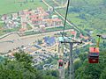
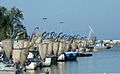
Mazandaran has three international airports and three major seaports. Millions of Iranian and foreign tourists visit Mazandaran. Many come for health tourism. Mazandaran is a top destination for tourists. Today, Mazandaran has many recreational tourist spots, villas, shopping malls, residential complexes, restaurants, and hotels.
Geography and Climate of Mazandaran

Geographical Features
Mazandaran is on the southern coast of the Caspian Sea. It shares borders with Golestan, Semnan, and Tehran provinces. To the west, it borders Qazvin and Gilan provinces.
The province has two main geographical parts: the coastal plains and the mountainous areas. The Alborz Mountain Range forms a huge wall around the Caspian Sea's coastal strip and plains. Because of constant sea breezes and local winds, sandy hills form. These create a low natural barrier between the sea and the plain.
There is often snowfall in the Alborz regions. These mountains run parallel to the Caspian Sea's southern coast. They divide the province into many separate valleys. The province has a mild, subtropical climate. The average temperature is 25 °C in summer and about 8 °C in winter. Snow falls heavily in the mountains in winter, but rarely at sea level.
-
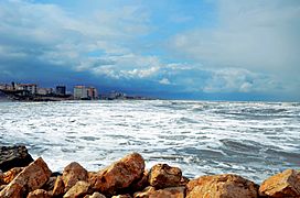
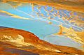
Caspian Sea
-
Rice Farm
-
Pasturage
-

Lar Vare
-
Old Stony
-
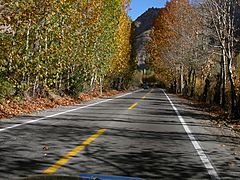
Road
-
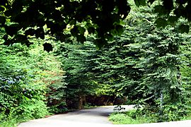
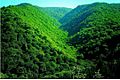
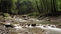
Javarom Forest, Mazandaran Province, Iran
-
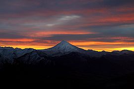
Damavand Mountain, The West Face, Mazandaran Province, Iran


.jpg)


Natural Environment and Wildlife
Caspian tiger and Caspian horse are two animals that came from Mazandaran. The Ramsar Convention, an important agreement about wetlands, was also held in Mazandaran.

Unlike other parts of Iran, Mazandaran has many rivers and mountain streams. All of these flow from the mountains to the sea. A German traveler named Gmelin visited this area in 1771. He said that on the road from Resht to Amot, he saw 250 such streams in just eight miles. Many of them were so wide and deep that crossing them was sometimes impossible for weeks.
Climate Zones
Mazandaran province's climate is affected by its latitude, the height of the Alborz mountains, its distance from the sea, and air currents. Because of this, the province has three main climate types:
- Moderate Caspian weather: This has hot, humid summers and mild, humid winters.
- Moderate mountainous weather: This has long, cold, and freezing winters. Summers are mild and short.
- Cold mountainous weather: This has long, freezing winters and short, cool summers. Snow often falls in this region during most seasons, even into mid-summer.
Images for kids
-
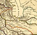
Location of Tapuri, between Amardus and Hyrcania
-
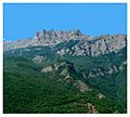
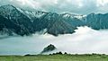
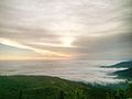
Central Alborz mountain range in Mazandaran Province
-
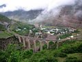
A railway bridge on the Trans Iranian Railroad in Savadkuh
-
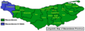
Linguistic Map of Mazandaran Province
-
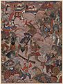
The Battle History of Mazandaran
-
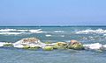
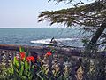
Caspian Sea Coast in Mazandaran
-
Kangelo Castle in Savadkuh
-
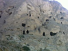
Huto and Kamarband Caves
-

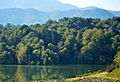
Lake in Churet
-
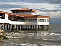
Babolsar Sea
-
Baladeh Castle
-

Sangeno Waterfall
-
Gorji Mahaleh Jungle in Behshahr
-

Babol Museum
-
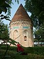
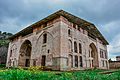
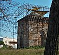
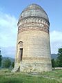
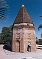
Haydar Amuli (Seyyed Se Tan) Tomb Tower in Amol, 15th century
-
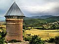
Restek tower in Dodangeh District
-
Moalagh Bridge in Amol
-
Namak Abrood Tourist resort
-
Cheshmeh Emarat in Behshahr
-
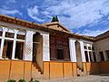
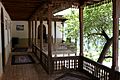
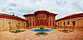
Kolbadi House in Sari
-

Forest in Mazandaran
-

Kebab and Rice
-

Caviar
-
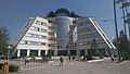
Noshirvani University of Technology
-
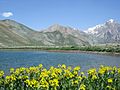
Aseman kuh (peak in Alborz range) viewed from Kahrizak Dare (lake), Lar.
-
Dyvasyab Mineral springs, Dasht-e Lar, Mount Damavand
-

Alborz Dam Lafoor
-
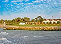
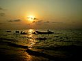
Mazandaran Coast
-
Nima House at Nour
-
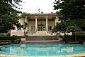
Ramsar Palace
-
Shahrak-e Namak Abrud at Chalus
-
Safarud Jungle and River
-
Riding a watercraft in Ramsar
-
Babolsar Pleasure
-
Fire Temple of Amol
-
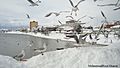
Snow in Tonekabon
-

Marals at Semes Kandeh Animal Shelter
-
Div Asiyab spring at Larijan
-
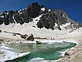
Glacial lake in Alam Kuh Kelardasht
-
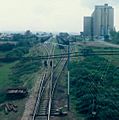
Neka Railway
-
Museum of Reza Shah Pahlavi at Alasht
-
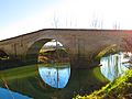
Davazdah Cheshmeh Bridge
-
Lajim Tower in Savadkuh
-
Elimalat Lake
-
Coast Beach
-
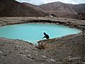
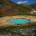
Badab Sort springs
-
Filband Village
-
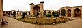
Farah Abad Complex
-
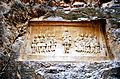
Nassereddin Shah relief
-
Fazeli House
-
Imamzadeh Abbas
-
Sefid Chah
-
Jomeh Bazaar bridge
.jpg)


fakhrul_islam_and_rukn_al_din_Amuli.JPG)

_bridge.jpg)
.jpg)
.jpg)


.jpg)


_springs,_(Info_in_page_1),_Damavand_mount,_Dasht-e_Lar_-_panoramio.jpg)


.jpg)

.jpg)


.jpg)


_%D8%AC%D9%88%DB%8C%D8%A8%D8%A7%D8%B1.JPG)
See also
 In Spanish: Provincia de Mazandar%C3%A1n para ni%C3%B1os
