Monrovia facts for kids
Quick facts for kids
Monrovia
|
||
|---|---|---|
Monrovia skyline
|
||
|
||
| Country | ||
| County | ||
| District | Greater Monrovia | |
| Established | April 25, 1822 | |
| Named for | James Monroe - U.S. President | |
| Government | ||
| • Type | Local Government of Monrovia | |
| Area | ||
| • Capital city | 75.00 sq mi (194.25 km2) | |
| • Land | 1,746 sq mi (4,523 km2) | |
| Population
(2022 Census)
|
||
| • Capital city | 1,761,032 | |
| • Density | 23,480.3/sq mi (9,065.80/km2) | |
| • Metro | 2,225,911 | |
| Time zone | UTC+00:00 (Greenwich Mean Time) | |
| • Summer (DST) | (Not Observed) | |
| Climate | Am | |
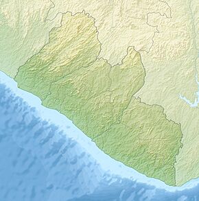
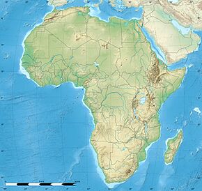
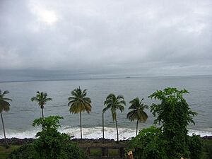
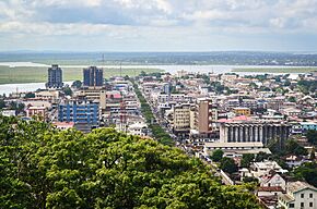
Monrovia is the capital and largest city of Liberia. It was founded in 1822. The city is located on Cape Mesurado right on the Atlantic Ocean coast. In 2022, about 1.7 million people lived there. This means about one-third of Liberia's entire population calls Monrovia home!
Monrovia is the most important city in Liberia. It is the country's main center for business, money, and culture. The city's economy mostly relies on its large harbor. It is also where the Liberian government is located. The Freeport of Monrovia is the biggest and most important port in the country.
The land where Monrovia stands was traditionally home to the Vai people. The city was started on April 5, 1822. It was founded by members of the American Colonization Society (ACS). This group helped former slaves born in the United States return to Africa.
Contents
How Monrovia Got Its Name
Monrovia is named after U.S. President James Monroe. He strongly supported the idea of creating a colony in Liberia. He also supported the American Colonization Society. Monrovia is one of only two capital cities in the world named after a U.S. President. The other is Washington, D.C.. Monrovia was first called Christopolis. But its name was changed to Monrovia in 1824, just two years after it was founded.
Monrovia's Story
Before 1816, the area around Cape Mesurado was called Ducor. It was a busy place for trade. Different groups like the Dey, Kru, Bassa, Gola, and Vai lived there. They were involved in fishing, trading, and farming.
In 1816, the first group of African American settlers arrived in West Africa. They came from the United States. Their goal was to create a new home for freed American slaves. This idea was similar to what had already happened in Freetown, Sierra Leone. These settlers were supported by the American Colonization Society and the U.S. government. They first landed on Sherbro Island.
On January 7, 1822, these settlers moved to Dazoe Island. This island is now called Providence Island. They then moved to Cape Mesurado. There, they started a settlement called Christopolis. In 1824, the city was renamed Monrovia. This honored James Monroe, who was the U.S. President at that time. Monroe strongly supported the idea of moving formerly enslaved Black people to Africa. This was seen as a different idea from ending slavery in America.
In 1845, an important meeting took place in Monrovia. This meeting created a document. Two years later, this document became the constitution for the new country, the Republic of Liberia.
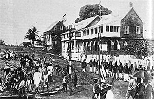
At the start of the 1900s, Monrovia had 4,000 residents. About 2,500 of them were Americo-Liberian. Monrovia had two main parts then: Monrovia proper and Krutown. Americo-Liberians lived in Monrovia proper. Their buildings looked like those in the southern United States. Krutown was home to the Kru people. Other groups like the Bassa and Grebo also lived there.
By 1926, people from Liberia's inner regions started moving to Monrovia. They were looking for jobs. By 1937, Monrovia's population grew to 10,000 people. The city had 30 police officers at that time.
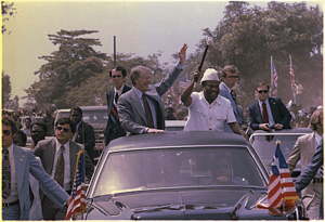
In 1979, the Organisation of African Unity held a conference near Monrovia. Liberia's president, William Tolbert, was in charge. During his time as president, Tolbert improved housing in Monrovia. He also cut tuition fees at the University of Liberia in half. In 1980, a military coup changed the government. Samuel Doe led this change. Many government members were killed.
The First Liberian Civil War (1989-1997) and Second Liberian Civil War (1999-2003) caused a lot of damage. The city's buildings and services were badly hurt. Much damage happened during the siege of Monrovia. During these wars, many young people were forced to join the fighting. They lost their homes and could not go to school.
In 2002, Leymah Gbowee started the Women of Liberia Mass Action for Peace. This group was made up of women from Monrovia. They met in a fish market to pray and sing. Their peaceful actions helped end the war the next year. This also led to Ellen Johnson Sirleaf becoming president of Liberia. She was the first female president in Africa.
In 2014, the city faced the 2014 West Africa Ebola outbreak. The Ebola virus epidemic in Liberia was declared over on September 3, 2015.
Monrovia's Location and Climate
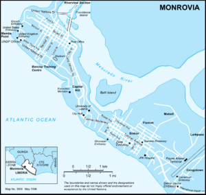
Monrovia is on the Cape Mesurado peninsula. It sits between the Atlantic Ocean and the Mesurado River. The river's mouth forms a large natural harbor. The Saint Paul River is just north of the city. It forms the northern edge of Bushrod Island. Monrovia is in Montserrado County. It is Liberia's largest city and its main center for government, business, and money.
Monrovia's Climate
Monrovia has a tropical monsoon climate. This means it is very wet and warm all year. It is the wettest capital city in the world. On average, it gets about 182 inches of rain each year. It has a wet season and a dry season. But it still rains even during the dry season. Temperatures stay around 79.5°F (26.4°C) throughout the year.
| Climate data for Roberts International Airport, 37 mi east of Monrovia, Liberia | |||||||||||||
|---|---|---|---|---|---|---|---|---|---|---|---|---|---|
| Month | Jan | Feb | Mar | Apr | May | Jun | Jul | Aug | Sep | Oct | Nov | Dec | Year |
| Record high °C (°F) | 35.0 (95.0) |
38.0 (100.4) |
37.0 (98.6) |
38.0 (100.4) |
35.0 (95.0) |
33.0 (91.4) |
36.0 (96.8) |
35.0 (95.0) |
32.0 (89.6) |
33.0 (91.4) |
36.0 (96.8) |
34.0 (93.2) |
38.0 (100.4) |
| Mean daily maximum °C (°F) | 31.8 (89.2) |
32.0 (89.6) |
31.8 (89.2) |
31.5 (88.7) |
30.5 (86.9) |
28.3 (82.9) |
27.2 (81.0) |
26.8 (80.2) |
27.7 (81.9) |
29.4 (84.9) |
30.3 (86.5) |
30.0 (86.0) |
29.8 (85.6) |
| Daily mean °C (°F) | 26.2 (79.2) |
27.1 (80.8) |
27.6 (81.7) |
27.8 (82.0) |
27.4 (81.3) |
26.0 (78.8) |
25.1 (77.2) |
24.9 (76.8) |
25.4 (77.7) |
26.1 (79.0) |
26.7 (80.1) |
26.4 (79.5) |
26.4 (79.5) |
| Mean daily minimum °C (°F) | 22.0 (71.6) |
23.4 (74.1) |
23.7 (74.7) |
23.8 (74.8) |
23.9 (75.0) |
23.4 (74.1) |
23.0 (73.4) |
22.9 (73.2) |
23.3 (73.9) |
23.2 (73.8) |
23.5 (74.3) |
22.5 (72.5) |
23.2 (73.8) |
| Record low °C (°F) | 15.0 (59.0) |
18.0 (64.4) |
18.0 (64.4) |
21.0 (69.8) |
20.0 (68.0) |
20.0 (68.0) |
20.0 (68.0) |
20.0 (68.0) |
17.0 (62.6) |
20.0 (68.0) |
20.0 (68.0) |
16.0 (60.8) |
15.0 (59.0) |
| Average rainfall mm (inches) | 51 (2.0) |
71 (2.8) |
120 (4.7) |
154 (6.1) |
442 (17.4) |
958 (37.7) |
797 (31.4) |
354 (13.9) |
720 (28.3) |
598 (23.5) |
237 (9.3) |
122 (4.8) |
4,624 (181.9) |
| Average rainy days | 4 | 3 | 8 | 12 | 22 | 24 | 21 | 17 | 24 | 22 | 16 | 9 | 182 |
| Average relative humidity (%) | 78 | 76 | 77 | 80 | 79 | 82 | 83 | 84 | 86 | 84 | 80 | 79 | 81 |
| Mean monthly sunshine hours | 158 | 167 | 198 | 195 | 155 | 105 | 84 | 81 | 96 | 121 | 147 | 155 | 1,662 |
| Source 1: Deutscher Wetterdienst (average temperature and extremes only) | |||||||||||||
| Source 2: Danish Meteorological Institute | |||||||||||||
Monrovia's Neighborhoods

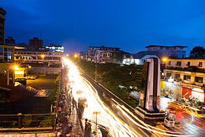
Monrovia has many different areas. They are spread out along the Mesurado peninsula. The main downtown area is on Broad Street. The big market area, Waterside, is nearby. It faces the city's large natural harbor.
Northwest of Waterside is West Point. This is a large community. To the west is Mamba Point. This area has many embassies, like those for the United States and United Kingdom. South of the city center is Capitol Hill. Here you find important government buildings. These include the Temple of Justice.
Further east is the Sinkor section. This used to be a quiet neighborhood. Now, Sinkor is a busy part of the city. It has many embassies, hotels, and businesses. It also has residential areas like Plumkor and Fiamah. Sinkor is also home to Spriggs Payne Airport. The area next to the airport, called Airfield, is a popular place for nightlife.
East of Airfield is the Old Road section of Sinkor. This area is mostly homes. It includes communities like Chugbor and Gaye Town. At the southeastern base of the peninsula is Congo Town. To its east is the large suburb of Paynesville. Other suburbs like Chocolate City and Gardnersville are to the north. These are across the river. On Bushrod Island, north of Monrovia, are Clara Town and New Kru Town.
- Other neighborhoods and suburbs of Monrovia include
- Bakoi
- Banjoa
- Barekling
- Bassa Community
- Buzzi Quarters
- Clara Town
- Crown Hill
- Dixville
- Doin Town
- Dwahn Town
- Duala
- Fanti Town
- Jatuja
- Jacob Town
- Jallah Town
- Logan Town
- Matadi
- New Kru Town
- Old Road
- Point Four
- Red Light
- Slipway
- Snapper Hill
- South Beach
- Toe Town
- Tomo
- Topoe Village
- Vai Town
- Virginia
Famous People from Monrovia
- Henry Clifford Boles (1910–1979), American architect
- Prince Johnson, Liberian politician
- Clarence Kparghai, Swiss ice hockey player
- Sio Moore, American football player
- Aloysius Wleh Penie, Liberian footballer
- Massimo Pigliucci (born 1964), scientist
- Ellen Johnson Sirleaf, former president of Liberia
- Takun J, Liberian musician
- Charles Taylor, former president of Liberia
- Benoni Urey, Liberian businessman
- George Weah, Liberian president and former footballer
- Ashton Youboty, American football player
Monrovia's Economy
Monrovia's economy is mostly about its harbor. This is the Freeport of Monrovia. It is also important because Liberia's government offices are there. The harbor was made much bigger by U.S. forces during World War II. Main exports from the harbor include latex and iron ore.
Many things are also made in Monrovia. These include cement, refined petroleum, and food products. Other items are brick and tile, furniture, and chemicals. The harbor is on Bushrod Island. It has places to store and fix ships.
Getting Around Monrovia
Boats connect the city's Freeport of Monrovia to other towns. These include Greenville and Harper. The closest airport is Spriggs Payne Airport. It is less than four miles from the city center. Roberts International Airport is Liberia's largest international airport. It is about 37 miles away in Harbel.
Monrovia is connected to the rest of the country by roads and railways. Many merchant ships around the world are registered in Liberia. This means Monrovia is their official home port. In the city, you can find private taxis and minibuses. There are also larger buses run by the Monrovia Transit Authority.
Since 2005, many roads in Monrovia have been rebuilt. This work was done by the World Bank and the Liberian Government. New and old buildings are being fixed up as the city rebuilds.
Culture and Media in Monrovia
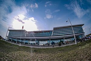
Monrovia has many interesting places to visit. These include the Liberian National Museum. There is also the Masonic Temple. You can visit the Waterside Market and several beaches. The city also has sports stadiums. These are Antoinette Tubman Stadium and the Samuel Kanyon Doe Sports Complex. The Samuel Kanyon Doe Sports Complex has one of Africa's largest stadiums. It can seat 40,000 people.
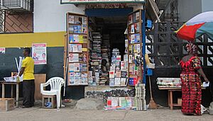
Newspapers have been printed in Monrovia since the 1820s. The Liberia Herald was one of the first newspapers in Africa. Today, many smaller newspapers are printed daily or twice a week. Most are 20 pages or less. Daily Talk is a special newspaper. It is news and Bible quotes written daily on a blackboard by the road in Sinkor.
Monrovia also has radio and TV stations. Radio is the main way people get news. This is because electricity can be a problem for watching TV. UNMIL Radio has been broadcasting since 2003. It is the only radio station in Liberia that broadcasts 24 hours a day. It reaches about two-thirds of the population. The government-owned Liberia Broadcasting System broadcasts from Monrovia. STAR radio broadcasts at 104 FM.
Education in Monrovia
Monrovia is home to several universities. These include the University of Liberia. There are also the African Methodist Episcopal University and United Methodist University. Stella Maris Polytechnic is another important school. Many other public and private schools are also in the city. Medical training is available at the A.M. Dogliotti College of Medicine. There is also a nursing school at the Tubman National Institute of Medical Arts.
Schools for students from kindergarten to twelfth grade are managed by the Monrovia Consolidated School System. This system serves the greater Monrovia area. Some of these schools are Monrovia Central High School and William V. S. Tubman High School. The American International School of Monrovia is located in Congo Town.
Places of Worship
Monrovia has many places of worship. Most of them are Christian churches. These include the Roman Catholic Archdiocese of Monrovia and the United Methodist Church in Liberia. There are also Baptist churches and Assemblies of God churches. In 2021, the Church of Jesus Christ of Latter-day Saints announced plans to build a temple in Monrovia. The city also has Muslim mosques.
Environmental Challenges
Pollution is a big challenge in Monrovia. Piles of trash from homes and factories often build up. The World Bank helps pay companies to collect the trash. However, collections are not always regular.
In 2013, there was so much uncollected trash in the Paynesville area. Traders and residents had to burn the huge piles. These piles were almost blocking the main road out of Monrovia.
Flooding also causes environmental problems for people. Floodwater picks up trash that has been left in swamps. Then it spreads the trash around residential areas. In 2009, only one-third of Monrovia's 1.5 million people had access to clean toilets. Crowded housing and a lack of proper city planning have created unhealthy conditions.
Monrovia's International Connections
Monrovia is connected with other cities around the world. These are called twin towns or sister cities.
See also
 In Spanish: Monrovia para niños


