Montgomery County, Alabama facts for kids
Quick facts for kids
Montgomery County
|
||
|---|---|---|

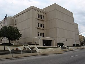
Montgomery County Courthouse in Montgomery
|
||
|
||

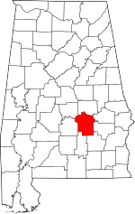
Location within the U.S. state of Alabama
|
||
 Alabama's location within the U.S. |
||
| Country | ||
| State | ||
| Founded | December 6, 1816 | |
| Named for | Lemuel P. Montgomery | |
| Seat | Montgomery | |
| Largest city | Montgomery | |
| Area | ||
| • Total | 800 sq mi (2,000 km2) | |
| • Land | 784 sq mi (2,030 km2) | |
| • Water | 16 sq mi (40 km2) 2.0% | |
| Population
(2020)
|
||
| • Total | 228,954 | |
| • Estimate
(2023)
|
224,980 |
|
| • Density | 286/sq mi (110/km2) | |
| Time zone | UTC−6 (Central) | |
| • Summer (DST) | UTC−5 (CDT) | |
| Congressional districts | 2nd, 7th | |
|
||
Montgomery County is a county in the state of Alabama. It was home to 228,954 people in 2020. This makes it the seventh-largest county in Alabama by population. The main city and county seat is Montgomery, which is also the capital city of Alabama. Montgomery County is part of the larger Montgomery metropolitan area.
Contents
History of Montgomery County
Montgomery County was created on December 6, 1816. It was formed from a part of Monroe County by the Mississippi Territorial Legislature. The county is named after Lemuel P. Montgomery. He was a young U.S. Army officer. He died in the Battle of Horseshoe Bend. This was the last battle of the Creek War, which happened during the War of 1812.
The city of Montgomery is the county seat. It is named after Richard Montgomery. He was an American general during the American Revolutionary War. He died in 1775 while trying to capture Quebec City in Canada.
For most of the 1800s, cotton farming brought a lot of money to the county. The American Civil War caused a short period of difficulty. A bigger problem arrived in 1914. This was the boll weevil, a tiny insect that destroyed cotton crops. By the 1940s, farms in the county made more money from raising cattle than from growing cotton.
Geography of Montgomery County
Montgomery County covers a total area of about 800 square miles. Out of this, 784 square miles is land. The remaining 16 square miles (2.0%) is water.
Major Roads
Public Transportation
- Montgomery Area Transit System helps people get around the county.
Neighboring Counties
- Elmore County (to the north)
- Macon County (to the northeast)
- Bullock County (to the east)
- Pike County (to the southeast)
- Crenshaw County (to the southwest)
- Lowndes County (to the west)
- Autauga County (to the northwest)
Protected Areas
- A part of the Selma to Montgomery National Historic Trail is in Montgomery County.
Population Information
| Historical population | |||
|---|---|---|---|
| Census | Pop. | %± | |
| 1820 | 6,604 | — | |
| 1830 | 12,695 | 92.2% | |
| 1840 | 24,574 | 93.6% | |
| 1850 | 29,711 | 20.9% | |
| 1860 | 35,904 | 20.8% | |
| 1870 | 43,704 | 21.7% | |
| 1880 | 52,356 | 19.8% | |
| 1890 | 56,172 | 7.3% | |
| 1900 | 72,047 | 28.3% | |
| 1910 | 82,178 | 14.1% | |
| 1920 | 80,853 | −1.6% | |
| 1930 | 98,671 | 22.0% | |
| 1940 | 114,420 | 16.0% | |
| 1950 | 138,965 | 21.5% | |
| 1960 | 169,210 | 21.8% | |
| 1970 | 167,790 | −0.8% | |
| 1980 | 197,038 | 17.4% | |
| 1990 | 209,085 | 6.1% | |
| 2000 | 223,510 | 6.9% | |
| 2010 | 229,363 | 2.6% | |
| 2020 | 228,954 | −0.2% | |
| 2023 (est.) | 224,980 | −1.9% | |
| U.S. Decennial Census 1790–1960 1900–1990 1990–2000 2010–2020 |
|||
In 2020, Montgomery County had 228,954 people living there. There were 93,223 households and 56,961 families. The county had about 291.5 people per square mile.
Most of the people in Montgomery County are African American. In 2020, about 56.69% of the population was Black or African American. About 32.04% of the population was White. Other groups, like Asian, Native American, and people of mixed races, also live in the county. About 4.67% of the population was Hispanic or Latino.
Education in Montgomery County

Most public schools in the county are run by Montgomery Public Schools. However, the Pike Road City School District manages schools in Pike Road. Children living on Maxwell Air Force Base attend schools run by the Department of Defense Education Activity (DoDEA). These include Maxwell Air Force Base Elementary/Middle School. For high school, students from Maxwell AFB go to Montgomery Public Schools.
The Montgomery City-County Public Library provides public library services.
Many colleges and universities are located in Montgomery County:
- Huntingdon College
- Faulkner University
- Alabama State University
- Auburn University Montgomery
- Virginia College
- Amridge University
- H. Council Trenholm Tech
- United States Air War College
- Troy University Montgomery
Fun Places to Visit
Montgomery County has many interesting cultural and historic places:
- Alabama Shakespeare Festival (for plays and performances)
- Montgomery Museum of Fine Arts (for art lovers)
- Montgomery Zoo (to see animals)
- Dexter Avenue Baptist Church (a historic church)
- Museum of Alabama (Alabama Department of Archives and History)
- Alabama State Capitol (the state government building)
- W. A. Gayle Planetarium (to learn about space)
- Civil Rights Memorial (a monument to the Civil Rights Movement)
- First White House of the Confederacy (a historic home)
- Zelda and F. Scott Fitzgerald Museum (about famous writers)
- Old Montgomery Greyhound Bus Station (now the Freedom Rides Museum)
- Rosa Parks Library and Museum (about a civil rights hero)
Communities in Montgomery County
Cities
- Montgomery (This is the county seat and the biggest city.)
Towns
Unincorporated Communities
These are smaller communities that are not officially cities or towns.
See also
 In Spanish: Condado de Montgomery (Alabama) para niños
 | Janet Taylor Pickett |
 | Synthia Saint James |
 | Howardena Pindell |
 | Faith Ringgold |


