Moortown, Leeds facts for kids
Quick facts for kids Moortown |
|
|---|---|
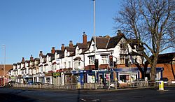 Parade of shops at Moortown Corner |
|
| Population | 22,792 (2011) |
| Metropolitan borough | |
| Metropolitan county | |
| Region | |
| Country | England |
| Sovereign state | United Kingdom |
| Post town | LEEDS |
| Postcode district | LS17 LS8 |
| Dialling code | 0113 |
| Police | West Yorkshire |
| Fire | West Yorkshire |
| Ambulance | Yorkshire |
| EU Parliament | Yorkshire and the Humber |
| UK Parliament |
|
Moortown is a busy area, or "suburb," in the city of Leeds, West Yorkshire, England. It's located in the northeast part of Leeds.
It is found between other areas like Roundhay and Gledhow to the east, and Weetwood to the west. To the south is Chapel Allerton, and to the north is Alwoodley. Sometimes, you might hear it called Moor Allerton, as both names are used for places there. Moortown is in the LS17 postcode area. In 2007, a newspaper called The Times said this area had some of the most expensive homes in Yorkshire and the Humber.
Contents
Exploring Moortown: A General Look
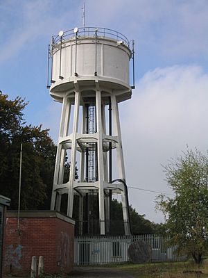
This suburb is mainly found around a big road crossing. This is where Harrogate Road (A61 road) meets the Leeds Outer Ring Road (A6120). This part of the Ring Road is sometimes called Moortown Ring Road. A tall Water Tower stands nearby, watching over the area.
Harrogate Road also leads south directly into Leeds city centre. The official boundary for the Moortown area (managed by Leeds City Council) is the Ring Road. Homes north of this road are in the Alwoodley area. However, the local Church of England church parish includes areas on both sides of the Ring Road.
There are woodlands near the Ring Road and the water tower. These woods are known as the Moortown Plantation and are part of the wider Forest of Leeds. You can find a post office, a petrol station, and other shops on Harrogate Road at the northern end of Moortown. Moortown also has some smaller areas with council housing. These are located around the crossing of King Lane and the Moortown Ring Road.
Moortown Corner: Shops and Transport
Moortown Corner is a well-known spot where Street Lane and Harrogate Road meet. It's a popular place for shopping and a good landmark. The building called the Corner House was once a cinema, ballroom, and restaurant from 1938 to 1940. Today, it has many different shops. From 1968 to 2008, it even had a casino.
Close by, there is a large Marks and Spencer Simply Food supermarket. This store serves all the nearby areas. You can also find branches of Leeds Building Society and Virgin Money (which used to be Yorkshire Bank) at Moortown Corner. The Halifax bank branch here closed on January 9, 2024.
Moortown Corner is a busy place for buses. First Leeds service 2 runs very often, about every 10 minutes. Other bus services like 7A, 7S, 38, and 48 also pass through less often. The Harrogate Bus Company's special route 36 also stops here. As of August 2021, this bus runs between central Leeds and Harrogate every 15 minutes.
Moor Allerton District Centre: A Shopping Hub
The Moor Allerton District Centre is next to the Moortown area, just north of the Ring Road. It's west of the King Lane crossing and first opened in 1982. This centre is mostly a shopping area. It has a large Sainsbury's supermarket and a Homebase store. There is also a public library here.
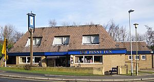
A pub nearby, now called the King on the Lane, was known as the Penny Fun until 2019. Its old name comes from the history of the area. The word 'pen' comes from the old Celtic word for 'hill'. A hill called Tunnel How Hill can be seen from the Centre. This hill was once known as Pen-how-fyn. A small village around where the Centre is now was called Paenfynaen, meaning 'settlement'. Tunnel How Hill was called Penny Fun in the 1800s, and some houses nearby used that name too. There's also a Penny Field in Meanwood Park.
Moortown's Housing Areas
Moortown has several different housing estates, each with its own character.
Black Moor and Cranmer Bank Homes
North of the Ring Road and west of King Lane, you'll find the Moortown estate (west). Cranmer Bank is part of this estate. It's named after the moorland where Moortown was built. This area has many types of homes, from the 1950s to newer buildings along Black Moor Road.
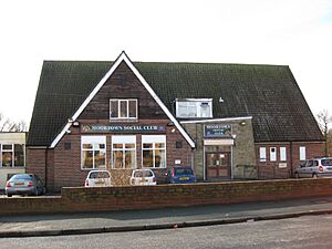
There's a line of shops on Cranmer Bank. You can also find Moortown Social Club at the top of the hill, along with St Stephen's Church (Church of England). The main parts of this estate include Blackmoor, Tynwald, Deanswood, Scotland Wood, Cranmer Bank, Alderton, and Saxon.
Lingfield Estate: Semi-Detached and Flats
To the north of the Ring Road and east of King Lane is the Lingfield Estate. This area mostly has semi-detached houses and council flats. These homes are rented out to residents.
Queenshill Estate: Low-Rise Living
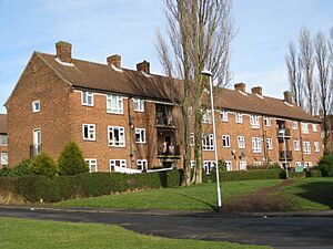
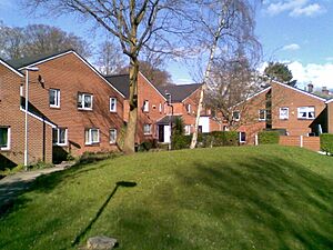
South of the Ring Road and east of King Lane is the Queenshill estate. This estate mainly has low-rise flats, which means buildings with only a few floors. It was officially opened in 1962 by Sir Keith Joseph.
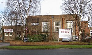
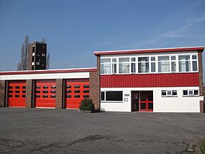
In this area, you'll find a small group of shops. There's also a fire station, Moortown Baptist Church, and the offices for the Leeds Jewish Housing Association.
Leafield: A Historic Home Area
A smaller group of public homes is located south of the Ring Road and west of King Lane. These homes are built on the land of a former large house called Leafield House. This house later became Leafield Clinic, which was once an office for health services. Today, it is a nursery.
Leafield House was built around 1873 and was first known as Albert House. In the 1920s, it was the home of William Powell Bowman. He owned a company that made "Yorkshire Relish," a popular spicy sauce. Millions of bottles of this sauce were made in the late 1800s and early 1900s.
Leeds Corporation bought Leafield House in 1951. Two years later, they planned to turn it into a centre for mothers and children. When health services moved to newer buildings in 2012, Leafield House was updated to become office space.
Darkwood: Modern Flats in the Woods
Darkwood is a small group of low-rise flats built in the 1990s. It's located off Shadwell Lane, within woods known as Blackwoods. These woods are part of the Forest of Leeds. The land was originally a large private estate called "Blackwood." The City of Leeds bought it before 1963. The main house was turned into several large flats, and the big grounds were kept. Later, the current low-rise flats were built in the 1990s.
Religion in Moortown
Moortown and its nearby area, Alwoodley, are important centres for the Jewish community in Leeds. There are three synagogues in the Moortown area. These are the Beth Hamidrash Hagadol Synagogue on Street Lane, Etz Chaim Synagogue on Harrogate Road, and the UHC Synagogue on Shadwell Lane.
The Marjorie and Arnold Ziff Community Centre opened in 2005. It offers facilities for the Jewish community in Leeds and the surrounding area. It has the only Kosher restaurant in Leeds and provides offices for some Jewish organisations.
The Church of England parish church is St John the Evangelist. It's on the corner of Harrogate Road and the Ring Road. The Catholic church is the Immaculate Heart of Mary Church. There is also a Baptist church on King Lane. Moortown Methodist Church Centre is in the Black Moor area. It is currently used by other ministries and churches, but it does not have regular Methodist services anymore.
There are also three mosques in the area. These mosques also serve as community centres for Muslims. One of them is in the building that used to be the "Lingfield" pub on Lingfield Hill, which opened in 2016.
St Gemma's Hospice: Caring for Others
Moortown is home to St Gemma's Hospice. A hospice is a special place that provides care and support for people who are very ill. This charity hospice was started by the Sisters of the Cross and Passion in 1978. It is named after St Gemma's School, which used to be on the same site. The school was named after an Italian Saint called Gemma Galgani.
The hospice is located south of Moortown Corner on Harrogate Road. In 2017, it became a University Teaching Hospice. This means it works with the University of Leeds to teach healthcare professionals about palliative care, which is care that helps people feel more comfortable. St Gemma's Hospice also runs 24 charity shops around Leeds to help raise money.
Sports and Recreation in Moortown
Moortown has a Rugby Union football club for those who enjoy the sport. The famous Moortown Golf Club hosted the 1929 Ryder Cup, a major golf tournament. However, this golf club is located well north of the Ring Road and is now part of the Alwoodley area.
Moor Allerton Sports and Social Centre offers various activities. You can play bowls, tennis, and enjoy other indoor sports there. North Leeds FC's home football pitch is on Cranmer Bank, right next to Moortown Social Club.
Local Government and Community
As of July 2022, Moortown is represented by three Labour Councillors. There is also one Labour MP who represents the area in the UK Parliament. These elected officials are responsible for listening to and helping with concerns from the Moortown community.
The Moortown Community Group often works with these local councillors. For example, they have helped with the Council's Neighbourhood Design Statement, which guides how the area develops.
Moortown's Location
 |
Alwoodley |  |
||
| Adel | Roundhay | |||
| Chapel Allerton |
 | Sharif Bey |
 | Hale Woodruff |
 | Richmond Barthé |
 | Purvis Young |


