
Mount Bogart facts for kids
Quick facts for kids Mount Bogart |
|
|---|---|

Mount Bogart (behind, left of center) seen with Ribbon Peak from Highway 40
|
|
| Highest point | |
| Elevation | 3,144 m (10,315 ft) |
| Prominence | 492 m (1,614 ft) |
| Parent peak | Wind Mountain (3153 m) |
| Listing | Mountains of Alberta |
| Geography | |

Mount Bogart
Location in Alberta

Mount Bogart
Location in Canada
|
|
| Location | Alberta, Canada |
| Parent range | Kananaskis Range Canadian Rockies |
| Topo map | NTS 82J/14 |
| Geology | |
| Age of rock | Cambrian |
| Climbing | |
| First ascent | 1930 by W. Feuz, K. Gardiner |
| Easiest route | Moderate Scramble |
Mount Bogart is a tall mountain, about 3,144 meters (10,315 feet) high. You can find it in Kananaskis Country, a beautiful area in the Canadian Rockies of Alberta, Canada. Its closest taller neighbor is Wind Mountain, which is about 4.7 kilometers (2.9 miles) north. Mount Bogart is located northwest of Mount Kidd. You can see both mountains from Highway 40 near the Kananaskis Village area.
Mountain History
Mount Bogart got its name from Donaldson Bogart Dowling. He was an engineer who worked for the Geological Survey of Canada. In 1904, he explored this area and named the mountain after his mother, whose maiden name was Bogart.
The first time someone successfully climbed to the top of Mount Bogart was in 1930. Two climbers, Kate Gardiner and Walter Feuz, achieved this. They also were the first to climb other mountains like Mount Lyautey and Mount Galatea that same year. The official name, Mount Bogart, was approved in 2006 by the Geographical Names Board of Canada.
How the Mountain Formed
Mount Bogart is made of sedimentary rock. This type of rock formed from layers of sand, mud, and shells that settled at the bottom of ancient shallow seas. These layers were laid down over millions of years, from the Precambrian to the Jurassic periods.
Later, during a time called the Laramide orogeny, huge forces pushed these rock layers. They were pushed east and even slid over younger rocks. This process created the towering mountains we see today, including Mount Bogart.
Mountain Climate
Mount Bogart has a subarctic climate. This means it has very cold and snowy winters. Summers are usually mild. Temperatures can drop below −20 °C (–4 °F), and with wind, it can feel even colder, sometimes below −30 °C (–22 °F).
Rain and melting snow from the mountain flow into two main areas. To the east, water drains into the Kananaskis River. To the west, it flows into Spray Lakes Reservoir. Both of these water bodies eventually empty into the Bow River.

Images for kids
-
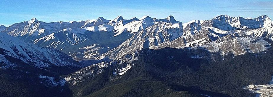
Mount Bogart far left, Lougheed center, Skogan Peak right
-
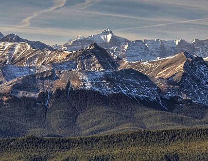
Mount Bogart centered in the distance


