Mount Margaret (Skamania County, Washington) facts for kids
Quick facts for kids Mount Margaret |
|
|---|---|
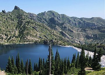
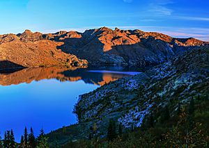
Southwest aspect, centered beyond St. Helens Lake
(The Dome upper left) |
|
| Highest point | |
| Elevation | 5,850 ft (1,780 m) |
| Prominence | 400 ft (120 m) |
| Isolation | 0.94 mi (1.51 km) |
| Parent peak | Mount Whittier (5,883 ft) |
| Geography | |
| Location | Mount St. Helens National Volcanic Monument Skamania County, Washington, U.S. |
| Parent range | Cascade Range |
| Topo map | USGS Spirit Lake West |
| Geology | |
| Volcanic arc | Cascade Volcanic Arc |
| Climbing | |
| Easiest route | class 1 hiking via trail |
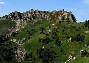
Mount Margaret is a mountain peak in southwest Washington state. It stands 5,850 feet (1,780 meters) tall. You can find it inside the Mount St. Helens National Volcanic Monument. It is also part of the Gifford Pinchot National Forest in Skamania County.
Mount Margaret is part of the Cascade Range. It is about 2 miles (3.2 km) north of Spirit Lake. It is also 2.4 miles (3.9 km) northeast of Coldwater Peak. The closest taller mountain is Mount Whittier, which is 0.93 miles (1.5 km) to the north. Mount St. Helens is about 8 miles (13 km) to the south. Water from Mount Margaret flows into Coldwater Creek. This creek then joins the North Fork Toutle River. Hikers can reach the mountain using a trail. The peak was named before 1900. A prospector admired Margaret "Maggie" Shultz Layton (1877-1965). She was an early resident of Toledo, Washington.
How Mount Margaret Was Formed
The Cascade Range formed millions of years ago. This happened during the late Eocene Epoch. Many geological events created the mountains. These events caused big changes in height and different climates.
During the Pleistocene period, over two million years ago, glaciers played a big role. They moved forward and backward many times. This movement carved and shaped the land. The North American Plate is slowly moving over the Pacific Plate. This movement caused volcanoes to erupt.
In 1980, Mount St. Helens had a huge eruption. A powerful side blast hit Mount Margaret. This blast removed all the plants from its slopes. Because Mount Margaret is so close to Mount St. Helens, volcanic ash is very common in the area.
Weather and Climate
Mount Margaret is in a marine west coast climate zone. This is typical for western North America. Most weather systems start in the Pacific Ocean. They then travel northeast towards the Cascade Range.
When these weather systems reach the mountains, they are forced upwards. This is called Orographic lift. As they rise, they drop their moisture. This moisture falls as rain or snow on the Cascades. So, the west side of the Cascades gets a lot of rain and snow. This is especially true in winter.
During winter, the weather is often cloudy. But in summer, high-pressure systems build over the Pacific Ocean. This often means clear skies. The best time to visit or climb Mount Margaret is from July through September. The weather is usually clear and pleasant then.
 | Tommie Smith |
 | Simone Manuel |
 | Shani Davis |
 | Simone Biles |
 | Alice Coachman |


