The Dome (Washington) facts for kids
Quick facts for kids The Dome |
|
|---|---|
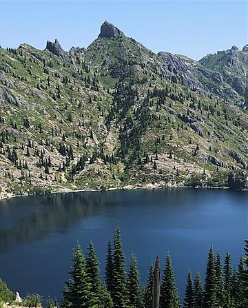
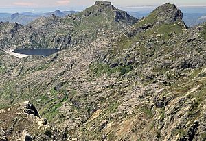
Southwest aspect, with St. Helens Lake
|
|
| Highest point | |
| Elevation | 5,720 ft (1,740 m) |
| Prominence | 400 ft (120 m) |
| Isolation | 1.16 mi (1.87 km) |
| Parent peak | Mount Margaret (5,860 ft) |
| Geography | |
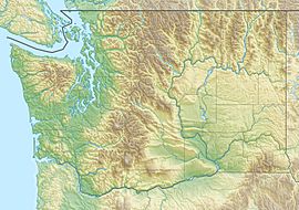
| Location | Mount St. Helens National Volcanic Monument Skamania County, Washington, U.S. |
| Parent range | Cascade Range |
| Topo map | USGS Spirit Lake West |
| Geology | |
| Type of rock | Tertiary volcanic rock |
| Volcanic arc | Cascade Volcanic Arc |
The Dome is a mountain peak in the state of Washington, USA. It stands about 5,720 feet (1,743 meters) tall. You can find it in the Mount St. Helens National Volcanic Monument. This area is part of the Gifford Pinchot National Forest in Skamania County.
The Dome is located in the Cascade Range of mountains. It's less than 2 miles (3.2 km) north of Spirit Lake. Another peak, Coldwater Peak, is about 1.28 miles (2.06 km) to its northeast. The closest taller mountain is Mount Margaret, which is about 1.16 miles (1.87 km) away. The famous Mount St. Helens volcano is about 7.5 miles (12.1 km) south of The Dome. Water from The Dome flows into Coldwater Creek, which then joins the North Fork Toutle River.
How The Dome Was Formed
The mountains in the Cascade Range began forming millions of years ago. This happened during a time called the late Eocene Epoch. Over a very long time, big geological events shaped the land. These events created the tall peaks and deep valleys you see today.
About two million years ago, during the Pleistocene period, glaciers played a big role. Huge sheets of ice moved across the land, carving out the mountains. This process happened many times, shaping the landscape we see now.
The North American Plate is a giant piece of Earth's crust. It slowly moved over another plate called the Pacific Plate. This movement caused volcanoes to form and erupt. The rocks that make up The Dome are from these ancient volcanic events.
The 1980 Mount St. Helens Eruption
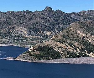
The Dome is very close to Mount St. Helens. In 1980, Mount St. Helens had a huge eruption. A powerful side-blast from the volcano shot straight towards The Dome. This blast was so strong that it ripped away all the trees and plants from the mountain's slopes. Because The Dome is so near Mount St. Helens, you can find a lot of volcanic ash in the area.
Weather and Climate
The Dome is in a place with a "marine west coast" climate. This means it gets a lot of moisture from the ocean. Most weather systems start over the Pacific Ocean. They then travel northeast towards the Cascade Mountains.
When these weather systems hit the tall Cascade Mountains, they are forced to rise. This process is called Orographic lift. As the air rises, it cools down and drops its moisture. This leads to a lot of rain or snow falling on the western side of the Cascades.
Because of this, the west side of the Cascades gets a lot of precipitation. This is especially true during the winter months, when there is often heavy snowfall. In winter, the weather is usually cloudy. However, during the summer, high-pressure systems over the Pacific Ocean often bring clear skies. This means there is little or no cloud cover in July, August, and September. These months usually offer the best weather for visiting or climbing The Dome.
 | Frances Mary Albrier |
 | Whitney Young |
 | Muhammad Ali |


