Mount Sunapee facts for kids
Quick facts for kids Mount Sunapee |
|
|---|---|

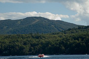
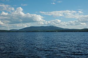
View from Lake Sunapee
|
|
| Highest point | |
| Elevation | 2,726 ft (831 m) |
| Prominence | 1,466 ft (447 m) |
| Geography | |
| Location | Newbury / Goshen, New Hampshire, U.S. |
| Topo map | USGS Newport Quadrangle |
| Climbing | |
| Easiest route | Andrew Brook Trail |
Mount Sunapee is a long mountain ridge in western New Hampshire, United States. It stretches about 5 miles (8 kilometers) through the towns of Newbury and Goshen. The highest point of the mountain is 2,726 feet (831 meters) above sea level.
Mount Sunapee has several other peaks too. These include White Ledges, North Peak, and South Peak. The northern part of the mountain, including its highest point, is part of Mount Sunapee State Park. This park is a large area of 3.85 square miles (9.97 square kilometers) and is home to the well-known Mount Sunapee Resort. The mountain also reaches south to Pillsbury State Park.
A special hiking path called the Monadnock-Sunapee Greenway runs along the entire mountain ridge. This trail connects Mount Sunapee's summit with Mount Monadnock, which is about 50 miles (80 kilometers) to the south. Another trail, the Sunapee-Ragged-Kearsarge Greenway, also crosses the summit. This 75-mile (121-kilometer) trail links ten towns around Lake Sunapee. Both Greenway trails meet at a spot called Lake Solitude and share the same path to the summit.
Contents
Where Does the Water Go?
The top of Sunapee Mountain acts like a natural dividing line for water. It separates the areas where water flows into the Merrimack River from where it flows into the Connecticut River. This is called a watershed divide.
Lake Solitude and Eastern Streams
Lake Solitude is a 6-acre (2.4-hectare) lake located just a short distance southeast of the White Ledges peak. It sits at a high elevation of 2,510 feet (765 meters). Water from Lake Solitude flows into Andrew Brook. This brook then joins the Warner River, which is part of the Merrimack River watershed. Further south on the mountain, the eastern slopes also drain into the West Branch of the Warner River, eventually reaching the Merrimack River.
Western and Northern Streams
The northern and western sides of Mount Sunapee send their water towards the Connecticut River. Johnson Brook flows down the northern slopes and into Lake Sunapee. The water from Lake Sunapee then flows out through the Sugar River to the Connecticut River. On the western slopes, streams like Gunnison Brook, Blood Brook, and Baker Brook flow into the South Branch of the Sugar River. The very southwestern end of the mountain drains into Cherry Brook, which is part of the Ashuelot River. The Ashuelot River eventually reaches the Connecticut River near the Massachusetts border.
Fun Things to Do at Mount Sunapee
Mount Sunapee is a great place for outdoor activities all year round.
Winter Sports
In winter, Mount Sunapee Resort & Ski Area is very popular for snow skiing and snowboard riding. This ski area is located inside Mount Sunapee State Park. In 1998, the state allowed a company to operate the 968-acre (392-hectare) ski area. New ski lifts were added that same year to make it even better for visitors.
Hiking and Trails
The state park has many trails that people use for hiking in all seasons. In winter, these trails are also perfect for snowshoeing. The park is connected to Pillsbury State Park by the 50-mile (80-kilometer) Monadnock-Sunapee Greenway. It's also part of the 75-mile (121-kilometer) "emerald necklace" of the Sunapee-Ragged-Kearsarge (SRK) Greenway. This larger trail connects Mount Sunapee to other state parks like Wadleigh State Park and Winslow and Rollins State Parks on Mount Kearsarge.
From the ski area parking lot, the Summit Trail goes for 2 miles (3.2 kilometers) along the western side of the mountain to the top. At the summit, it meets the Solitude Trail, which is a 1-mile (1.6-kilometer) walk to Lake Solitude and White Ledges. The Solitude Trail then connects to other paths, including the popular Andrew Brook Trail and the steeper Newbury Trail, both heading east. It also links to the Monadnock-Sunapee Greenway as it continues south along Sunapee Mountain towards Pillsbury State Park.

 | May Edward Chinn |
 | Rebecca Cole |
 | Alexa Canady |
 | Dorothy Lavinia Brown |


