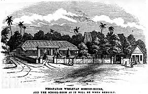
Nagapattinam facts for kids
Quick facts for kids
Nagapattinam
Chola nadu
|
|
|---|---|
|
Town
|
|
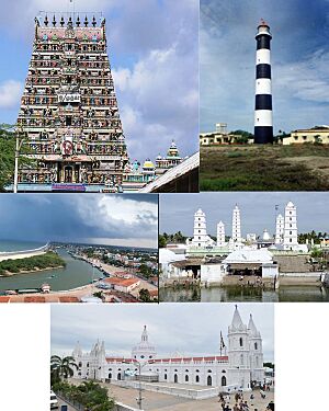
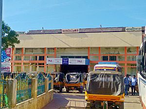
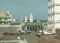
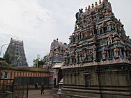
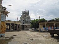
Sikkal Singaravelan temple, Nagapattinam Lighthouse, Beach view, Nagore Dargah, Velankanni Basilica of Our Lady of Good Health
|
|
| Nickname(s):
City of Coromandel
|
|
| Country | |
| State | |
| District | Nagapattinam |
| Region | Cauvery Delta |
| Established | 1866 |
| Government | |
| • Type | Selection Grade Municipality |
| • Body | Nagapattinam Municipality Chairman R.Marimuthu |
| Area | |
| • Total | 17.92 km2 (6.92 sq mi) |
| Elevation | 29 m (95 ft) |
| Population
(2011)
|
|
| • Total | 102,905 |
| • Rank | 32 |
| • Density | 5,800/km2 (15,000/sq mi) |
| Languages | |
| • Official | Tamil |
| Time zone | UTC+5:30 (IST) |
| PIN |
611xxx
|
| Telephone code | 04365 |
| Vehicle registration | TN 51 |
Nagapattinam is a historic town in the Indian state of Tamil Nadu. It's the main city of the Nagapattinam District. This town became very important during the time of the Medieval Cholas (from the 9th to 12th centuries). It was a key port for trade and for their navy's trips to the east.
A famous Buddhist building called the Chudamani Vihara was built here. It was made by a king from Srivijaya with help from Rajaraja Chola I. Later, the Portuguese and then the Dutch settled in Nagapattinam. It was even the capital of Dutch Coromandel for a while. In 1781, the British East India Company took control.
Today, many people in Nagapattinam work in sea trade, fishing, farming, and tourism. Important religious sites include the Kayarohanaswami Temple and Soundararajaperumal Temple, Nagapattinam. Nagapattinam is also a great starting point to visit nearby places like Sikkal, Velankanni, and Nagore Dargah.
Contents
What Does Nagapattinam Mean?
The name Nagapattinam comes from two words. Nagar refers to people from Sri Lanka who settled here. Pattinam means "town."
Long ago, during the time of King Kulottunga I, it was also called CholakulaVallipattinam. This name honored one of his queens. The ancient writer Ptolemy might have called it "Nikam," saying it was a major trade center. However, there isn't much proof for this.
The town was often called "the city of Coromandel" by early travelers. Seventh-century poets Appar and Tirugnanasambandar called it Nagai in their poems. The word Pattinam was added later when it grew into an important port during the Chola period.
A Glimpse into Nagapattinam's Past
There are signs of human life in Nagapattinam from a very long time ago. This includes ancient burial sites. While Ptolemy might have mentioned it, there are no direct records of Nagapattinam from 3rd century BCE to 3rd century CE. A nearby port, Kaveripoompattinam (now Poompuhar), was the capital of the Chola kingdom during the Sangam Age.
Ancient Temples and Buddhist Influence
The Soundarajaperumal temple is mentioned in old Hindu texts. It's one of the 108 special Vishnu temples called Divya Desams. These temples are praised by the Alvars, who were saint poets from the 5th to 9th centuries CE.
Poems from the 7th century describe Nagapattinam as a town with strong walls, busy roads, and a lively port. Inscriptions show that the Kayarohanaswami temple started being built around 691–729 CE. A Buddhist temple was also built here, influenced by Chinese styles. Many Buddhist travelers visited the town.
In the 11th century CE, a Buddhist monastery called Chudamani Vihara was built. It was supported by King Rajaraja Chola I. This monastery was named after the father of the king who built it. Nagapattinam was a key port for the Cholas for trade and for their journeys to conquer lands in the east.
European Influence and British Rule
In the early 1500s, the Portuguese started trading here and set up a business center in 1554 CE. They also began missionary work. In 1658, the Dutch made a deal with the King of Thanjavur. This agreement gave them ten villages, including Nagapattinam Port, from the Portuguese in 1662. The Dutch built churches and a hospital. They even made coins with "Nagapattinam" written in Tamil.
Nagapattinam became the capital of Dutch Coromandel in 1690. The town was taken by the British in 1781 after naval battles. When the Dutch and British made peace in 1784, Nagapattinam officially became British territory.
From 1799 to 1845 CE, Nagapattinam was the main city of the Tanjore district. Nagapattinam and Nagore became one municipality in 1866 CE. It remained an important port for the Madras Presidency. However, its importance lessened when other ports like Tranquebar and Tuticorin grew. After India became independent, Nagapattinam was part of Thanjavur district until 1991. Then, it became the main city of the new Nagapattinam district.
Nagapattinam's Location and Environment
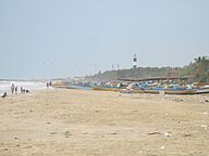
Nagapattinam is located on the eastern coast of India. It is bordered by the Bay of Bengal to the east. The town is very close to sea level. It covers an area of about 17.92 square kilometers (6.92 sq mi). Nagapattinam is about 300 kilometers (186 mi) from Chennai.
The land in Nagapattinam is flat and made of a mix of sand, silt, and clay. The Vettar River and other branches of the Cauvery river flow through the area. Paddy is the main crop grown here. Other crops include groundnuts and sugarcane. The town is in an area that often gets hit by cyclones.
Climate in Nagapattinam
Nagapattinam has a tropical climate. It has a wet season from August to December because of the northeast monsoon. The city gets about 1350 millimeters (53 inches) of rain each year. Because it's so close to the sea, the air is humid all year round.
| Climate data for Nagapattinam, India (1981–2010, extremes 1901–2012) | |||||||||||||
|---|---|---|---|---|---|---|---|---|---|---|---|---|---|
| Month | Jan | Feb | Mar | Apr | May | Jun | Jul | Aug | Sep | Oct | Nov | Dec | Year |
| Record high °C (°F) | 32.4 (90.3) |
35.6 (96.1) |
40.0 (104.0) |
41.7 (107.1) |
42.8 (109.0) |
41.7 (107.1) |
41.7 (107.1) |
40.6 (105.1) |
38.9 (102.0) |
37.6 (99.7) |
35.0 (95.0) |
33.9 (93.0) |
42.8 (109.0) |
| Mean daily maximum °C (°F) | 29.0 (84.2) |
30.0 (86.0) |
31.6 (88.9) |
33.5 (92.3) |
36.2 (97.2) |
36.7 (98.1) |
36.1 (97.0) |
35.5 (95.9) |
34.2 (93.6) |
32.0 (89.6) |
29.8 (85.6) |
29.0 (84.2) |
32.8 (91.0) |
| Mean daily minimum °C (°F) | 22.5 (72.5) |
23.0 (73.4) |
24.5 (76.1) |
26.6 (79.9) |
27.4 (81.3) |
26.9 (80.4) |
26.4 (79.5) |
25.9 (78.6) |
25.6 (78.1) |
25.1 (77.2) |
24.0 (75.2) |
23.0 (73.4) |
25.1 (77.2) |
| Record low °C (°F) | 16.1 (61.0) |
15.6 (60.1) |
16.7 (62.1) |
20.0 (68.0) |
20.6 (69.1) |
20.6 (69.1) |
21.7 (71.1) |
20.0 (68.0) |
20.6 (69.1) |
20.6 (69.1) |
16.7 (62.1) |
16.7 (62.1) |
15.6 (60.1) |
| Average rainfall mm (inches) | 56.4 (2.22) |
13.1 (0.52) |
16.7 (0.66) |
33.2 (1.31) |
42.6 (1.68) |
40.3 (1.59) |
47.1 (1.85) |
82.9 (3.26) |
92.2 (3.63) |
252.3 (9.93) |
444.1 (17.48) |
245.4 (9.66) |
1,366.3 (53.79) |
| Average rainy days | 2.7 | 0.9 | 0.8 | 1.2 | 2.5 | 2.1 | 3.2 | 4.2 | 5.0 | 9.8 | 13.1 | 8.4 | 53.9 |
| Average relative humidity (%) (at 17:30 IST) | 72 | 69 | 70 | 71 | 69 | 65 | 65 | 66 | 71 | 76 | 79 | 76 | 71 |
| Source: India Meteorological Department | |||||||||||||
The 2004 Tsunami's Impact
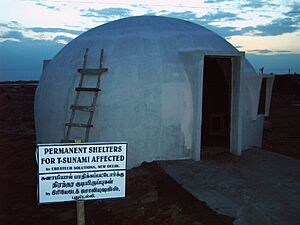
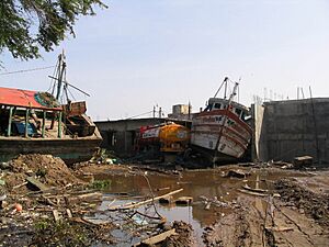
On December 26, 2004, a huge tsunami hit the coasts of the Indian Ocean. It was caused by a powerful undersea earthquake near Sumatra, Indonesia. Nagapattinam district was the worst affected part of Tamil Nadu. More than 6,000 people lost their lives here. Many of the victims were from the fishing community, who lived close to the sea. The tsunami also damaged many boats, which hurt the fishing industry.
Who Lives in Nagapattinam?
| Religion in Nagapattinam (2011) | ||||
|---|---|---|---|---|
| Religion | Percent(%) | |||
| Hindu | 71.4% | |||
| Muslim | 24.8% | |||
| Christian | 3.7% | |||
| Others | 0.1% | |||
| Historical population | ||
|---|---|---|
| Year | Pop. | ±% |
| 1901 | 35,890 | — |
| 1911 | 42,586 | +18.7% |
| 1921 | 49,282 | +15.7% |
| 1931 | 55,978 | +13.6% |
| 1941 | 62,674 | +12.0% |
| 1951 | 69,370 | +10.7% |
| 1961 | 74,965 | +8.1% |
| 1981 | 80,560 | +7.5% |
| 1991 | 86,155 | +6.9% |
| 2001 | 93,148 | +8.1% |
| 2011 | 102,905 | +10.5% |
Sources:
|
||
In 2011, Nagapattinam had a population of 102,905 people. There were slightly more females than males. About 11,884 residents were under the age of six. The average literacy rate (people who can read and write) was about 78.74%.
Most people in Nagapattinam are Hindus (71.4%). A significant number are Muslims (24.79%), and about 3.68% are Christians. The town has grown over the years, but some people have moved to other cities for work. In 2001, there were 40 slum areas in the town. Many of these were rebuilt with tsunami-proof houses after the 2004 disaster.
Nagapattinam's Economy
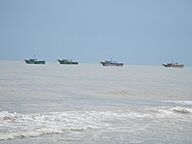
The main job in Nagapattinam is fishing in the Bay of Bengal. The fish caught are sold in local markets. There are many ice factories to keep the fish fresh. The fishing industry faced challenges after the 2004 tsunami.
While there isn't much farming directly in the town, a lot of agricultural trade happens here. Many people also work in service jobs, like retail. Nagapattinam is a central place for buying and selling goods for nearby towns and villages.
Tourism is also a big part of the economy. Many people visit the historic and religious sites nearby. These include Nagore, Velankanni, and Sikkal.
There are not many large factories in Nagapattinam. Most industries are small, like tailoring, embroidery, and making plastic wires. The Nagapattnam Refinery, which processes oil, is a major business and helps the town's economy.
Getting Around Nagapattinam
Nagapattinam has a good network of roads, totaling over 100 kilometers (62 mi). Two national highways connect the town to other major cities. The Tamil Nadu State Transport Corporation runs many daily bus services. These connect Nagapattinam to various cities and also provide local transport within the town.
Rail and Sea Travel
The Great Southern of India Railway Company (GSIR) had its main office in Nagapattinam from 1861 to 1875. A railway line was built connecting Nagapattinam to other towns. The railway workshop, which helped the town grow, was also in Nagapattinam until 1929.
Today, Nagapattinam Junction railway station connects to nearby towns like Thiruvarur Junction and Nagore. There are passenger trains to many cities, including Chennai Egmore.
The port of Nagapattinam is located at the mouth of the Kuduvayyar river in the Bay of Bengal. It was the most important port for the Chola empire. All the eastern naval trips of Rajendra Chola I (1012–44 CE) started from this port. The Dutch, Portuguese, and British also used it as a major trading port. Goods like rice, tobacco, and hides were sent from here to places like Sri Lanka and Burma. The port also used to have passenger services to Singapore.
Today, the port mainly handles imports of edible oil. The Nagapattinam lighthouse, built by the British in 1869, is 20 meters (66 ft) tall. It helps guide ships.
Air Travel
The closest airport to Nagapattinam is Tiruchirapalli Airport. It is about 145 kilometers (90 mi) away from the town.
Culture and Tourist Spots
Tourism is a big part of Nagapattinam's economy. The town is a great starting point to visit many historical and religious sites.
Hindu Temples
The Soundararajaperumal Temple is a Hindu temple dedicated to Vishnu. It is one of the 108 special temples for Vishnu. Nagapattinam is also close to other important Hindu temples. These include the Sikkal Singaravelan Temple and the Vedaranyeswarar Temple.
The Kayarohanaswami Temple is a Hindu temple dedicated to Shiva. It has been around since the 6th century CE. This temple is famous for its special dance styles of the deity Thyagaraja. It is also known for the shrine of Neelayadakshi, who is the partner of Kayarohanaswami.
Nagore Dargah and Christian Churches
Nagore Durgha is a 16th-century minaret in Nagore. It's an important pilgrimage site. The Kanduri festival is a 14-day event celebrated here every year. It honors the saint Hajrath Shahul Hamid. People from different religions, including Hindus and Muslims, take part in this festival. Many believe that Hindus helped build a large part of the shrine.
Velankanni is another important pilgrimage center, about 10 kilometers (6 mi) from Nagapattinam. It is known for the Basilica of Our Lady of Good Health, a Roman Catholic church built in the 17th century. Many people, including Hindus, Muslims, and Christians, visit the basilica, especially in September.
Education and Services
St. Joseph's College started in Nagapattinam in 1846. It later moved to Tiruchirappalli. In 2012, the Tamil Nadu Government opened a special fisheries university in Nagapattinam.
The town has many schools: 12 elementary schools, 8 high schools, and 7 higher secondary schools. There is also 1 Medical College, 3 arts and science colleges, 2 engineering colleges, and 3 polytechnic colleges.
The Tamil Nadu Electricity Board (TNEB) provides electricity to the town. The Nagapattinam Municipality supplies water from the Vettar river. About 55 metric tonnes of waste are collected from the town every day. Nagapattinam does not have an underground drainage system.
Bharat Sanchar Nigam Limited (BSNL) provides phone and internet services. There are six government hospitals in the town, with the District Government Hospital being the largest. There are also many private hospitals and clinics.
|
See also
 In Spanish: Nagapattinam para niños
 | Toni Morrison |
 | Barack Obama |
 | Martin Luther King Jr. |
 | Ralph Bunche |


