Narbona Pass facts for kids
Quick facts for kids Narbona Pass |
|
|---|---|
| Washington Pass | |
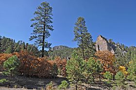
Chuska Mountains near Narbona Pass
|
|
| Elevation | 8,721 ft (2,658 m) |
| Traversed by | |
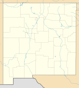
| Location | San Juan County, New Mexico |
| Coordinates | 36°05′24″N 108°51′36″W / 36.090°N 108.860°W |
Narbona Pass (once called Washington Pass) is a mountain pass in the Chuska Mountains. These mountains are a long range on the Colorado Plateau, located within the Navajo Nation.
A paved road, New Mexico Highway 134, goes through Narbona Pass. It connects the towns of Sheep Springs and Crystal. The pass was named Narbona to honor a Navajo leader. This was unusual because Navajo tradition usually avoids naming places after people. The name celebrates his victory over a Mexican army in 1835.
In the Navajo language, the pass is known as So Sila, which means "Twin Stars." Later, in 1859, it was named in English after Colonel John M. Washington. He was a military governor of New Mexico. In 1849, he led an expedition into Navajo lands. During this trip, his troops shot and killed the Navajo leader Narbona.
In 1992, the pass was officially renamed Narbona Pass. This change honors the Navajo leader Narbona.
Contents
Why is it called Narbona Pass?
The name Narbona Pass honors the Navajo chief Narbona. It celebrates his important victory against a Mexican invasion. This invasion was aimed at traditional Navajo lands.
What is the geology of Narbona Pass?
Narbona Pass sits within the caldera of a very old volcano. A caldera is a large bowl-shaped hollow that forms after a volcano erupts and collapses. This volcano, called the Narbona Pass volcano, was formed by powerful explosions long ago.
The lowest layers in the crater are about 5 to 20 meters (16 to 66 feet) thick. They are made of volcanic rock pieces called lapilli tuff. On top of these are layers from many explosive eruptions. These eruptions created a mix of volcanic ash and thick lava flows. Three lava flows happened between 27.5 and 24.3 million years ago. The crater is about 2 miles (3.2 km) wide, with walls 700 feet (213 meters) high.
The Chuska Mountains, near Narbona Pass, show a type of rock called Chuska sandstone. This sandstone is what's left of an ancient sand field from the Oligocene era. This era was about 34 to 23 million years ago. This sand field, called an erg, might have covered a huge area of about 125,000 square kilometers (48,000 sq mi). It was surrounded by other ancient volcanoes.
What is the climate like at Narbona Pass?
In 1849, someone on the Washington expedition described the area. They saw tall pine and fir trees, oak, aspen, and willow. There were also many kinds of bushes and colorful flowers. They hoped to see more of this "rich, well-timbered and sufficiently well-watered country."
However, even in July, the temperature stays cool, reaching only about 70°F (21°C) at noon. Only two months of the year are free of frost. In winter, up to 50 inches (127 cm) of snow can pile up in drifts on north-facing slopes. In 1884, Thomas Keam wrote that the mountain plain was nice in summer. But he said it was "entirely impracticable in winter" because it was one of the coldest places. He heard it was often covered with two feet of snow.
Prehistory of Narbona Pass
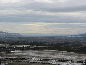
Narbona Pass Chert is a special type of rock. It has a fine texture and breaks in a regular way. This makes it great for making stone tools and weapon heads. This process is called flintknapping. The chert comes in many colors, like white, pale blue, dark gray, and pink. Narbona Pass is the only known place to find this pure, fine-grained rock.
This chert was traded across the Four Corners region. This area was home to the Ancestral Puebloans. They are also known as the Chaco people because of their rock structures in Chaco Canyon. Chaco Canyon is east of Narbona Pass.
Narbona Pass Chert was found more often in stone tools from Chaco Canyon. This was especially true between 1020 AD and 1120 AD. During this time, chert made up over 20% of the material used for stone tools there. It seems the raw rock was brought in, not finished tools. Chert was also found at other Chaco period sites, but in much smaller amounts.
In 2009, researchers found a pink stone spear point at Bluebird House. This was a small pueblo in the Hovenweep National Monument. It was about 90 miles (145 km) north of Narbona Pass. The stone was identified as Narbona Pass Chert. This was a rare find for sites north of the San Juan River. The tool was likely made between 1000 AD and 1140 AD. This was when a large trading network existed, centered in Chaco Canyon. It was probably made using a pressure flaking technique at Narbona Pass. Then it was traded to other areas.
Early History of Narbona Pass
The Navajo people arrived in the Southwest around 1400 AD. They were nomadic hunter-gatherers who spoke Southern Athabaskan languages. They settled in the mountains between the valleys where the Pueblo people lived. Over time, the Navajo became farmers and then herders. They adopted parts of Pueblo culture through trade and marriage.
However, the Navajo remained strong warriors. They marked the northern edge of Spanish expansion. The Canyon de Chelly, west of Narbona Pass, became a sacred place for the Navajo. The Navajo people called Narbona Pass Beesh Lichii'ii Bigiizh, which means "Copper Pass." The Navajo see the Chuska mountain range as the body of a male god. Chuska peak is its head, and Narbona Pass is its neck.
In the early 1800s, Navajo warriors often raided Mexican lands and attacked traders on the Santa Fe Trail. Mexicans would also raid Navajo lands, sometimes to capture people for slavery. In 1804, the Navajo attacked a Spanish military post. They wanted to get back their grazing land near Mount Taylor, their sacred Turquoise Mountain. In 1805, Spanish Lt. Col. Antonio Narbona (not related to the Navajo leader) led an expedition. He crossed Narbona Pass to attack Canyon de Chelly. His forces killed over 115 Navajo and took 33 women and children as slaves.
In February 1835, Mexican Captain Blas de Hinojos left Santa Fe. He led nearly 1,000 Mexican troops into Navajo country. On February 28, 1835, Hinojos's force entered Narbona Pass. The Navajo leader Narbona knew Hinojos was coming. He prepared an ambush with about 250 warriors. Narbona's warriors hid on both sides of the narrow pass. When the signal was given, they attacked the Mexican column with arrows, guns, and rocks. The Mexicans were completely surprised and panicked. Many were killed, including their leader. It is said that bones from this battle can still be found in the pass. Some wooden ladders the Navajo used to climb the rocks for the ambush might also be there.
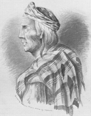
In 1849, the United States took control of New Mexico from Mexico. Colonel John M. Washington led a large force of soldiers and volunteers into Navajo country. They met Navajo envoys who wanted to talk about peace. Then they met the main Navajo forces, led by Narbona and José Largo. The Navajo brought gifts, including sheep and horses. After the talks, one Navajo was accused of stealing a horse. When the Navajo tried to leave, Washington's troops shot six of them as they ran away. Narbona was among those killed. The expedition then moved through the pass, naming it "Washington Pass" to honor their leader.
Later History of Narbona Pass
In 1864, Colonel Kit Carson began a harsh campaign against the Navajo. His soldiers destroyed Navajo herds and crops. Then they invaded Canyon de Chelly. In 1866, eight thousand Navajo people were forced to walk to Fort Sumner in eastern New Mexico. Many died on this march or later from smallpox. The survivors were allowed to return in 1868. They were given reservation lands that grew to 11.5 million acres by 1886.
The first known trader in Washington Pass was Romulo Martinez in 1873. Other traders followed, but they seemed to be temporary. They often traded from tents during the summer.
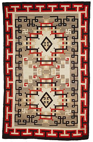
In 1896, John Bradford Moore arrived. He bought the trading site. He built a log trading post using timber from the mountains. He stocked it with supplies brought from Gallup. His post was at the western entrance to the pass. He named it the Crystal Trading Post. In winter, he hired Navajo weavers to make rugs. Moore made sure the wool and weaving were high quality. He also created his own designs. Soon, his post became known for good quality rugs.
Moore's business grew. In 1903 and 1911, he published mail-order catalogs. This brought customers from all over the United States. Moore understood what people in the eastern U.S. wanted. He emphasized natural materials and traditional methods in his catalog. However, he also used modern production methods. He was fine with using machine-made yarns and synthetic dyes.
Traders in Navajo rugs had to keep costs low to offer good prices. This meant wages for weavers were low. Moore said that weaving was often the only way for Navajo women to earn money.
A. J. Molohon took over from Moore. He continued to introduce complex designs, some inspired by Oriental rugs. The Crystal Trading Post changed owners several times. Until the 1930s, Crystal rugs usually had borders and a central design in natural colors, sometimes with red. After that, the style changed. New rugs had banded designs with wavy lines made by using two or three different colors. These newer rugs often used muted colors like rust, brown, and gray, but sometimes included pastel colors. Don Jensen bought the post in 1944 and owned it until 1981. He is credited with developing the modern Crystal rug style.
The Navajo people slowly became more successful and independent. However, they faced problems like overgrazing. In the 1950s, the discovery of coal, oil, and uranium brought money to the Navajo. But it also brought social problems and pollution. Most Navajo people forgot the true history of the pass. They thought it was named after George Washington or Washington, D.C..
In 1990, students at the Navajo Community College in Shiprock learned the real story. They were upset that a place on the Navajo Nation was named after an enemy. They started a campaign to change the name to "Narbona Pass." They gained a lot of support. On December 10, 1992, the United States Board on Geographic Names voted to change the name. This was perhaps the first time Native Americans successfully named a place after a Native American. Narbona Pass is also one of the few Native American sites named after a victim in a conflict.
Narbona Pass Today
The 33rd Annual Narbona Pass Classic was held on July 1, 2012. It used to be called the Washington Pass Classic. The event included a 5 km (3.1 mi) fitness walk, a 5 km run, and a 10 km (6.2 mi) run. The 10 km race is one of the top 100 races of its kind in the United States. It happens every year on the 4th of July weekend. In 2000, most of the 400+ runners were local. Their families and friends supported them with a relaxed barbecue at the finish line. Running is important in Navajo culture.
The Narbona Pass Classic race is challenging. It goes through difficult forest terrain. Nicholas Kipruto, a former Diné College runner from Kenya, set a record for the 10 km race in 2009 with a time of 34 minutes and 7 seconds. In 2011, Jackson Thomas won the 10 km race with a time of 39 minutes and 43 seconds. That year, three women in their seventies competed in the 5 km race. In 2012, Kipruto won again with a time of 34 minutes and 36 seconds. Jackson Thomas came in second with 39 minutes and 40 seconds.
There is an easy cross-country ski trail in the crater. It goes from the road to Todacheene Lake. It is about 3 miles (4.8 km) long and goes up about 200 feet (61 meters). The road through the pass is also popular for biking. It is a 36-mile (58 km) round trip. It starts at 5,900 feet (1,800 meters) and rises to 8,700 feet (2,650 meters) at the top. Riders need to be in good shape. The reward is amazing panoramic views. There is also a campground in the pass. You have to pay a fee, and campfires are allowed.
 | Isaac Myers |
 | D. Hamilton Jackson |
 | A. Philip Randolph |


