National Register of Historic Places listings in Arlington County, Virginia facts for kids
Welcome to Arlington County, Virginia! Did you know that many special places here are protected because of their history? This list tells you all about the buildings, neighborhoods, and other spots in Arlington County that are part of the National Register of Historic Places.
The National Register of Historic Places is like a special list kept by the United States government. It helps protect places that are important to American history, architecture, archaeology, engineering, or culture. When a place is on this list, it means it's recognized as a valuable part of our past.
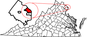
Arlington County has 70 amazing places on this list! Five of these are even more special and are called National Historic Landmarks. These landmarks are considered super important to the history of the entire country. You can even see where some of these places are on an online map if you have their exact location coordinates.
Historic Places in Arlington County
This section lists all the cool and important places in Arlington County that are on the National Register of Historic Places. Each entry tells you a little bit about the place, where it is, and when it was added to the list.
| Name on the Register | Image | Date listed | Location | City or town | Description | |
|---|---|---|---|---|---|---|
| 1 | Al's Motors |
(#03000628) |
3910 Wilson Blvd. 38°52′47″N 77°06′24″W / 38.879722°N 77.106667°W |
Ballston | This building used to be a car dealership. Today, it's a Gold's Gym! | |
| 2 | Arlington Forest Historic District |
(#05001344) |
Bounded by Carlin Springs Rd., George Mason Dr., Henderson Rd., Aberdeen St., Columbus St., Granada, Galveston and 2nd 38°52′14″N 77°07′08″W / 38.870556°N 77.118889°W |
Arlington | This is a historic neighborhood known for its unique homes and community feel. | |
| 3 | Arlington Heights Historic District |
(#08000063) |
Bounded by Arlington Blvd., S. Fillmore St., S. Walter Reed Dr., Columbia Pk., & S. Glebe Rd. 38°52′03″N 77°05′27″W / 38.867500°N 77.090833°W |
Arlington | Another historic neighborhood in Arlington, recognized for its special character. | |
| 4 | Arlington House, The Robert E. Lee Memorial |
(#66000040) |
Arlington National Cemetery 38°52′52″N 77°04′21″W / 38.881111°N 77.072500°W |
Arlington | This historic house was once the home of Robert E. Lee. It's now a memorial. Its protected area was made larger in 2014. | |
| 5 | Arlington Memorial Bridge |
(#80000346) |
Spans the Potomac River 38°53′06″N 77°03′44″W / 38.885000°N 77.062222°W |
SW | This beautiful bridge connects Arlington to Washington, D.C., over the Potomac River. | |
| 6 | Arlington National Cemetery Historic District |
(#14000146) |
1 Memorial Drive 38°52′48″N 77°04′12″W / 38.880000°N 77.070000°W |
Arlington | This famous cemetery is a historic district itself, including Arlington House and Memorial Drive. | |
| 7 | Arlington Ridge Park |
(#09000688) |
Northwest corner of N. Meade St. and Marshall Dr. 38°53′26″N 77°04′11″W / 38.890556°N 77.069722°W |
Arlington | A park that is recognized for its historical significance. | |
| 8 | Arlington Village Historic District |
(#03000215) |
S. 13th St., S. 13 Rd., S. 16th St., S. Barton S., S. Cleveland St. and Edgewood St. 38°51′33″N 77°05′02″W / 38.859167°N 77.083889°W |
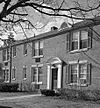
Arlington | This district is known for its garden-style apartment homes built in the 1930s. | |
| 9 | Ashton Heights Historic District |
(#03000561) |
Roughly bounded by Wilson Blvd., N. Irving St., Arlington Blvd., N. Oxford St., N. Piedmont & N. Oakland Sts. 38°51′08″N 77°03′28″W / 38.852222°N 77.057778°W |
Arlington | A historic neighborhood with many older homes, showing how Arlington grew. | |
| 10 | Aurora Highlands Historic District |
(#08001018) |
Bounded by 16th St. S., S. Eads St., 26th St. S., and S. Joyce St. 38°51′16″N 77°03′28″W / 38.85445°N 77.057733°W |
Arlington | This area is recognized for its historical development and architecture. | |
| 11 | Ball-Sellers House |
(#75002014) |
5620 S. 3rd St. 38°51′50″N 77°07′30″W / 38.863750°N 77.125000°W |
Glencarlyn | One of the oldest buildings in Arlington, showing early settlement. | |
| 12 | Barcroft Community House |
(#95000928) |
800 S. Buchanan St. 38°51′35″N 77°06′37″W / 38.859639°N 77.110278°W |
Arlington | This building has served as a community gathering place for many years. | |
| 13 | Benjamin Banneker: SW-9 Intermediate Boundary Stone |
(#76002094) |
18th and Van Buren Sts. 38°52′59″N 77°09′33″W / 38.882944°N 77.159083°W |
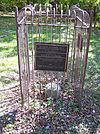
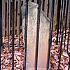
Arlington | This stone marks part of the original border of Washington, D.C., surveyed by Benjamin Banneker. | |
| 14 | Buckingham Historic District |
(#98001649) |
Roughly bounded by N. 5th, N. Oxford, and N. 2nd Sts., and N. Glebe Rd.; also bounded by N. Oxford St., Fifth St. N, N. Henderson Rd., First St. N., N. Pershing, N. Thomas St., and Second St. N.; also bounded by and including N. Thomas St., 4th St. N. , N. Pershing Dr., and N. George Mason Dr. 38°52′30″N 77°06′20″W / 38.875000°N 77.105556°W |
Arlington | A large apartment complex built in the 1930s, known for its unique design. Its protected area has been expanded over time. | |
| 15 | Calvert Manor |
(#97001506) |
1925-1927 N. Calvert St. 38°53′44″N 77°05′31″W / 38.895556°N 77.091944°W |
Arlington | This building is a historic apartment complex. | |
| 16 | Carlin Hall |
(#93000833) |
5711 4th St., S. 38°51′47″N 77°07′34″W / 38.863194°N 77.126111°W |
Glencarlyn | Carlin Hall is an important community building in Glencarlyn. | |
| 17 | Cherrydale Historic District |
(#03000461) |
Roughly bounded by Lorcom Ln., N. Utah and N. Taylor Sts., and Interstate 66 38°53′41″N 77°06′12″W / 38.894722°N 77.103333°W |
Cherrydale | This historic district shows the development of the Cherrydale area. | |
| 18 | Cherrydale Volunteer Fire House |
(#95000927) |
3900 N. Lee Hwy. 38°53′47″N 77°06′26″W / 38.896389°N 77.107222°W |
Cherrydale | This old fire station is a landmark in the Cherrydale community. | |
| 19 | Claremont Historic District |
(#06000751) |
Bounded by S. Dinwiddie St., S. Chesterfield Rd., S. Buchanan St., 25th St. S, 24th St. S, 23rd St. S and 22nd St. S 38°50′47″N 77°06′20″W / 38.846389°N 77.105556°W |
Arlington | A historic neighborhood in Arlington. | |
| 20 | Clarendon School |
(#99001502) |
3550 Wilson Blvd. 38°52′54″N 77°06′07″W / 38.881667°N 77.101944°W |
Clarendon | This old school building is now the Arlington Arts Center. | |
| 21 | Colonial Village |
(#80004170) |
Roughly bounded by Wilson Blvd., Lee Hwy., N. Veitch St. and Queens Lane 38°53′40″N 77°05′00″W / 38.894444°N 77.083333°W |
Arlington | Colonial Village is a historic apartment community. | |
| 22 | Columbia Forest Historic District |
(#04000047) |
Bounded by 11th, S. Edison, S. Dinwiddie, S. Columbus, S. George Mason, and S. Frederick St. 38°51′09″N 77°06′41″W / 38.8525°N 77.1114°W |
Arlington | This area is recognized for its historic homes and layout. | |
| 23 | George Crossman House |
(#03000455) |
2501 N. Underwood St. 38°53′32″N 77°09′38″W / 38.892222°N 77.160694°W |
Arlington | A historic house that shows the architecture of its time. | |
| 24 | Dominion Hills Historic District |
(#12000239) |
Roughly bounded by N. Four Mile Run Dr., N. McKinley Rd., N. Larrimore, N. Madison, N. Montana Sts., & 9th St. N. 38°52′33″N 77°08′29″W / 38.875833°N 77.141389°W |
Arlington | This historic district is known for its residential architecture. | |
| 25 | Charles Richard Drew House |
(#76002095) |
2505 1st St., S. 38°52′22″N 77°05′13″W / 38.872778°N 77.086806°W |
Arlington | This was the home of Dr. Charles Drew, a famous surgeon and medical researcher. | |
| 26 | Fairlington Historic District |
(#99000368) |
Roughly bounded by Quaker Lane, King St., I-395, S. Walter Reed Dr., and S. Abingdon St. 38°50′17″N 77°05′57″W / 38.838056°N 77.099167°W |
Fairlington | Fairlington is a large historic community built during World War II. | |
| 27 | Fort C. F. Smith Historic District |
(#99001719) |
2411 24th St. 38°54′06″N 77°05′25″W / 38.901667°N 77.090278°W |
Arlington | This fort was part of the defenses of Washington, D.C., during the Civil War. | |
| 28 | Fort Ethan Allen |
(#04000052) |
Junction of Glebe and Ridgeview Rds. 38°55′27″N 77°07′26″W / 38.924167°N 77.123889°W |
Arlington | Another Civil War-era fort that helped protect the capital. | |
| 29 | Fort Myer Historic District |
(#72001380) |
Arlington Blvd. (U.S. 50) 38°52′58″N 77°04′58″W / 38.882778°N 77.082778°W |
Arlington | Fort Myer is an active military base with a rich history. | |
| 30 | George Washington Memorial Parkway |
(#95000605) |
Roughly, south side of the Potomac River from American Legion to Memorial Bridge and north side from Brickyard Rd. to Chain Bridge 38°55′15″N 77°06′33″W / 38.920833°N 77.109167°W |
Arlington | This scenic parkway is a historic route along the Potomac River. | |
| 31 | Georgetown Pike |
(#12000537) |
From DC/VA boundary at Chain Bridge to the junction with Leesburg Pike at Seneca Rd. 38°55′52″N 77°07′09″W / 38.931111°N 77.119167°W |
Arlington | An old road that connects Arlington to other historic areas. It goes into Fairfax County too. | |
| 32 | Glebe Center |
(#04000055) |
71-89 N. Glebe Rd. 38°52′20″N 77°07′10″W / 38.872222°N 77.11944°W |
Ballston | A historic commercial building in Ballston. | |
| 33 | The Glebe |
(#72001381) |
4527 17th St., N. 38°53′31″N 77°07′04″W / 38.891944°N 77.117778°W |
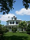
Arlington | This historic house is known for its unique octagon-shaped wing. | |
| 34 | Glebewood Village Historic District |
(#04000049) |
N. Brandywine St. between Lee Highway and 10th Place N., 21St Rd. between N. Brandywine St. and N. Glebe Rd. 38°53′44″N 77°07′26″W / 38.895556°N 77.123889°W |
Arlington | This district features historic homes and a special neighborhood design. | |
| 35 | Glencarlyn Historic District |
(#08000910) |
Bounded by S. Carlin Springs Rd., Arlington Blvd., 5th Rd. S., Glencarlyn Park 38°51′49″N 77°07′35″W / 38.863611°N 77.126389°W |
Glencarlyn | Glencarlyn is one of Arlington's oldest planned communities. | |
| 36 | Harry W. Gray House |
(#64000051) |
1005 S. Quinn St. 38°51′55″N 77°04′29″W / 38.865139°N 77.074722°W |
Arlington | This house is recognized for its historical architecture. | |
| 37 | Highland Park-Overlee Knolls |
(#11000548) |
Roughly bounded by 22nd St. N., N. Lexington St., 16th St. N., N. Longfellow St., McKinley Rd., I-66 & N. Quantico St. 38°53′12″N 77°08′49″W / 38.886667°N 77.146944°W |
Arlington | A historic residential area in Arlington. | |
| 38 | Hume School |
(#79003027) |
1805 S. Arlington Ridge Rd. 38°51′32″N 77°04′03″W / 38.858750°N 77.067500°W |
Arlington | This old school building now houses the Arlington Historical Society. | |
| 39 | Francis Scott Key Bridge |
(#96000199) |
U.S. Route 29 over the Potomac River 38°54′05″N 77°04′13″W / 38.901389°N 77.070278°W |
Arlington | This historic bridge connects Arlington to Georgetown in Washington, D.C. | |
| 40 | Lee Gardens North Historic District |
(#04000109) |
2300-2341 N. 11th St. 38°53′08″N 77°05′12″W / 38.885556°N 77.086667°W |
Arlington | A historic district known for its garden apartment style. | |
| 41 | Lomax African Methodist Episcopal Zion Church |
(#04000038) |
2704 24th Rd. S. 38°50′52″N 77°04′56″W / 38.847778°N 77.082222°W |
Arlington | This church is an important part of the African American history in Arlington. | |
| 42 | Lyon Park Historic District |
(#03000437) |
Roughly bounded by 10th St. N, Arlington Blvd., and N. Irving St. 38°52′45″N 77°05′26″W / 38.879167°N 77.090556°W |
Arlington | A historic neighborhood with a strong community feel. | |
| 43 | Lyon Village Historic District |
(#02000512) |
Roughly bounded by Lee Highway, N. Veitch St., N. Franklin Rd., N. Highland St., N. Fillmore St., and N. Kirkwood Rd. 38°53′29″N 77°05′42″W / 38.891389°N 77.095000°W |
Arlington | This district is known for its early 20th-century homes. | |
| 44 | Maywood Historic District |
(#03000460) |
Roughly bounded by Lorcom Ln., Spout Run Parkway, I-66, Lee Highway, N. Oakland St., N. Nelson St., and N. Lincoln St. 38°53′53″N 77°06′05″W / 38.898056°N 77.101389°W |
Arlington | Maywood is a historic neighborhood with unique architecture. | |
| 45 | Monroe Courts Historic District |
(#08000064) |
1041-1067 N. Nelson and 1036-1062 & 1033-1055 N. Monroe Sts. 38°53′08″N 77°06′16″W / 38.885556°N 77.104444°W |
Arlington | This district includes historic apartment buildings. | |
| 46 | Mount Vernon Memorial Highway |
(#81000079) |
Washington St. and George Washington Memorial Parkway 38°47′42″N 77°02′57″W / 38.795000°N 77.049167°W |
Arlington | This highway is a historic route leading to George Washington's home. | |
| 47 | Northwest No. 1 Boundary Marker of the Original District of Columbia |
(#91000003) |
3607 Powhatan St. 38°54′12″N 77°09′33″W / 38.903472°N 77.159167°W |
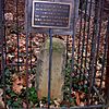
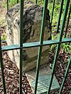
Arlington | One of the original stones marking the border of Washington, D.C. | |
| 48 | Northwest No. 2 Boundary Marker of the Original District of Columbia |
(#91000004) |
5145 N. 38th St. 38°54′49″N 77°08′46″W / 38.913667°N 77.146111°W |
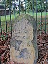
Arlington | Another boundary stone from the early days of the nation's capital. | |
| 49 | Northwest No. 3 Boundary Marker of the Original District of Columbia |
(#91000005) |
4013 N. Tazewell St. 38°55′28″N 77°07′55″W / 38.924583°N 77.132083°W |
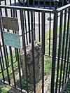
Arlington | This stone helps mark the original northwest corner of the District of Columbia. | |
| 50 | Penrose Historic District |
(#04000112) |
Roughly bounded by Arlington Blvd., S. Courthouse Rd., S. Fillmore St., S. Barton St. S, and Columbia Pike 38°52′08″N 77°05′04″W / 38.868889°N 77.084444°W |
Arlington | A historic neighborhood in Arlington. | |
| 51 | Pentagon Office Building Complex |
(#89000932) |
Jefferson Davis Highway/VA 110 at I-395 38°52′16″N 77°03′23″W / 38.871111°N 77.056389°W |
Pentagon City | The Pentagon is the headquarters of the U.S. Department of Defense. It's a huge and very important building. | |
| 52 | Quarters 1, Fort Myer |
(#72001382) |
Grant Ave. 38°52′58″N 77°04′53″W / 38.882778°N 77.081389°W |
Arlington | This historic house at Fort Myer has been home to many important military leaders. | |
| 53 | Saegmuller House |
(#03000453) |
5101 Little Falls Rd. 38°54′22″N 77°08′24″W / 38.906111°N 77.140000°W |
Arlington | A historic house with unique architectural features. | |
| 54 | Southwest No. 4 Boundary Marker of the Original District of Columbia |
(#91000009) |
King St. north of the junction with Wakefield St. 38°49′54″N 77°05′36″W / 38.831667°N 77.093333°W |
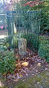
Alexandria | Another one of the original boundary stones for Washington, D.C. | |
| 55 | Southwest No. 5 Boundary Marker of the Original District of Columbia |
(#91000010) |
Northeast of the junction of King St. and Walter Reed Dr. 38°50′31″N 77°06′24″W / 38.842083°N 77.106667°W |
Arlington | This stone marks part of the historic border. | |
| 56 | Southwest No. 6 Boundary Marker of the Original District of Columbia |
(#91000011) |
S. Jefferson St. south of the junction with Columbia Pike, in median strip 38°51′07″N 77°07′09″W / 38.851861°N 77.119250°W |
Arlington | One of the many stones that show the original shape of the District of Columbia. | |
| 57 | Southwest No. 7 Boundary Marker of the Original District of Columbia |
(#91000012) |
Behind 3101 S. Manchester St. 38°51′44″N 77°07′57″W / 38.862361°N 77.132500°W |
Arlington | This stone is another piece of the historic D.C. boundary. | |
| 58 | Southwest No. 8 Boundary Marker of the Original District of Columbia |
(#91000013) |
Junction of Wilson Blvd. and John Marshall Dr., behind apartment building 38°52′22″N 77°08′45″W / 38.872639°N 77.145861°W |
Arlington | This boundary stone is located near a busy intersection. | |
| 59 | Stratford Junior High School |
(#04000110) |
4100 Vacation Ln. 38°54′00″N 77°06′44″W / 38.900000°N 77.112222°W |
Cherrydale | This school is famous for being the site of an important event in civil rights history. | |
| 60 | Unitarian Universalist Church of Arlington |
(#14000943) |
4444 Arlington Blvd. 38°52′06″N 77°06′27″W / 38.868333°N 77.107500°W |
Arlington | This church building is recognized for its architectural design. | |
| 61 | US Post Office-Arlington |
(#86000151) |
3118 N. Washington Blvd. 38°53′08″N 77°05′44″W / 38.885556°N 77.095417°W |
Clarendon | This historic post office building serves the Clarendon area. | |
| 62 | Virginia Heights Historic District |
(#08000065) |
Bounded by 10th Pl. S., S. Frederick St. & S. George Mason Dr. 38°51′02″N 77°06′53″W / 38.850556°N 77.114722°W |
Arlington | A historic neighborhood in Arlington. | |
| 63 | Walter Reed Gardens Historic District |
(#03000451) |
2900-2906 13th St. S., 2900-2914 13th Rd. S., 1301-1319 S. Walter Reed Dr. 38°51′33″N 77°05′13″W / 38.859167°N 77.086944°W |
Arlington | This district is known for its historic garden apartment buildings. | |
| 64 | Washington National Airport Terminal and South Hangar Line |
(#97001111) |
Thomas Ave. 38°50′56″N 77°02′30″W / 38.848889°N 77.041667°W |
Arlington | The original terminal and hangar area of the airport are historically important. | |
| 65 | Waverly Hills Historic District |
(#04000111) |
Roughly bounded by 20th Rd. N., N. Utah St, I-66, N. Glebe Rd. and N. Vermont St. 38°53′31″N 77°07′02″W / 38.891944°N 77.117222°W |
Arlington | A historic neighborhood in Arlington. | |
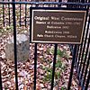
| 66 | West Cornerstone |
(#91000014) |
West side of Meridian St., south of the junction with Williamsburg Blvd. 38°53′36″N 77°10′20″W / 38.893333°N 77.172222°W |
Falls Church | This stone marks the westernmost point of the original District of Columbia. | |
| 67 | Westover Historic District |
(#06000345) |
Bounded by McKinley Rd., N. Washington Blvd., N. 16th St., N. Jefferson St., N. 11th St. and N. Fairfax Dr. 38°52′58″N 77°08′11″W / 38.882775°N 77.136525°W |
Arlington | Westover is a historic neighborhood with a unique town center. | |
| 68 | Earle Micajah Winslow House |
(#11000028) |
2333 N. Vernon St. 38°54′06″N 77°07′09″W / 38.901667°N 77.119167°W |
Arlington | This house is recognized for its historical importance. |


