
National Register of Historic Places listings in Brooklyn facts for kids
The National Register of Historic Places is a special list of places in the United States that are important to history. These places can be buildings, neighborhoods, or even parks. When a place is on this list, it means it's worth protecting and learning about. Brooklyn, which is also known as Kings County, New York, has many amazing places on this list!

Contents
- Famous Landmarks in Brooklyn
- Historic Buildings and Districts
- Important Public Buildings
- Historic Neighborhoods and Homes
- Brooklyn Heights Historic District
- Carroll Gardens Historic District
- Clinton Hill Historic District
- Crown Heights North Historic District
- Ditmas Park Historic District
- DUMBO Industrial District
- Fort Greene Historic District
- Greenpoint Historic District
- Park Slope Historic District
- Prospect Park South Historic District
- Stuyvesant Heights Historic District
- Wallabout Historic District
- Houses of Worship
- Other Notable Places
- Images for kids
- See also
Famous Landmarks in Brooklyn
Brooklyn is home to some truly iconic spots that are recognized for their history.
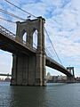
The Brooklyn Bridge
The Brooklyn Bridge is one of the most famous bridges in the world. It connects Brooklyn to Manhattan across the East River. This amazing bridge was finished in 1883 and was a huge achievement in engineering at the time. It's not just a way to get across the river; it's a symbol of New York City's history and growth.
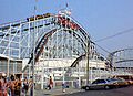
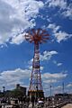
Coney Island's Fun History
Coney Island is a famous amusement area in Brooklyn. It has several historic attractions on the National Register.
The Cyclone Roller Coaster
The Coney Island Cyclone is a classic wooden roller coaster that opened in 1927. It's known for its thrilling drops and turns. Even today, it gives riders an exciting experience, just like it did almost a hundred years ago!
The B&B Carousell
The B&B Carousell is a beautiful carousel that dates back to 1906. It's the only original carousel left in Coney Island. Riding it feels like stepping back in time to the early days of amusement parks.
The Parachute Jump
The Parachute Jump is a tall tower that looks like a giant erector set. It was built for the 1939 New York World's Fair and later moved to Coney Island. Riders would sit in seats attached to parachutes and be lifted up, then dropped down. While it doesn't operate anymore, it's still a very recognizable landmark.
Prospect Park: A Green Oasis
Prospect Park is a large park designed by the same people who created Central Park in Manhattan. It's a wonderful place for people to relax and play.
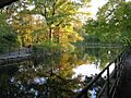
The Boathouse on the Lullwater
Inside Prospect Park, you'll find the Boathouse. This beautiful building is located by the lake and adds to the park's charm. It's a great example of classic park architecture.
The Grecian Shelter
Another lovely spot in Prospect Park is the Grecian Shelter. This open-air structure has a classic Greek design. It's a peaceful place where visitors can find shade and enjoy the park's beauty.
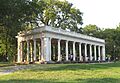
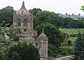
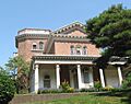
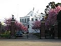
Litchfield Villa
The Litchfield Villa is a historic mansion located on the western edge of Prospect Park. It was built in the 1850s and is a stunning example of Italianate architecture. Today, it serves as the headquarters for the Prospect Park Alliance.
Historic Buildings and Districts
Many individual buildings and entire neighborhoods in Brooklyn are recognized for their historical importance.
Important Public Buildings
Brooklyn has several public buildings that tell a story about the borough's past.
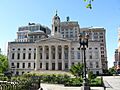
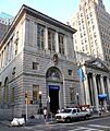
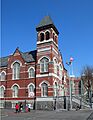
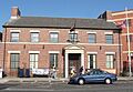
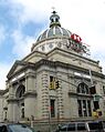
Brooklyn Borough Hall
Brooklyn Borough Hall is the historic seat of government for Brooklyn. This grand building, completed in 1848, was once the city hall for the independent City of Brooklyn before it became part of New York City. It's a symbol of Brooklyn's long history.
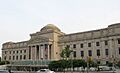
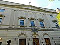
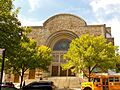
Brooklyn Museum
The Brooklyn Museum is one of the oldest and largest art museums in the United States. Its grand building, opened in 1897, is a landmark itself. It holds millions of artworks from around the world, making it a treasure for art lovers.
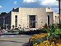
Brooklyn Public Library - Central Building
The Central Library of the Brooklyn Public Library system is a magnificent building at Grand Army Plaza. It opened in 1941 and is known for its impressive architecture and the important role it plays in the community as a center for learning.
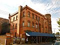
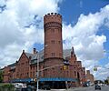
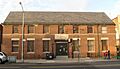
Old Brooklyn Fire Headquarters
The Old Brooklyn Fire Headquarters is a historic building that once served as the main fire station for Brooklyn. Built in 1892, it's a great example of the architecture from that time and shows the importance of fire services in the city's history.
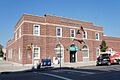
Federal Building and Post Office
The Federal Building and Post Office in Downtown Brooklyn is a significant government building. It was completed in 1891 and showcases impressive architectural details, reflecting the importance of federal services in the borough.
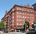
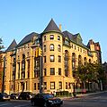
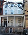
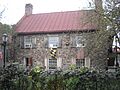
Historic Neighborhoods and Homes
Many of Brooklyn's neighborhoods have been preserved because of their unique history and architecture.
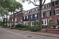
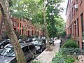
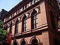
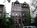
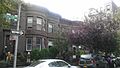
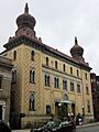
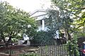
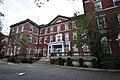
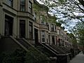
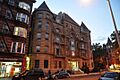
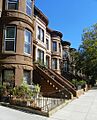
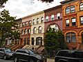
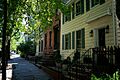
Brooklyn Heights Historic District
Brooklyn Heights Historic District was one of the first neighborhoods in the United States to be designated as a historic district. It's famous for its beautiful brownstone homes, tree-lined streets, and stunning views of the Manhattan skyline. Walking through Brooklyn Heights feels like stepping into a different era.
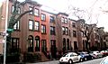
Carroll Gardens Historic District
The Carroll Gardens Historic District is known for its charming homes with large front gardens, which are unusual for New York City. This district shows how neighborhoods developed in the 19th century.
Clinton Hill Historic District
Clinton Hill Historic District features a mix of grand mansions and elegant row houses. It was once a fashionable neighborhood for wealthy families in the late 1800s.
Crown Heights North Historic District
The Crown Heights North Historic District is a large area with over 1,500 well-preserved buildings. It shows how the neighborhood grew from the 1870s to the 1930s. This district also includes properties connected to Shirley Chisholm, who was the first African-American woman elected to Congress.
Ditmas Park Historic District
Ditmas Park Historic District is unique because it features many large, freestanding Victorian-style homes, which are rare in New York City. It feels more like a suburban neighborhood than part of a bustling city.
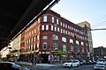
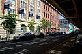
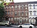
DUMBO Industrial District
The DUMBO Industrial District (which stands for Down Under the Manhattan Bridge Overpass) was once a busy industrial area with factories and warehouses. Today, many of these old buildings have been turned into homes and businesses, but they still keep their historic look.
Fort Greene Historic District
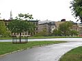
The Fort Greene Historic District is known for its beautiful brownstones and historic buildings. It's also home to Fort Greene Park, which has a monument dedicated to prisoners of war from the American Revolution.
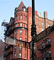
Greenpoint Historic District
Greenpoint Historic District is a neighborhood with a rich industrial and maritime history. It has many historic buildings that reflect its past as a shipbuilding and manufacturing center.
Park Slope Historic District
Park Slope Historic District is famous for its beautiful Victorian brownstone homes and its close proximity to Prospect Park. It's a very popular and well-preserved neighborhood.
Prospect Park South Historic District
Similar to Ditmas Park, Prospect Park South Historic District is another area known for its large, detached homes with spacious yards, giving it a suburban feel within Brooklyn.
Stuyvesant Heights Historic District
The Stuyvesant Heights Historic District is a beautiful area in Bedford-Stuyvesant known for its elegant brownstone and limestone row houses. It shows the architectural styles popular in the late 19th and early 20th centuries.
Wallabout Historic District
The Wallabout Historic District contains some of the oldest surviving wooden frame houses in Brooklyn, dating back to the 17th century. It's one of the borough's earliest settled areas.
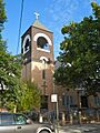
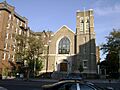
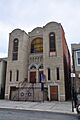
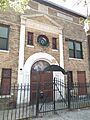
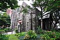
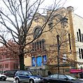
Houses of Worship
Many churches and synagogues in Brooklyn are recognized for their historical and architectural significance.
Beth El Jewish Center of Flatbush
The Beth El Jewish Center of Flatbush is a synagogue in Flatbush. It's an important center for the Jewish community in the area.
East Midwood Jewish Center
The East Midwood Jewish Center is another significant synagogue in Brooklyn. It serves as a community hub in the Midwood neighborhood.
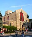
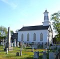
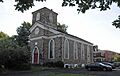
Flatbush Dutch Reformed Church Complex
The Flatbush Dutch Reformed Church Complex includes a historic church and cemetery. The church dates back to the 17th century, making it one of the oldest religious sites in Brooklyn.
New Utrecht Reformed Church
The New Utrecht Reformed Church and its buildings are also very old, with parts dating back to the 17th century. It's a key historical site in the New Utrecht area.
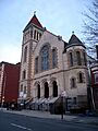
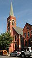
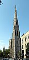
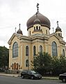
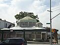
Russian Orthodox Cathedral of the Transfiguration of Our Lord
The Russian Orthodox Cathedral of the Transfiguration of Our Lord in Greenpoint is known for its unique Russian Revival architecture with onion domes. It's a beautiful and distinctive landmark.
Shaari Zedek Synagogue
The Shaari Zedek Synagogue in Bedford-Stuyvesant is a historic place of worship. It reflects the growth of Jewish communities in Brooklyn during the early 20th century.
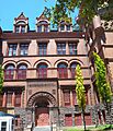
Other Notable Places
Brooklyn has many other interesting places on the National Register.
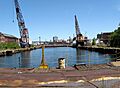
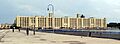
The Brooklyn Navy Yard was a very important shipyard where naval vessels were built and repaired for many years, from the American Revolution all the way through World War II. It played a huge role in American history.
Within the Navy Yard, Quarters A is a historic building that served as the home for the commandant, or commanding officer, of the naval facility.
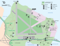
Floyd Bennett Field
Floyd Bennett Field was New York City's first municipal airport. It was a very important place for aviation history, with many famous flights taking off from there. Today, it's part of the Gateway National Recreation Area.
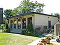
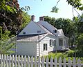
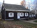
The Old Stone House of Brooklyn
The Old Stone House is a reconstructed Dutch farmhouse. It played a role in the Battle of Long Island during the American Revolutionary War. It's a reminder of Brooklyn's early history.
Jackie Robinson House
The Jackie Robinson House in East Flatbush was the home of Jackie Robinson, the legendary baseball player who broke the color barrier in Major League Baseball. It's a significant site for civil rights history.
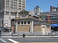
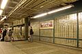
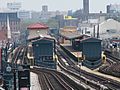
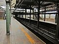
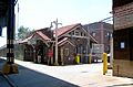
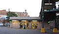
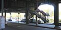
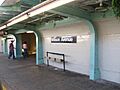
Historic Transportation Hubs
Several subway stations and related structures are on the National Register, recognized for their design and role in New York City's transportation system. These include stations like the Atlantic Avenue Subway Station and the Borough Hall Subway Station.
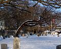
Old Cemeteries
Several cemeteries in Brooklyn are listed, not just as burial grounds, but as historic landscapes with beautiful art and architecture.
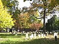
Green-Wood Cemetery
Green-Wood Cemetery is a large, historic cemetery that opened in 1838. It's known for its beautiful landscaping, impressive monuments, and being the final resting place for many famous New Yorkers. It's also a National Historic Landmark.
Beth Olam Cemetery
Beth Olam Cemetery was started in 1851 by three Jewish congregations. It's a rural cemetery with many examples of interesting architecture and funerary art.
Cypress Hills National Cemetery
Cypress Hills National Cemetery is a national cemetery established during the American Civil War. It's a place of honor for military veterans.
Historic Roadways
Two important roadways in Brooklyn are also on the National Register.
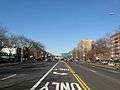
Eastern Parkway
Eastern Parkway was built in the 1870s and is considered to be the first "parkway" in the world. It was designed to be a beautiful, tree-lined road connecting parks and neighborhoods.
Ocean Parkway
Ocean Parkway, also built in the 1870s, was the second parkway planned in the United States. It connects Prospect Park to Coney Island, offering a scenic route to the beach.
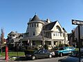
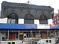
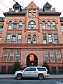
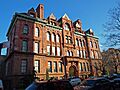
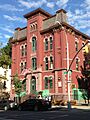
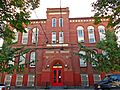
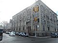
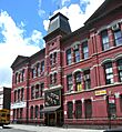
Images for kids
-
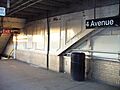
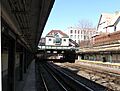
4th Avenue Station (IND)
-
9th Avenue Station (Dual System BRT)
-
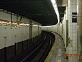
15th Street – Prospect Park Subway Station (IND)
-
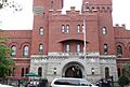
68th Police Precinct Station House and Stable
-
75th Police Precinct Station House
-
83rd Precinct Police Station and Stable
-
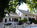
Albemarle-Kenmore Terraces Historic District
-
Alku and Alku Toinen
-
Andrews United Methodist Church
-
Astral Apartments
-
Atlantic Avenue Control House
-
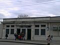
Atlantic Avenue Subway Station (IRT and BMT)
-
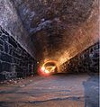
Atlantic Avenue Tunnel
-

Austin, Nichols and Company Warehouse
-
Avenue U Station (Dual System BRT)
-
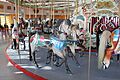
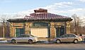
B&B Carousell
-
Baptist Temple (Brooklyn, New York)
-
Bay Parkway Station (Dual System BRT)
-
Bay Ridge United Methodist Church
-
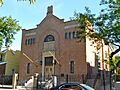
Beth El Jewish Center of Flatbush
-
Beth Olam Cemetery
-
Beverley Road Subway Station (BRT pre-Dual System)
-
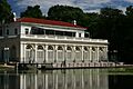
Boathouse on the Lullwater of the Lake in Prospect Park
-
Boerum Hill Historic District
-
Borough Hall Subway Station (IRT)
-
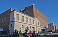
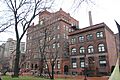
Boy's High School
-
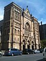
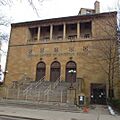
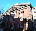
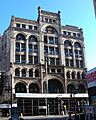
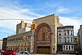
Brooklyn Academy of Music
-
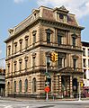
Brooklyn Borough Hall
-
Brooklyn Bridge
-
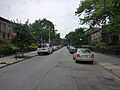
Brooklyn Heights Historic District
-
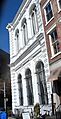
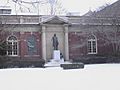
Brooklyn Historical Society
-
Brooklyn Museum
-
Brooklyn Navy Yard Historic District
-
Brooklyn Public Library-Central Building
-
Brooklyn Trust Company Building
-
Buildings at 375–379 Flatbush Avenue and 185–187 Sterling Place
-
Bushwick Avenue Central Methodist Episcopal Church
-
Carroll Gardens Historic District
-
Casemate Fort, Whiting Quadrangle
-
Christ Evangelical English Lutheran Church
-
Church of the Holy Innocents
-

Clinton Hill Historic District
-
Clinton Hill South Historic District
-
Cobble Hill Historic District
-
Coney Island Fire Station Pumping Station
-
Coney Island Yard Electric Motor Repair Shop
-
Coney Island Yard Gatehouse
-
Congregation Beth Israel
-
Congregation Chevra Linath Hazedeck
-
Congregational Church of the Evangel
-
Congregation Tifereth Israel
-

William B. Cronyn House
-
Crown Heights North Historic District
-
Cuyler Presbyterian Church
-
Cyclone Roller Coaster
-
Cypress Avenue West Historic District
-

Cypress Hills National Cemetery
-

Ditmas Park Historic District
-

DUMBO Industrial District
-
East Midwood Jewish Center
-
Eastern Parkway
-
Eighth Avenue (14th Brooklyn Regiment) Armory
-
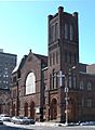
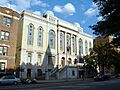
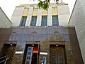
Emmanuel Baptist Church
-
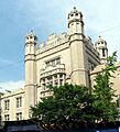
Erasmus Hall Academy
-
Evergreens Cemetery
-

Federal Building and Post Office
-
Feuchtwanger Stable
-
Flatbush Dutch Reformed Church Complex
-
Flatbush Town Hall
-

Flatlands Dutch Reformed Church
-
Floyd Bennett Field Historic District
-
Fort Greene Historic District
-
Fulton Ferry District
-
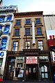
Gage and Tollner Restaurant
-
German Evangelical Lutheran St. John's Church
-
Grecian Shelter
-
Green-Wood Cemetery
-

Greenwood Baptist Church
-
Greenpoint Historic District
-

Hanson Place Seventh Day Adventist Church
-
Holy Trinity Church (Protestant Episcopal)
-
Houses at 216–264 Ovington Ave.
-
Hubbard House
-
Hunterfly Road Historic District
-
Immanuel Congregational Church
-
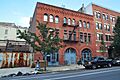
Industrial Complex at 221 McKibbin Street
-
The Jewish Center of Coney Island
-
Jewish Center of Kings Highway
-
Kings County Savings Bank
-
Kingsway Jewish Center
-
Kismet Temple
-
Knickerbocker Field Club
-

Kol Israel Synagogue
-
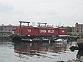
Lehigh Valley Railroad Barge No. 79
-
Lefferts Manor Historic District
-
Lefferts-Laidlaw House
-

Lincoln Club
-
Litchfield Villa
-
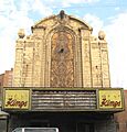
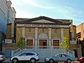
Loew's Kings Theatre
-
Hendrick I. Lott House
-
Magen David Synagogue
-
Manhattan Beach Jewish Center
-

Manhattan Bridge
-
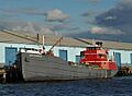
MARY A. WHALEN (tanker)
-
Monsignor McGolrick Park and Shelter Pavilion
-
New England Congregational Church and Rectory
-
New Lots Reformed Church and Cemetery
-
New Utrecht Avenue Station (Dual System BRT)
-
New Utrecht Reformed Church and Buildings
-
New York Congregational Home for the Aged
-
Ocean Parkway
-
Ocean Parkway Jewish Center
-
Ocean Parkway Station (Dual System BRT)
-
Offerman Building
-
Old Brooklyn Fire Headquarters
-
Nassau Brewing Company
-
Old First Reformed Church
-
Old Gravesend Cemetery
-
The Old Stone House of Brooklyn
-
Parachute Jump
-
Park Slope Historic District
-
Parkway Theatre
-
Plymouth Church of the Pilgrims
-
Pratt Institute Historic District
-

Prospect Hall
-

Prospect Heights Historic District
-
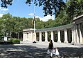
Prospect Park
-
Prospect Park South Historic District
-
Public Bath No. 7
-
Public School 108
-
Public School 111 and Public School 9 Annex
-
Public School 39
-
Public School 65K
-
Public School 7
-
Public School 71K
-
Quarters A
-

John Rankin House
-
Renaissance Apartments
-

Ridgewood Reservoir
-
John Roosevelt "Jackie" Robinson House
-
Rockwood Chocolate Factory Historic District
-
Russian Orthodox Cathedral of the Transfiguration of Our Lord
-

Saitta House
-
Senator Street Historic District
-
Shaari Zedek Synagogue
-
South Bushwick Reformed Protestant Dutch Church Complex
-
South Congregational Church
-

St. Bartholomew's Protestant Episcopal Church and Rectory
-
St. George's Protestant Episcopal Church
-
St. Luke's Protestant Episcopal Church
-

St. Mary's Episcopal Church
-
St. Paul's Protestant Episcopal Church
-

State Street Houses
-
Stoothoff-Baxter-Kouwenhaven House
-
Storehouse No. 2, U.S. Navy Fleet Supply Base
-
Stuyvesant Heights Historic District
-
Substation 401
-
Sunset Park Historic District
-
Temple Beth El of Borough Park
-
Twenty third Regiment Armory
-

Union Temple of Brooklyn
-
U.S. Army Military Ocean Terminal
-
US Post Office-Flatbush Station
-
US Post Office-Kensington
-
US Post Office-Metropolitan Station
-
US Post Office-Parkville Station
-
Joost Van Nuyse House
-
Wallabout Historic District
-
Wallabout Industrial Historic District
-
Weir Greenhouse
-
Williamsburgh Savings Bank
-
Willoughby-Suydam Historic District
-
Wilson Avenue Subway Station (Dual System BMT)
-
Pieter Wyckoff House
-
Wyckoff-Bennett Homestead
-
Young Israel of Flatbush


.JPG)


_Emmanuel_Baptist_Church-1534893.jpeg)


See also
 In Spanish: Anexo:Registro Nacional de Lugares Históricos en Brooklyn para niños
