
Oceanside, New York facts for kids
Quick facts for kids
Oceanside, New York
|
|
|---|---|

Oceanside's Liberty Lighthouse on the Veterans Triangle in 2021.
|
|

Location in Nassau County and the state of New York.
|
|

Oceanside, New York
Location in Long Island

Oceanside, New York
Location in New York
|
|
| Country | |
| State | |
| County | Nassau |
| Town | Hempstead |
| Area | |
| • Total | 5.43 sq mi (14.06 km2) |
| • Land | 4.93 sq mi (12.77 km2) |
| • Water | 0.50 sq mi (1.30 km2) |
| Elevation | 10 ft (3 m) |
| Population
(2020)
|
|
| • Total | 32,637 |
| • Density | 6,620.08/sq mi (2,556.05/km2) |
| Time zone | UTC-5 (Eastern (EST)) |
| • Summer (DST) | UTC-4 (EDP) |
| ZIP code |
11572
|
| Area codes | 516, 363 |
| FIPS code | 36-54441 |
| GNIS feature ID | 0959214 |
Oceanside is a community in Nassau County, New York, United States. It's a type of town called a hamlet and also a census-designated place (CDP). This means it's a specific area recognized for collecting population data. Oceanside is located in the southern part of the larger town of Hempstead. In 2020, about 32,637 people lived there.
| Top - 0-9 A B C D E F G H I J K L M N O P Q R S T U V W X Y Z |
History of Oceanside
Oceanside was first known as South Bay. In 1674, the English government created a township there called Christian Hook. They named it after the main religion of the people living in the area.
Early Growth and Name Changes
The area grew quickly. Selling oysters became a very important business. A local spot called "Mott's Landing" was a popular place to buy them.
In the 1800s, people thought "Oceanville" sounded better than "Christian Hook." The name "Oceanville Oysters" helped sales. So, in 1864, the new name became official. However, there was already another Oceanville in New York. Because of this, the name "Ocean Side" (two words) was chosen in 1890. It's interesting because the town doesn't actually touch the Atlantic Ocean. The ocean is a few miles south, separated by Reynolds Channel and other islands.
Fire Department and Expansion
The Oceanside Fire Department started in 1902. An old firehouse, Columbia Engine Co. #1, is still there. You can find it where Lincoln Avenue meets Long Beach Road.
In the 1900s, the town began to grow fast towards the south. They built on swamps and marshes. This made the town much bigger, changing it from a small port to a large community. In 1918, the name was shortened to "Oceanside."

Nathan's Famous Hot Dogs
The second Nathan's Famous restaurant opened in Oceanside on June 4, 1959. It was on Long Beach Road. This spot used to be a popular place called Roadside Rest. Roadside Rest had live music and dancing. It also sold hot dogs like Nathan's and local seafood.
The Nathan's building was large with play areas and a big dining room. Family shows were held there. The building was taken down in 1976. A shopping center was built in its place. Later, a new Nathan's opened on a small part of the original land. In 2016, Nathan's moved to a smaller spot on Long Beach Road.
Building Boom and Natural Disasters
After World War II, Oceanside grew even more. Many houses were built on former swampland. This made the town look more like Levittown. More schools were built, along with large houses and a public park.
However, building on swampland made Oceanside more likely to flood. This was clear in 2012 when Hurricane Sandy hit. It was the worst natural disaster for Oceanside. The storm completely flooded the southern part of town. Water even rushed down streets as far north as Nathan's.
Hurricane Sandy also caused a power outage for almost two weeks. A power station in nearby Island Park exploded. Many towns, including Oceanside, were unhappy with the slow response from the Long Island Power Authority. They held a rally because of it. Even in 2019, some people in Oceanside were still dealing with the effects of Sandy. Flooding in low areas became more common.
Recent Changes to Nathan's
In 2014, Nathan's announced it would move to a smaller location. This new spot was on Long Beach Road and Merle Avenue. Many people worried about traffic from deliveries near the school. But the Town of Hempstead approved the move. The old building closed on January 4, 2015. The new Nathan's opened in early 2015. It was designed to remind people of the first two locations, but with a modern feel.
In 2016, a huge blizzard hit Long Island. It dumped almost 2 feet of snow. This storm also flooded many towns nearby and some parts of Oceanside closest to the channel.
Oceanside's Geography

Oceanside covers about 5.4 square miles (14.0 square kilometers). Most of this area, about 5.0 square miles (12.8 square kilometers), is land. The rest, about 0.4 square miles (1.0 square kilometer), is water.
Oceanside has a humid subtropical climate. This means it has hot, humid summers and mild winters. The average monthly temperatures range from about 32°F (0°C) in January to 75°F (24°C) in July. The area is in hardiness zone 7b, which helps gardeners know what plants will grow well there.
The town was built on swampland from the early 1900s to the late 1970s. Before this, it was a small seaport. It was near larger villages like Rockville Centre, Baldwin, and East Rockaway. The town grew a lot, and its population reached almost 30,000 people by the end of the 1990s.
Getting Around Oceanside
Main Roads
Some of the main roads in Oceanside include Long Beach Road, Oceanside Road, Lawson Boulevard, and Atlantic Avenue. Other roads like Brower Avenue and Waukena Avenue were built for homes. But they also carry a lot of traffic. Sunrise Highway (NY 27) is on the northern edge of Oceanside. Merrick Road briefly goes through the town near South Nassau Communities Hospital.
Train Service
The Long Beach Branch of the Long Island Rail Road runs through the west side of Oceanside. The Oceanside train station is at Weidner Avenue and Lawson Boulevard. It's the third train station south on the Long Beach line. A train ride from Oceanside to Penn Station takes about 40 minutes. In northern Oceanside, many people use the nearby Rockville Centre Station or the Baldwin Station. These stations are on the Babylon Branch train line.
Bus Routes
The Nassau Inter-County Express (NICE Bus) serves Oceanside. The n4 and n15 bus routes pass through the town. The n36 route used to serve Oceanside until 2017. The n16 route also served Oceanside until 2012. Its route was shortened because of budget cuts. Currently, there is no bus that goes directly to the Oceanside LIRR station. There are no plans for one either.
Oceanside's Population
| Historical population | |||
|---|---|---|---|
| Census | Pop. | %± | |
| 2020 | 32,637 | — | |
| U.S. Decennial Census | |||
Population Details from 2010
In 2010, the population of Oceanside was mostly White (92.2%). About 85.9% were Non-Hispanic White. Other groups included 1.7% African American and 2.7% Asian. About 9.2% of the population was Hispanic or Latino.
Education in Oceanside
The Oceanside School District serves the community.
Oceanside's first school was built around 1838. It was on the northwest corner of Oceanside and Foxhurst Roads. It had only one room and an attic. The building was still standing in 1960, but it was moved and is now a private house. The land where the school once stood is now called Schoolhouse Green. Many school events are held there.
Oceanside schools are named with numbers, from 1 to 9. School #1 was taken down in 1981. Today, Schools #2-5, 8, and 9E are elementary schools. School #6 is a kindergarten center. School #7 is the high school. School #9M is the middle school. School #9 is named after Walter Boardman.
Currently, Phyllis Harrington is the superintendent of the Oceanside School District. She took over after Dr. Herb Brown retired in 2013.
Nearby colleges include Adelphi University, Nassau Community College, Molloy College, Hofstra University, New York Institute of Technology, Farmingdale State College, Stony Brook University, and C.W. Post College.
Famous People from Oceanside
Many notable people have connections to Oceanside:
- Don Diamont, an actor known for roles on The Young and the Restless and The Bold and the Beautiful.
- Arthur Rose Eldred (1895–1951), the very first Eagle Scout (Boy Scouts of America).
- Jay Fiedler (born 1971), a former NFL quarterback for several teams, including the Miami Dolphins.
- Susie Fishbein (born 1968), a best-selling author of kosher cookbooks.
- Shep Gordon, a talent manager and film producer in Hollywood.
- Bob Iger, the current CEO of The Walt Disney Company.
- Dan Ingram (1934-2018), a famous disc jockey.
- Leon Johnson, a former professional football player.
- Dennis Leonard, a member of the Kansas City Royals Hall of Fame.
- Mike Massimino, a NASA astronaut.
- Stephen Robert Morse, an Emmy-nominated producer and director.
- David Paymer, an actor who appeared in Carpool.
- Frank Pellegrino, an actor known for GoodFellas and The Sopranos.
- Thomas H. Cormen, a computer scientist and author of a well-known book called Introduction to Algorithms.
- Andrew Pollack, an activist focused on school safety.
- Michael Rosenbaum, an actor, singer, and film producer.
- Jackie Tohn (born c. 1980/1981), an actress and musician.
- Al Trautwig, a sportscaster who was named NYC Sportscaster of the Year in 2000.
- Ernie Vandeweghe, a former Knicks basketball star.
- Harold E. Varmus, who won the Nobel Prize in Physiology or Medicine in 1989.
- Reginald VelJohnson, an actor best known as Carl Winslow on Family Matters.
Oceanside in Popular Culture

- The outside of the Greater Lincoln Shopping Center was used in the Netflix show Maniac.
Images for kids
-
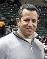
Jay Fiedler

_(cropped).jpg)
See also
 In Spanish: Oceanside (Nueva York) para niños
