Oklahoma County, Oklahoma facts for kids
Quick facts for kids
Oklahoma County
|
||
|---|---|---|

|
||
|
||

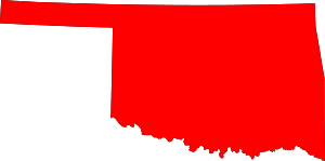
Location within the U.S. state of Oklahoma
|
||
 Oklahoma's location within the U.S. |
||
| Country | ||
| State | ||
| Founded | 1890 | |
| Seat | Oklahoma City | |
| Largest city | Oklahoma City | |
| Area | ||
| • Total | 718 sq mi (1,860 km2) | |
| • Land | 708.82 sq mi (1,835.8 km2) | |
| • Water | 9.6 sq mi (25 km2) 1.3%% | |
| Population
(2020)
|
||
| • Total | 796,292 |
|
| • Density | 1,123/sq mi (434/km2) | |
| Time zone | UTC−6 (Central) | |
| • Summer (DST) | UTC−5 (CDT) | |
| Congressional districts | 3rd, 4th, 5th | |
Oklahoma County is a county in the central part of Oklahoma, a state in the United States. It is the most populated county in Oklahoma. In 2020, about 796,292 people lived here.
The main city and county seat is Oklahoma City. This city is also the capital of Oklahoma. Oklahoma County is the center of the larger Oklahoma City metropolitan area.
Oklahoma County is special because its name is the same as the state. Only a few counties in the U.S. share their name with their state. Oklahoma County is also the only one of these counties that includes its state capital.
Contents
History of Oklahoma County
The land that is now Oklahoma County was first home to Native American groups. In the 1830s, it became part of the land given to the Seminole and Creek nations. This happened after they were moved from their original homes in the southeastern U.S.
Later, in 1866, the U.S. government made new treaties. The land was taken from the tribes. It was not given to other tribes either. People started calling it the "Unassigned Lands."
In 1889, the U.S. government held a land run. This was a race to claim land. Many people quickly settled in the area. By 1890, Oklahoma County was officially created. It was first called "County Two." It was one of seven counties made by the Organic Act of 1890.
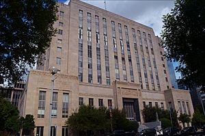
County business first took place in a building on California Avenue. Later, the first Oklahoma County Courthouse was built. In 1937, the county government moved to a new building. This building now serves as the county courthouse.
Geography and Transportation
Oklahoma County covers about 718 square miles. Most of this area, about 709 square miles, is land. The rest, about 9.6 square miles, is water.
How People Travel (Transit)
People in Oklahoma County can use different ways to get around.
- Embark (local buses)
- Oklahoma City Streetcar (streetcar in Oklahoma City)
- Flixbus (long-distance bus service)
- Greyhound Lines (long-distance bus service)
- Amtrak (Heartland Flyer) at Oklahoma City station (train service)
Major Roads and Highways
Many important roads and highways cross Oklahoma County. These roads help people travel easily.
 I-35
I-35 I-40
I-40 I-44
I-44 I-235
I-235 I-240
I-240 I-335
I-335 I-344
I-344 US-62
US-62 US-66
US-66 US-77
US-77 US-270
 Turner Turnpike
 Kilpatrick Turnpike
 Kickapoo Turnpike
 SH-3
SH-3 SH-3A
SH-3A SH-66
SH-66 SH-74
SH-74 SH-77H
 SH-152
 SH-270
Neighboring Counties
Oklahoma County shares borders with several other counties:
- Logan County (north)
- Lincoln County (east)
- Pottawatomie County (southeast)
- Cleveland County (south)
- Canadian County (west)
- Kingfisher County (northwest)
Special Areas
- Oklahoma City National Memorial is a protected area. It honors those affected by the 1995 Oklahoma City bombing.
Population and People
| Historical population | |||
|---|---|---|---|
| Census | Pop. | %± | |
| 1890 | 11,742 | — | |
| 1900 | 25,915 | 120.7% | |
| 1910 | 85,232 | 228.9% | |
| 1920 | 116,307 | 36.5% | |
| 1930 | 221,738 | 90.6% | |
| 1940 | 244,159 | 10.1% | |
| 1950 | 325,352 | 33.3% | |
| 1960 | 439,506 | 35.1% | |
| 1970 | 526,805 | 19.9% | |
| 1980 | 568,933 | 8.0% | |
| 1990 | 599,611 | 5.4% | |
| 2000 | 660,448 | 10.1% | |
| 2010 | 718,633 | 8.8% | |
| 2020 | 796,292 | 10.8% | |
| 2023 (est.) | 808,866 | 12.6% | |
| U.S. Decennial Census 1790-1960 1900-1990 1990-2000 2010 |
|||
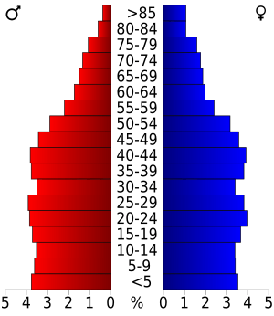
In 2010, there were 718,633 people living in Oklahoma County. By 2020, the population grew to 796,292. In 2023, it was estimated to be over 808,000 people.
People from many different backgrounds live here. In 2010, about 64.6% of people were White. About 15.4% were Black or African American. About 3.5% were Native American. About 3% were Asian. About 15.1% of the population was Hispanic or Latino.
Most people in Oklahoma County speak English. About 84.4% speak English as their first language. About 11.5% speak Spanish.
In 2021, there were about 313,822 households. A household is a group of people living together. The average household had about 2.48 people.
Cities and Towns
Oklahoma County has many different communities. These include cities, towns, and smaller unincorporated areas.
Cities in Oklahoma County
Towns in Oklahoma County
Unincorporated Communities
These are smaller communities that are not officially cities or towns.
Education in Oklahoma County
Many school districts serve the students in Oklahoma County.
K-12 School Districts
These districts offer education from kindergarten through 12th grade.
- Bethany Public Schools
- Choctaw/Nicoma Park Schools
- Crooked Oak Public Schools
- Deer Creek Public Schools
- Edmond Public Schools
- Harrah Public Schools
- Jones Public Schools
- Luther Public Schools
- McLoud Public Schools
- Midwest City-Del City Schools
- Millwood Public Schools
- Moore Public Schools
- Mustang Public Schools
- Oklahoma City Public Schools
- Piedmont Public Schools
- Putnam City Public Schools
- Western Heights Public Schools
Elementary Only School Districts
These districts focus on elementary school education.
- Crutcho Public School
- Oakdale Public School
See also
 In Spanish: Condado de Oklahoma para niños
 | Shirley Ann Jackson |
 | Garett Morgan |
 | J. Ernest Wilkins Jr. |
 | Elijah McCoy |


