Old Appleton, Missouri facts for kids
Quick facts for kids
Old Appleton, Missouri
|
|
|---|---|

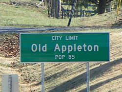
Old Appleton, road sign
|
|

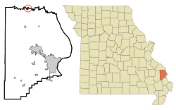
Location of Old Appleton, Missouri
|
|
| Country | United States |
| State | Missouri |
| County | Cape Girardeau |
| Township | Apple Creek |
| Area | |
| • Total | 0.12 sq mi (0.31 km2) |
| • Land | 0.12 sq mi (0.31 km2) |
| • Water | 0.00 sq mi (0.00 km2) |
| Elevation | 446 ft (136 m) |
| Population
(2020)
|
|
| • Total | 73 |
| • Density | 603.31/sq mi (233.49/km2) |
| Time zone | UTC-6 (Central (CST)) |
| • Summer (DST) | UTC-5 (CDT) |
| ZIP code |
63770
|
| Area code(s) | 573 |
| FIPS code | 29-54200 |
| GNIS feature ID | 2396830 |
Old Appleton is a small village in Cape Girardeau County, Missouri, in the United States. In 2020, 73 people lived there. It is part of the larger Cape Girardeau–Jackson, MO-IL area.
Contents
The Name of Old Appleton
The first people settled in the Old Appleton area in 1824.
The community was first called Apple Creek. It got this name from the stream it is built on. By the 1870s, the village was known as Appleton. In 1918, the word "Old" was added to its name. This was done to avoid confusion with another town called Appleton City in Missouri.
History of Old Appleton
We don't know who the very first Native Americans were in the Old Appleton area. Later, the Shawnee and Delaware tribes lived there. These tribes had been forced to leave their homes in places like Delaware and Pennsylvania.
Native American Settlement
In the 1780s, Pierre Louis Lorimier moved to Cape Girardeau. He was a French Canadian who worked as an interpreter for Native Americans. His wife was part French and part Shawnee. Lorimier became an agent for the Native Americans under the Spanish government.
The Shawnee and Delaware tribes had supported the British. This put them in a difficult spot after the American Revolution. Lorimier asked the Spanish leaders for land grants. He wanted land for the Shawnee and Delaware tribes from American territory.
The Spanish gave Lorimier two large areas of land near Apple Creek. They hoped the Shawnee and Delaware would act as a shield against the Osage Indians. The Osage were not friendly with the Spanish. Lorimier then convinced 1,200 Shawnee and 600 Delaware people to move to the Apple Creek area. In 1784, they settled near what is now Old Appleton.
There were two main villages:
- "Le Grand Village Sauvage" was west of Old Appleton.
- "Petit Village Sauvage" was east of Old Appleton.
Many French people and Native Americans mixed in these villages. The Shawnee and Delaware people started to live more like the French and Americans. They built barns to store crops and houses for their animals. Their log homes were built in the French style.
Changes and Relocation
In the early 1800s, American settlers began moving onto the Shawnee and Delaware lands. In 1807, the Shawnee asked for protection from the Osage tribe. The Americans had promised to respect old treaties with the tribes. However, these promises were often ignored.
By 1809, American settlers were bothering and stealing from the Shawnee and Delaware. The tribes asked the governor, Meriwether Lewis, to trade their lands for new lands farther west. They stayed for a while, but the situation got worse.
In 1815, Governor William Clark and President Madison ordered white settlers to leave the Native American lands. But this order was not followed well. By 1816, the US government decided to move the Shawnee and Delaware tribes to lands farther west.
Founding of the Village
In 1824, John McClain and John Schatz started a settlement on Apple Creek. It was first called "Apple Creek." By the time a post office opened in 1876, the town was known as Appleton.
Old Appleton also had several breweries, like "The Old Appleton Brewery." These breweries had to close when a law called Prohibition made alcohol illegal.
In 1982, a flood on Apple Creek destroyed McClain Mill and the original bridge in Old Appleton. The historic bridge was fixed in 2006. The Old Appleton Bridge was added to the National Register of Historic Places in 2009. This means it is a special place in history.
Geography
Old Appleton is located on the south side of the Apple Creek. It is on the northern edge of Cape Girardeau County. Missouri Route 61 runs along the west side of the village. Uniontown is about one mile north in Perry County.
The village covers about 0.12 square miles (0.31 square kilometers) of land. There is no water area within the village limits. Apple Creek forms the border between Perry County and Cape Girardeau County.
Population Information
| Historical population | |||
|---|---|---|---|
| Census | Pop. | %± | |
| 1880 | 100 | — | |
| 1890 | 96 | −4.0% | |
| 1900 | 99 | 3.1% | |
| 1910 | 98 | −1.0% | |
| 1920 | 106 | 8.2% | |
| 1930 | 112 | 5.7% | |
| 1940 | 119 | 6.3% | |
| 1950 | 120 | 0.8% | |
| 1960 | 75 | −37.5% | |
| 1970 | 77 | 2.7% | |
| 1980 | 80 | 3.9% | |
| 1990 | 82 | 2.5% | |
| 2000 | 82 | 0.0% | |
| 2010 | 85 | 3.7% | |
| 2020 | 73 | −14.1% | |
| U.S. Decennial Census 2020 | |||
2010 Census Details
In 2010, the village had 85 people living in 27 households. Most of these households (23) were families. The village had 31 housing units.
- About 44% of households had children under 18.
- About 67% were married couples living together.
- The average household had about 3 people.
- The average family had about 3.4 people.
The average age in the village was 30.2 years old.
- About 30% of residents were under 18.
- About 11% were between 18 and 24.
- About 26% were between 25 and 44.
- About 21% were between 45 and 64.
- About 12% were 65 or older.
The village had slightly more females (51.8%) than males (48.2%).
Nearby Communities
See also
 In Spanish: Old Appleton (Misuri) para niños
 | Jewel Prestage |
 | Ella Baker |
 | Fannie Lou Hamer |


