Oneida County, Wisconsin facts for kids
Quick facts for kids
Oneida County
|
|
|---|---|

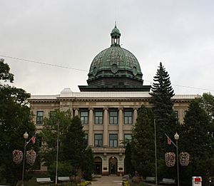
Oneida County Courthouse in Rhinelander
|
|

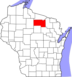
Location within the U.S. state of Wisconsin
|
|
 Wisconsin's location within the U.S. |
|
| Country | |
| State | |
| Founded | 1887 |
| Named for | Oneida people |
| Seat | Rhinelander |
| Largest city | Rhinelander |
| Area | |
| • Total | 1,236 sq mi (3,200 km2) |
| • Land | 1,113 sq mi (2,880 km2) |
| • Water | 123 sq mi (320 km2) 10% |
| Population
(2020)
|
|
| • Total | 37,845 |
| • Estimate
(2023)
|
38,226 |
| • Density | 34/sq mi (13/km2) |
| Time zone | UTC−6 (Central) |
| • Summer (DST) | UTC−5 (CDT) |
| Congressional district | 7th |
Oneida County is a county located in the state of Wisconsin, United States. In 2020, about 37,845 people lived there. The main city and government center, called the county seat, is Rhinelander.
Contents
History
Oneida County was created in 1887. It was formed from parts of Lincoln County. The county got its name from the Oneida people. They are an indigenous (native) tribe and were one of the five nations of the Iroquois Confederacy.
Geography
Oneida County covers a total area of about 1,236 square miles. Most of this area, about 1,113 square miles, is land. The remaining 123 square miles (which is 10% of the total) is covered by water.
Many people visit Oneida County to enjoy its beautiful lakes. The town of Minocqua is especially popular with tourists. It has a year-round population of nearly 5,000 people, but this number can grow to around 15,000 in the summer!
Neighboring Counties
Oneida County shares its borders with these other counties:
- Forest County to the east
- Langlade County to the southeast
- Lincoln County to the south
- Price County to the west
- Vilas County to the north
Main Roads
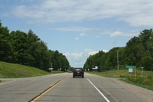
Several important highways pass through Oneida County:
 U.S. Highway 8
 U.S. Highway 45
 U.S. Highway 51
 Highway 17 (Wisconsin)
 Highway 32 (Wisconsin)
 Highway 47 (Wisconsin)
 Highway 70 (Wisconsin)
Railroads
- Watco operates a railroad line in the county.
Airports
Oneida County has two airports that are open for public use:
- Rhinelander–Oneida County Airport (KRHI) serves the county. It offers both scheduled flights for travelers and services for smaller private planes.
- Three Lakes Municipal Airport (40D) also provides services for general aviation (private planes).
There is also Dolhun Field Airport in the county. However, this airport is only for private use by members of a specific association.
Protected Areas
A part of the Nicolet National Forest is located within Oneida County. This is a large area of protected forest land.
Population
| Historical population | |||
|---|---|---|---|
| Census | Pop. | %± | |
| 1890 | 5,010 | — | |
| 1900 | 8,875 | 77.1% | |
| 1910 | 11,433 | 28.8% | |
| 1920 | 13,996 | 22.4% | |
| 1930 | 15,899 | 13.6% | |
| 1940 | 18,938 | 19.1% | |
| 1950 | 20,648 | 9.0% | |
| 1960 | 22,112 | 7.1% | |
| 1970 | 24,427 | 10.5% | |
| 1980 | 31,216 | 27.8% | |
| 1990 | 31,679 | 1.5% | |
| 2000 | 36,776 | 16.1% | |
| 2010 | 35,998 | −2.1% | |
| 2020 | 37,845 | 5.1% | |
| U.S. Decennial Census 1790–1960 1900–1990 1990–2000 2010 2020 |
|||
The population of Oneida County has changed over the years. The chart above shows how many people lived there during different census counts.
2020 Census Information
According to the census taken in 2020, Oneida County had 37,845 residents. The population density was about 34 people per square mile. This means that, on average, 34 people lived in every square mile of land.
There were also 30,465 housing units in the county. Most of the people in the county (93.7%) identified as White. Other groups included Native American (1.2%), Black or African American (0.6%), and Asian (0.5%). About 3.3% of people identified with two or more races.
About 1.5% of the population identified as Hispanic or Latino.
Communities
Oneida County is made up of one city, several towns, and many smaller communities.
City
- Rhinelander (This is the county seat, where the main government offices are located.)
Towns
Census-Designated Places (CDPs)
These are areas that are like towns but are not officially incorporated as cities or villages.
Unincorporated Communities
These are small settlements that are not part of any city or town government.
- Clearwater Lake
- Clifford (partial)
- Crescent Corner
- Enterprise
- Gagen
- Gary Post
- Goodnow
- Harshaw
- Hazelhurst
- Jennings
- Lennox
- McCord
- Malvern
- Monico
- McNaughton
- Newbold
- Pelican Lake
- Pratt Junction
- Rantz
- Roosevelt
- Sugar Camp
- Starks
- Sunflower
- Tripoli (partial)
- Woodboro
Ghost Towns/Neighborhoods
See also
 In Spanish: Condado de Oneida (Wisconsin) para niños
 | Roy Wilkins |
 | John Lewis |
 | Linda Carol Brown |


