Orting, Washington facts for kids
Quick facts for kids
Orting, Washington
|
|
|---|---|
| City of Orting | |

Location of Orting, Washington
|
|
| Country | United States |
| State | Washington |
| County | Pierce |
| Government | |
| • Type | Mayor–council |
| Area | |
| • Total | 2.76 sq mi (7.15 km2) |
| • Land | 2.71 sq mi (7.01 km2) |
| • Water | 0.06 sq mi (0.14 km2) |
| Elevation | 190 ft (58 m) |
| Population
(2020)
|
|
| • Total | 9,041 |
| • Density | 3,182.99/sq mi (1,228.79/km2) |
| Time zone | UTC-8 (Pacific (PST)) |
| • Summer (DST) | UTC-7 (PDT) |
| ZIP code |
98360
|
| Area code(s) | 360, 564 |
| FIPS code | 53-52005 |
| GNIS feature ID | 1512539 |
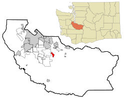
Orting is a city in Pierce County, Washington, United States. It's home to about 9,041 people, based on the 2020 census. The city is nestled between the Puyallup and Carbon rivers in central Pierce County. It's also about 30 miles (48 km) northwest of the famous Mount Rainier.
Contents
History of Orting
The first people to claim land in Orting were William Henry Whitesell, Thomas Headley, Daniel Lane, and Daniel Varner in 1854. You can still see streets in Orting named after these four early settlers. There's even a monument in Orting City Park that remembers them.
The area was first called Gunson's Prairie by early settlers. Later, it was known as Carbon. In 1877, a superintendent from the Northern Pacific Railway renamed the town Orting. This happened while the company was building a railroad to Wilkeson. The name "Orting" is believed to be an old local word meaning "prairie." Orting officially became a city on April 22, 1889.
Early Industries and Growth
Orting grew quickly because of its logging and other production industries. Later, farms growing Christmas trees and flower bulbs also became important to the local economy. Orting was also a key supply town for nearby coal mining towns like Wilkeson and Carbonado.
The first railroad in the city was built in 1877 by the Northern Pacific Railway. It was called "Whitesell's Crossing" because it went right through the Whitesell family's land. With railroads making transportation easier, more people moved to Orting. Some parts of this old railroad are still used today by the Meeker Southern Railroad. This line runs between Puyallup and McMillin.
Modern Orting
Orting's size stayed the same for many years until it started adding new areas in 1959. In the 2000s, Orting became a popular place for people who work in Tacoma and Seattle to live. Many new neighborhoods were built around the old downtown area. In 2008, the city's local newspaper, The Gazette, stopped being published.
Geography of Orting
Orting is located at coordinates 47.096071 degrees North and -122.205401 degrees West.
The city covers a total area of about 2.80 square miles (7.25 square kilometers). Most of this area, about 2.73 square miles (7.07 square kilometers), is land. The rest, about 0.07 square miles (0.18 square kilometers), is water.
Mount Rainier and Safety
Orting is built in a rich valley between two main rivers, the Carbon and Puyallup. The ground beneath the city is made up of several layers of lahar deposits. Lahars are fast-moving mudflows that can come from volcanoes.
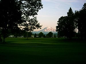
Orting is about 30 miles (48 km) from Mount Rainier. Because of how past lahars have flowed and the shape of the mountain, Orting is considered the city most at risk from Mount Rainier's lahar activity. Scientists believe a lahar could reach Orting in just 30 minutes from the mountain.
To keep everyone safe, the Mount Rainier Volcano Lahar Warning System has placed sirens all around the area. These sirens are set off by sensors on Mount Rainier. Local schools regularly practice lahar evacuation drills, and people living in Orting are taught about safe escape routes. There's even a project called the Bridge for Kids. This is a walking bridge across the Carbon River that people could use for fun or for a quick escape towards Cascadia, Washington, if needed.
Population of Orting
| Historical population | |||
|---|---|---|---|
| Census | Pop. | %± | |
| 1890 | 623 | — | |
| 1900 | 728 | 16.9% | |
| 1910 | 799 | 9.8% | |
| 1920 | 972 | 21.7% | |
| 1930 | 1,109 | 14.1% | |
| 1940 | 1,211 | 9.2% | |
| 1950 | 1,299 | 7.3% | |
| 1960 | 1,520 | 17.0% | |
| 1970 | 1,643 | 8.1% | |
| 1980 | 1,787 | 8.8% | |
| 1990 | 2,106 | 17.9% | |
| 2000 | 3,760 | 78.5% | |
| 2010 | 6,746 | 79.4% | |
| 2020 | 9,041 | 34.0% | |
| U.S. Decennial Census 2020 Census |
|||
2010 Census Information
In 2010, the city of Orting had 6,746 people living in 2,184 households. Out of these, 1,688 were families. The population density was about 2,471 people per square mile (954 per square kilometer).
Many households (48.4%) had children under 18 living with them. About 59.5% of households were married couples living together. The average household had 3.01 people, and the average family had 3.34 people.
The average age of people in Orting was 32.7 years old. About 30.7% of residents were under 18. About 10.2% were 65 years old or older.
Places to See in Orting
Washington Soldiers Home
The Washington Soldiers Home is a special place that offers nursing care, medical care, and support services for veterans and their families. It is located southwest of the city on the Orting Kapowsin Highway. Close by, the Soldiers Home Cemetery has 2,265 graves. This includes the graves of four people who received the Medal of Honor during the American Civil War.
Voights Creek Hatchery
The Voights Creek Hatchery is just outside Orting. It's a place where fish, especially salmon, are raised. This hatchery attracts many fishermen to the area.
Parks and Murals
Orting has several city parks, including community and neighborhood parks. These parks often have sports fields and walking trails. Main City Park, located downtown, features a covered gazebo and a memorial wall. You can also find historic murals painted on buildings throughout the city, showing Orting's past.
Daffodil Parade
Orting is the fourth and final stop for the yearly Daffodil Festival Parade. This parade has marched through downtown Orting since 1934, except for a few years during the COVID-19 pandemic (2020) and Second World War (1943-1945). The parade happens in early April and brings over 10,000 people to the city for the fun. You can usually see the parade in the late afternoon. It also travels through the cities of Tacoma, Puyallup, and Sumner. School bands play music, and the Daffodil Queen makes an appearance.
Education in Orting
The Orting School District manages four schools in the area:
- Orting Elementary School (for students in pre-kindergarten through 4th grade)
- Ptarmigan Ridge Elementary School (for students in kindergarten through 5th grade)
- Orting Middle School (for students in 6th through 8th grade)
- Orting High School (for students in 9th through 12th grade)
Transportation in Orting
Orting is located near State Route 162, which is a main road. The closest Sounder commuter rail station, which is a train service for commuters, is in Sumner, Washington.
Foothills Trail
The Pierce County Foothills Trail is a paved path built on an old railroad track. It goes through Orting, stretching to South Prairie in one direction and to Sumner in the other. People can enjoy many activities on the trail, such as walking, bicycling, horseback riding, skating, skateboarding, and scooter riding. Motorized vehicles are not allowed on the trail. While it's great for recreation, many people also use the trail to bike to work.
Notable People from Orting
- Casey Carrigan – An athlete who competed in the 1968 Summer Olympics. He attended Orting High School.
See also
 In Spanish: Orting (Washington) para niños


