Petitcodiac River facts for kids
Quick facts for kids Petitcodiac RiverRivière Petitcodiac (French) |
|
|---|---|
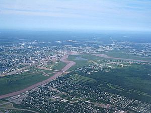
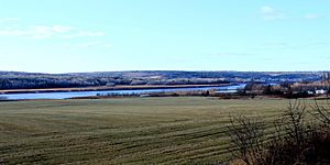
An aerial view of the bend in the river at Moncton
|
|
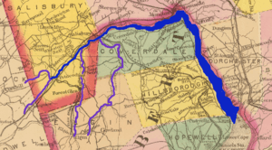
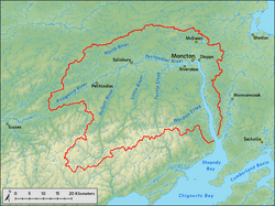
A map of the Petitcodiac River, highlighted in dark blue. Purple indicates its four major tributaries.
|
|
| Country | Canada |
| Province | New Brunswick |
| Counties | Westmorland, Albert, Kings |
| Cities | Moncton, Dieppe |
| Physical characteristics | |
| River mouth | Shepody Bay, Albert County, New Brunswick 45°51′58″N 64°34′28″W / 45.86611°N 64.57444°W |
| Length | 79 km (49 mi)approx. |
| Basin features | |
| Basin size | 2,071 km2 (800 sq mi) |
| Tributaries |
|
The Petitcodiac River is also known as the Chocolate River (or Rivière Chocolat in French). It is a river in southeastern New Brunswick, Canada. The river is about 79 kilometres (49 miles) long and flows through Westmorland, Albert, and Kings counties. It drains a large area of land, about 2,071 square kilometres (800 sq mi). This area has valleys, hills, and is home to many different kinds of animals and plants. Ten smaller rivers and streams flow into the Petitcodiac River before it reaches Shepody Bay.
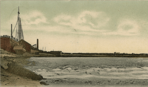
Before a large causeway was built in 1968, the river had one of the biggest tidal bores in the world. A tidal bore is a special wave that travels up a river from the ocean. This wave could be 1 to 2 metres (3.3–6.6 ft) high and move at speeds from 5 to 13 kilometres per hour (3.1–8.1 mph). After the causeway gates were opened in April 2010, the river started to clean itself of ocean mud. The tidal bore is now growing back to its original size.
The Mi'kmaq people were the first to live near the river. They used it as a path to travel between Shubenacadie and their winter camp in Petitcodiac. Later, Acadians from Port Royal, Nova Scotia settled here in 1698. However, they were forced to leave in 1755 during the Seven Years' War. Acadian fighters tried to defend their homes, but many settlements were destroyed. In the 1840s, the Greater Moncton area became busy with shipbuilding. But when steam trains arrived, the river became less important for travel and trade.
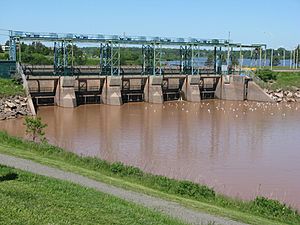
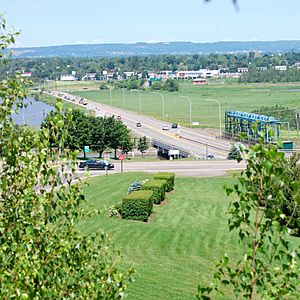
In 1968, a causeway was built between Moncton and Riverview. It was made of rock and earth. The goal was to stop farm fields from flooding and to create a road for people to cross the river. However, the causeway caused many problems for the river and its wildlife. About 10 million cubic meters of mud built up in the river below the causeway in just three years. It also made it hard for fish to move, and the number of salmon caught in the area dropped by 82 percent. The water quality also got worse because of factories and businesses nearby. In 2003, the Petitcodiac River was called the most endangered river in Canada.
To fix these problems, the causeway's gates were opened permanently on April 14, 2010. This was part of a big project costing $68 million. The plan is to build a new bridge by 2021 so the river can flow naturally again.
Contents
- What's in a Name? The Petitcodiac River's Story
- Exploring the Petitcodiac River's Path
- Water Quality and River Health
- Wildlife and Nature of the Petitcodiac River
- A Look Back: History of the Petitcodiac River
- Fun Things to Do at the Petitcodiac River
- River Crossings and Tributaries
- Images for kids
- See also
What's in a Name? The Petitcodiac River's Story
Many people think the name "Petitcodiac" comes from the French words "petit coude", meaning "little elbow". But the name actually comes from an Indigenous word. It might be from the Maliseet language, where petakuyak means "sound of thunder," referring to the rushing water. If it's from the Mi'kmaq people, it could be from Petkootkweăk, which means "the river that bends like a bow." This describes the sharp bend near Moncton.
Over time, Acadians changed the name to Petcoudiac or Petitcoudiac. British settlers then changed it to Petitcodiac. The river is also called the "Chocolate River" because of its brown color. This color comes from a lot of mud and sediment in the water. After the causeway was built, even more mud piled up in the river below it.
Exploring the Petitcodiac River's Path
Where Does the Petitcodiac River Flow?
The Petitcodiac River is about 79 km (49 mi) long. It starts where the Anagance and North rivers meet in western Westmorland County. The Anagance River drains about 81 km2 (31 sq mi) from the southeast, and the North River drains about 264 km2 (102 sq mi) from the north.
From where it starts, the river flows under a bridge on Route 106 in Petitcodiac. The road then follows the river towards Moncton. Route 1 crosses the river a few kilometers downstream. The Pollett River, a major branch, joins the Petitcodiac near River Glade. Further along, the Little River (also called Coverdale River) joins it near Salisbury. The river then passes Coverdale and is joined by Turtle Creek. It gets wider as it gets closer to Moncton.
The causeway, built in 1968, blocked most of the river's flow. Before the causeway, the river was very wide in Moncton, about 1.6 km (one mile) across. The river makes a sharp 90-degree turn south, which is why Moncton was originally called Le Coude (The Elbow). The river then flows past Dieppe on its east side and Hillsborough on its west side before reaching its end.
The Memramcook River joins the Petitcodiac River near its mouth. The Petitcodiac then flows into Shepody Bay. Shepody Bay then connects with the Cumberland Basin, which leads to Chignecto Bay. Finally, Chignecto Bay flows into the Bay of Fundy, which connects to the Atlantic Ocean.
The Petitcodiac River's Drainage Area
The area of land that drains into the Petitcodiac River is about 2,071 km2 (800 sq mi). This area gets about 1,100 millimetres (43 in) of rain and snow each year. Summer temperatures average 17.5 °C (63.5 °F), and winter temperatures average −7.5 °C (18.5 °F).
Most of this area is covered with forest (80 percent). About 10 percent is used for farming, and 3 percent is wetlands. Only 4 percent is used for homes or businesses. Even with all the forest, the growth of towns like Moncton has caused some environmental problems for the river.
Water Quality and River Health
How Clean is the Petitcodiac River?
In 2003, the Petitcodiac River was named the most endangered river in Canada. The causeway was a big reason for the river's poor health. Studies have shown that some parts of the river have good water quality, but many parts are only fair or even marginal.
Since 1999, groups like the Petitcodiac Watershed Alliance have been testing the water. They check for bacteria, nutrients, pH levels, and dissolved oxygen. In some areas, especially downstream from the causeway, E. coli bacteria levels were too high for safe swimming. Sometimes, levels of nitrates and phosphates were also too high.
Farming can affect the river's water quality. Experts have suggested working with farmers to put fences around streams to keep farm animals out. They also recommend stopping the use of certain pesticides. Environmental groups like the Petitcodiac Riverkeeper want all cosmetic pesticides to be banned because they can wash into the water. Removing trees and plants along the riverbanks also causes erosion, which is bad for the river.
Mining has also been a concern. Even though gypsum mines closed in 1982, there have been worries about uranium mining near Turtle Creek, which is where Moncton gets its drinking water. Environmentalists are concerned that mining could pollute the water. The province has since put rules in place to limit uranium mining near homes and drinking water areas.
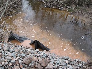
A large landfill was built near the river after the causeway. Even though it closed in 1992, tests showed that pollution from the landfill was still leaking into the water. This pollution included high levels of ammonium, heavy metals, and other harmful chemicals. This caused serious problems for fish and other water creatures. The City of Moncton and the company responsible for the landfill were fined and ordered to help reduce the pollution.
River Flow and the Tidal Bore
The Petitcodiac River gets water from ten main streams. On average, about 27.3 m3/s (960 cu ft/s) of water flows through the causeway each year. The highest flow recorded was 730 m3/s (26,000 cu ft/s) in 1962, and the lowest was 0.36 m3/s (13 cu ft/s) in 1966.
The Petitcodiac River has a special wave called a tidal bore. This wave happens twice a day and comes from the very high tides in the Bay of Fundy. The first time Europeans wrote about it was in 1758.
Before the causeway was built, these waves could be 1 to 2 m (3.3–6.6 ft) high and move at speeds of 5 to 13 km/h (3.1–8.1 mph). In 1825, a historian named Peter Fisher wrote that the "noise of the Bore is heard a great distance, and animals immediately take to the highland, and manifest visible signs of terror if near it." After the causeway, the bores became much smaller, only about 5 to 75 cm (2.0–29.5 in). However, since the causeway gates opened, the bore is starting to get bigger again.
Wildlife and Nature of the Petitcodiac River
Animals of the Petitcodiac River
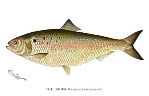
Before the causeway, the Petitcodiac River was full of aquatic animals. Many fish species lived here, including Atlantic tomcod, rainbow smelt, gaspereau, American shad, American eel, Atlantic salmon, brook trout, and striped bass. There were also Atlantic sturgeon. Other fish like blueback herring and white perch were present.
Some marine mammals, like pilot whales and harbor seals, were sometimes seen. The river was also home to several types of freshwater mussels. Many other water creatures were thought to enter the river because its water was not very salty.
Sadly, six species of fish have disappeared from the river since the mid-1980s. The Petitcodiac River was the only place in Canada where the dwarf wedgemussel lived. The Atlantic salmon is now an endangered species in Canada and is no longer found in the river. The American shad was a popular fish for fishermen, but it has also disappeared. Striped bass, Atlantic sturgeon, and Atlantic tomcod are also gone from the river.
However, a project by the Petitcodiac Riverkeeper believes that removing the causeway will help bring back these lost species. It also has a great chance of increasing the numbers of species that have been reduced.
Many insects and spiders live around the Petitcodiac River, such as stoneflies, mayflies, and caddisflies. Some non-native species have also made their home here. At the southern end of the river's area, huge numbers of semipalmated sandpipers (50 to 90 percent of the world's population) feed on mud shrimp in Shepody Bay. Many other birds, like the semipalmated plover and red knot, also stop here during their long migrations.
Plants and Trees of the Petitcodiac River Area
The Petitcodiac River area has many different kinds of plants. Common trees include red, white, and black spruce, red maple, white birch, and trembling aspen. Jack pine trees are often found in areas that have had fires. Cedar trees grow in wet areas and where gypsum and limestone are found. Higher up on slopes, you can find sugar maple, beech, and yellow birch trees.
The areas right along the riverbanks, called riparian zones, have trees like willows, white spruce, white pine, and speckled alder. Other trees like tamarack can also be found. Some plants, like the rufous bulrush, grow near areas with a lot of calcium. There are also some non-native plants like mother-of-thyme and Japanese barberry.
In 1937, the skeleton of a mastodon (an ancient elephant-like animal) was found near Hillsborough. It was about 37,000 years old and was in very good condition. It is now on display at the New Brunswick Museum in Saint John.
A Look Back: History of the Petitcodiac River
Early Settlers and French History (1604–1763)
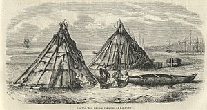
The Mi'kmaq people were the first to live in the Petitcodiac River region. They used the river to travel and had a winter camp where the Anagance and North rivers meet. The first Europeans arrived in 1604. A French group, led by Pierre Dugua de Mons, explored the Bay of Fundy. They didn't explore the Petitcodiac area then, but they later founded Port Royal in Nova Scotia.
In 1698, Pierre Thibodeau, an Acadian settler, founded Chipody (now Shepody, New Brunswick) near Shepody Bay. People living in the Petitcodiac, Memramcook, and Shepody River areas often called it "Trois-Rivières" (Three Rivers).
The French and Indian War started in 1754 between the British and the French. The Acadians, who lived in the area, tried to stay neutral. They refused to promise full loyalty to the British king. Because of this, the British saw them as a threat. In 1755, the British ordered the Acadians to be expelled from their lands.
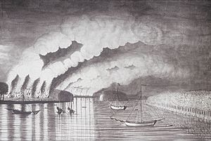
About 1,100 Acadians near the Petitcodiac River were affected. British troops were sent to destroy their settlements. Acadian fighters, led by Charles Deschamps de Boishébert, tried to defend their homes. They fought a battle in August 1755, but many settlements were still destroyed. The Acadians who escaped faced a terrible famine.
In 1758, Joseph Broussard, an Acadian leader, led attacks against British ships. This caused the British to raid Acadian settlements again. They burned homes and took prisoners. In November 1758, British troops burned more buildings and took cattle. Many Acadians fled to other areas to escape.
By late 1759, the Acadians who remained were struggling. After the British won a major battle in Quebec, the Acadians in the Petitcodiac region surrendered in November 1759. They were offered new land, but many wanted to return to their original homes around the Three Rivers, which the governor allowed.
From Resettlement to Modern Times (1763–Present)
After the Treaty of Paris (1763), some Acadians returned, but their numbers were small. In 1766, settlers from Philadelphia began to move to the Petitcodiac River area, including families who would become the Trites, Jones, and Steeves families. By 1829, Moncton had about 100 people.
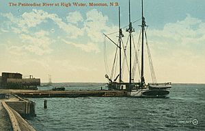
Moncton became a busy shipbuilding center in the 1840s. Ships built here sailed to other ports for trade. A ferry service also started on the river. Joseph Salter helped the shipbuilding industry grow, and he became Moncton's first mayor in 1855.
However, when the railway arrived in 1857, it changed everything. Moncton's shipbuilding industry declined, and the town's population dropped. Moncton even went bankrupt and lost its town status in 1862. But it later recovered and became a railway headquarters. While the river was still used for shipping goods, shipbuilding mostly ended by the 1890s.
In 1924, there was a plan to build a dam on the Petitcodiac River to create tidal power. But this project never happened. As trains and airplanes became more common, the river became less important for transportation.
The Gunningsville Bridge, which connects Moncton and Riverview, was built in 1867. It was damaged and rebuilt several times due to storms and ice. The current bridge is a modern four-lane crossing.
The Causeway's Impact and Restoration (1968–Present)
In 1968, the government built a causeway between Moncton and Riverview. It was meant to help farmers and provide a road crossing. However, it caused many problems for the river. Fish could not easily cross it, and mud built up quickly. This led to a big drop in fish populations, especially salmon.
For years, reports showed the causeway was harming the river, but little was done. In the 1980s, they started opening the gates for short periods to help fish migrate. In 1991, it was suggested to open the gates from April to December each year.
In 2001, a report suggested four ways to fix the problem, including replacing the causeway with a bridge. In 2007, the government decided to build a new 280 m (310 yd) bridge instead of the causeway.
This project was divided into three parts and cost $68 million. The first part, from 2008 to 2010, involved preventing erosion and building dikes. The second part, which started in 2010, involved opening the causeway gates to let the river flow more freely. The third part, starting in 2012, is building the new bridge and removing the old causeway. The new bridge is expected to be finished in 2021.
Some people worried about the project. They were concerned about more mosquitoes, potential flooding, and property values. But despite these worries, the causeway gates opened on April 14, 2010.
Since then, the river has improved a lot, even more than expected. The riverbanks are getting wider, and the tidal bore is growing closer to its original size. Many fish, like gaspereau, have returned to the river.
Fun Things to Do at the Petitcodiac River
People have enjoyed the Petitcodiac River for many years. In the past, people took boat trips for celebrations. In the 1930s, a towboat offered "moonlight cruises."
Before the causeway gates opened in 2010, the area west of the causeway was like a lake, sometimes called Lake Petitcodiac. People enjoyed boating, canoeing, water skiing, and even ice skating and snowmobiling in winter. However, studies showed that the water quality in this "lake" was often not safe for swimming due to high bacteria levels.
Today, activities like fishing, birdwatching, boating, canoeing, and kayaking are popular. You might even see seals and porpoises. In 2013, a North American record was set for surfing a single river wave on the Petitcodiac River's tidal bore.
Bore Park in Moncton is a popular spot to watch the famous tidal bore. The park has information about the wave and a clock showing when it will appear next. Bore Park is part of Riverfront Park, which is a 5 km (3.1 mi) section of the Trans Canada Trail. Here, you can walk, bike, or skate along the river. The trail continues to other towns and even to Fundy National Park.
River Crossings and Tributaries
How Many Bridges Cross the Petitcodiac River?
The Petitcodiac River is crossed 11 times by 10 bridges and one causeway.
| Route | Description | Sources |
|---|---|---|
| Gunningsville Bridge | ||
| Petitcodiac River Causeway (Findlay Boulevard) | ||
| Salem and Hillsborough Railroad bridge, Salisbury | ||
| Coverdale River Road bridge, Salisbury | ||
| "Hasty" covered bridge, River Glade | ||
| Sanatorium Road bridge, River Glade | ||
| Canadian National Railway bridge, River Glade | ||
| Route 1 expressway crossing, River Glade | ||
| Plantation Road bridge | ||
| Canadian National Railway bridge, Petitcodiac | ||
| Old Post Road bridge, Petitcodiac |
What Streams Flow into the Petitcodiac River?
The Petitcodiac River has ten main streams that flow into it. These streams collect water from 28 smaller streams.
| Name | Watershed area | Source | River bank | Mouth coordinates | Sources |
|---|---|---|---|---|---|
| Weldon Creek | 89 km2 (34 sq mi) | Area near Weldon and Salem | Right | 45°56′59″N 64°40′0″W / 45.94972°N 64.66667°W | |
| Fox Creek | 29 km2 (11 sq mi) | Area near Dieppe and Chartersville | Left | 46°4′0″N 64°40′59″W / 46.06667°N 64.68306°W | |
| Mill Creek | 51 km2 (20 sq mi) | Town of Riverview | Left | 46°4′0″N 64°43′59″W / 46.06667°N 64.73306°W | |
| Halls Creek | 125 km2 (48 sq mi) | City of Moncton (Sunny Brae and Tankville) | Left | 46°5′42″N 64°46′4″W / 46.09500°N 64.76778°W | |
| Jonathan Creek | 50 km2 (19 sq mi) | City of Moncton (Centennial Park) | Left | 46°4′0″N 64°46′59″W / 46.06667°N 64.78306°W | |
| Turtle Creek | 192 km2 (74 sq mi) | Area near Turtle Creek and Berryton | Right | 46°3′0″N 64°52′59″W / 46.05000°N 64.88306°W | |
| Little River | 275 km2 (106 sq mi) | Area near Colpitts Settlement | Right | 46°1′59″N 65°1′0″W / 46.03306°N 65.01667°W | |
| Pollett River | 314 km2 (121 sq mi) | Area near Kay Settlement | Right | 45°59′13″N 65°5′27″W / 45.98694°N 65.09083°W | |
| Anagance River | 81 km2 (31 sq mi) | Hayward Brook, Holmes Brook | Right | 45°55′37″N 65°11′20″W / 45.92694°N 65.18889°W | |
| North River | 264 km2 (102 sq mi) | Area around Intervale | Left | 45°55′59″N 65°10′59″W / 45.93306°N 65.18306°W |
Images for kids
See also
 In Spanish: Río Petitcodiac para niños
 | Audre Lorde |
 | John Berry Meachum |
 | Ferdinand Lee Barnett |


