Richmond River facts for kids
Quick facts for kids Richmond |
|
|---|---|
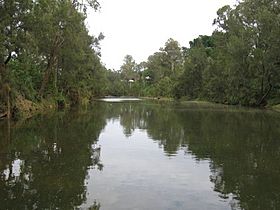
The Richmond River at Casino, 2006.
|
|
|
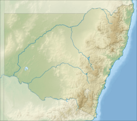
Location of the Richmond River mouth in New South Wales
|
|
| Country | Australia |
| State | New South Wales |
| Region | NSW North Coast (IBRA), Northern Rivers |
| Local government areas | Kyogle, Richmond Valley, Ballina |
| Physical characteristics | |
| Main source | McPherson Range west of Mount Lindesay, near Woodenbong 236 m (774 ft) 28°19′48″S 152°40′30″E / 28.33000°S 152.67500°E |
| River mouth | Coral Sea, South Pacific Ocean near Ballina / South Ballina 0 m (0 ft) 28°52′36″S 153°35′29″E / 28.87667°S 153.59139°E |
| Length | 394 km (245 mi) |
| Basin features | |
| Basin size | 6,862 km2 (2,649 sq mi) |
| Tributaries |
|
| National parks | Border Ranges NP, Richmond Range NP |
The Richmond River is an important river in the Northern Rivers area of New South Wales, Australia. It has a wide mouth that connects to the ocean. This river is a key part of the local environment and history.
Contents
Journey of the Richmond River
The Richmond River starts high up in the Great Dividing Range. Its source is on the southern side of the McPherson Range, near Mount Lindesay. From there, it flows mostly southeast and then northeast.
Many smaller streams, called tributaries, join the Richmond River. One important tributary is the Wilsons River. The Richmond River finally meets the Coral Sea, which is part of the Pacific Ocean, near the town of Ballina.
The river drops 256 metres (840 ft) over its 237 kilometres (147 mi) journey. Along the way, it passes through several towns. These include Kyogle, Casino, Coraki, and Woodburn. The Summerland Way road runs close to the middle part of the river. The Pacific Highway crosses the river at Ballina.
The area of land that drains into the Richmond River is called its catchment area. This area is about 6,862 square kilometres (2,649 sq mi). It is the sixth largest river catchment in New South Wales. The flat land next to the river, called its floodplain, covers over 1,000 square kilometres (390 sq mi).
History of the Richmond River
The Richmond River has a rich history. It involves both the Aboriginal people who lived there for thousands of years and later European explorers and settlers.
Aboriginal Heritage
The original people of the Richmond River area are the Githabul Aboriginal people. Their traditional lands stretched far north, even to the city of Toowoomba. They also included towns like Tenterfield and Warwick.
Each year, the Githabul people would move from the mountains to the coast. They did this during the winter months when there were many mullet fish. This was an important part of their way of life.
European Discovery and Settlement
The famous explorer Captain James Cook missed the Richmond River when he sailed along Australia's east coast in 1770. It was not until 1828 that Europeans discovered the river's mouth. This discovery was made by Captain Henry John Rous.
Captain Rous sailed about 20 miles (32 km) up the river. He then named it Richmond, after the fifth Duke of Richmond. Later that same year, another explorer named Allan Cunningham reached the river by land.
From the 1840s into the 1900s, the river was a very busy port. Early European settlers found a lot of Australian Red Cedar trees in the Richmond Valley. They quickly started cutting down these trees. The river was essential for moving the timber.
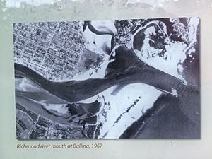
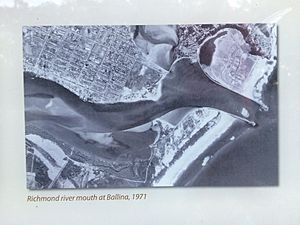
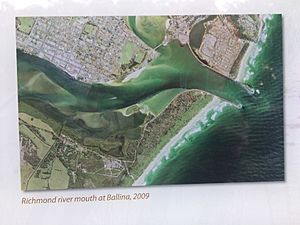
Before the early 1900s, the river's mouth was very dangerous. It had sand bars that constantly moved, causing many ships and lives to be lost. To make it safer, two long walls called breakwaters were built. These were finished in the early 1900s. The breakwaters also helped create Shaw's Bay.
Over time, roads and railways became better. This meant that shipping became less important for transport. The main shipping company in the area closed in 1954. After this, the Richmond River was no longer as important as a port.
How the River is Used Today
Boats can travel up the Richmond River for some distance. It is possible to go as far as Casino. The Wilsons River, a major tributary that flows through Lismore, can also be navigated. Boats can go at least 12 kilometres (7.5 mi) upstream from Lismore to a place called Boatharbour.
The Richmond River is widely used for irrigation. This means its water helps grow crops along its banks. Several weirs, which are small dams, have been built on the river. These weirs help control the river's flow and reduce the effects of flooding, especially near Casino.
River Animals
The freshwater parts of the Richmond River were once home to a special fish called the Richmond River Cod. This fish was similar to the Murray Cod. Sadly, this unique native fish disappeared between the 1930s and 1950s. This happened because its home was damaged and too many fish were caught. Dynamite was even used for fishing when the local railway line was being built.
The endangered Oxleyan Pygmy Perch has also been found in the river. Efforts are made to protect this rare fish.
 | Charles R. Drew |
 | Benjamin Banneker |
 | Jane C. Wright |
 | Roger Arliner Young |


