San Francisquito Pass facts for kids
Quick facts for kids San Francisquito Pass |
|
|---|---|
| Elevation | 3,655 feet (1,114 m) |
| Traversed by | San Francisquito Canyon Road |
| Location | Los Angeles County, California |
| Range | Sierra Pelona Mountains |
| Coordinates | 34°38′22.74″N 118°22′50.34″W / 34.6396500°N 118.3806500°W |
| Topo map | Lake Hughes, CA |
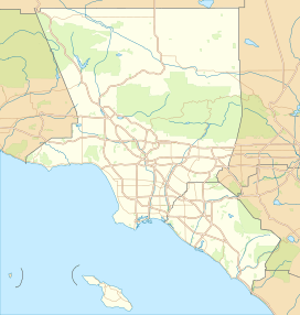
San Francisquito Pass is a special spot in the Sierra Pelona Mountains in southern California. It's like a natural doorway through the mountains. You can find it in northern Los Angeles County, not far from Green Valley and Santa Clarita.
Contents
Exploring San Francisquito Pass
This mountain pass sits at a height of about 3,655 feet (1,114 meters) above sea level. It's located at the very top of San Francisquito Canyon. A road called San Francisquito Canyon Road goes right over the mountains here.
If you travel north on this road, it will take you towards Elizabeth Lake in the Leona Valley. If you head south, the road leads to Saugus.
A Look Back in Time: History of the Pass
San Francisquito Pass has been an important route for a very long time.
Old Trails and Roads
Long ago, this pass was part of a trail called the El Camino Viejo. This was an alternative land route that people used to travel to northern Spanish and Mexican areas of Alta California. It helped connect the old settlement of Los Angeles and the San Fernando Valley with the San Joaquin Valley.
After crossing San Francisquito Pass, the trail continued over the Tehachapi Mountains. It then entered the San Joaquin Valley through a place called Old Tejón Pass.
Later, a new route called the Stockton - Los Angeles Road also used San Francisquito Pass. This road also used Fort Tejon Pass, which was west of Old Tejón Pass.
The Butterfield Overland Mail
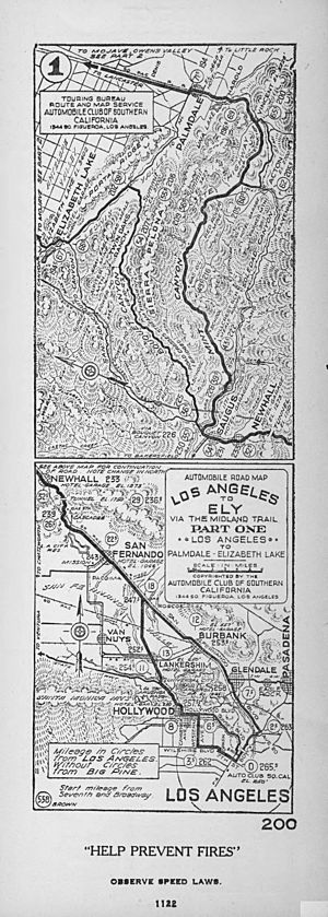
From 1857 to 1861, the famous Butterfield Overland Mail route used these same passes. This was a stagecoach service that carried mail and passengers. It traveled between the San Fernando and San Joaquin Valleys. Along San Francisquito Canyon, there were stops for the stagecoaches. These stops included King's Station and Widow Smith's Station.
San Francisquito Pass was a main route for travel between the north and south until 1915. That's when a new road, the Ridge Route, was opened.
San Francisquito Pass Today
Even though new roads have been built, San Francisquito Pass is still used today. San Francisquito Canyon Road continues to cross the pass. People use it for local travel and to enjoy the beautiful scenery.
Part of the pass and the road are located within the northwestern area of the Angeles National Forest.
In the 2000s, Los Angeles County made some changes to the upper part of San Francisquito Canyon Road. They straightened out some of the narrow and curvy sections. However, the original, very curvy part of the road is still there. This older section is now a hiking trail. It follows San Francisquito Creek and goes past the historic site of the St. Francis Dam and its ruins.
 | Jessica Watkins |
 | Robert Henry Lawrence Jr. |
 | Mae Jemison |
 | Sian Proctor |
 | Guion Bluford |


