San Martín de los Andes facts for kids
Quick facts for kids
San Martín de los Andes
|
|
|---|---|
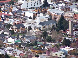
Aerial view of the city
|
|
| Country | |
| Province | |
| Department | Lácar |
| Area | |
| • Total | 140 km2 (50 sq mi) |
| Elevation | 640 m (2,100 ft) |
| Population | |
| • Total | 23,519 |
| • Density | 168/km2 (435/sq mi) |
| Time zone | UTC−3 (ART) |
| CPA base |
Q8370
|
| Dialing code | +54 2972 |
| Climate | Csb |
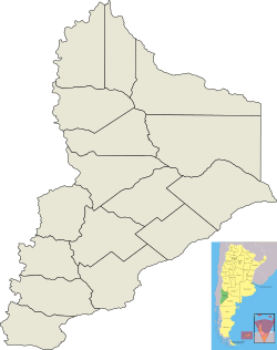
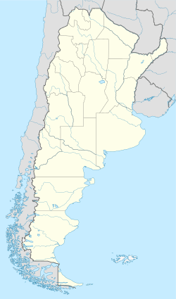
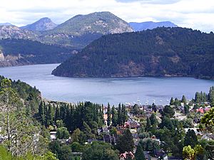
San Martín de los Andes is a city in the southwest of the Neuquén province in Argentina. It is the main city of the Lácar Department. The city sits at the foot of the Andes mountains, right by Lácar lake. It is a very popular place for tourists in the province.
The National Route 40 goes through the city. This road connects San Martín de los Andes to other important tourist spots. These include Lanín National Park and Nahuel Huapí National Park.
The city was started in 1898 as a military base. This was to make sure Argentina controlled the area. At first, people in this mountain village mostly worked in logging (cutting down trees) and raising animals. But in 1937, the Lanín National Park opened. After that, tourism became the main business. Many people moved here from Europe, the Middle East, Chile, and other parts of Argentina. This helped the city grow a lot.
Contents
History of San Martín de los Andes
Before San Martín de los Andes was founded, the Chapelco valley was home to the Puelche people. They were an indigenous group who used the valley as a safe place during harsh winters. For a long time, the Puelches traded with the Huilliche people. The Huilliche lived on the other side of the Andes mountains in Chile.
The Puelches raised horses on the eastern side of the Andes. They traded these horses for weapons and drinks. They became a main supplier of food for the isolated city of Valdivia in Chile. Later, military actions by Argentina and Chile ended this trade.
German Settlers and Trade
In the 1840s, German settlers started arriving in southern Chile. Some of these settlers began a successful leather business. They got leather from indigenous groups across the Andes. In the 1880s, the Argentine Army moved indigenous communities. This stopped the leather trade. So, many business owners from Chile, often with German backgrounds, had to cross the Andes themselves. They set up cattle and trade businesses near Lácar Lake and Nahuel Huapi Lake.
Founding the City
In 1898, the Argentine military came to this area. They wanted to take control because of arguments with Chile about the border. The Boundary Treaty of 1881 between Chile and Argentina caused problems. It was unclear if the main Andes mountains or the continental divide should be the border. Chilean officials said that since Lácar Lake drained into the Pacific, San Martín should belong to Chile.
Argentina was also worried that the area relied too much on trade with Chile. This was similar to Bariloche and other southern Andes towns. So, San Martín de los Andes was founded on February 4, 1898. Colonel Celestino Pérez followed orders from Army Chief Rudecino Roca. After the city was founded, the main jobs were cutting wood and raising animals.
Growth and Tourism
A big change happened when Lanín National Park was created in 1937. This meant that logging slowly decreased. Many small villages along the lake disappeared. New roads were built, connecting San Martín to the rest of Argentina. This led to more trade, which almost ended local farming and animal raising.
In the 1970s, with help from banks, many tourism businesses started in San Martín. This made the town an important place for tourists. It is especially popular in winter when the ski slopes are open.
Geography and Climate
Geology of the Area
San Martín de los Andes is in an area with many different types of rocks. These include metamorphic, plutonic, and volcanic rocks. Metamorphic rocks like schists and gneisses are found here. They formed from older sediments. These sediments were laid down a very long time ago, in the Cambrian period. The rocks changed during the Devonian period.
Plutonic rocks around San Martín de los Andes formed from magma in the Devonian period. These rocks include granodiorites and tonalites. These plutonic and metamorphic rocks form the base of the land. Near Cerro Chapelco, this base is covered by volcanic and sedimentary rocks. The higher parts of Cerro Chapelco are made of basalt and andesite lavas. These lavas erupted about 4 million years ago.
San Martín de los Andes Climate
San Martín de los Andes has a cool climate influenced by the ocean. It is a mix between a Mediterranean climate and an oceanic climate. The Andes mountains in Chile protect the city a bit. This means it gets less rain and more sun than Chilean Patagonia.
However, it still gets strong storms in winter. These storms often bring a mix of rain and snow. When it's not raining or snowing heavily, the weather can be very sunny. But nights can be cold, and it can even freeze in summer.
| Climate data for San Martín de los Andes (1993–2004) | |||||||||||||
|---|---|---|---|---|---|---|---|---|---|---|---|---|---|
| Month | Jan | Feb | Mar | Apr | May | Jun | Jul | Aug | Sep | Oct | Nov | Dec | Year |
| Record high °C (°F) | 38.0 (100.4) |
34.7 (94.5) |
36.9 (98.4) |
26.6 (79.9) |
22.1 (71.8) |
16.7 (62.1) |
16.3 (61.3) |
21.3 (70.3) |
24.7 (76.5) |
28.4 (83.1) |
30.8 (87.4) |
33.5 (92.3) |
38.0 (100.4) |
| Mean daily maximum °C (°F) | 21.9 (71.4) |
19.9 (67.8) |
19.5 (67.1) |
15.1 (59.2) |
12.1 (53.8) |
9.4 (48.9) |
9.6 (49.3) |
9.4 (48.9) |
11.8 (53.2) |
14.5 (58.1) |
17.7 (63.9) |
20.4 (68.7) |
15.1 (59.2) |
| Daily mean °C (°F) | 17.1 (62.8) |
15.5 (59.9) |
13.8 (56.8) |
10.3 (50.5) |
7.6 (45.7) |
4.5 (40.1) |
4.9 (40.8) |
5.5 (41.9) |
7.7 (45.9) |
10.2 (50.4) |
12.8 (55.0) |
15.5 (59.9) |
10.4 (50.7) |
| Mean daily minimum °C (°F) | 11.8 (53.2) |
10.1 (50.2) |
8.8 (47.8) |
6.1 (43.0) |
3.1 (37.6) |
0.0 (32.0) |
0.4 (32.7) |
1.9 (35.4) |
3.4 (38.1) |
5.0 (41.0) |
7.4 (45.3) |
10.0 (50.0) |
5.6 (42.1) |
| Record low °C (°F) | 3.1 (37.6) |
0.1 (32.2) |
−0.4 (31.3) |
−3.5 (25.7) |
−4.5 (23.9) |
−7.1 (19.2) |
−6.1 (21.0) |
−4.8 (23.4) |
−3.6 (25.5) |
−1.3 (29.7) |
0.2 (32.4) |
−0.2 (31.6) |
−7.1 (19.2) |
| Average precipitation mm (inches) | 24.8 (0.98) |
26.7 (1.05) |
51.7 (2.04) |
65.9 (2.59) |
114.8 (4.52) |
262.1 (10.32) |
137.8 (5.43) |
91.9 (3.62) |
86.8 (3.42) |
85.4 (3.36) |
50.6 (1.99) |
21.1 (0.83) |
1,019.4 (40.13) |
| Average precipitation days | 4.9 | 4.3 | 8.0 | 8.8 | 14.0 | 16.9 | 13.6 | 8.9 | 12.0 | 9.4 | 6.9 | 4.5 | 112.0 |
| Source: Instituto Nacional de Tecnología Agropecuaria | |||||||||||||
People and Population
In 2010, the city had 35,787 people living there. This makes it one of the biggest cities in the Neuquén province. San Martín de los Andes has grown a lot since 2001. Back then, only 23,519 people lived in the area. In 1991, there were 15,711 residents. Earlier, in 1980, it had 10,262 people, and in 1970, it had 6,465.
Since it was founded as a military outpost, many people have moved here. Immigrants came from different parts of Europe, like Spain, Italy, Germany, the Netherlands, and France. Also, Syrian-Lebanese shop owners and settlers from nearby Chile joined the local people. This made the city very diverse from the start. Over the years, more people from other parts of Argentina have also moved here, helping the population grow.
Economy and Fun Activities
San Martín de los Andes is a top place for tourists in Neuquén province. People visit in both summer and winter. Close to the city center, you can do many outdoor activities. These include hiking, mountain trekking, and rafting.
The city is also the main office for the Lanín National Park. This makes it a starting point for visiting many places in southern Neuquén. These include the Lanín and Nahuel Huapí national parks, and Cerro Chapelco.
Tourism became the most important business after Lanín National Park opened in 1937. It took over from animal farming and wood logging, which didn't fit with the park's goals. Even though wood logging is much smaller now, it still provides some local jobs.
San Martín de los Andes hosts many regular events. Each year, they celebrate the National Mountainman Festival and the Trabún Festival. Both are about the local culture. The South American Bird Fair, a big meeting for bird watchers, also takes place here.
City Buildings and Style
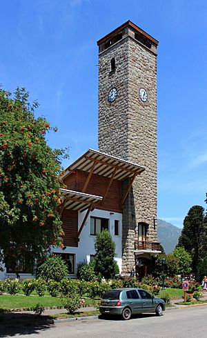
San Martín de los Andes was designed to look like a mountain village. It used local materials like stone, wood, and shingle roofs. Some old buildings from the early 1900s include:
- The First Post Office (built in 1899)
- The Old Lácar Hotel (1910)
- The Primeros Pobladores Museum building (1911)
- The old Chidiak general store (1938)
- Houses of the first families who settled here
When Lanín National Park was created, using wood from the park was limited. This led to a new building style. Two-story houses became common. Some buildings from this time include:
- The first aid center (1942)
- The Lanín National Park administration building (1946)
- The first school in the village (1948)
- The town hall (1960)
The city grew quickly after it became a tourist spot in the 1970s. Since then, architects have mostly stopped using the old mountain village style. They now build more modern, city-like structures with new materials.
Getting Around San Martín
San Martín de los Andes is on National Route 40. This road runs north and south through the city. It connects San Martín with Junín de los Andes to the north and Villa La Angostura to the south. The southern part of the road is called the Road of the Seven Lakes. It goes through the Lanín and Nahuel Huapi national parks. Provincial Route 19 connects the city to the popular tourist spot, Cerro Chapelco. Provincial Route 62 also ends in the city.
Since the city is close to the border, there are several ways to cross into Chile. You can use the Hua Hum Pass (via Provincial Route 48). Other options are Carirriñe Pass and Mamuil Malal Pass (both north of Junín de los Andes). The Cardenal Antonio Samoré Pass is to the south via Villa La Angostura. The Hua-Hum international pass is about 45 kilometers (28 miles) from San Martín de los Andes. It leads to Panguipulli in Chile. Once you cross the border, you can take a ferry across Lake Pirihueico. This ferry takes travelers from Puerto Pirihueico to Puerto Fuy, as there are no roads in that area.
The city has a public bus system. There are bus lines that connect the city to nearby attractions and villages. Taxi services also operate in the city.
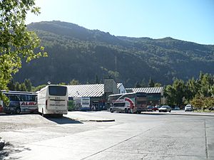
San Martín de los Andes has a bus terminal. It offers both long-distance and medium-distance services. You can travel to many places in Argentina and to neighboring Chile from here. The city is also served by the Aviador Carlos Campos Airport. This airport is about 22 kilometers (14 miles) from the city center. It is the main airport in southern Neuquén province.
Sports and Activities
The natural beauty of the area makes it great for outdoor sports all year. In summer, you can go mountain biking, fishing, and horseback riding. In winter, nearby Cerro Chapelco is a famous ski center in Argentina and South America. You can enjoy many winter sports there, like skiing and snowboarding.
The area has hosted many national and international sports events. These include the San Martín de los Andes marathons. It also hosted Snowboardcross competitions for the FIS Snowboard World Cup.
Athletic Curruhinca is an amateur soccer team from San Martín de los Andes. In 2013, they won the "Copa Cablevision" title. They were the first amateur soccer champions from this city to win in Buenos Aires.
Sister Cities
 Rocca di Cambio, Italy
 Steamboat Springs, Colorado, United States
 Pucón, Chile
See also
 In Spanish: San Martín de los Andes para niños
 | George Robert Carruthers |
 | Patricia Bath |
 | Jan Ernst Matzeliger |
 | Alexander Miles |


