Shining Tor facts for kids
Quick facts for kids Shining Tor |
|
|---|---|

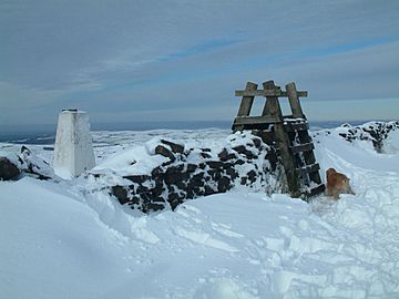
The trig point and former ladder stile at the summit of Shining Tor.
|
|
| Highest point | |
| Elevation | 559 m (1,834 ft) |
| Prominence | 236 m |
| Parent peak | Kinder Scout |
| Listing | Marilyn, County Top, Dewey |
| Geography | |
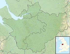
| Location | Cheshire, England |
| Parent range | Peak District |
| OS grid | SJ994737 |
| Topo map | OS Landranger 118 |
Shining Tor is a cool hill in the Peak District of England. It stands 559 metres (1,834 ft) tall, which is about 1,834 feet, above sea level. You can find it between the towns of Buxton and Macclesfield.
This hill sits right on the border between Derbyshire and Cheshire East. Even though it used to be fully in Cheshire, its top is now the highest point in the Cheshire East area. It's also the highest point in the old administrative county of Cheshire (from 1974 to 2009). But don't get confused! The very highest point in the historic county of Cheshire is actually Black Hill, which is a bit taller at 582 metres (1,909 ft).
The word tor means a high rock or rocky hill. It's an old word that came from the ancient British language. Shining Tor is part of a long, north-south ridge of moorland. This ridge stretches between Whaley Bridge and the A537 road, near the Cat and Fiddle Inn. Another hill on this ridge is Cats Tor, which is 519 metres (1,703 ft) high.
(There's another hill called Shining Tor near Dovedale in Derbyshire, but this article is about the one in the Peak District.)
Contents
Climbing Shining Tor
Shining Tor is a great place for a walk! You can climb it in many ways, and the views are really rewarding.
Popular Walking Routes
One common way to reach the top is from the Upper Goyt Valley. You can start near Errwood reservoir. Many people combine this with a walk along the ridge north from Shining Tor, going over Cats Tor. This makes for a longer, fun adventure.
If you want an easier climb, you can start closer to the top. The Cat and Fiddle Inn is a good starting point, as it's already quite high up. This means less climbing to reach the summit.
Amazing Views from the Top
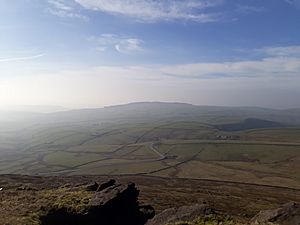
Since Shining Tor is the highest point around, the views from its summit are fantastic! It's even 8 metres (26 ft) higher than Axe Edge Moor near Buxton.
What You Can See
While the top of the hill is quite flat, you can still see some amazing things on a clear day:
- To the southwest, you'll see the peak of Shutlingsloe above Wildboarclough. It's a very noticeable hill.
- If the weather is clear, you might spot Winter Hill near Bolton.
- You can also see the city of Manchester and a large part of the Cheshire Plain.
- Look out for the giant radio telescopes at Jodrell Bank, which are about 20 kilometres (12 mi) to the west.
- On very clear days, you can even see North Wales and the mountains of Snowdonia far away!
Radio Fun
Shining Tor is also used by amateur radio operators. They come here for something called "Summits On The Air" (SOTA) activations. It's a fun way for them to talk to other radio enthusiasts from the top of a hill!
How Shining Tor Was Formed
The main part of Shining Tor, including its summit, is made from a type of rock called Chatsworth Grit. This is a thick sandstone that you can find in many parts of the Peak District. It formed a very long time ago!
Ice Age Survivor
Scientists believe that Shining Tor was so tall that it stood above the huge ice sheets during the last ice age. This means it wasn't covered by ice like many other areas. Because of this, you won't find any rocks or soil left behind by glaciers on its summit.
Peat Bogs
The eastern slopes and some parts of the western slopes of Shining Tor are covered in peat. Peat is a type of soil made from partly decayed plants. It can be several metres deep in some places, like a thick, spongy blanket over the land.
 | Audre Lorde |
 | John Berry Meachum |
 | Ferdinand Lee Barnett |


