
Smestow Brook facts for kids
Quick facts for kids Smestow Brook or River Smestow |
|
|---|---|
| Country | England |
| Counties | West Midlands, Staffordshire |
| District | Wolverhampton, South Staffordshire |
| Physical characteristics | |
| Main source | Wolverhampton 52°35′31″N 2°07′14″W / 52.59191°N 2.1206188°W |
| River mouth | Prestwood, Staffordshire 52°28′03″N 2°12′10″W / 52.4675047°N 2.2027346°W |
| Length | 27 km (17 mi) |
| Basin features | |
| Tributaries |
|
The Smestow Brook, also known as the River Smestow, is a small river in the United Kingdom. It helps drain water from Wolverhampton, South Staffordshire, and parts of Dudley. This river was very important for the growth of industries in the Black Country. It is the main stream that flows into the River Stour, Worcestershire, and its waters eventually join the River Severn.
Contents
What's in a Name?
The name Smestow might come from an old Anglo-Saxon word. It means "place of the smiths." This area of the West Midlands was famous for making iron a long time ago. Forests like Kinver Forest provided charcoal for melting and shaping iron. The lower Smestow and the Stour had many ironworks and forges. They used the river water for cooling and to power simple machines.
Some people in the area call the lower part of the stream, from Wombourne, the "River Smestow." They call the upper part the "Smestow Brook." The lower part looks bigger now because it was made deeper in the 1990s. But most people use both names for the whole stream, with "Smestow Brook" being more common.
Where Does the Smestow Flow?
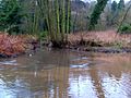
The Smestow Brook starts in the Springfield area of Wolverhampton. Many street names there show that there used to be lots of water. However, the natural springs were put into pipes when buildings were built in the 1870s. A lot of water was sent to the Springfield Brewery. Today, you can't see the Smestow for a long way from its start.
It appears further north in the Park Village area, at the edge of Fowler's Park. The Smestow then flows north through the park, filling a pool. After that, it turns sharply west and goes into an underground pipe. This pipe takes it under major roads and railway lines in Wolverhampton. It also goes under the BCN Main Line canal.
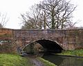
The brook comes out near Wolverhampton Racecourse at Dunstall. Here, a small lake helps prevent floods and is a home for wildlife. The Smestow then crosses over the Staffordshire and Worcestershire Canal on a special bridge called an aqueduct, the Dunstall Water Bridge. This aqueduct was built by James Brindley to keep the water flowing in the Smestow and Stour. These rivers were important for power in the 1700s.
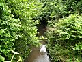
The Smestow flows along the Smestow Valley Local Nature Reserve. It goes under the main road between Wolverhampton and Tettenhall. It also passes Tettenhall Station, which used to be a railway station but is now a small café. In this area, the valley has steep sides. The brook flows between the Wolverhampton areas of Compton and Tettenhall. Here, the Graiseley Brook and Finchfield Brook join it. These brooks drain water from the southwest of Wolverhampton. The Smestow then passes Wightwick Manor.
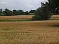
At Wightwick, the brook moves away from the canal for a few kilometers. It flows across open farmland, and you can see its green path winding through the fields. The Trescott Ford, a shallow crossing, can be tricky for drivers after heavy rain.
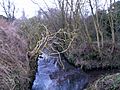
The Smestow then passes through Furnace Grange. Here, the Black Brook, a large stream, joins it from the right. The Smestow turns south. It then swings southeast through the village of Seisdon, flowing between houses and their gardens. The same happens at Trysull.
It then turns south for good, going past the southwestern edge of Wombourne. This area used to flood a lot until the river's path was changed in the 1990s. Here, its most important helper, the Wom Brook, joins it. From this point, the Smestow flows very close to the Staffordshire and Worcestershire Canal again.
After passing the small village of Smestow, it goes to Swindon. From here, it stays very close to the canal. Sometimes, only the walking path separates them. You can clearly see how the banks have been strengthened here to stop floods.
The river winds through open farmland, often hidden by trees. At Greensforge, it passes an old Victorian corn mill. This was once a very important iron forge, but now it's been turned into apartments.
The valley gets much narrower after the river flows through Ashwood. The marina at Ashwood is where the Dawley Brook joins the Smestow. This meeting point helped Roman soldiers protect one of their forts, which was named after Greensforge.
At Gothersley, just south of Ashwood, the Spittle Brook joins from the right. Here, the two streams create a small but important wetland area.
Finally, at Prestwood, near Stourton and Kinver, the Smestow flows into the Stour. After rain, you can see the darker water from the Smestow mixing with the sandy Stour. The Stour then flows south to join the River Severn at Stourport-on-Severn. Its water eventually reaches the Atlantic Ocean.

Can You Travel on the Smestow?
No, you cannot travel by boat on the Smestow. However, its valley is a natural path from north to south. This was so important that the Staffordshire and Worcestershire Canal was built as a way to travel instead of using the river. The Smestow also provides water for the canal.
Wildlife Along the Smestow

The Smestow flows through an important local nature reserve in Wolverhampton. Its lower part follows a conservation area next to the canal, often through wooded areas and small wetlands. This means it's home to many different kinds of wildlife. Even if nothing is super rare, there's a great variety of plants and animals. When the river is cleaned or changed, wildlife usually comes back quickly. Less pollution over the last 30 years has allowed nature to grow and thrive.
The Smestow Valley reserve has seen over 170 types of birds, either living there or visiting. About 55 species even breed there. Winter brings the most variety, with common birds like the blackbird and common chaffinch joined by visitors like redwings, fieldfares, and little grebes. Birds of prey like the buzzard and sparrowhawk can also be seen.
Insect life is also rich. More than 20 kinds of butterflies have been seen, including ringlets, common blues, peacocks, and red admirals. There are also many different damselflies and dragonflies.
How the Smestow Was Formed
The Smestow got its current shape because of the last Ice Age. Glaciers removed part of a low hill north of Wolverhampton. This created a gap called the Aldersley Gap. Because of this, the Smestow could flow south and became part of the River Severn's water system instead of the River Trent's.
In some areas, especially around Wolverhampton, the Smestow flows over gravel beds left by the Ice Age. But for most of its path, the Smestow flows over deep layers of sandstone. This sandstone lets water drain through it quickly. Because of this, the land around the river in South Staffordshire used to have natural heathland and open birch woods, even with a fair amount of rain. Over time, people cleared land for farming. Today, farming methods can cause pollution to get into the water underground. This is now the main pollution threat to the Smestow valley's water supply.
History and Importance
The Smestow flows very close to important Roman sites. The most important was at Greensforge, where two Roman camps were built. One camp even used the stream as part of its defenses. However, it was the Anglo-Saxon settlers who built permanent homes in the valley. They likely gave the stream its name.
Industry Along the River
As mentioned, the banks of the Smestow and Stour were home to a busy iron industry. This lasted from the Middle Ages until the 1700s. It included many forges (places where iron was shaped). From the mid-1600s, some larger businesses were run by rich people. These were at places like Grange Furnace near Trescott, Heath Forge near Wombourne, Swindon, Greensforge, and Gothersley. To power Heath Mill, a large channel was built to take water from the Smestow at Trysull. This water went into a pond, then dropped into the Wom Brook, powering several mills, and finally flowed back into the Smestow.
Important people in these developments included the Foley family and Dud Dudley. Dudley was an illegitimate son of Edward Sutton, 5th Baron Dudley. He experimented with using coal instead of charcoal to make iron. The Dudley family had large ironworks, and Dud Dudley claimed his process was used at an ironworks in Swindon. His father, who also made iron, lived at Himley Hall on a stream that fed into the Smestow.
In the late 1700s, new blast furnaces that used coke (a type of coal) became popular. This slowly ended the use of charcoal for iron production. Heath Forge became a corn mill in the 1810s. Swindon Forge was updated in the mid-1800s. Water power was still very important for industry. So, when the Staffordshire and Worcestershire Canal was built around 1770, James Brindley was stopped from cutting off the flow of the upper Smestow. Instead, he had to build the "water bridge" or aqueduct at Dunstall. This bridge carries the brook over the canal, allowing it to continue its natural path.
The canal made it easier to move coal, coke, and iron. This allowed industries to use both water and steam power, along with coke-fired furnaces. This led to bigger ironworks at Swindon and Gothersley on the Smestow. These were located where the river and canal were close together. The Swindon works had a rolling mill and mostly used coal for power. It lasted until 1976.
Even though large iron production became centralized, small-scale iron working continued and even grew. In 1817, someone wrote that Swindon had "an iron-works, some forges, and a blade-mill." This mill made scythes, sickles, and axes. An 1834 survey also mentioned corn mills at Swindon. It said Wombourne was a large village where "nailors" worked for nearby manufacturers. These nail-makers often worked from their own small forges. The need for water to power these forges continued to rise into the Victorian period. During this time, the Smestow powered at least 30 mills. In some cases, like at Greensforge, iron-working eventually changed to corn milling.
Water Supply for People and Industry
Industries in north Wolverhampton continued to use the Smestow's water for many things, including carrying away waste. From the 1870s, a lot of water was taken from the Smestow's source for brewing beer. The large Springfield Brewery was built for William Butler in 1873 at the Smestow's source. It operated until 1991.
The river often looks small because the rock underneath is very porous sandstone. This means a lot of water is stored underground in the aquifer. In 1851, an engineer named Henry Marten measured the water supply. He found about 45 million liters per day and suggested taking water from the Smestow for drinking and industry. But this idea was blocked by carpet makers in Kidderminster. They worried that taking water from the Smestow would reduce the flow of the Stour, which they used to carry away their waste.
The next year, Marten proposed a plan to get drinking water from the lower Smestow. He sent water samples to labs in London, and they said the water was very clear. However, the underground water supply is easily polluted. It's probably a good thing Marten's idea wasn't fully used until the 1890s. That's when a large pumping station was built at Ashwood, south of Swindon. It supplied water to industries in the Black Country. Soon after, the Bratch pumping station was built at Wombourne to provide drinking water to Bilston. Both of these stations took water from the underground aquifer, not directly from the river. They were also built close to the canal, which could bring them coal.
In the 1900s, people made efforts to clean up the Smestow. This, along with the decline of heavy industry in the 1980s, allowed the river to recover from earlier pollution. Today, the water is clear. The river and canal are important places for wildlife.
Streams That Join the Smestow
The Smestow gets bigger as other streams flow into it. Here are some of them, starting from the Stour and going upstream:
- The Spittle Brook: This stream drains the area north of Enville. It flows through a marshy area to join the Smestow near Gothersley.
- The Dawley Brook: This stream drains the Kingswinford area. It fills the Ashwood basin before joining the Smestow.
- The Holbeche Brook: This stream starts near Gornalwood and flows past Holbeche House. It joins the Smestow at Hinksford.
- The Wom Brook: This stream drains areas like Penn Common and Sedgley. It flows through Wombourne and joins the Smestow south of the village.
- The Black Brook: This stream drains the area near Perton and Pattingham. It joins the Smestow near Trescott.
- The Perton Brook: This stream flows down Wightwick Bank and waters the gardens of Wightwick Manor.
- The Finchfield and Graiseley Brooks: These streams drain the west of Wolverhampton. They join the Smestow in the Smestow Valley Local Nature Reserve.
Towns and Villages Along the Smestow
The Smestow flows through or near several towns and villages. Many of these places are linked to the old iron industry or the canal.
In South Staffordshire, going upstream from where it meets the Stour:
- Ashwood
- Greensforge
- Swindon
- Smestow village
- Wombourne
- Trysull
- Seisdon
- Trescott
In Wolverhampton:
- Wightwick
- Finchfield
- Tettenhall
- Compton
- Aldersley
- Dunstall Hill
- Park Village
Important Locations
| Point | Coordinates (links to map & photo sources) |
|---|---|
| Source in Springfield, Wolverhampton | 52°35′32″N 2°07′11″W / 52.5921°N 2.1197°W |
| Emergence in Fowler's Park, Park Village | 52°35′50″N 2°07′06″W / 52.5973°N 2.1182°W |
| Wolverhampton Racecourse | 52°36′10″N 2°08′53″W / 52.6029°N 2.1481°W |
| Dunstall Water Bridge | 52°36′12″N 2°09′05″W / 52.6033°N 2.1513°W |
| Smestow Valley Local Nature Reserve (entrance) | 52°35′48″N 2°09′43″W / 52.5967°N 2.1620°W |
| Wightwick Manor | 52°35′01″N 2°11′39″W / 52.5836°N 2.1941°W |
| South Staffordshire Railway Walk Local Nature Reserve | 52°34′26″N 2°11′18″W / 52.5740°N 2.1882°W |
| Trescott Ford | 52°34′22″N 2°13′11″W / 52.5727°N 2.2197°W |
| Confluence with Black Brook | 52°33′39″N 2°14′17″W / 52.5607906°N 2.2381854°W |
| Confluence with Wom Brook | 52°31′32″N 2°12′50″W / 52.5255°N 2.2138°W |
| Highgate Common Country Park | 52°30′29″N 2°14′00″W / 52.5080°N 2.2333°W |
| Confluence with River Stour | 52°28′03″N 2°12′10″W / 52.4676°N 2.2027°W |
Images for kids
-

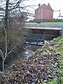
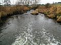
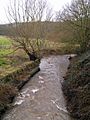
1. Where the Smestow Brook is thought to start.
-
2. The brook appears in Fowler's Park, Park Village, Wolverhampton.
-
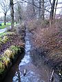
3. Flowing through Fowler's Park.
-
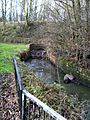
4. The brook goes into an underground pipe.
-
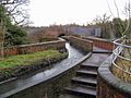
5. Crossing the Staffordshire and Worcestershire Canal at Dunstall Water Bridge.
-
6. The Dunstall Water Bridge seen from the canal.
-
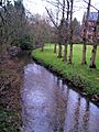
7. Near Tettenhall Station.
-
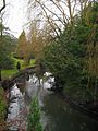
8. Where Graiseley Brook joins in Smestow Valley Local Nature Reserve.
-
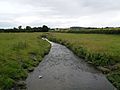
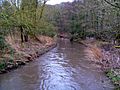
9. In farmland near Trescott.
-
10. Trescott Ford, close to the main road.
-
11. At Furnace Grange.
-
12. The Smestow at Seisdon in South Staffordshire.
-
13. At Trysull in South Staffordshire.
-
14. At Swindon.
-
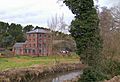
15. Greensforge Mill.
-
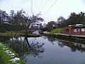
16. Marina in the canal basin at Ashwood, Staffordshire, where Dawley Brook enters the Smestow.
-
17. At Gothersley, near where Spittle Brook joins.
-
18. Where it meets the Stour.


