Stamford Bridge, East Riding of Yorkshire facts for kids
Quick facts for kids Stamford Bridge |
|
|---|---|
| Village and civil parish | |
|
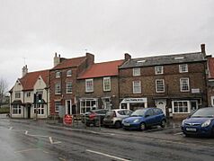
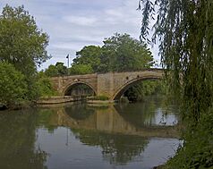
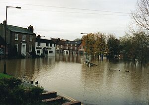
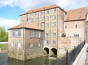
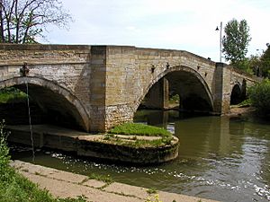
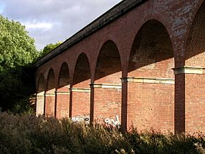
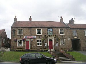
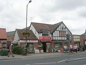
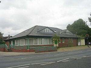
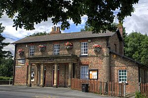
From the top, The Main Square, Railway Viaduct, The Corn Mill, The Bridge
|
|
| Population | 3,528 (2011 census) |
| OS grid reference | SE710550 |
| Civil parish |
|
| Unitary authority | |
| Ceremonial county | |
| Region | |
| Country | England |
| Sovereign state | United Kingdom |
| Post town | YORK |
| Postcode district | YO41 |
| Dialling code | 01759 |
| Police | Humberside |
| Fire | Humberside |
| Ambulance | Yorkshire |
| EU Parliament | Yorkshire and the Humber |
| UK Parliament |
|
Stamford Bridge is a village and civil parish in the East Riding of Yorkshire, England. It's located on the River Derwent, about 5 miles (8 km) east of York. The village is built around an old ford, which is a shallow place in a river where people and vehicles can cross.
Stamford Bridge is famous for several things:
- It was once home to a Roman fort called Derventio.
- A very important battle, the Battle of Stamford Bridge, happened here in 1066 AD.
- It had a railway line (which closed in 1965), a railway station, and a large viaduct.
- The road bridge crosses the River Derwent.
Contents
- How is Stamford Bridge Governed?
- What Does the Name "Stamford Bridge" Mean?
- A Look at Stamford Bridge's History
- Nature and Flooding in Stamford Bridge
- Important Landmarks in Stamford Bridge
- Education in Stamford Bridge
- Shops and Services in Stamford Bridge
- Other Things to Do in Stamford Bridge
- Getting Around: Public Transport
- Famous People From Stamford Bridge
- See also
How is Stamford Bridge Governed?
Stamford Bridge is close to the borders of North Yorkshire and the City of York. The village has its own local council, called Stamford Bridge Parish Council. It's also part of the Pocklington Provincial area within the East Riding of Yorkshire Council. This council elects three local representatives every four years.
How Many People Live Here?
The number of people living in Stamford Bridge has grown recently. This is because many new houses have been built on the south side of the village.
| Year | Population | Source |
|---|---|---|
| 2021 | todo | 2021 UK census |
| 2011 | 3,528 | 2011 UK census |
| 2001 | 3,394 | 2001 UK census |
| 1882 | 449 |
What Does the Name "Stamford Bridge" Mean?
The name Stamford Bridge comes from old words. In 1066 AD, the place where the famous battle happened was called "Stanfordbrycge".
The part of the name 'brycge' comes from an Old English word that means "bridge".
What is the Toponym?
The name basically means "Stone ford bridge". A "ford" is a shallow place to cross a river, and "bridge" means a structure built over it.
A Look at Stamford Bridge's History
The Roman Fort: Derventio
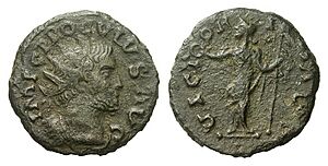
The Romans built a fort here around 70 AD. A large civilian settlement grew up around it, focusing on a bridge about one mile (1.6 km) south of where the village is today.
The Roman name Derventio comes from a Celtic word meaning "oak-tree". This name is linked to the River Derwent. The fort was connected to other Roman areas by a Roman road called Cade's Road. You can still see parts of Cade's Road heading north from Stamford Bridge.
The Viking Age and a Famous Battle
The Battle of Stamford Bridge took place on September 25, 1066. This battle is often seen as the end of the Viking Age in Britain. In this battle, King Harold II of England fought against an invading Norwegian army. This army was led by his brother Tostig Godwinson and King Harald Hardrada of Norway. King Harold won the battle, but just three weeks later, he lost the Battle of Hastings. This allowed the Norman Conquest of England to happen.
The Normans later called the settlement Pons Belli, which means "battle bridge". Records from 1368 show that people rented land and there was a shared oven in the village.
More Recent History
The A166 is an important road that crosses the river at Stamford Bridge. It's one of the main routes from York to the coast. The road bridge in the village was closed for repairs in 2007 because it's very old (from 1727) and handles a lot of traffic. It reopened after about 11 weeks.
The village experienced severe floods in November 2000. About 30 businesses and homes were flooded. New flood defenses have since been built, costing £3.7 million.
Nature and Flooding in Stamford Bridge
Understanding Flooding
The River Derwent flows through Stamford Bridge, splitting it into two parts. The river starts in the North York Moors and eventually joins the River Ouse.
In March 1999, there was a huge amount of rain in the Derwent area. This, combined with melting snow, caused the river to flood. By March 7, large parts of Stamford Bridge were underwater, reaching about 5 feet (1.5 meters) deep.
The river reached 5 meters (16.4 feet) above its normal level, which was the highest ever recorded at that time. However, in October 2000, a new record was set when the river flooded again, even higher than in 1999.
Work began in 2003 to build new flood defenses for Stamford Bridge, and they were finished in 2004. Despite these defenses, the village square flooded again in June 2007 after very heavy rainfall.
Important Landmarks in Stamford Bridge
Stamford Bridge has many interesting landmarks. These include the Corn Mill, the stone arched bridge over the River Derwent, and the Stamford Bridge Viaduct. The Stamford Bridge railway station and viaduct were built around 1847. There's also a Wesleyan Methodist Chapel from 1828 and the Bay Horse Inn, an old public house from the late 1700s or early 1800s. The "Derwent Plastics factory" on the west side of the river started in 1934 in an old brewery building.
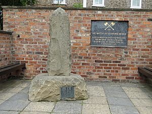
Just east of the village is Burtonfields Hall, a large house built in 1837. A memorial for the Battle of Stamford Bridge can be found on Whiterose Drive, overlooking the area where the battle is believed to have happened.
The Corn Mill
The Cornmill is an old water mill from the late 1700s or early 1800s. It is a Grade II listed building, meaning it's historically important.
The mill was likely made bigger between 1847 and 1850. It used to have two water wheels and seven sets of grinding stones. The mill stopped working in 1964 and became a restaurant in 1967. More recently, the Cornmill was turned into twelve apartments, but some of the original mill equipment is still there.
The Road Bridge
People have been crossing the river here since Roman times. About 250 meters (273 yards) upstream from the current bridge, there was a natural rocky ford that could be crossed when the river wasn't flooded. Records from 1066 mention a bridge at or near the village during the famous battle. Archeological studies show there was a Roman bridge about one mile (1.6 km) south of the village, connecting the Roman settlement of Derventio.
In the Middle Ages, a new wooden bridge was built on three stone supports. This bridge was repaired in the 1200s and 1500s. A map from 1724 shows this bridge was about 70 meters (77 yards) upstream from the bridge we see today.
In the 1700s, a weir (a small dam) and a canal with a lock were built. The old medieval bridge was then replaced with the current one.
The present bridge was designed by William Etty and finished in 1727. It was made stronger in the 1960s, and a separate pedestrian bridge was added next to it. The bridge is a Grade II* listed monument, meaning it's very important historically.
The Viaduct
The viaduct opened on October 3, 1847. It used to carry the York to Beverley railway line across the Derwent, but the railway closed in 1965. The viaduct has red brick arches on either side and a wider iron section that crosses the river. Today, the viaduct is part of a public cycle path and is also a Grade II* listed building.
Education in Stamford Bridge
The village school was first built on Main Street in 1795. It was started with money left by Christopher Wharton. At first, 12 poor boys and 6 poor girls could go to school for free, but they had to pay a small amount for firewood. Other students also paid to attend, and by 1822, there were 30 students.
In 1874, education became required by law. In 1911, the East Riding County Council took over and built a new school on the current Church Road site. This building was updated and made bigger in 1968 and again in 1978 because the village was growing fast. In 1983, a new building for younger children (infants) was added on Godwinsway. This meant the school was split between two locations, but it greatly improved education for the children. This infant building was also expanded in 2000.
Shops and Services in Stamford Bridge
Even though it only takes about an hour to drive from York to the coast, Stamford Bridge is a popular place for travelers to stop on the A166 road. Most people stop for food or drinks, often because of the long waits to cross the old one-lane bridge in the village square.
Here are some of the things you can find in central Stamford Bridge:
- A post office and solicitors (lawyers)
- An estate agent (for buying and selling houses)
- A convenience store, a butcher/baker, and a pharmacy
- A caravan park (for campers)
- A nursing home
- Three pubs: The Three Cups, the New Inn (which used to be called The Swordsman), and the Bay Horse. All three serve food.
- A bistro (a small restaurant)
- A tea room and a village shop
- An old-fashioned sweet shop with a barber's shop in the back
- Fast food places like a pizza/kebab shop, a fish and chip shop, a Chinese restaurant/take-away, an Indian restaurant/take-away, and a sandwich shop
- A modern veterinary clinic, a dental practice, and a doctor's surgery
- Two car repair garages
- A special shop that sells whisky
- A shop with unique and unusual items
- A hairdressing salon and a beauty/therapy salon
- A florist (flower shop) that also serves hot drinks
- A funeral director
In recent years, Stamford Bridge has lost some services, including a petrol station (it once had three!), a ladies' clothing shop, a bank, a newsagent, an ice cream shop, a DIY store, a cafe, and a hotel.
Other Things to Do in Stamford Bridge
The village offers several other facilities for both locals and visitors.
- Walks: There are clear public footpaths along the River Derwent. You can walk towards Low Catton or Buttercrambe. These paths offer beautiful countryside views and are not paved. The the White Rose Way, a long-distance walking route from Leeds to Scarborough, also passes through the village.
- Car parking: You can find parking spaces in the village square. There's also a large free public car park near the A166 road bridge and Viking Road.
- Village hall and scout hall: These are located on Low Catton Road.
- Playing Fields Association: Also on Low Catton Road, this is home to the cricket club, with tennis courts and lawn bowls. There are also football pitches further down Low Catton Road.
- Churches: There's a Methodist church in the village square and a Church of England church on Church Road.
- Sports hall: This is located behind the Old Station Club.
- Community First Responder Group: Since 2005, a group of volunteers has been helping the Yorkshire Ambulance Service by responding to emergencies in the community.
Getting Around: Public Transport
The village has two bus routes. The number 10 bus, run by First York (and York Pullman in the evenings), provides regular service to the center of York and then to Poppleton. East Yorkshire Motor Services runs an occasional service (No 747) between York and Stamford Bridge, continuing to Full Sutton, Fangfoss, and Pocklington. (Information as of October 2011).
The Stamford Bridge railway station closed in 1965 as part of the Beeching cuts, which were changes that closed many railway lines in Britain. The Minsters Rail Campaign is working to reopen the railway line between Beverley and York, with stops planned at Stamford Bridge, Pocklington, and Market Weighton. If the railway reopens, the new track would go around the eastern edge of the village because the old railway path has been built on.
Famous People From Stamford Bridge
- Paul Robinson, a former goalkeeper for the England football team, used to live here.
- Nick Culkin, a former goalkeeper for Manchester United, was born here.
- Matt Brash, a veterinarian known from television, has a new surgery next to the bridge.
See also
 In Spanish: Stamford Bridge (Yorkshire del Este) para niños
 | Lonnie Johnson |
 | Granville Woods |
 | Lewis Howard Latimer |
 | James West |


