Taylor County, West Virginia facts for kids
Quick facts for kids
Taylor County
|
||
|---|---|---|

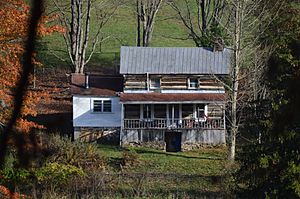
Clelland House, built in 1800.
|
||
|
||

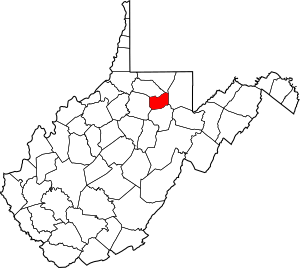
Location within the U.S. state of West Virginia
|
||
 West Virginia's location within the U.S. |
||
| Country | ||
| State | ||
| Founded | January 19, 1844 | |
| Named for | John Taylor of Caroline | |
| Seat | Grafton | |
| Largest city | Grafton | |
| Area | ||
| • Total | 176 sq mi (460 km2) | |
| • Land | 173 sq mi (450 km2) | |
| • Water | 2.9 sq mi (8 km2) 1.7%% | |
| Population
(2020)
|
||
| • Total | 16,705 | |
| • Estimate
(2021)
|
16,492 |
|
| • Density | 94.91/sq mi (36.65/km2) | |
| Time zone | UTC−5 (Eastern) | |
| • Summer (DST) | UTC−4 (EDT) | |
| Congressional district | 1st | |
Taylor County is a county located in the state of West Virginia in the United States. In 2020, about 16,705 people lived there. The main town and county seat (where the government offices are) is Grafton. Taylor County was created in 1844. It was named after Senator John Taylor of Caroline. This county is part of the Clarksburg, WV Micropolitan Statistical Area.
Contents
History of Taylor County
Long ago, ancient people called the Adena culture lived in this area. They were here during the Pre-Columbian Woodland period, which was a time before Europeans arrived in America.
Some of the first Europeans to visit this land might have been soldiers. They reportedly left their army post at Fort Pitt in 1761. This was during the French and Indian War. They explored northwestern Virginia for several years. A European trader from the Hudson's Bay Company also visited these lands around 1764.
Pruntytown is the oldest known European settlement in what is now Taylor County. It was founded around 1798. At first, it was called Cross Roads. On January 1, 1801, its name changed to Williamsport. This honored Abraham Williams, who lived there for a long time. The name changed again on January 23, 1845, to Pruntytown. This new name honored pioneer settler John Prunty, Sr. and his son David. Pruntytown was the county seat from 1844 until 1878. Then, people voted to move the county seat to Grafton, West Virginia.
The Virginia General Assembly officially created Taylor County on January 19, 1844. It was formed from parts of Barbour, Harrison, and Marion counties in Virginia. Most historians believe the county was named after John Taylor (1753-1824). He was a senator from Caroline County, Virginia. Some people think it was named after Zachary Taylor, who later became president.
On June 20, 1863, during the Civil War, Taylor was one of fifty Virginia counties. These counties joined together to form the new state of West Virginia. Later that year, counties were divided into smaller areas called civil townships. This was meant to help local governments. But it was hard to do in rural areas. So, in 1872, townships became magisterial districts.
Taylor County first had nine townships: Booths Creek, Clay, Court House, Fetterman, Flemington, Grafton, Haymond, Union, and Webster. Grafton Township covered the town of Grafton. Over time, some townships were combined. In the 1970s, the six historic districts became three new ones: Central, Eastern, and Western. In the 1990s, Central District was renamed Tygart.
The West Virginia Equal Suffrage Association was started in November 1895. This happened at the Taylor County Courthouse. The group worked to get women the right to vote.
Anna Jarvis, who started Mother's Day, was born in Taylor County. The International Mother's Day Shrine is located there today.
Geography of Taylor County
The United States Census Bureau says Taylor County covers about 176 square miles. Most of this area, about 173 square miles, is land. The rest, about 2.9 square miles (1.7%), is water. Taylor County is the fifth-smallest county in West Virginia by land area.
Main Roads in Taylor County
Neighboring Counties
Taylor County shares borders with these other counties:
- Monongalia County (north)
- Preston County (east)
- Barbour County (south)
- Harrison County (west)
- Marion County (northwest)
People and Population
| Historical population | |||
|---|---|---|---|
| Census | Pop. | %± | |
| 1850 | 5,367 | — | |
| 1860 | 7,463 | 39.1% | |
| 1870 | 9,367 | 25.5% | |
| 1880 | 11,455 | 22.3% | |
| 1890 | 12,147 | 6.0% | |
| 1900 | 14,978 | 23.3% | |
| 1910 | 16,554 | 10.5% | |
| 1920 | 18,742 | 13.2% | |
| 1930 | 19,114 | 2.0% | |
| 1940 | 19,919 | 4.2% | |
| 1950 | 18,422 | −7.5% | |
| 1960 | 15,010 | −18.5% | |
| 1970 | 13,878 | −7.5% | |
| 1980 | 16,584 | 19.5% | |
| 1990 | 15,144 | −8.7% | |
| 2000 | 16,089 | 6.2% | |
| 2010 | 16,895 | 5.0% | |
| 2020 | 16,705 | −1.1% | |
| 2021 (est.) | 16,492 | −2.4% | |
| U.S. Decennial Census 1790–1960 1900–1990 1990–2000 2010–2020 |
|||
What the 2020 Census Showed
The 2020 United States census counted 16,705 people living in Taylor County. There were 6,557 households. Most people (94%) were White. About 0.7% were African American, and 0.2% were Asian. A small number (1.1%) were Hispanic or Latino.
The average household had 3.08 people. The average age in the county was 44.1 years old. About 20.2% of the people were under 18. The average income for a household was $52,823. About 16.2% of the population lived below the poverty line.
Communities in Taylor County
City
- Grafton (This is the county seat)
Town
Magisterial Districts
Magisterial districts are local government areas within the county.
Current Districts
- Eastern
- Tygart
- Western
Historic Districts
These districts were used in the past:
- Booths Creek
- Court House
- Fetterman
- Flemington
- Grafton
- Knottsville
Unincorporated Communities
These are smaller communities that are not officially cities or towns.
Images for kids
See also
 In Spanish: Condado de Taylor (Virginia Occidental) para niños
 | Sharif Bey |
 | Hale Woodruff |
 | Richmond Barthé |
 | Purvis Young |


