Thames River (Ontario) facts for kids
Quick facts for kids Thames River |
|
|---|---|

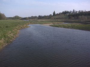
North Thames River, just upstream from the confluence with the Avon River near Stratford, Ontario
|
|
|
Location of the mouth of the Thames River in southern Ontario
|
|
| Native name | Deshkan Ziibi |
| Other name(s) | Antler River |
| Country | Canada |
| Province | Ontario |
| Region | Southwestern Ontario |
| Physical characteristics | |
| Main source | Near Tavistock |
| River mouth | Lake Saint Clair Lighthouse Cove 173 m (568 ft) 42°19′9″N 82°27′15″W / 42.31917°N 82.45417°W |
| Length | 273 km (170 mi) |
| Basin features | |
| River system | Great Lakes Basin |
| Basin size | 5,825 km2 (2,249 sq mi) |
The Thames River is a cool river in southwestern Ontario, Canada. It flows for about 273 kilometres (170 mi) through the region.
The river starts near Tavistock and travels through cities like Woodstock, London, and Chatham. It finally empties into Lake St. Clair at a place called Lighthouse Cove. The area of land that drains into the Thames River is huge, covering about 5,825 square kilometres (2,249 sq mi)!
Did you know the river has another name? In the Ojibwe language, it's called Deshkan Ziibi, which means “Antler River.” The Anishinaabe and Neutrals peoples lived here long before Europeans arrived. In 1793, a British leader named John Graves Simcoe named the river after the famous River Thames in England.
Long ago, much of the land around the Thames River was covered in thick deciduous forests. These were part of the special Carolinian forests. But over time, many trees were cut down to make space for farms and other buildings.
Two special groups, the Upper Thames River Conservation Authority and Lower Thames Valley Conservation Authority, help take care of the Thames River. They work to stop floods and manage the river's natural resources.
Contents
The River's Journey

The Thames River system actually has three main parts: the Thames River itself, the North Thames River, and the Middle Thames River. People sometimes call them the South Branch, North Branch, and Middle Branch. The South Branch is the main river, starting near Tavistock and flowing towards Woodstock.
The Thames River and North Thames River flow through valleys that were carved out by huge glaciers during the last ice age. These two rivers meet in the middle of London at a spot called the "Forks." The University of Western Ontario is located near where the North Thames River meets Medway Creek. The Middle Thames River joins the main Thames River west of Ingersoll.
Further downstream from London, the Thames River flows through a flatter area of sand and clay. Here, it's usually about 4 feet (1.2 m) deep. The lower part of the river passes through towns like Delaware, Chatham, and Thamesville. It also flows past First Nations communities of the Chippewa and Oneida peoples. Many smaller streams, called tributaries, flow into the Thames River, including the Avon River, Medway Creek, and Trout Creek.
Controlling the Water
To help control seasonal floods, there are three important dams on the Thames River system:
- The Wildwood Dam is on Trout Creek, which flows into the North Thames River.
- The Pittock Dam is on the Thames River near Woodstock.
- The Fanshawe Dam is on the North Thames River in London.
There was also a dam at Springbank Park in London, which helped control water levels for many years. It was closed in 2005 for repairs, but one of its gates broke in 2008. After some discussions, the city decided in 2018 to permanently close the Springbank Dam.
River History and Events
The Thames River has seen many important events throughout history.
War of 1812 Battle
The river was the site of a major battle during the War of 1812. This battle, known as the Battle of the Thames, happened on October 5, 1813. American General William Henry Harrison fought against British General Henry Proctor and his ally, the great Native American leader Tecumseh. Sadly, Chief Tecumseh was killed in this battle.
Boat Accidents and Floods
The Thames River has also been involved in some sad accidents:
- On May 25, 1881, a river boat called the Victoria capsized and sank, leading to the loss of 182 passengers. After this, new rules were made to make sure ferries didn't carry too many people.
- On July 11, 1883, heavy rain caused London to flood. Another ferry, the Princess Louise, was swept over a dam and sank, and seven people lost their lives.
- On August 25, 1899, a boat called the Thames caught fire and sank near the Waterworks Dam.
- On April 27, 1937, the Thames River reached its highest water level ever, about 21.5 feet (6.6 m) above normal. This caused five deaths and damaged over 1,000 homes.
- On August 13, 1950, a small boat capsized, and four passengers died.
A Special River
On August 14, 2000, the Thames River was given a special honor. It was named a Canadian Heritage River. This means it's recognized for its important natural, cultural, and recreational value.
Recent Flooding
In February 2018, very heavy rains caused a lot of flooding along the riverbanks. Many properties in Chatham and nearby Thamesville were damaged.
 | Sharif Bey |
 | Hale Woodruff |
 | Richmond Barthé |
 | Purvis Young |


