Torres del Paine National Park facts for kids
Quick facts for kids Torres del Paine National Park |
|
|---|---|
|
IUCN Category II (National Park)
|
|
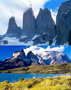
Towers of Paine and Paine Horns
|
|
 |
|
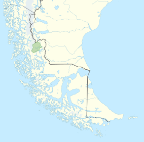
| Location | Magallanes Region, Chile |
| Nearest city | Puerto Natales |
| Area | 181,414 ha (448,280 acres) |
| Established | May 13, 1959 |
| Visitors | 304,947 (in 2019) |
| Governing body | Corporación Nacional Forestal |
Torres del Paine National Park (which means Parque Nacional Torres del Paine in Spanish) is a famous national park in southern Chile. It is part of a region called Patagonia. The park is full of amazing natural sights like mountains, glaciers, lakes, and rivers.
The main part of the park is the Cordillera del Paine mountain range. This area is special because it sits where two different types of land meet: the Magellanic subpolar forests and the Patagonian Steppes. The park is about 112 km (70 mi) north of Puerto Natales.
The word Paine means "blue" in the native Tehuelche language. It is pronounced PIE-neh. Torres means "towers" in Spanish. The park was created in 1959. It is one of the biggest and most visited parks in Chile. Around 252,000 people visit each year, and many come from other countries.
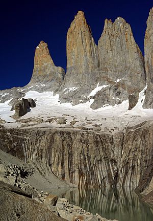
The Torres del Paine are three tall, distinct granite peaks. They are called Torres d'Agostini, Torres Central, and Torres Monzino. These towers reach up to 2,500 metres (8,200 ft) above sea level. They are connected to other mountains called the Cuernos del Paine.
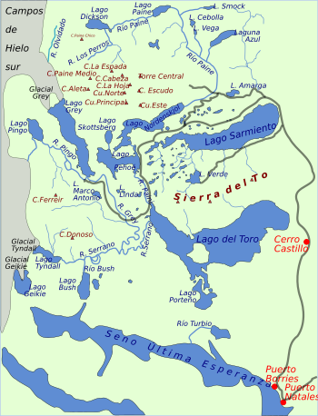
The park also has beautiful valleys, rivers like the Paine River, and many lakes. Some well-known lakes are Grey, Pehoé, Nordenskiöld, and Sarmiento. There are also large glaciers, including Grey, Pingo, and Tyndall. These glaciers are part of the huge Southern Patagonia Ice Field.
Contents
Park History
One of the first descriptions of this area came from Lady Florence Dixie in 1880. She wrote about the three towers, calling them Cleopatra's Needles. Many people think she and her group were the first "foreign tourists" to visit this special place.
Later, several European scientists and explorers came to the area. These included Otto Nordenskiöld and Carl Skottsberg. Gunther Plüschow was the first person to fly over the Paine massif (a group of mountains).
The park officially opened on May 13, 1959. It was first called Parque Nacional de Turismo Lago Grey. In 1970, its name was changed to Torres del Paine National Park.
In 1976, a British mountaineer named John Garner, along with two park rangers, Pepe Alarcon and Oscar Guineo, created the famous Circuit trail. This trail goes all the way around the Paine massif.
In 1977, a person named Guido Monzino gave 12,000 hectares (about 30,000 acres) of land to the Chilean Government. This helped set the park's final boundaries. In 1978, UNESCO named the park a World Biosphere Reserve. This means it is a special place where nature is protected.
Fires in the Park
Unfortunately, Torres del Paine National Park has had several large fires. These fires have often been started by accident by visitors.
- In 1985, a fire started by a tourist burned about 150 km2 (58 sq mi) of the park.
- In February 2005, another accidental fire destroyed 155 km2 (60 sq mi) of the park. This included about 2 km² of native forest.
- In late 2011 and early 2012, a fire started by a backpacker burned about 176 km2 (68 sq mi) of the reserve. This fire destroyed about 36 km² of native forest. It affected areas around Lake Pehoé and Lake Sarmiento.
- In 2019, a small fire started by a cigarrette butt was quickly put out by firefighters.
These events show how important it is for everyone to be careful and follow park rules to prevent fires.
Park Climate
The park has a "temperate climate of cold rain without a dry season." This means it often rains, and there isn't a really dry time of year. The weather can change quickly because of the many mountains and valleys.
Torres del Paine is known for its very strong winds. The windiest months are from November to January. This is also when most tourists visit the park.
Temperatures in the Park
Summers in the park are cool. The warmest month, January, has temperatures lower than 16 °C (61 °F). Winters are quite cold. In July, the average high temperature is 5 °C (41 °F), and the average low is −3 °C (27 °F).
Rainfall in the Park
The most rain falls in March and April, with about 80 mm each month. This is twice as much rain as in the drier winter months (July to October).
Water Systems (Hydrology)
The park has many rivers, streams, lakes, ponds, and waterfalls. All this water comes from the Southern Patagonia Ice Field. It flows southeast towards the Última Esperanza Sound, which is near the city of Puerto Natales. The rivers are often fast-moving with sudden changes, creating waterfalls and rapids.
The Southern Patagonian Ice Field covers the entire western side of the park. This ice field feeds four main glaciers: Dickson, Grey, Zapata, and Tyndall. The Tyndall glacier is shrinking quickly.
The largest glacier is Glacier Grey. It is split into two parts by a piece of land or ice called an Island or Nunatak. This "island" gets bigger each year. The eastern part of the glacier is about 1.2 km wide, and the western part is about 3.6 km wide. The glacier stretches 15 km (9.3 mi) into the park.
Park Geography
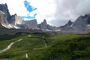
The main feature of the park's landscape is the Paine massif. This is a part of the Andes mountains that rises sharply from the flat Patagonian steppe. Small valleys run between the granite peaks of the massif. These include Valle del Francés (French Valley), Valle Bader, Valle Ascencio, and Valle del Silencio (Silence Valley).
The French Valley has tall cliffs that form a bowl shape. The huge walls of Cerro Cota 2000 and Cerro Catedral are in the western part of the valley. Cerro Cota 2000 is named for its height, which is about 2,000 m (6,562 ft). Cerro Catedral looks like a cathedral from its east side. To the north is a granite ridge called Aleta de Tiburón (Shark's Fin). To the east, you can see peaks like Fortaleza (Fortress), La Espada (The Sword), La Hoja (The Blade), La Máscara (The Mask), Cuerno Norte (North Horn), and Cuerno Principal (Main Horn).
In the Valley of Silence, the massive granite walls of Cerro Fortaleza and Cerro Escudo (Shield Mountain) face the western sides of the Torres del Paine. Ascencio Valley is the usual way to reach the Torres del Paine lookout. This spot is next to a milky green mountain lake. The tallest mountain in the group is Paine Grande, which is 2,884 m (9,462 ft) tall.
A large part of the park is covered by the Southern Patagonian Ice Field. This includes glaciers like the Dickson, Grey, and Tyndall.
The park's lakes include Dickson Lake, Nordenskjöld Lake, Lake Pehoé, Grey Lake, Sarmiento Lake, and Del Toro Lake. Only part of Del Toro Lake is inside the park. All these lakes have bright colors, often because of fine rock dust in their water. The main river in the park is the Paine River. Most of the park's rivers and lakes flow into the Última Esperanza Sound through the Serrano River.
Park Geology
The mountains in Torres del Paine are made mostly of Cretaceous sedimentary rocks. These rocks were pushed up by a type of rock called a laccolith during the Miocene period. Over thousands of years, the forces of mountain building and erosion (wearing away by wind and water) shaped the land. Glaciers have also played a big role in carving out the mountains.
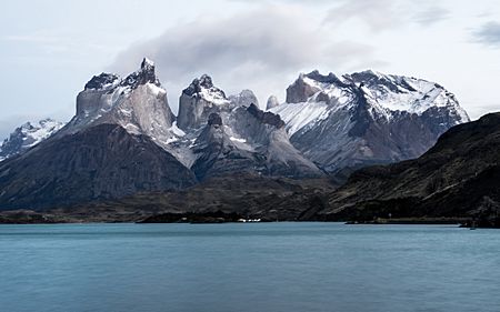
A great example of this is the Cuernos del Paine (Paine Horns). Their middle parts show light-colored granite. This granite stands out against the dark tops, which are what's left of the older sedimentary rock layer that has mostly worn away. For Las Torres (The Towers), the sedimentary rock that once covered them has completely eroded, leaving only the stronger granite.
In June 2014, scientists found fossils of at least 46 nearly complete skeletons of dolphin-like creatures called Ichthyosaurs. These creatures lived between 245 and 90 million years ago. The fossils were found as melting glaciers revealed new rock faces.
Park Biology
Flora: Plants of the Park
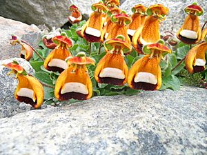
The park has beautiful plants. One is the evergreen Embothrium coccineum, which has bright red flowers. Another is Calceolaria uniflora, which has a striking shape and colors.
There are also 7 types of Orchidaceae (orchids) found in the park, including Chloraea magellanica.
However, 85 types of non-native plants have been found in the park. Most of these came from Europe, and 31 are considered to be harmful to the native plants.
The park has four main plant zones:
- Patagonian steppe: This area has tough grasses like Festuca gracillima that can handle strong winds.
- Pre-Andean shrubland: Here you find plants like Mulinum spinosum and Escallonia rubra.
- Magellanic subpolar forests: This forest is home to trees like Nothofagus pumilio and Nothofagus antarctica.
- Andean Desert: Above the tree line, you'll see plants like Escallonia rubra and Empetrum rubrum.
Fauna: Animals of the Park
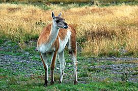
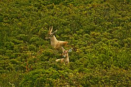
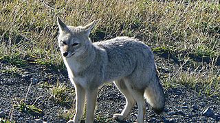
Guanacos are one of the most common mammals you will see in the park. Other mammals include foxes and pumas. The park is also home to the Chilean Huemul, which is an endangered deer. Scientists have studied how pumas hunt guanacos in the park.
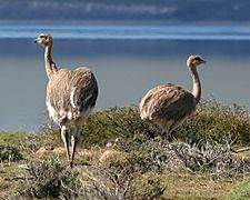
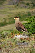
The park is a great place for birds. It has 15 types of bird of prey that live and raise their young here. These include the Andean condor, black-chested buzzard-eagle, and rufous-tailed hawk. Other birds you might see are the Chilean flamingo, Darwin's rhea, coscoroba swan, black-necked swan, Magellanic woodpecker, Magellan goose, and black-faced ibis.
- Fauna in Torres del Paine National Park
Park Tourism
Torres del Paine National Park is a very popular place for visitors, with over 252,000 people coming each year. It's a top hiking destination in Chile.
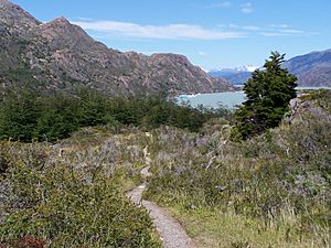
The park has clear paths and many refugios. These are like mountain huts that offer shelter and basic services. Hikers can choose short day trips to see the towers, French Valley, or Glacier Grey. Or, they can go on longer treks that last several days.
Popular multi-day treks include:
- The "W" route: This usually takes about three to five days.
- The full circuit or "O" route: This typically takes 7 to 9 days.
The refugios also have campsites where you can rent tents. It's important to know that cooking with a camp stove is only allowed at refugio locations. Camping is only allowed at special campsites, and wood fires are not allowed anywhere in the park. Since October 2016, you must book your campsites or refugios before you enter the park. If you prefer not to camp, there are also hotels in and around the park.
A good time to visit Torres del Paine is between October and April. During these months, there is less rain. However, the entrance fee is more expensive during this peak season than from May to September. Some of the park's amazing sights include the Paine horns, which are mountains about 2000 meters high. You can also get a great view of Pingo Lake from the Grey Glacier.
Hikers must stay on the marked paths in the national park. This helps protect the park's nature. For some parts of the park, you need a certified guide to enter.
Visiting the park is best from September to April. This is during the southern spring, summer, and early autumn. During summer, the days are very long because the park is so far south. Outside of these months, the weather can be very extreme for most visitors. In the southern winter, there are only about 8 hours of daylight each day.
Torres del Paine has even been chosen as the 8th Wonder of the World by TripAdvisor.
How to Get There
You can reach the park by Chile Route 9. This road is paved and connects Punta Arenas and Puerto Natales. It continues as an asphalt road for 100 km (62 mi) and then becomes a gravel road. In winter, it's a good idea to use tire chains on your vehicle because of the changing weather. You can also get to the park by boat or by plane. Buses also leave from Puerto Natales to the park.
See also
 In Spanish: Parque nacional Torres del Paine para niños
- Laguna San Rafael National Park
- Los Glaciares National Park
- Salto Grande (waterfall)
 | Jewel Prestage |
 | Ella Baker |
 | Fannie Lou Hamer |


