
Twin Falls County, Idaho facts for kids
Quick facts for kids
Twin Falls County
|
||
|---|---|---|

|
||
|
||

Location within the U.S. state of Idaho
|
||
 Idaho's location within the U.S. |
||
| Country | ||
| State | ||
| Founded | February 21, 1907 | |
| Named for | Snake River waterfall | |
| Seat | Twin Falls | |
| Largest city | Twin Falls | |
| Area | ||
| • Total | 1,928 sq mi (4,990 km2) | |
| • Land | 1,921 sq mi (4,980 km2) | |
| • Water | 7.1 sq mi (18 km2) 0.4% | |
| Population
(2020)
|
||
| • Total | 90,046 | |
| • Estimate
(2022)
|
93,696 |
|
| • Density | 47/sq mi (18/km2) | |
| Time zone | UTC−7 (Mountain) | |
| • Summer (DST) | UTC−6 (MDT) | |
| Congressional district | 2nd | |

Twin Falls County is an area in the south central part of Idaho, a state in the United States. In 2020, about 90,046 people lived here. This makes it the fifth-most populated county in Idaho. The main city and biggest city is Twin Falls. Twin Falls County is part of the larger Twin Falls city area.
Before the 1860s, the land that is now Twin Falls County was part of Shoshone lands. Later, it became part of the Oregon Country. In 1864, it was first set up as part of Owyhee County in the Idaho Territory. Then, in 1879, it became part of Cassia County. The county gets its name from a special waterfall on the Snake River. This waterfall is called Twin Falls because it splits into two parts. The Snake River forms the northern edge of the county.
Even after Idaho became a state in 1890, the Twin Falls area had very few people. Not many towns were there. This changed when the city of Twin Falls was started in 1904. Also, the Milner Dam was finished in 1905. Most of the other towns in the county were built around this time. These new communities needed their own local government. They were about 80 miles (129 km) away from Cassia County's main town, Albion. So, the Idaho Legislature created Twin Falls County on February 21, 1907.
Contents
Geography of Twin Falls County
Twin Falls County covers a total area of about 1,928 square miles (4,993 square kilometers). Most of this area, about 1,921 square miles (4,975 square kilometers), is land. The rest, about 7.1 square miles (18 square kilometers), is water. Water makes up about 0.4% of the county's total area.
Neighboring Counties of Twin Falls
Twin Falls County shares its borders with several other counties:
- Gooding County - to the north
- Jerome County - to the northeast
- Cassia County - to the east
- Elko County, Nevada - to the south (this border is also where the time zone changes to Pacific Time)
- Owyhee County - to the west
- Elmore County - to the northwest
Main Roads in Twin Falls County
These are the most important roads that go through Twin Falls County:
 US 30
US 30 US 93
US 93 SH-50
SH-50 SH-74
SH-74
Protected Natural Areas
Twin Falls County is home to parts of these important natural areas:
- Hagerman Fossil Beds National Monument
- Sawtooth National Forest (a part of this forest is in the county)
People Living in Twin Falls County
| Historical population | |||
|---|---|---|---|
| Census | Pop. | %± | |
| 1910 | 13,543 | — | |
| 1920 | 28,398 | 109.7% | |
| 1930 | 29,828 | 5.0% | |
| 1940 | 36,403 | 22.0% | |
| 1950 | 40,979 | 12.6% | |
| 1960 | 41,842 | 2.1% | |
| 1970 | 41,807 | −0.1% | |
| 1980 | 52,927 | 26.6% | |
| 1990 | 53,580 | 1.2% | |
| 2000 | 64,284 | 20.0% | |
| 2010 | 77,230 | 20.1% | |
| 2020 | 90,046 | 16.6% | |
| 2023 (est.) | 95,156 | 23.2% | |
| U.S. Decennial Census 1790–1960, 1900–1990, 1990–2000, 2010–2020, |
|||
In 2010, about 77,230 people lived in Twin Falls County. There were 28,760 households, which are groups of people living together. The population density was about 40 people per square mile. Most people (88.9%) were white. About 13.7% of the people were of Hispanic or Latino background.
The average age of people in the county was 34.4 years old. About 35.4% of households had children under 18 living with them. The average household had 2.65 people. The average family had 3.16 people.
The average income for a household in the county was $42,455. For families, it was $49,188. About 13.0% of all people in the county lived below the poverty line. This included 16.9% of those under 18 years old.
Cities and Towns in Twin Falls County
Cities
Other Communities
These are smaller communities that are not officially cities:
- Amsterdam
- Artesian City
- Caldron Linn
- Clover
- Curry
- Deep Creek
- Fairview
- Godwin
- Knull
- Peavey
- Milner Dam (This area also extends into Cassia County and Jerome County)
- Rock Creek
- Rogerson
Schools and Education
Twin Falls County has several school districts. These districts manage the public schools in different areas:
- Bliss Joint School District 234
- Buhl Joint School District 412
- Cassia County Joint School District 151
- Castleford School District 417
- Filer School District 413
- Hagerman Joint School District 233
- Hansen School District 415
- Kimberly School District 414
- Murtaugh Joint School District 418
- Three Creek Joint Elementary School District 416
- Twin Falls School District 411
The county is also in the area that supports the College of Southern Idaho. This means students from the county can attend this college.
Images for kids
-
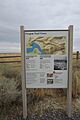
A sign for the Oregon Trail at Hagerman Fossil Beds National Monument.
-

The official seal of Twin Falls County.
See also
 In Spanish: Condado de Twin Falls (Idaho) para niños
