Upper Dublin Township, Pennsylvania facts for kids
Quick facts for kids
The Township of Upper Dublin
|
||
|---|---|---|
|
Township
|
||
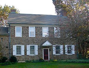
Quaker Manor House
|
||
|
||
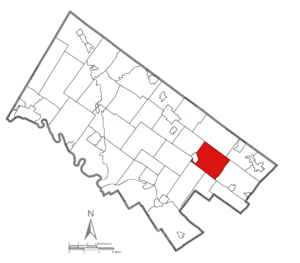
Location of Upper Dublin in Montgomery County, Pennsylvania
|
||
| Country | United States | |
| State | Pennsylvania | |
| County | Montgomery | |
| Purchased | 1684 | |
| Area | ||
| • Total | 13.26 sq mi (34.3 km2) | |
| • Land | 13.23 sq mi (34.3 km2) | |
| • Water | 0.03 sq mi (0.08 km2) | |
| Elevation | 230 ft (70 m) | |
| Population
(2010)
|
||
| • Total | 25,569 | |
| • Estimate
(2016)
|
26,225 | |
| • Density | 1,928.3/sq mi (744.51/km2) | |
| Time zone | UTC-5 (EST) | |
| • Summer (DST) | UTC-4 (EDT) | |
| ZIP Code |
19001, 19002, 19025, 19034, 19038, 19075, 19090
|
|
| Area code(s) | 215, 267, 445 | |
| FIPS code | 42-091-79008 | |
Upper Dublin Township is a community in Montgomery County, Pennsylvania, United States. In 2010, about 25,569 people lived here. Until the 1950s, Upper Dublin was mostly farms and open land. After World War II, many people moved here. It became a residential area.
The population grew from 6,000 in the 1950s to nearly 20,000 by 1970. Today, Upper Dublin has many homes. It is known for having one of the highest average incomes in Montgomery County.
Upper Dublin includes several smaller community areas. Many of these are not official towns. They are mainly used by the US Postal Service for mail delivery. These areas include parts of Abington (19001), Ambler (19002), Ardsley (19038), Dresher (19025), Fort Washington (19034), Jarrettown (19025), Maple Glen (19002), North Hills (19038), Oreland (19075), and Willow Grove (19090).
Contents
History of Upper Dublin Township
How Upper Dublin Was Founded
In 1684, William Penn gave land to Edward Tanner in Province of Pennsylvania. Tanner named this land "Upper and Lower Dublin." In 1854, Lower Dublin became part of Philadelphia. The "upper" part remained and became Upper Dublin Township.
Upper Dublin Township was officially created in 1701. This happened when William Penn ordered a survey of all townships. People first settled here in 1698. The township was officially formed in 1719. On January 1, 1946, it became a "First Class Township." This means it has a certain type of local government. The area started as a farming community. People also mined limestone here. Today, Limekiln Pike is still an important road.
Upper Dublin and the American Revolutionary War
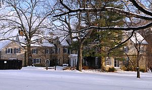
During the American Revolutionary War, George Washington and his army stayed here. This was after their defeat at the Battle of Germantown in 1777. They were here right before marching to Valley Forge. From December 5-8, 1777, the Battle of White Marsh took place here. British and American forces fought in this battle.
Washington's headquarters during this time was the Emlen House. This house was built in 1745 by a Quaker named George Emlen. The British commander, General William Howe, watched the American lines from a church tower. This was the belltower of St. Thomas' Episcopal Church. Fort Washington State Park is nearby. It was where the main American defenses were located.
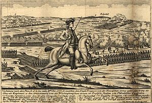
Battle of White Marsh in a German illustration
|
2021 Tornado Event
On September 1, 2021, a strong storm hit Upper Dublin Township. It was an EF2 tornado. This tornado was caused by the leftover energy from Hurricane Ida. It mainly affected the towns of Fort Washington and Maple Glen.
Geography of Upper Dublin
Upper Dublin Township covers about 13.2 square miles (34.2 km2). Most of this area is land. Only a very small part is water. The township is part of the Delaware River area. Most of its water flows into the Wissahickon Creek. This creek then flows into the Schuylkill River. Small parts of the township drain into the Neshaminy Creek and the Pennypack Creek.
People and Population in Upper Dublin
| Historical population | |||
|---|---|---|---|
| Census | Pop. | %± | |
| 1800 | 744 | — | |
| 1850 | 1,330 | — | |
| 1860 | 1,437 | 8.0% | |
| 1870 | 1,588 | 10.5% | |
| 1880 | 1,856 | 16.9% | |
| 1890 | 2,008 | 8.2% | |
| 1900 | 1,933 | −3.7% | |
| 1910 | 2,936 | 51.9% | |
| 1920 | 3,045 | 3.7% | |
| 1930 | 4,379 | 43.8% | |
| 1940 | 4,620 | 5.5% | |
| 1950 | 6,637 | 43.7% | |
| 1960 | 10,184 | 53.4% | |
| 1970 | 19,562 | 92.1% | |
| 1980 | 22,348 | 14.2% | |
| 1990 | 24,028 | 7.5% | |
| 2000 | 25,878 | 7.7% | |
| 2010 | 25,569 | −1.2% | |
| 2020 | 26,665 | 4.3% | |
| (1930-2000); (1850-1930) | |||
In 2010, Upper Dublin had 25,569 people. There were 9,397 households. About 7,214 families lived in the township. The population density was about 1,966 people per square mile.
Most residents were White (83.0%). Other groups included African American (6.6%) and Asian (8.5%). About 1.8% of the population was Hispanic or Latino.
Many households (35.2%) had children under 18. Most households (66.1%) were married couples. The average household had 2.69 people. The average family had 3.13 people.
The population was spread out by age. About 27.3% were under 19. About 33.2% were between 45 and 64. About 15.1% were 65 or older. The average age was 43.9 years.
In 2000, the average household income was $80,093. The average family income was $91,418. By 2007, these numbers had grown. The average household income was $106,337. The average family income was $123,030. About 3.0% of the population lived below the poverty line.
The most common backgrounds of residents are Irish (21.3%) and German (19.0%). Other common backgrounds include Italian (14.2%) and English (10.2%).
English is the main language spoken at home (88.6%). Other languages include Korean (3.1%), Italian (1.7%), and Chinese (1.5%).
Notable People from Upper Dublin
Many interesting people have connections to Upper Dublin.
- Bill Apter – A journalist who writes about professional wrestling.
- Kim Gallagher – An athlete who was on the U.S. Olympic track team.
- Geologist (musician) – Brian Weitz, a member of the band Animal Collective.
- Suzy Kolber – A well-known anchor and reporter for ESPN.
- Zach Pfeffer – A former soccer player for the Philadelphia Union team.
- Josh Singer – An Emmy Award and Academy Award for Best Original Screenplay winner. He wrote for shows like The West Wing and the movie Spotlight.
- John Tartaglia – A Tony Award nominee for Avenue Q. He also starred in Disney Channel's Johnny and the Sprites.
- Tom Warburton – An animator who created the Codename: Kids Next Door series.
- Marc Zumoff – A TV commentator for the Philadelphia 76ers basketball team.
Business and Industry in Upper Dublin
The Fort Washington Office Park is a major business area. It opened in 1955. It was the first modern suburban business park on the East Coast. This park is 566 acres. It has over 80 buildings. More than 230 businesses are located here. They employ over 12,000 workers.
Over the years, the types of businesses have changed. They used to be light industrial. Now, most are office-based companies. To stay modern, Upper Dublin Township is working to improve the area. They are upgrading roads and planning new buildings. They also want to add more housing, shops, and restaurants.
Many new businesses have moved into the Fort Washington Office Park. These include Aon Affinity Insurance and Kellogg Company. Other companies like Honeywell and Johnson & Johnson have been there for a long time. Toll Brothers moved its main office here in 2020.
In 2017, Upper Dublin Township bought an office building. It now houses several town services. The Upper Dublin Public Library also moved into this building. The library opened its new location in 2020.
Transportation in Upper Dublin
Upper Dublin Township has about 131 miles of public roads. Some roads are maintained by the Pennsylvania Turnpike Commission. Others are managed by the Pennsylvania Department of Transportation. Most roads are maintained by the township itself.
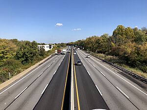
Important roads include PA 63 and PA 152. The Pennsylvania Turnpike (I-276) also runs through the township. PA 309 (Fort Washington Expressway) is another key route. I-276 and PA 309 meet at the Fort Washington Interchange. Other important roads are Bethlehem Pike and Susquehanna Road.
The Lansdale/Doylestown Line train passes through Upper Dublin. However, there are no train stops within the township. The closest stations are in nearby towns.
SEPTA provides bus service in Upper Dublin. Route 80 runs on weekdays. Route 94 and Route 95 also pass through the western part of the township. Route 201 connects the Fort Washington business parks to the train station.
A freight train line, the Norfolk Southern Railway's Morrisville Line, also runs through Upper Dublin. It runs next to the Pennsylvania Turnpike.
Education in Upper Dublin
Upper Dublin has a great school system. It includes four elementary schools, one middle school, and one high school. All schools are approved by the Middle States Association. Teachers here have an average of 16 years of experience. About 85% of them have advanced degrees.
The elementary schools are:
- Fort Washington Elementary School
- Maple Glen Elementary School
- Jarrettown Elementary School
- Thomas Fitzwater Elementary School
The middle school is Sandy Run Middle School. The high school is Upper Dublin High School. Upper Dublin High School is one of the best public schools in Pennsylvania. It has been recognized as a Blue Ribbon School of Excellence three times.
There are also private schools in the township. Our Lady of Mercy Regional Catholic School is in Maple Glen. This school was formed in 2012 by combining three other schools.
Several universities have campuses in the township:
- Temple University (Ambler and Fort Washington campuses)
- DeVry University (Fort Washington campus)
- Gwynedd Mercy College (Fort Washington campus)
Parks and Recreation in Upper Dublin
Upper Dublin has over 40 parks and open spaces. These areas cover more than 600 acres. They range from small neighborhood parks to large meadows. Some areas protect nature. Others are for active fun.
You can find many things to do in the parks:
- Tennis courts
- Playgrounds
- Jogging and exercise trails
- Picnic areas
- Sports fields
- Basketball courts
- Sand volleyball courts
In 2005, the township opened MonDaug Bark Park. It has wooded trails. It also has a 1-acre fenced area where dogs can run off-leash.
In 2006, the township created a plan to protect open spaces. This plan helps guide how new parks are created. It also helps protect natural areas.
Upper Dublin also has two golf courses. Manufacturers Golf & Country Club is on Camp Hill. Lu Lu Country Club is in the southeastern part of the township.


