
Waynesburg, Pennsylvania facts for kids
Quick facts for kids
Waynesburg, Pennsylvania
|
||
|---|---|---|
|
Borough
|
||

Greene County Courthouse in downtown Waynesburg
|
||
|
||
| Etymology: Anthony Wayne | ||

Location of Waynesburg in Greene County, Pennsylvania.
|
||
| Country | United States | |
| State | Pennsylvania | |
| County | Greene | |
| Established | 1796 | |
| Area | ||
| • Total | 0.81 sq mi (2.08 km2) | |
| • Land | 0.81 sq mi (2.08 km2) | |
| • Water | 0.00 sq mi (0.00 km2) | |
| Elevation | 1,034 ft (315 m) | |
| Population
(2020)
|
||
| • Total | 4,001 | |
| • Estimate
(2023)
|
3,728 | |
| • Density | 4,976.4/sq mi (1,921.4/km2) | |
| Time zone | UTC-4 (EST) | |
| • Summer (DST) | UTC-5 (EDT) | |
| ZIP Code |
15370
|
|
| Area code(s) | 724, 878 | |
| FIPS code | 42-81832 | |

Waynesburg is a small town, also called a borough, in Pennsylvania, United States. It is the main town of Greene County. Waynesburg is located about 50 miles south of Pittsburgh. In 2020, about 4,001 people lived there.
The land around Waynesburg has lots of natural resources. There are many layers of coal, including the Pittsburgh No. 8 seam. The area also has a lot of natural gas, which comes from a deep rock layer called the Marcellus Shale. This is one of the biggest natural gas reserves in the country. A long time ago, in the early 1900s, Waynesburg had large stations that compressed gas and a factory that made steam shovels.
Waynesburg is named after General "Mad" Anthony Wayne. He was an important leader who helped George Washington during the American Revolutionary War (1776–1781). Waynesburg is also home to Waynesburg University. The town is served by the Greene County Airport.
Contents
History of Waynesburg

In 1796, the government of Pennsylvania decided to create a new county called Greene County. They did this by splitting Washington County into two parts. The new law said that a town needed to be chosen as the main city, or county seat, for Greene County. Waynesburg was chosen because it was in the middle of the county.
The land where Waynesburg now stands was once owned by Thomas Slater. He bought the land from a Native American. The story says he traded a two-year-old cow and a special rifle for it. At that time, to develop land, you needed a special paper from William Penn. The town was first called Eden, named after Slater's wife, Elanor.
County leaders bought 158 acres of land from Slater for $2,376. They wanted to build a jail, a courthouse, and other public buildings there. The leaders then changed the town's name to Waynesburg, honoring General Anthony Wayne. Thomas Slater continued to live nearby until he passed away in 1815. On April 9, 1816, the state government officially made Waynesburg a borough.
In August 1875, construction started on the Waynesburg and Washington Railroad. This was a special narrow-gauge railway. It was first thought of by John Day in 1874. Passenger trains stopped running on this line in 1929. During World War II, in 1944, the tracks were changed to a wider size. The railroad was then called the Waynesburg Secondary Railroad. Regular freight service ended in 1976. However, parts of the line are still used sometimes to reach a coal mine.
Some important buildings in Waynesburg are listed on the National Register of Historic Places. These include the Waynesburg Historic District, Hanna Hall at the university, and Miller Hall.
Waynesburg's Location and Landscape
Waynesburg is located in the northeastern part of Greene County. Its southern edge follows the South Fork of Tenmile Creek. This creek flows east into the Monongahela River. The borough is surrounded by Franklin Township, which is a separate local government area.
U.S. Route 19 goes through the center of Waynesburg. It uses High Street for westbound traffic and Greene Street for eastbound traffic. On the north side of town, it turns to follow Morris Street (northbound) and Richhill Street (southbound). Pennsylvania Route 21 also runs through downtown Waynesburg with US 19.
PA 21 goes east about 2 miles to Interstate 79 at Exit 14. It continues east for another 25 miles to Uniontown. To the west, PA 21 goes 6 miles to Rogersville. It then continues 24 miles to the West Virginia border. I-79 goes north from Exit 14 about 21 miles to Washington and 53 miles to Pittsburgh. Morgantown, West Virginia, is about 24 miles to the south.
The United States Census Bureau says that Waynesburg covers a total area of about 0.81 square miles (2.07 square kilometers). All of this area is land.
Climate in Waynesburg
| Climate data for Waynesburg, Pennsylvania (1991–2020 normals, extremes 1948–present) | |||||||||||||
|---|---|---|---|---|---|---|---|---|---|---|---|---|---|
| Month | Jan | Feb | Mar | Apr | May | Jun | Jul | Aug | Sep | Oct | Nov | Dec | Year |
| Record high °F (°C) | 75 (24) |
78 (26) |
85 (29) |
90 (32) |
92 (33) |
98 (37) |
102 (39) |
100 (38) |
94 (34) |
90 (32) |
84 (29) |
77 (25) |
102 (39) |
| Mean daily maximum °F (°C) | 38.5 (3.6) |
41.6 (5.3) |
50.9 (10.5) |
63.8 (17.7) |
72.8 (22.7) |
79.8 (26.6) |
83.4 (28.6) |
82.4 (28.0) |
76.8 (24.9) |
65.2 (18.4) |
53.1 (11.7) |
42.8 (6.0) |
62.6 (17.0) |
| Daily mean °F (°C) | 29.0 (−1.7) |
31.2 (−0.4) |
39.1 (3.9) |
50.1 (10.1) |
59.9 (15.5) |
67.9 (19.9) |
71.9 (22.2) |
70.6 (21.4) |
64.1 (17.8) |
52.4 (11.3) |
41.7 (5.4) |
33.7 (0.9) |
51.0 (10.6) |
| Mean daily minimum °F (°C) | 19.4 (−7.0) |
20.8 (−6.2) |
27.2 (−2.7) |
36.4 (2.4) |
46.9 (8.3) |
56.0 (13.3) |
60.4 (15.8) |
58.8 (14.9) |
51.4 (10.8) |
39.6 (4.2) |
30.3 (−0.9) |
24.7 (−4.1) |
39.3 (4.1) |
| Record low °F (°C) | −25 (−32) |
−15 (−26) |
−8 (−22) |
14 (−10) |
22 (−6) |
31 (−1) |
38 (3) |
34 (1) |
26 (−3) |
16 (−9) |
2 (−17) |
−16 (−27) |
−25 (−32) |
| Average precipitation inches (mm) | 3.42 (87) |
2.84 (72) |
3.74 (95) |
3.38 (86) |
4.34 (110) |
4.17 (106) |
4.31 (109) |
3.88 (99) |
3.51 (89) |
3.25 (83) |
2.94 (75) |
3.29 (84) |
43.07 (1,094) |
| Average snowfall inches (cm) | 9.5 (24) |
8.1 (21) |
5.6 (14) |
0.4 (1.0) |
0.0 (0.0) |
0.0 (0.0) |
0.0 (0.0) |
0.0 (0.0) |
0.0 (0.0) |
0.2 (0.51) |
0.7 (1.8) |
5.6 (14) |
30.1 (76) |
| Average precipitation days (≥ 0.01 in) | 15.2 | 13.1 | 13.1 | 13.5 | 14.4 | 13.1 | 11.4 | 11.0 | 10.3 | 11.3 | 11.7 | 14.2 | 152.3 |
| Average snowy days (≥ 0.1 in) | 7.7 | 6.2 | 3.6 | 0.6 | 0.0 | 0.0 | 0.0 | 0.0 | 0.0 | 0.1 | 1.0 | 5.3 | 24.5 |
| Source: NOAA | |||||||||||||
People Living in Waynesburg
| Historical population | |||
|---|---|---|---|
| Census | Pop. | %± | |
| 1820 | 298 | — | |
| 1830 | 518 | 73.8% | |
| 1840 | 597 | 15.3% | |
| 1850 | 852 | 42.7% | |
| 1860 | 1,054 | 23.7% | |
| 1870 | 1,272 | 20.7% | |
| 1880 | 1,208 | −5.0% | |
| 1890 | 2,101 | 73.9% | |
| 1900 | 2,544 | 21.1% | |
| 1910 | 3,545 | 39.3% | |
| 1920 | 3,332 | −6.0% | |
| 1930 | 4,915 | 47.5% | |
| 1940 | 4,891 | −0.5% | |
| 1950 | 5,514 | 12.7% | |
| 1960 | 5,188 | −5.9% | |
| 1970 | 5,152 | −0.7% | |
| 1980 | 4,482 | −13.0% | |
| 1990 | 4,270 | −4.7% | |
| 2000 | 4,184 | −2.0% | |
| 2010 | 4,176 | −0.2% | |
| 2020 | 4,001 | −4.2% | |
| 2023 (est.) | 3,728 | −10.7% | |
| Sources: | |||
In 2000, there were 4,184 people living in Waynesburg. These people lived in 1,619 households. About 869 of these households were families. The population density was about 5,038 people per square mile.
Most people in Waynesburg are White (96.94%). There are also African American (1.63%), Native American (0.10%), and Asian (0.57%) residents. A small number of people are from other backgrounds or more than one race. About 0.65% of the population was Hispanic or Latino.
About 24.1% of households had children under 18 living with them. About 38.4% of households were married couples. Around 11.6% were single mothers. Many households (46.3%) were not families. About 38.2% of all households had only one person living there. Around 16.7% of households had someone aged 65 or older living alone.
The average household had 2.24 people. The average family had 2.99 people. The town's population included 18.6% under 18 years old. About 24.2% were between 18 and 24. The median age in Waynesburg was 30 years old.
The average income for a household in Waynesburg was $30,990. For families, the average income was $42,933. About 8.0% of families and 13.0% of all people lived below the poverty line. This included 10.5% of those under 18 and 11.7% of those 65 or older.
Education in Waynesburg
The schools in Waynesburg are part of the Central Greene School District.
The Eva K. Bowlby Public Library is on Bowlby Street. It used to be the home of the Bowlby family. Mrs. Bowlby was a well-known person in the town. When she passed away in 1957, she left her home to be used as a library for children.
Notable People from Waynesburg
Many interesting people have connections to Waynesburg:
- Mary Temple Bayard (1853–1916), a writer and journalist.
- Arthur I. Boreman, the first governor of West Virginia. He moved from Waynesburg when he was four years old.
- Todd Tamanend Clark, a poet and composer, lived in Waynesburg from 1965 to 1970.
- Bill George, a famous linebacker for the Chicago Bears and the Los Angeles Rams football teams.
- Greg Hopkins, an Arena Football League player who played high school football in Waynesburg.
- Josh Koscheck, a mixed martial artist.
- Edward Martin, a Republican governor and senator for Pennsylvania.
- Dave Palone, a harness racing driver.
- Rittz, a rapper signed to Tech N9ne's record label Strange Music.
- Coleman Scott, who won a bronze medal in freestyle wrestling at the 2012 London Olympics.
- Sarah Rush, an American actress known for her role in the original Battlestar Galactica TV show.
Images for kids
-
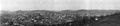
Waynesburg, around 1905
See also
 In Spanish: Waynesburg (Pensilvania) para niños
