West Baton Rouge Parish, Louisiana facts for kids
Quick facts for kids
West Baton Rouge Parish
|
|
|---|---|

Antonia (Port Allen, Louisiana)
|
|

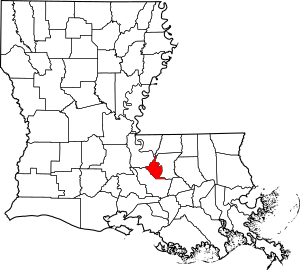
Location within the U.S. state of Louisiana
|
|
 Louisiana's location within the U.S. |
|
| Country | |
| State | |
| Founded | March 31, 1807 |
| Named for | bâton rouge, French for red stick |
| Seat | Port Allen |
| Largest city | Port Allen |
| Area | |
| • Total | 204 sq mi (530 km2) |
| • Land | 192 sq mi (500 km2) |
| • Water | 11 sq mi (30 km2) 5.6% |
| Population
(2020)
|
|
| • Total | 27,199 |
| • Density | 133.3/sq mi (51.48/km2) |
| Time zone | UTC−6 (Central) |
| • Summer (DST) | UTC−5 (CDT) |
| Congressional districts | 2nd, 6th |
West Baton Rouge Parish is one of Louisiana's 64 parishes. It was created in 1807. The main town, called the parish seat, is Port Allen. In 2020, about 27,199 people lived here. West Baton Rouge Parish is part of the larger Baton Rouge area.
The parish has good schools. It also uses private companies for school bus services. After Hurricane Katrina, the parish grew a little. In 2018, its population was around 26,427 people.
Contents
History of West Baton Rouge Parish
Early History and Native Americans
The Medora site is an old Native American village. It belongs to the Plaquemine culture. This site is found near Bayou Bourbeaux in the parish's southeast part. It helped experts learn a lot about the Plaquemine culture. Archeologists James A. Ford and George I. Quimby studied the site in 1939–40.
How West Baton Rouge Parish Was Formed
West Baton Rouge Parish was officially created in 1807. It was first called "Baton Rouge Parish" until 1812. Its name comes from the French words bâton rouge, meaning red stick.
Railroads and Early Transportation
In 1853, a railroad company was started. It was called the Baton Rouge, Gross-Tete and Opelousas Railroad. Its eastern end was in what is now Port Allen. This was across the Mississippi River from Baton Rouge. A ferry boat, the Sunny South, carried people and goods across the river. The railroad went west into Iberville Parish and then north to Livonia. By 1861, the tracks were planned to go even further.
West Baton Rouge During the Civil War
The American Civil War stopped the railroad from getting more tracks. The line to Opelousas was never finished.
During the war, two local groups of soldiers were formed. They were called the Delta Rifles and the Tirailleurs of Brusly Landing. These groups joined the 4th Louisiana Regiment. This regiment fought in battles like the Battle of Shiloh and the Battle of Baton Rouge.
The railroad kept running until May 1862. It carried sugar cane, cotton, and soldiers. When Union forces took over Baton Rouge, the railroad's trains were moved to safety. Many people from Baton Rouge moved to West Baton Rouge Parish to escape the Union army.
The Confederate ship CSS Arkansas was damaged during the Battle of Baton Rouge. It crashed into the bank of the Mississippi River in West Baton Rouge Parish. Its crew then set it on fire so the Union forces could not capture it.
In May 1864, the Union army passed through West Baton Rouge Parish. They were returning to New Orleans after a failed military campaign.
After the Civil War
The Civil War badly hurt the sugar industry in Louisiana. This included West Baton Rouge Parish. The Union army controlled the Mississippi River, so sugar could not be sold. Horses and mules were taken, and crops were left in the fields. Many sugar farms went bankrupt. New owners from the North bought many of these farms.
The Baton Rouge, Grosse Tete, and Opelousas Railroad started running again. But the economy was very bad. Also, the company's enslaved workers were now free. They had to hire new workers. In 1867, a big flood damaged the tracks. The railroad lost money and stopped running in 1883. Another company took over its assets until 1902.
The Texas and Pacific Railway was created in 1871. It aimed to build a railroad across the southern United States. This line went through the southwestern part of West Baton Rouge Parish. A special track was built from a place called "Baton Rouge Junction" to Port Allen. The town of Addis grew up around Baton Rouge Junction. Later, the Texas and Pacific extended the track from Port Allen to New Roads, Louisiana.
West Baton Rouge in the 1900s
In May 1912, a flood from a nearby parish reached northern West Baton Rouge Parish. It flooded areas south to Addis.
The Texas and Pacific railroad later became part of the Union Pacific Railroad.
Another railroad, the Southern Pacific, built a track from Lafayette, Louisiana to Anchorage in West Baton Rouge. This line crossed the Atchafalaya Basin. It was not successful and closed in the 1920s.
From 1906 to 1947, the Missouri Pacific Railroad used a special ferry boat. It was called the George H. Walker. This boat carried train cars across the Mississippi River between Anchorage and Baton Rouge. It stopped running when the Huey P. Long Bridge was built. This bridge had a railway track.
During World War II, from 1943 to 1946, West Baton Rouge Parish had a prisoner of war camp. It housed German prisoners who worked on farms. The camp was in Port Allen.
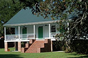
The Cinclare Sugar Mill Historic District is a historic sugar mill area. It is located near Brusly.
Geography and Nature
West Baton Rouge Parish covers about 204 square miles. About 192 square miles are land, and 11 square miles are water. It is one of the smallest parishes in Louisiana.
The southwestern part of the parish has lots of trees and no people. The most important natural feature is the Mississippi River. It forms the eastern border of the parish. High walls called levees protect the parish from river floods.
The parish is part of the Two Rivers Region. This is a special area called the Atchafalaya National Heritage Area.
Neighboring Parishes
- West Feliciana Parish (north)
- East Baton Rouge Parish (east)
- East Feliciana Parish (northeast)
- Iberville Parish (southwest)
- Pointe Coupeé Parish (northwest)
Towns and Communities
City
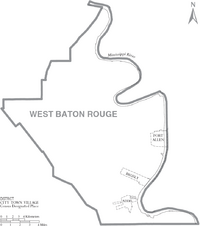
- Port Allen (This is the parish seat and the biggest town.)
Towns
Other Communities
- Erwinville (This is a census-designated place, meaning it's a community recognized by the census but not an official town.)
- Bueche
- Chamberlin
- Devalls
- Ithra
- Kahns
- Lobdell
- Lukeville
- Walls
- Winterville
Population and People
| Historical population | |||
|---|---|---|---|
| Census | Pop. | %± | |
| 1810 | 1,463 | — | |
| 1820 | 2,335 | 59.6% | |
| 1830 | 3,084 | 32.1% | |
| 1840 | 4,638 | 50.4% | |
| 1850 | 6,270 | 35.2% | |
| 1860 | 7,312 | 16.6% | |
| 1870 | 5,114 | −30.1% | |
| 1880 | 7,667 | 49.9% | |
| 1890 | 8,363 | 9.1% | |
| 1900 | 10,285 | 23.0% | |
| 1910 | 12,636 | 22.9% | |
| 1920 | 11,092 | −12.2% | |
| 1930 | 9,716 | −12.4% | |
| 1940 | 11,263 | 15.9% | |
| 1950 | 11,738 | 4.2% | |
| 1960 | 14,796 | 26.1% | |
| 1970 | 16,864 | 14.0% | |
| 1980 | 19,086 | 13.2% | |
| 1990 | 19,419 | 1.7% | |
| 2000 | 21,601 | 11.2% | |
| 2010 | 23,788 | 10.1% | |
| 2020 | 27,199 | 14.3% | |
| U.S. Decennial Census | |||
In 2020, there were 27,199 people living in the parish. There were about 9,643 households and 7,194 families. In 2000, the population was 21,601 people.
The population density was about 113 people per square mile. In 2000, about 62.78% of the people were White, and 35.49% were Black or African American. About 1.45% of the population was Hispanic or Latino.
In 2000, about 37.60% of households had children under 18. About 51.50% were married couples. The average household had 2.74 people.
The median age in the parish was 34 years old. This means half the people were younger than 34, and half were older.
Economy and Jobs
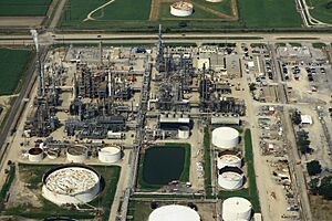
West Baton Rouge Parish is located on the Mississippi River. This, along with its railroads, makes it a good place for big industries. Important companies here include Placid Refining Company near Port Allen. Also, Dow Chemical Company and ShinTech are near Addis.
The Port of Greater Baton Rouge has docks and other property in West Baton Rouge Parish. This port helps move goods by water.
Interstate 10 runs through the parish. This makes it a good spot for distribution centers. Many warehouses have been built near I-10. Many trucking companies are also located near the Huey P. Long Bridge.
Education and Learning
The West Baton Rouge Parish School Board manages the public schools in the area.
Holy Family School is a private Catholic school. It teaches students from pre-kindergarten to eighth grade.
The parish is also served by Baton Rouge Community College.
Museums and Libraries
The West Baton Rouge Museum in Port Allen keeps historical information about the parish. The town of Addis also has a museum about its own history.
The Parish of West Baton Rouge has public libraries. You can find them in Port Allen and Brusly.
News and Media
West Baton Rouge Parish has two weekly newspapers. The West Side Journal comes out every Thursday. It shares important news and official parish information. The Riverside Reader is published every Monday. It focuses on history and interesting stories about people.
Transportation and Roads
Main Highways
 Interstate 10
 U.S. Highway 190
 Louisiana Highway 1
 Louisiana Highway 76
 Louisiana Highway 327
 Louisiana Highway 411
 Louisiana Highway 413
 Louisiana Highway 415
 Louisiana Highway 620
 Louisiana Highway 982
 Louisiana Highway 983
 Louisiana Highway 984
 Louisiana Highway 985
 Louisiana Highway 986
 Louisiana Highway 987-1
 Louisiana Highway 987-3
 Louisiana Highway 987-4
 Louisiana Highway 988
 Louisiana Highway 989-1
 Louisiana Highway 989-2
 Louisiana Highway 990
 Louisiana Highway 1145
 Louisiana Highway 1148
 Louisiana Highway 3091
 Louisiana Highway 3237
West Baton Rouge Parish is connected to East Baton Rouge Parish by two bridges. These are the Huey P. Long Bridge (U.S. Highway 190) and the Horace Wilkinson Bridge (Interstate 10).
Rail Transport
West Baton Rouge is served by two major railroads. These are the Kansas City Southern Railroad and the Union Pacific Railroad.
Famous People From West Baton Rouge
- Henry Watkins Allen
- Slim Harpo
- John Hill
- Edmond Jordan, a politician who represents this area.
- Raful Neal
- Major Thibaut, another politician who represents West Baton Rouge Parish.
See also
 In Spanish: Parroquia de West Baton Rouge para niños
 | Jackie Robinson |
 | Jack Johnson |
 | Althea Gibson |
 | Arthur Ashe |
 | Muhammad Ali |


