West Chester, Pennsylvania facts for kids
Quick facts for kids
West Chester
|
||
|---|---|---|
|
Borough
|
||
|
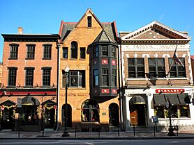
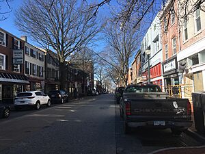
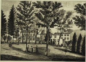
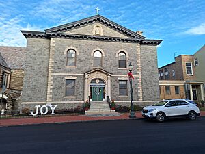
West Chester Downtown Historic District
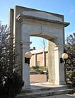
West Chester University of Pennsylvania
|
||
|
||
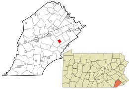
Location of West Chester in Chester County (left) and of Chester County in Pennsylvania (right)
|
||
| Country | United States | |
| State | Pennsylvania | |
| County | Chester | |
| Incorporated | 1799 | |
| Area | ||
| • Total | 1.85 sq mi (4.78 km2) | |
| • Land | 1.85 sq mi (4.78 km2) | |
| • Water | 0.00 sq mi (0.00 km2) | |
| Elevation | 446 ft (136 m) | |
| Population
(2023)
|
||
| • Total | 18,750 | |
| • Density | 10,114.30/sq mi (3,904.69/km2) | |
| Time zone | UTC-5 (EST) | |
| • Summer (DST) | UTC-4 (EDT) | |
| ZIP Codes |
19380–19383, 19388
|
|
| Area code(s) | 484 and 610 | |
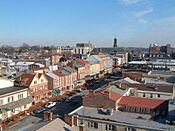
West Chester is a small town, or borough, in Pennsylvania, United States. It is the main city, also called the county seat, of Chester County, Pennsylvania. West Chester is located near Philadelphia, in an area known as the Philadelphia metropolitan area.
In 2010, about 18,461 people lived in West Chester. Many people who live in nearby areas also use West Chester as their mailing address.
A big part of West Chester University of Pennsylvania and the local government offices for Chester County are located right in the borough. The very center of town is where Market Street and High Street meet.
Contents
History of West Chester
This area was first known as Turk's Head. It got its name from an inn that was located in the middle of what is now the borough. West Chester became the center of government for Chester County in 1786. Before that, the government was in a nearby town called Chester. West Chester officially became a borough in 1799.
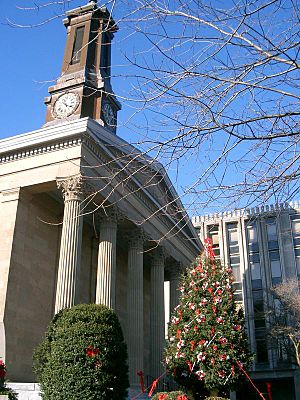
The town's courthouse is in the heart of West Chester. It's a beautiful building designed in the 1840s by Thomas U. Walter. He was one of the architects who helped design the Capitol Building in Washington, D.C..
In the 1700s, West Chester was famous for making clocks. Later, in the late 1800s, a company called Hoopes, Bro. and Darlington made wheels for wagons and then for cars. In the early 1900s, the Sharples cream separator company was also a big business here.
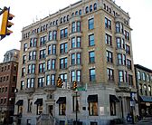
Many historic buildings in West Chester are listed on the National Register of Historic Places. This includes the West Chester Downtown Historic District, which means the whole downtown area is special. Other important buildings are the Bank of Chester County, the Buckwalter Building, and the Chester County Courthouse.
Geography and Climate
West Chester is surrounded by other townships. West Goshen Township is to the north, south, and east. East Bradford Township is to the west. The town is located near two important waterways: the Brandywine Creek and Chester Creek.
West Chester is about 25 miles (40 km) west of Philadelphia. It is also about 17 miles (27 km) north of Wilmington, Delaware. The borough covers a total area of about 1.8 square miles (4.7 square kilometers), and all of it is land.
Weather in West Chester
West Chester has a climate that changes with the seasons. Summers are usually hot and humid. Winters are cold, but the temperature can vary a lot.
- Average high temperatures range from about 39°F (4°C) in winter to 85.4°F (29.7°C) in summer.
- Average low temperatures range from about 22.2°F (-5.4°C) in winter to 64.4°F (18°C) in summer.
- The highest temperature ever recorded was 105°F (41°C).
- The lowest temperature ever recorded was -16°F (-27°C).
The area gets about 46.7 inches (119 cm) of rain each year. It also gets about 27.7 inches (70 cm) of snow each year.
| Climate data for West Chester, Pennsylvania | |||||||||||||
|---|---|---|---|---|---|---|---|---|---|---|---|---|---|
| Month | Jan | Feb | Mar | Apr | May | Jun | Jul | Aug | Sep | Oct | Nov | Dec | Year |
| Mean daily maximum °F (°C) | 39.0 (3.9) |
40.5 (4.7) |
50.8 (10.4) |
62.1 (16.7) |
72.7 (22.6) |
80.9 (27.2) |
85.4 (29.7) |
83.5 (28.6) |
77.1 (25.1) |
65.9 (18.8) |
54.1 (12.3) |
42.2 (5.7) |
62.9 (17.1) |
| Daily mean °F (°C) | 30.7 (−0.7) |
31.6 (−0.2) |
40.9 (4.9) |
51.2 (10.7) |
61.5 (16.4) |
70.2 (21.2) |
74.9 (23.8) |
73.2 (22.9) |
66.4 (19.1) |
55.1 (12.8) |
44.6 (7.0) |
33.8 (1.0) |
52.8 (11.6) |
| Mean daily minimum °F (°C) | 22.2 (−5.4) |
22.6 (−5.2) |
30.8 (−0.7) |
40.2 (4.6) |
50.3 (10.2) |
59.5 (15.3) |
64.4 (18.0) |
62.9 (17.2) |
55.7 (13.2) |
44.3 (6.8) |
35.0 (1.7) |
25.5 (−3.6) |
42.8 (6.0) |
| Average precipitation inches (mm) | 3.5 (89) |
3.3 (84) |
3.8 (97) |
3.7 (94) |
4 (100) |
4.3 (110) |
4.5 (110) |
4.6 (120) |
4.1 (100) |
3.6 (91) |
3.6 (91) |
3.7 (94) |
46.7 (1,180) |
| Average snowfall inches (cm) | 7 (18) |
8.6 (22) |
4.6 (12) |
0.9 (2.3) |
0.0 (0.0) |
0.0 (0.0) |
0.0 (0.0) |
0.0 (0.0) |
0.0 (0.0) |
0.1 (0.25) |
1.2 (3.0) |
5.3 (13) |
27.7 (70) |
| Source: Weatherbase | |||||||||||||
People in West Chester
| Historical population | |||
|---|---|---|---|
| Census | Pop. | %± | |
| 1800 | 374 | — | |
| 1810 | 471 | 25.9% | |
| 1820 | 552 | 17.2% | |
| 1830 | 1,258 | 127.9% | |
| 1840 | 2,152 | 71.1% | |
| 1850 | 3,172 | 47.4% | |
| 1860 | 4,757 | 50.0% | |
| 1870 | 5,630 | 18.4% | |
| 1880 | 7,046 | 25.2% | |
| 1890 | 8,028 | 13.9% | |
| 1900 | 9,524 | 18.6% | |
| 1910 | 11,767 | 23.6% | |
| 1920 | 11,717 | −0.4% | |
| 1930 | 12,325 | 5.2% | |
| 1940 | 13,289 | 7.8% | |
| 1950 | 15,168 | 14.1% | |
| 1960 | 15,705 | 3.5% | |
| 1970 | 19,301 | 22.9% | |
| 1980 | 17,435 | −9.7% | |
| 1990 | 18,041 | 3.5% | |
| 2000 | 17,861 | −1.0% | |
| 2010 | 18,461 | 3.4% | |
| 2020 | 18,671 | 1.1% | |
| U.S. Decennial Census | |||
In 2010, most people in West Chester (72.1%) were White. About 12.1% were Black or African American. Other groups included Asian people (1.4%) and Native Americans (0.2%). About 13.4% of the population was of Hispanic or Latino background.
In 2000, there were 17,861 people living in the borough. There were 6,265 households, which are groups of people living together. The average household had about 2.31 people.
The population of West Chester is quite young. In 2000, about 37.7% of residents were between 18 and 24 years old. The median age was 25 years. This means half the people were younger than 25 and half were older.
The average income for a household in West Chester was $71,875 between 2018 and 2022. About 21% of the people in West Chester live below the poverty line.
Economy and Businesses
West Chester is home to the main offices of several companies:
- Communications Test Design, Inc. (CTDI): This company helps with telecommunications equipment.
- Mars Drinks: They make drink systems like Flavia.
- VWR International: A company that sells lab and science supplies.
- Synthes: A medical company.
- Economy.com: This is part of Moody's Analytics, a financial company.
QVC, a famous shopping channel, has its main offices and TV studios nearby in West Goshen Township. These buildings used to be the headquarters for Commodore International, a company that made early home computers.
There are also shopping areas like Bradford Plaza. This large shopping center was sold for $35.7 million in 2014.
Culture and Media
The West Chester Public Library has been serving the community since 1872. It has over 50,000 items and gets many visitors each year. The university also has a large library called the Francis Harvey Green Library.
For news, you can read Daily Local News, which covers events in Chester County. WCHE (1520 AM) is a local radio station that broadcasts from downtown West Chester. WCUR (91.7 FM) is another radio station run by students at West Chester University. The university also has a student newspaper called The Quad.
West Chester has its own flag, which was chosen in 2019 after a contest. The flag has six gold ribbons. These ribbons stand for the six original streets of West Chester: Market, Gay, High, Chestnut, Walnut, and Church. The flag uses the official colors of the borough: blue and gold.
Transportation
Roads and Highways
West Chester has about 33.82 miles (54.43 km) of public roads. Most of these roads are kept up by the borough itself.
Major highways like US 202 and US 322 pass by West Chester. They use a special bypass road.
- US 202 goes northeast to King of Prussia and south to Wilmington, Delaware.
- US 322 goes northwest to Downingtown and southeast to Chester.
A business route, US 322 Business, goes through the center of West Chester.
The main road for traveling east and west is West Chester Pike. This road starts near Philadelphia and is part of Pennsylvania Route 3 (PA 3). In West Chester, PA 3 follows Market Street (eastbound) and Gay Street (westbound). The main north-south road is High Street.
Public Transportation
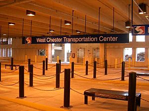
West Chester has a West Chester Transportation Center. This building is a parking garage and also a bus terminal.
- Three SEPTA bus routes serve West Chester:
- Route 92 connects to the King of Prussia Transit Center.
- Route 104 goes between West Chester University and the 69th Street Transportation Center.
- Route 135 connects West Chester to Exton, Downingtown, and Coatesville.
The Route 104 bus replaced an old trolley service that used to run between West Chester and Philadelphia. There is also a local bus service called SCCOOT that connects West Chester to other towns like Kennett Square and Oxford.
West Chester used to have a commuter train line, but service stopped in 1986. Now, a special heritage railroad called the West Chester Railroad uses the train tracks for fun rides.
Education
Public Schools
The West Chester Area School District manages the public schools in the area. All three high schools in the district serve parts of West Chester borough:
- Henderson High School
- West Chester East High School
- Rustin High School
There are also three middle schools: E.N. Peirce, J.R. Fugett, and G.A. Stetson Middle Schools.
Several elementary schools serve parts of West Chester borough, including East Bradford, East Goshen, Hillsdale, Greystone, Sarah Starkweather, and Westtown-Thornbury.
Private Schools
St. Agnes School is a private Catholic school for grades K-8 located in the borough. It opened in 1871. There are also other Catholic K-8 schools nearby that have West Chester mailing addresses, such as SS. Peter and Paul School, SS. Simon and Jude School, and St. Maximilian Kolbe School.
Colleges and Universities
A large part of West Chester University's campus is located in the borough, just south of the main town center. Delaware County Community College also serves students from Chester County.
Public Libraries
The West Chester Public Library is the local community library. It was founded in 1872 and moved to its current building in 1888. The land for the library was given by Hannah M. Darlington, who also donated beautiful stained-glass windows.
Entertainment and Fun Things to Do
West Chester has many fun places to visit, including restaurants, shops, parks, and historical sites.
- Uptown! Knauer Performing Arts Center: A great place to see shows and performances.
- Chester County History Center: Learn about the history of the area.
- American Helicopter Museum: See different types of helicopters.
- West Chester Railroad: Take a scenic train ride.
- QVC studio tours: See how the famous shopping channel works.
You can also explore Downtown West Chester. It has many places to eat and shop, along with interesting old buildings.
West Chester is also home to West Chester United SC, a professional soccer club. They play their home games at Kildare's Field.
Notable People
Many interesting people have lived in or are from West Chester.
See also
 In Spanish: West Chester (Pensilvania) para niños
 | Laphonza Butler |
 | Daisy Bates |
 | Elizabeth Piper Ensley |


