
Wetzel County, West Virginia facts for kids
Quick facts for kids
Wetzel County
|
||
|---|---|---|

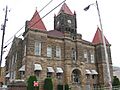
Wetzel County Courthouse
|
||
|
||

Location within the U.S. state of West Virginia
|
||
 West Virginia's location within the U.S. |
||
| Country | ||
| State | ||
| Founded | January 10, 1846 | |
| Named for | Lewis Wetzel | |
| Seat | New Martinsville | |
| Largest city | New Martinsville | |
| Area | ||
| • Total | 361 sq mi (930 km2) | |
| • Land | 358 sq mi (930 km2) | |
| • Water | 3.3 sq mi (9 km2) 0.9%% | |
| Population
(2020)
|
||
| • Total | 14,442 | |
| • Estimate
(2021)
|
14,170 |
|
| • Density | 40.01/sq mi (15.446/km2) | |
| Time zone | UTC−5 (Eastern) | |
| • Summer (DST) | UTC−4 (EDT) | |
| Congressional district | 1st | |

Wetzel County is a county located in the state of West Virginia in the United States. In 2020, about 14,442 people lived there. The main town and county seat is New Martinsville.
The county was started in 1846. It was named after Lewis Wetzel, a famous frontiersman. He was known for his skills in the wilderness. The northern edge of Wetzel County follows the Mason-Dixon line. This line is a historic border.
Contents
History of Wetzel County
Wetzel County was created in 1846. It was formed from a part of Tyler County, which was then in Virginia.
During the American Civil War, on June 20, 1863, Wetzel County became part of the new state of West Virginia. West Virginia was one of fifty counties from Virginia that joined the Union.
Later that year, counties in West Virginia were divided into smaller areas called townships. This was done to help local government. But it was hard to manage in the countryside. So, in 1872, these townships became "magisterial districts."
Wetzel County was first split into six districts: Center, Church, Grant, Green, Magnolia, and Proctor. A seventh district, Clay, was added in the 1880s. New Martinsville, the county's main town, was in the Magnolia District. These seven districts stayed mostly the same for about 100 years. In the 1980s, they were combined into three new districts: District 1, District 2, and District 3.
Geography and Location
Wetzel County covers a total area of about 361 square miles. Most of this area, 358 square miles, is land. The rest, about 3.3 square miles, is water.
Main Roads in Wetzel County
 US 250
 WV 2
WV 2 WV 7
WV 7 WV 20
WV 20 WV 69
WV 69 WV 180
Neighboring Counties
Wetzel County shares borders with several other counties:
- Marshall County (north)
- Greene County, Pennsylvania (northeast)
- Monongalia County (east)
- Marion County (east)
- Harrison County (southeast)
- Doddridge County (south)
- Tyler County (southwest)
- Monroe County, Ohio (west)
Protected Natural Areas
Part of the Ohio River Islands National Wildlife Refuge is located in Wetzel County. This area helps protect wildlife.
Population and People
| Historical population | |||
|---|---|---|---|
| Census | Pop. | %± | |
| 1850 | 4,284 | — | |
| 1860 | 6,703 | 56.5% | |
| 1870 | 8,595 | 28.2% | |
| 1880 | 13,896 | 61.7% | |
| 1890 | 16,841 | 21.2% | |
| 1900 | 22,880 | 35.9% | |
| 1910 | 23,855 | 4.3% | |
| 1920 | 23,069 | −3.3% | |
| 1930 | 22,334 | −3.2% | |
| 1940 | 22,342 | 0.0% | |
| 1950 | 20,154 | −9.8% | |
| 1960 | 19,347 | −4.0% | |
| 1970 | 20,314 | 5.0% | |
| 1980 | 21,874 | 7.7% | |
| 1990 | 19,258 | −12.0% | |
| 2000 | 17,693 | −8.1% | |
| 2010 | 16,583 | −6.3% | |
| 2020 | 14,442 | −12.9% | |
| 2021 (est.) | 14,170 | −14.6% | |
| U.S. Decennial Census 1790–1960 1900–1990 1990–2000 2010–2020 |
|||
What the 2020 Census Shows
In 2020, the census counted 14,442 people living in Wetzel County. There were 5,603 households. Most people, about 95.2%, were White. A small number were Asian, African American, or Native American. About 3.7% of people were of two or more races. About 1% of the population was Hispanic or Latino.
The average age in the county was 46.4 years. About 20.4% of the people were under 18 years old.
What the 2010 Census Showed
In 2010, there were 16,583 people living in the county. There were 6,968 households. The population density was about 46.3 people per square mile. Most people (98.7%) were white.
About 28.1% of households had children under 18. The average household had 2.36 people. The average family had 2.83 people. The median age was 44.8 years.
Many people in Wetzel County have German, Irish, American, or English backgrounds.
Local Stories and History
Wetzel County has some interesting local stories. In the mid-to-late 1800s, there was a group called the Jennings Gang. They were known for robberies and other crimes. They were said to hide near Doolin Run. Their home even had a secret escape tunnel! A local group called the "Redmen" eventually caught the gang.
The county also has a long history with the oil and gas industry. One of the oldest oil wells was drilled on Long Run. It found oil at about 360 feet deep. During the oil boom in the 1800s, there were many businesses in the area. For example, the Proctor Creek area had many places for oil workers.
Communities in Wetzel County
Wetzel County has several towns and communities.
Cities
- New Martinsville (This is the county seat, the main town for county government)
- Paden City (part of this city is in Wetzel County)
Towns
Magisterial Districts (Current)
- District 1
- District 2
- District 3
Magisterial Districts (Historic)
- Center
- Church
- Clay
- Grant
- Green
- Magnolia
- Proctor
Census-Designated Places
These are areas that are like towns but are not officially incorporated:
Unincorporated Communities
These are smaller communities that are not officially part of a city or town:
Images for kids
-
Wetzel County Courthouse
See also
 In Spanish: Condado de Wetzel para niños
