Yocemento, Kansas facts for kids
Quick facts for kids
Yocemento, Kansas
|
|
|---|---|
|
|
|
|
| Country | United States |
| State | Kansas |
| County | Ellis |
| Township | Big Creek |
| Founded | 1906 |
| Platted | 1907 |
| Elevation | 2,051 ft (625 m) |
| Time zone | UTC-6 (CST) |
| • Summer (DST) | UTC-5 (CDT) |
| ZIP code |
67601
|
| Area code | 785 |
| FIPS code | 20-80725 |
| GNIS ID | 484723 |
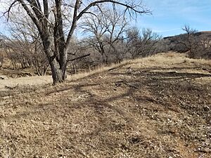
Yocemento is a small, unincorporated community in Ellis County, Kansas, United States. It sits along the banks of Big Creek, at the foot of tall bluffs made of huge limestone blocks. These bluffs were key to the town's start in the early 1900s.
The area was first called Hog Back by early settlers. A train station was built here with that name in 1881. The name "Hog Back" came from the high ridge of limestone and chalk that stretches across the area. This ridge is part of the Fort Hays Limestone Member.
Yocemento was founded in 1906 by Erasmus Haworth, Kansas's first state geologist, and I. M. Yost, a successful businessman from Hays. They wanted to use the local limestone to make Portland cement. Yocemento is one of several towns in the High Plains region created for this purpose.
History of Yocemento
Early People in the Area
The Yocemento area has been home to people for a very long time. Scientists have found signs of an early settlement from about 1000 CE. This was during the Early Ceramic period of the Woodland culture. They found pieces of pottery, stone tools, and animal bones. This suggests it was a hunting and tool-making camp, likely used during warmer months.
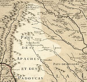
In the early 1700s, French mapmakers showed Comanche villages in this part of Kansas. Later, by the early 1800s, the Pawnee had a large hunting camp nearby. When the first United States settlers arrived in the mid-1800s, the land was mainly claimed by the Kiowa, Comanche, Cheyenne, and Arapaho tribes.
The Railroad Arrives
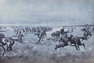
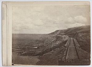
In 1867, the Kansas Pacific Railway began building tracks west from Junction City. This caused problems with the Native American tribes who used this land for hunting buffalo. The railroad's path went through their traditional hunting grounds.
Because of these disagreements, construction workers and settlers faced attacks. On August 1, seven workers were killed near what is now Victoria. The next day, a conflict happened near the Saline River, about 12 miles north of where Yocemento would be. These events caused all railroad work west of Hays to stop for a while.
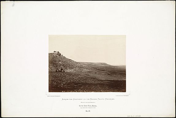
Alexander Gardner, a famous photographer, took pictures of the Yocemento area in October 1867. One photo, On the Great Plains, Kansas..., shows the limestone bluffs that later attracted geologists and business owners. These bluffs were perfect for making cement.
Another famous photo, Westward The Course of Empire Takes Its Way, shows railroad workers laying tracks. This picture was taken just before a treaty was signed, allowing the railroad to continue.
After the conflicts ended, railroad construction continued through the winter of 1867–1868. By 1870, the tracks reached Denver. The railroad helped new towns like Ellis grow. By 1873, Ellis had a hotel and a roundhouse built from the local Fort Hays Limestone.
I. M. Yost, one of Yocemento's founders, moved to Hays in 1877. He built the area's first flour mill, knowing that the railroad would help transport wheat.
Land for More Than Farming
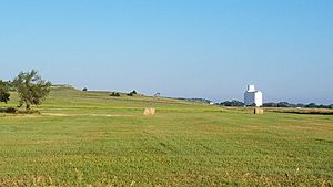
The Hog Back ridge, with its limestone and chalk, was not good for growing wheat. Early settlers often avoided it. By 1910, people called it the "long neglected" Hog Back. Today, much of these hills are still used for pasture.
Geologists Explore the Bluffs
Early geologists were very interested in the huge limestone bluffs and chalk areas. They studied the rocks and mapped Cretaceous fossils. F. V. Hayden visited the site in 1871. He noted how Big Creek had cut into the bluff, showing 60 feet of "Benton Shale" rock.
The U.S. Portland Cement Company
The United States Portland Cement Company was started by Erasmus Haworth and I. M. Yost.
Erasmus Haworth was the first president of the Kansas Geological Survey. He was known for accurately predicting where oil would be found in western Kansas.
I. M. Yost was a leading businessman in Hays. He built the first flour mills in the region.
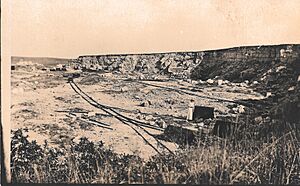
In 1906, Haworth and Yost met and climbed the high bluff near Big Creek. Haworth suggested building a cement plant there. He realized that gravity could easily move limestone from the top of the bluff to a mill below. Yost saw that the creek provided water, and the railroad could bring in fuel and ship out cement. They also planned to sell land lots in a new town next to the mill.
The partners started the United States Portland Cement Company. They named the new town Yocemento, combining "Yost" and "cement." The town was officially planned in 1907, and a post office opened that year.
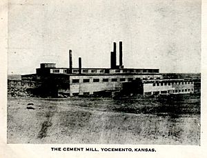
Construction of the cement mill began in 1907. A special cable lift and trolley were built to carry limestone from the quarry to the mill. By mid-1908, the mill was working. The town grew to include a general store, a hotel, and a restaurant. Many workers were Hungarian immigrants who built a Catholic church.
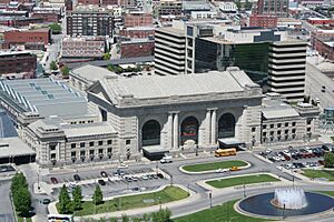
The Yocemento mill made good quality cement. It was used to build the Kansas City Union Station and to pave streets in Denver.
However, the Yocemento mill faced tough competition from larger cement companies in Kansas City and Denver. These larger companies made it hard for Yocemento to get affordable coal for its operations.
Even though the mill could use oil from eastern Kansas and Oklahoma, it struggled. Other cement plants lowered their prices, and railroads charged higher fees to the plains cement mills. In 1911, the company complained to the government about unfair shipping costs, but the government found no major issues. They said the problem was too much cement being made and less cheap natural gas available.
The mill started losing money, and Haworth and Yost lost control. In 1916, a millionaire named John Kernan Mullen bought the company. He wanted to restart the mill. But in 1917, the Boettcher Company bought the mill and quickly took it apart. They believed the mill was too far from fuel and markets to be successful.
After the mill closed, people began to leave Yocemento. The post office also closed. In 1931, the church building was moved to another township to be used as a community hall.
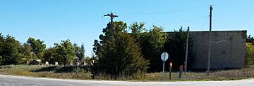
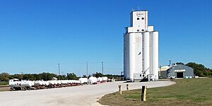
Today, Yocemento has a grain elevator and a warehouse for farm supplies, run by Midland Marketing. Some homes have been built, and parts of the old mill's concrete walls and foundations have been made into family homes.
Oil Discovery
Erasmus Haworth had predicted that oil would be found near Yocemento. In 1923, after the mill closed, Haworth returned to drill for oil a few miles northwest of Yocemento. His company drilled one well, but it was dry, and they stopped due to falling oil prices. Later, other explorers found oil, proving Haworth right. His well was actually between two of Kansas's largest oil fields. For many years, Ellis County was a top oil-producing county in Kansas.
Changes to Railroad and Highways
Over the years, the railroad tracks and highways in Yocemento have been moved and improved. The original railroad tracks were built on unstable ground near the bluff, which often needed repairs. In 1951–52, the Union Pacific Railroad straightened the tracks, moving them away from the bluff and even changing the path of Big Creek.
The first public road from Hays to Yocemento, called "Yocemento Road," was built to connect the towns for business. This road later became part of U.S. Route 40. Over time, this highway was also realigned to improve safety and convenience. Today, parts of the old highway are now county roads, like Rome Avenue.
Geography of Yocemento
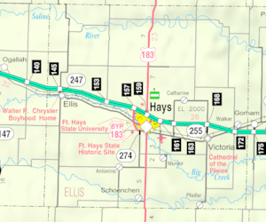
Yocemento is located about 1 mile south of Interstate 70. It is about 5.5 miles west-northwest of Hays, which is the county seat.
The community sits along Big Creek on the eastern edge of the Chalk Hills. This area is part of the Smoky Hills region within the larger Great Plains.
Media in Yocemento
The town once had its own newspaper, the Yocemento Star. It was edited by Frank Motz, who later founded the Hays Daily News.
Transportation in Yocemento
Train Tracks
The Kansas Pacific (KP) line of the Union Pacific Railroad runs through Yocemento. There is a special track, called a spur, for the grain elevator and bulk supplies.
Roads
Old Highway 40 (RS 1977) runs through Yocemento. This road is an older path of U.S. Route 40. It connects the downtown areas of Hays and Ellis.
Yocemento Avenue runs north-south and connects to Exit 153 of Interstate 70 about a mile north.
Rome Avenue runs east-west through the old townsite and then goes north of the train tracks towards Hays.
See also
- Other communities that used Fort Hays Limestone for cement:
- Guide Rock (Pa-hur), another important bluff changed by people.
 | Jessica Watkins |
 | Robert Henry Lawrence Jr. |
 | Mae Jemison |
 | Sian Proctor |
 | Guion Bluford |


