
Alamitos Creek facts for kids
Quick facts for kids Los Alamitos Creek |
|
|---|---|

Los Alamitos Creek Trail
|
|

Location of the mouth in California
|
|
| Other name(s) | Arroyo de los Alamitos |
| Country | United States |
| State | California |
| Region | Santa Clara County |
| City | San Jose, California |
| Physical characteristics | |
| Main source | Almaden Reservoir 10 mi (16 km) west of Morgan Hill, California 37°9′56″N 121°49′34″W / 37.16556°N 121.82611°W |
| River mouth | Guadalupe River San Jose, California 194 ft (59 m) 37°14′48″N 121°52′16″W / 37.24667°N 121.87111°W |
| Basin features | |
| Tributaries |
|
Los Alamitos Creek is a 7.7-mile-long creek in San Jose, California. It flows into the Guadalupe River. This happens after it leaves Lake Almaden and joins Guadalupe Creek.
Los Alamitos Creek is found in Almaden Valley. It starts from the Los Capitancillos Ridge and the Santa Cruz Mountains. The creek flows through the Valley's Guadalupe Watershed. This area is managed by the Santa Clara Valley Water District.
The creek generally flows northwest. It goes around the Los Capitancillos Ridge and the town of New Almaden. Then it winds along the Santa Teresa Hills. Some parts of the creek are still wild, while others are near homes. Its original name was Arroyo de los Alamitos. This means "little poplar" in Spanish, as "alamo" means "poplar" or "cottonwood."
Contents
History of the Creek
For thousands of years, Native American tribes lived along the banks of Alamitos Creek. They were hunter-gatherers. Scientists have found signs of their old camps and tools.
Mercury in the Creek
From the mid-1800s to the 1970s, the New Almaden Quicksilver Mines released a lot of mercury into the creek. This happened near where the creek starts. Even today, piles of leftover mine materials still pollute the creek. Because of this, there are warning signs along the creek. They tell people not to eat any fish caught there.
Protecting the Creek
In the 1940s and 1950s, many homes were built in Almaden Valley. Some were built too close to the creek, in areas that could flood. The Santa Clara Valley Water District began to study the creek. They wanted to control floods. They made some small changes to the streambed.
In 1976, the District made a big plan to control floods. They hired a company to study the creek's biology, water quality, geology, and old human sites. This study helped them learn a lot about Alamitos Creek. In 1989, the city of San Jose started planning a trail. This trail would run along the creek from Almaden Quicksilver County Park.
The Creek's Watershed
The Alamitos Creek watershed covers about 38 square miles (98 km2). A watershed is an area of land where all the water drains into a single river or creek. Alamitos Creek starts at the bottom of Almaden Reservoir. The reservoir itself gets its water from Herbert Creek and other smaller streams.
Herbert Creek and Protection Efforts
Herbert Creek's source is near Mount Umunhum. Other small streams like Barret Creek also feed the reservoir. Barret Creek starts in Barret Canyon. It drains the north side of Loma Prieta, the tallest peak in the Santa Cruz Mountains. In 2018, a large area of land around Barret Creek was bought to protect it. This was done by several groups working together.
Marti Tedesco from the Peninsula Open Space Trust said that "Rainbow trout in Barret Creek were [once] so plentiful that fishermen used to catch them by the hundreds." This shows how important it is to protect these areas.
Calero Reservoir and Lake Almaden
Further downstream, Alamitos Creek gets water from another main stream, Arroyo Calero. Arroyo Calero was dammed to create Calero Reservoir.
Alamitos Creek also flows into Lake Almaden. This lake was made by a company digging for gravel. It used to be a meadow where cows grazed. Lake Almaden has pollution from mercury and Canada goose waste. Because of this, people are not allowed to use the lake.
Lake Almaden makes it hard for native steelhead trout (Oncorhynchus mykiss) to migrate. This is because the lake has many fish that eat trout, like largemouth bass (Micropterus salmoides). The lake also makes the water warmer, which is not good for trout. The Santa Clara Valley Water District is working to separate the creek from the lake. They expect to finish this work in 2022.
After leaving Lake Almaden, Alamitos Creek joins Guadalupe Creek. This is where the main part of the Guadalupe River begins. This spot is west of Almaden Expressway and north of Coleman Road.
Wildlife and Plants
Alamitos Creek used to have many steelhead trout. In 1997, the Santa Clara Valley Water District studied fish near the creek's meeting point with Golf Creek.
Animals and Birds
In the lower, rocky parts of the creek, you can see many kinds of birds. These include mallard ducks, black phoebes, common mergansers, and red-shouldered hawks. You might also spot snowy egrets, belted kingfishers, great blue herons, and black-crowned night-herons. A few mammals, like raccoons, also live along the lower creek.
On the chaparral slopes, you might see rufous-crowned sparrows, California thrashers, and American kestrels. In the oak woodlands near the creek, look for acorn woodpeckers, California quail, Anna's hummingbirds, and scrub jays. Other birds include oak titmouses, bushtits, Bewick's wrens, and spotted towhees.
Plants Along the Creek
The plants along the creek include large trees like coast live oak and California bay laurel. Smaller plants like coyote brush, toyon, and poison oak grow underneath. Near the water, you'll find plants like red willow and wild blackberry.
Fish Safety Warning
The California Office of Environmental Health Hazard Assessment has issued a warning. They say "Do Not Eat" any fish caught in Alamitos Creek. This is because of the high levels of mercury in the fish.
Los Alamitos Creek Trail
The Los Alamitos Creek Trail is a paved path for walking and biking. It is about 4.7 miles long. The trail runs along Alamitos Creek. It starts at Harry Road in the south and goes to Lake Almaden Park in the north.
As the trail goes under the Coleman Road bridge, it meets Guadalupe Creek. At this point, it becomes the Guadalupe River Trail. This paved trail system continues north along the Guadalupe River. It goes all the way to Chynoweth Avenue. If you want to keep going, you can use sidewalks to cross the Almaden Expressway bridge. Then you can follow the Guadalupe Creek Trail west.
Images for kids
-
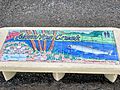
A painting on tiles on a bench symbolizing Los Alamitos Creek's marine life, footbridges & public recreation
-
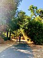
Los Alamitos Creek Trail
-
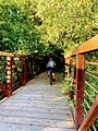
One of the footbridges on the Los Alamitos Creek Trail


