Albuquerque Basin facts for kids
Quick facts for kids Albuquerque Basin |
|
|---|---|
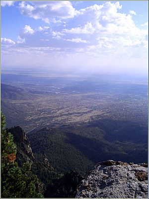
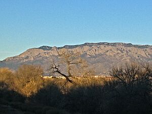
View of the Albuquerque Basin from Sandia Peak
|
|
| Type | Structural basin |
| Unit of | Rio Grande rift |
| Location | |
| Coordinates | 35°06′N 106°36′W / 35.10°N 106.60°W |
| Country | |
 |
|
The Albuquerque Basin (also called the Middle Rio Grande Basin) is a large, bowl-shaped area of land in central New Mexico. It's part of a bigger geological feature called the Rio Grande rift, which is a long crack in the Earth's crust. The famous city of Albuquerque is located right in this basin.
Geologically, the Albuquerque Basin is like a giant tilted trough, known as a half-graben. It slopes down towards the east, ending at the Sandia and Manzano mountains. This basin is the biggest and oldest of the three main basins in the Rio Grande rift. It's very deep, ranging from about 4,400 to 6,600 meters (about 2.7 to 4.1 miles) deep.
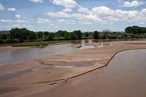
The basin has a dry climate, with many areas being desert. Evidence from ancient people who lived here 12,000 years ago shows that the climate used to be much wetter. The Rio Grande river flows through the basin from north to south. People have been using its water for farming for at least 1,000 years. More intense irrigation started in the late 1800s, which has sometimes caused environmental issues.
When the Rio Grande river has low water levels, Albuquerque gets its drinking water from underground. This water comes from an aquifer, which is like a huge underground sponge made of rock and soil. The amount of water in this aquifer changes with the weather. There might be natural gas in the basin, but some people worry about how drilling for it could affect the groundwater and the local environment.
Contents
Where is the Albuquerque Basin?
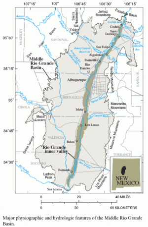
The Albuquerque Basin covers about 8,000 square kilometers (3,100 square miles) in New Mexico. It's surrounded by mountains and other landforms. To the east are the Sandia and Manzano mountains. The Jemez Mountains are to the north. The Rio Puerco river is to the west, and the Socorro Basin is to the south.
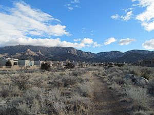
The basin is about 160 kilometers (100 miles) long from north to south. At its widest point, it's about 86 kilometers (53 miles) from east to west. The Rio Grande river flows through the basin at an elevation of about 1,420 meters (4,660 feet). East of the river, gentle slopes and terraces lead down from the mountains. West of the river, the land gradually rises towards the Rio Puerco, with a few isolated mountains and volcanoes. Because there isn't much rain, the basin has many sand dunes.
This area is rich in sites from ancient people, some dating back 12,000 years. Most of these sites are found on higher ground near the Rio Grande. Back then, dry lake beds (called playas) had wetlands and more plants than they do today. Tools and bones from the Folsom people, who were early inhabitants, have been found here.
Many communities are located in this basin. From north to south, they include Cochiti, Santo Domingo, San Felipe, Algodones, Bernalillo, Rio Rancho, Albuquerque, Isleta, Los Lunas, Belen, and Bernardo.
How the Basin Formed (Geology)
The Albuquerque Basin is the largest and oldest of the three main basins in the Rio Grande rift. Its depth ranges from about 4,400 to 6,600 meters (2.7 to 4.1 miles). Layers of rock and sediment, called the Santa Fe Group, built up in the basin between 15 million and 1 million years ago. These sediments came from nearby mountains and from the ancient Rio Grande river.
Long ago, the Albuquerque and Espanola basins were one big basin. It was a tilted half-graben that leaned to the west. Over time, new faults (cracks in the Earth's crust) became active. This caused the Albuquerque basin to tilt the other way, towards the east. Now, it slopes down to the base of the Sandia Mountains, which were uplifted by these geological changes.
Scientists have studied the basin's shape using different methods. Early studies in the 1990s suggested the northern and southern parts tilted in opposite directions. More recent studies, using gravity data, show a different picture. They suggest the northern part is a half-graben facing east-northeast, extending further east than thought. The southern part is also an east-facing half-graben. These two parts are connected by a raised area.
Volcanic eruptions happened while the Santa Fe Group sediments were forming, and continued until about 156,000 years ago. Most of the volcanic rocks, like basalt and andesite, are on the west side of the basin. The Albuquerque volcanic field has volcanoes west of Albuquerque that were active relatively recently. The surface of the basin also has large areas of sand dunes formed by wind.
Climate and Water
The climate in the Albuquerque Basin is semi-arid, meaning it's quite dry. A large part of the basin is considered a desert. The average yearly temperature is about 13°C (55°F). It ranges from about 1°C (34°F) in January to 24°C (75°F) in July.
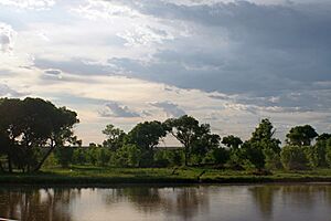
The average yearly rainfall varies a lot, from about 190 mm (7.5 inches) near Belen to 760 mm (30 inches) at Sandia Crest. Rain comes from summer thunderstorms and winter storm fronts. The amount of rain can be very unpredictable, and droughts lasting several years are common. Most of the time, the ground is dry unless it's irrigated. The plants here include desert shrubs and grasses, riverside forests (called bosque) along the Rio Grande, and trees on the mountain slopes.
Surface Water: The Rio Grande
The Rio Grande river flows for about 2,000 kilometers (1,240 miles) from Colorado to the Gulf of Mexico. In 1993, it was called one of North America's most endangered rivers. The river enters the Albuquerque Basin between the Sandia and Jemez mountains. Before it enters the basin, its flow is controlled by the Cochiti Dam, built in 1975. After leaving the basin, it's controlled by the Elephant Butte Reservoir, built in 1916.
Between these dams, the river has structures that send water into a network of levees, canals, and drains. When the river is low, diversion dams at Isleta and San Acacia can divert all the water from a 177-kilometer (110-mile) stretch of the river. Other rivers that flow into the Rio Grande here include the Jemez River and Rio Puerco from the west, and the Santa Fe River and Galisteo Creek from the east.
History of Irrigation
The Pueblo people in the Rio Grande valley started using simple irrigation systems by the 10th century AD. By the 13th century, most major pueblos had established communities. Their irrigation system, using a main shared ditch called an acequia, is one of the oldest in North America. Smaller ditches branched off for individual families. Maintaining the main acequia was a community effort.
When the Spanish arrived in 1598, they expanded these irrigation systems, often using Native American labor. They were familiar with similar techniques from their own history and adapted them. As communities grew, they formed groups to manage the acequias.
In 1848, the United States took control of the territory. Railways arrived in 1880, bringing new settlers. More irrigation was encouraged, peaking around the early 1890s. Farmers grew grapes, fruits, and vegetables, even exporting them to California. However, too much irrigation led to problems like droughts, too much sediment in the river, salty soil, and waterlogging. The acequia in Albuquerque became a dirty drainage ditch.
In 1925, the Middle Rio Grande Conservancy District (MRGCD) was formed. It built levees to control floods, drained swampy land, and improved the acequias. After World War II, Albuquerque grew rapidly. The MRGCD still manages a large network of canals and irrigation systems. As of 2012, they were responsible for a huge area of land, maintaining dams, canals, and drains. With more people living in cities, the MRGCD's role has changed. Now, they also focus on protecting the river's environment and helping to refill the underground water supply (aquifer).
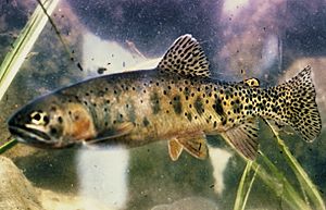
The Rio Grande in the Albuquerque basin used to have many different kinds of fish, mostly native to the area. By the 1960s, many native species were gone from the northern part of the basin. By the mid-1990s, only 17 of the 45 fish species found were native. More than 40% of the native fish species in this part of the river have disappeared.
The biggest threats to the fish are diverting and pumping water. River levels are highest from March to June due to melting snow. But the demand for irrigation water is highest from July to October. During irrigation season, the river downstream from the Isleta Diversion Dam can almost dry up. Native fish can get trapped in small pools and die from lack of water or be eaten by introduced fish. The river may not flow steadily again until irrigation stops in late October.
Groundwater: Our Underground Water Supply
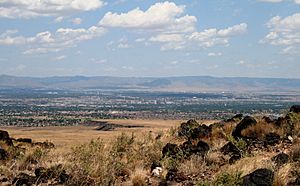
Many communities in the region rely on groundwater for their drinking water. In the 1960s, Albuquerque started pumping a lot of water from wells. People thought there was a huge aquifer that would last for centuries. But in the late 1980s, water levels dropped in some areas, causing concern. Since 1992, scientists have been studying the basin's geology and aquifer more closely.
The groundwater was deposited in three main stages. The oldest layers, from the lower Santa Fe group, have low amounts of poor-quality water. Most of the good drinking water comes from later deposits in the upper Santa Fe group. These deposits were formed by the ancient Rio Grande and its tributaries. They are mostly within 2 kilometers (1.2 miles) of the eastern edge of the basin. The modern Rio Grande then carved its valley into these sediments.
In the last 10,000 to 15,000 years, the river valley has collected a lot of new sediment, up to 61 meters (200 feet) deep. There is groundwater in this new sediment, forming a shallow aquifer close to the surface. This makes it very easy for this water to get polluted. Pumping water from this shallow aquifer can also cause the ground to sink, which could damage buildings.
Oil and Gas in the Basin
Other basins in the Rio Grande rift have oil and gas. Small amounts have been found in wells near Española and Santa Fe. The first well drilled in the Albuquerque Basin to look for oil and gas was in 1914. Since then, at least 50 test wells have been drilled.
Before 1953, most wells were shallow and found signs of oil and gas. After 1953, deeper wells were drilled, mostly by companies like Royal Dutch Shell. They found gas in older rocks, but not enough to be worth selling. Exploration stopped in the late 1980s and early 1990s because oil prices were low.
In 2001, a U.S. government report suggested that gas might be present in the Albuquerque Basin. It noted that the basin contains thick layers of coal and other rocks from the Cretaceous era, which are known to produce gas. The report concluded that a "basin-centered gas accumulation" (a large amount of gas spread throughout the rock) was likely present.
In 2007-2008, a company called Tecton Energy explored for natural gas on the Southwest Mesa. They drilled about 46 test wells. However, plans to extract gas faced opposition from people worried about harm to groundwater and the environment. In January 2008, Governor Bill Richardson put a six-month pause on further exploration.
 | Valerie Thomas |
 | Frederick McKinley Jones |
 | George Edward Alcorn Jr. |
 | Thomas Mensah |


