
Algarve facts for kids
Quick facts for kids Algarve |
|
| Region | |
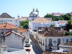
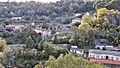
 The city of Silves, the old capital of the Algarve .
|
|
| Name origin: algarve from Arabic: الغرب the west | |
| Country | Portugal |
|---|---|
| Capital | Faro |
| - elevation | 11 m (36 ft) |
| - coordinates | 37°0′52″N 7°56′7″W / 37.01444°N 7.93528°W |
| Highest point | Fóia |
| - location | Serra de Monchique |
| - elevation | 902 m (2,959 ft) |
| - coordinates | 37°18′54″N 8°35′47″W / 37.31500°N 8.59639°W |
| Lowest point | Sea level |
| - location | Atlantic Ocean |
| - elevation | 0 m (0 ft) |
| Length | 143 km (89 mi), East-West |
| Width | 63 km (39 mi), North-South |
| Area | 4,996.80 km² (1,929 sq mi) |
| Population | 442,358 (2013) |
| Density | 89 /km² (231 /sq mi) |
| Timezone | WET (UTC+0) |
| - summer (DST) | WEST (UTC+1) |
| NUTS | PT15 |
| GDP (PPP) | 2013 estimate |
| - Total | € 9.274 billion |
| - Per capita | € 20,900 |
| GDP (nominal) | 2013 estimate |
| - Total | € 7.232 billion |
| - Per capita | € 16,300 |
| Statistics from INE (2011) | |
The Algarve is the southernmost part of Portugal. Its name comes from the Arabic words al-Gharb, meaning "the West". The main city and capital of the Algarve is Faro. You can find an airport and a public university (University of Algarve) there.
The Algarve region is known for its beautiful beaches and old buildings. Because of this, tourism is the most important way people make money here. The region today is the same as the old province and the Faro district.
Contents
History of Algarve
The name Algarve comes from Gharb Al-Andalus. This means "The West of Al-Andalus" in Arabic. The Muslim people who lived in Iberia gave this name to the area west of Andalusia.
Geography of Algarve
The Algarve covers an area of about 4,997 square kilometers (1,929 square miles). To the north, it shares a border with the Alentejo region. The Atlantic Ocean is to its west and south. To the east, it borders the Guadiana river and Andalusia in Spain.
The Algarve region is split into two main parts:
- Barlavento: This is the western part. Its main city is Portimão.
- Sotavento: This is the eastern part. Its main city is Faro.
The region has several mountain ranges. These include Serra de Monchique, Serra de Espinhaço de Cão, and Serra do Caldeirão. The highest point in the Algarve is Fóia mountain. It is 902 meters (2,959 feet) high and is part of the Serra de Monchique mountains.
The westernmost point of the Algarve, and of continental Europa, is Cape St. Vincent. You can find it in the municipality of Vila do Bispo.
Administrative Divisions
The Algarve is made up of 16 municipalities, also called concelhos. These municipalities are further divided into 67 smaller areas called freguesias.

Among the 16 municipalities, Loulé is the largest. It covers an area of about 764 square kilometers (295 square miles). Both Loulé and Silves touch both the Alentejo region and the Atlantic Ocean. Vila Real de Santo António is the smallest municipality, with an area of about 61 square kilometers (24 square miles).
Only three municipalities in the Algarve do not have a coastline: Monchique, São Brás de Alportel, and Alcoutim.
Economy of Algarve

The Algarve grows many different farm products. These include figs, almonds, oranges, carob beans, strawberry trees, and cork oak. Growing plants and flowers (called Horticulture) is also important. Along the coast, Fishing and raising fish (called aquaculture) are big activities.
The wines from the Algarve are well-known. Four wines from the region have a special quality mark called "Protected Designation of Origin" (DOC). These are Lagoa DOC, Lagos DOC, Portimão DOC, and Tavira DOC.
Other important industries include making food products, cement, and construction.
Tourism is a huge part of the Algarve's economy, especially in the summer. Many people visit for the beaches and sunny weather.
Gallery
-
The city of Tavira
-
The historic centre of Lagos
-
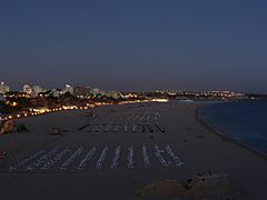
Portimão at night
-
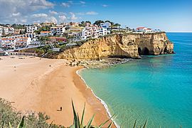
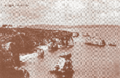
Partial view of Carvoeiro
-
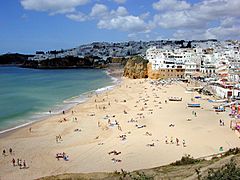
A beach in Albufeira
-
Vila Real de Santo António
-
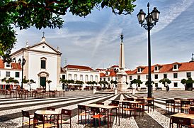
Municipal market of Loulé
-
Silves Cathedral


_(5469253558).jpg)


Images for kids
-
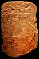
Conii script, 8th century BC.
-
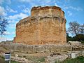
The Roman temple of Milreu in Estói
-
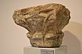
A Visigothic capital found in Silves
-
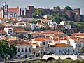
The city of Silves, the first capital of the Algarve and an example of the noticeable Moorish influence in the region
-
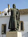
Statue of King Afonso III of Portugal in Faro, Algarve, Portugal
-
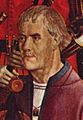
Portrait of Henry the Navigator who based himself near Lagos, in the Algarve, and conducted various maritime expeditions.
-
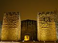
The walls of the ancient town of Lagos which was severely destroyed during the 1755 earthquake
-
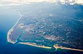
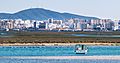
Aerial view of Ria Formosa
-
In the summer, droughts and very high temperature spells in the interior Algarve often result in wildfires
-
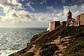
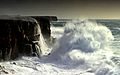
Cape St. Vincent, Europe's southwesternmost point, has a dry and very moderate climate (temperatures usually vary between 13 and 19 °C (55 and 66 °F) throughout the year)
-
A partial view of Portimão, the second largest city of the Algarve
-
A view of Odeceixe, in the northwestern Algarve
-
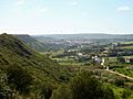
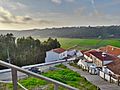
The interior of the Algarve consists of small villages and is sparsely inhabited.
-
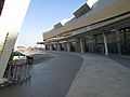
Faro International Airport.
-
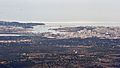
A panoramic view of Faro, the capital of the Algarve
-
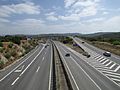
A22 motorway near Albufeira, Algarve, Portugal.
-
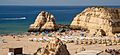
Praia da Rocha, Portimão, one of many sites that attract tourists
-
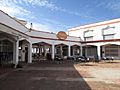
The Saffron Indian restaurant in the shopping arcade located in the neighborhood of Cerro Grande, Albufeira, Algarve, Portugal.
-
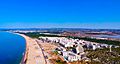
Aerial view of Monte Gordo, in the Algarve, Portugal.
-
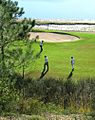
The Algarve features some of Europe's top golf courses.
-

A view of Vilamoura, its marina and hotels.
-
Postcard of the early 20th century with a photograph of the Costa de Oiro (Golden Coast) near the city of Lagos, Algarve, in southern Portugal. In the center is the Dona Ana Beach, and the building on the left is the Convento da Trindade (Trinitarian Convent).
-
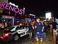
Scotland fans dancing on Francisco Sá Carneiro Avenue (The Strip) in Albufeira after the Gibraltar vs. Scotland UEFA Euro 2016 qualifying game played at Estádio Algarve.
-
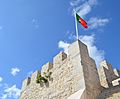
A view of the Castle of Loulé with the Portuguese flag.
-
Typical architecture of the Algarve: ornate chimneys and platibandas are unique in their designs and first appeared in the 19th century.
-
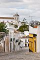
A central street in Tavira, Portugal.
-
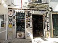
Algarve ceramic and pottery shop in Lagos.
-
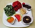
Typical sweets of the Algarve: Dom Rodrigo, doces de amêndoa (marzipan sweets) and fig paste sweets.
-
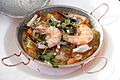
Seafood Cataplana at World Heritage Cuisine Summit & Food Festival 2018: the cataplana is a Portuguese method of cooking, item of cookware used for cooking a wide variety of ingredients and typical dish from the Algarve.
-
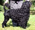
Portuguese Water Dogs are native to the Algarve; they were the fisherman's main companion and often accompanied sailors during the Portuguese discoveries.
-
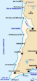
Map of the land area of the Southwest Alentejo and Vicentine Coast Natural Park in the southwest corner of Portugal. This Portuguese natural park covers territory of coastal Algarve from Burgau to Odeceixe.
-
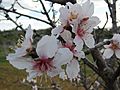
Almond blossom (Prunus dulcis) in Algarve, Portugal.
-
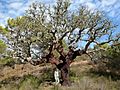
Quercus suber in Algarve.
-
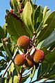
Arbutus unedo (strawberry tree) fruits in Algarve.
-
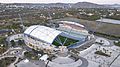
The 30,000-seat Algarve Stadium (Estádio Algarve) was built as a venue for UEFA Euro 2004.
-
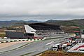
Algarve International Circuit holds since 2020 the Formula One
-

Aníbal Cavaco Silva, Prime Minister and President of Portugal.
-
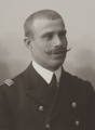
José Mendes Cabeçadas, Portuguese Navy officer, revolutionary and politician.
-
Laura Ayres, virologist.
-
Maria Keil, visual artist.
-
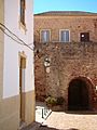
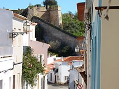
A street in Silves
-
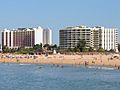
Marina beach in Vilamoura
-
Typical view of the Algarve coast
-
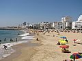
Beach in Quarteira
-
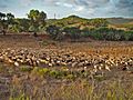
Shepherd and sheep near Lagos
-
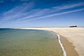
Desert island near Faro
-
Sagres Point, in the extreme of continental Portugal
-
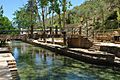
The bog fountain in Alte
-
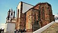
Silves Cathedral
-
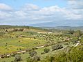
The open fields of the Algarve in spring
-
The spa resort town of Caldas de Monchique


.jpg)

.jpg)

_julesvernex2.jpg)

,_by_Klugschnacker_in_Wikipedia_(20).JPG)


.JPG)

.JPG)


.JPG)


.jpg)


_-_20.jpg)


.jpg)

,_by_Klugschnacker_in_Wikipedia_(25).JPG)
.jpg)
_-_Photographia_Allem%C3%A3,_crop.png)


.jpg)


See also
 In Spanish: Algarve para niños
