Barton, Oxfordshire facts for kids
Quick facts for kids Barton |
|
|---|---|
| Housing estate | |
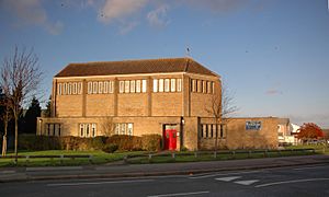
 St Mary's parish church in Bayswater Road |
|
| Population | 7,300 (2021 Census) |
| OS grid reference | SP555078 |
| Civil parish |
|
| District | |
| Shire county | |
| Region | |
| Country | England |
| Sovereign state | United Kingdom |
| Post town | Oxford |
| Postcode district | OX3 |
| Dialling code | 01865 |
| Police | Thames Valley |
| Fire | Oxfordshire |
| Ambulance | South Central |
| EU Parliament | South East England |
| UK Parliament |
|
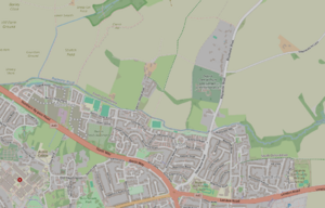
Barton is a village and suburb located in Oxford, Oxfordshire, England. It sits about 3 miles east of Oxford's city centre, just outside the main Oxford Ring Road. Barton is close to other areas like Headington, Risinghurst, and Marston. Even though it's now its own place, Barton used to be considered part of the Headington area a long time ago.
The Oxford City Council built the Barton housing estate in the 1930s. This was done because there weren't enough houses for everyone. Today, a good number of homes in Barton are socially rented houses. This means they are rented at lower costs to help people find affordable places to live.
When people say "Barton," they might mean just the housing estate. But often, they are talking about the estate and the areas around it, especially north of the ring road. These include Barton Park to the west and Sandhills to the east. These areas together form the Barton and Sandhills electoral ward. Some other nearby places like Wick Farm and Bayswater Farm Mobile Home Park are also sometimes included when people refer to the Barton area.
Barton gets its mail from the East Oxford Royal Mail office. Even though Barton is separate from Headington, some addresses in Barton still use "Headington" as part of their postal address. This is a leftover from when Barton was historically part of the Headington area.
Contents
A Look Back: Barton's History
Early Times and Roman Connections
A very old Roman road used to run right through Barton. This road connected two Roman towns: Dorchester-on-Thames and Alchester. People have found signs of Roman life here. For example, a Roman villa (a large Roman house) was located northwest of Barton in the 3rd and 4th centuries. In the 1940s, sixteen Roman coins were discovered near Barton. Later, in 1953, three Romano-British pots were found in the Bayswater Brook.
The name "Barton" comes from Old English and means "barley farm." In the past, it was known by names like Aldebarton or Oldebarton. Another local place, Wick Farm, also has an Old English name meaning "dairy farm." The Bayswater Brook was once called Edenebroke or Hedena's Brook.
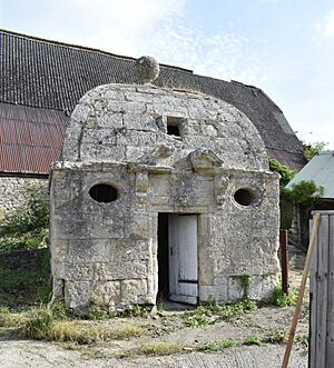
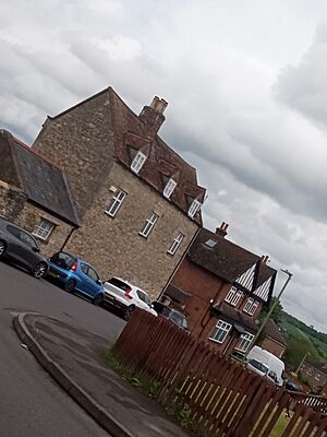
Wick Farm has been around since at least the 13th century. Today, it has several listed buildings, which are special buildings protected for their history. On Bayswater Road, you can find Bayswater Mill. This building was once an 18th-century limestone watermill and windmill. It has now been changed into a house. Barton Manor is another 17th century listed building. It's made of special Cotswold stone. It used to be a pub from the 1860s to the 1980s.
The Oxford Crematorium, which is north of Barton, opened in 1939. It is the burial place of William Morris, a famous car maker. St. Mary's Church was built in 1958. It took over from St. Andrew's Church in Headington as the main local church.
How Barton Grew
The land where Barton was built slopes upwards and faces north. Because of this, people didn't think it was good for building houses. However, in the 1930s, there was a big shortage of homes in Oxford. So, Oxford City Council bought the land from Magdalen College. In 1937, there were 54 council houses in Barton. By 1977, this number had grown to 1,600. The last council houses were built in the late 1980s.
Barton's first community centre was built in 1949. It was later replaced by the Barton Neighbourhood Centre. This new centre is a hub for community activities. It has a café, a youth club, and a library. The Barton Community Association, which started in 1946, runs the centre.
The Bayswater Brook flows west from Forest Hill. It eventually joins the River Cherwell in Cutteslowe. Since 1975, this brook has marked the boundary between the City of Oxford and the Oxford Green Belt.
New Developments: Barton Park and Bayswater
Almost 900 new homes are being built at Barton Park. These homes are expected to be finished by 2027. Christ Church, a college in Oxford, has also asked for permission to build even more homes. They plan to build 1,450 homes north of the Bayswater Brook. This new area would also include a new primary school and nursery.
Barton Park Pavilion is a sports facility. It is home to local football teams like Headington Amateurs F.C. and Barton United F.C. The pavilion also has a bar and a playground for kids.
Fun Things to Do in Barton
Local Facilities and Schools
The Barton Leisure Centre is on Waynflete Road. It has a swimming pool and a gym where you can stay active. Barton has four schools for children. These include Bayards Hill Primary School, Barton Park Primary School, and Sandhills Community Primary School. The last two are part of the River Learning Trust. There is also Endeavour Academy, which is a special needs school.
Rectory Farm started in 1954. It owns land around Barton. Since 1980, it has run a pick-your-own farm north of Barton. Here, you can pick your own berries in the summer. In the autumn, you can pick sweetcorn and pumpkins.
In the middle of the estate, at Underhill Circus, you'll find a community centre. There's also a chippy for food, a corner shop for groceries, a graffiti wall for art, and a pharmacy for medicines. Barton also has two small nature reserves, allotments for gardening, and a pond.
Getting Around: Buses
Barton is well connected by bus. The Oxford Bus Company and Stagecoach run route 8. This bus links Barton to Oxford, going through Headington. The Oxford Bus Company's route X3 connects Barton to Abingdon. This route passes by the John Radcliffe Hospital. Route 108 goes to Bicester via Beckley. Stagecoach route H5 also links Barton to Bicester, but it goes through Islip.


