
Beaver River (Canada) facts for kids
Quick facts for kids Beaver River |
|
|---|---|

The Beaver south of Lac La Biche, Alberta
|
|

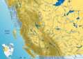
Location of the mouth in Saskatchewan
|
|
| Other name(s) | Rivière Castor (French), Amiskwasîpi (Cree) |
| Country | Canada |
| Provinces | |
| Physical characteristics | |
| Main source | Beaver Lake Lac La Biche County, Alberta 618 m (2,028 ft) 54°43′40″N 111°54′04″W / 54.72778°N 111.90111°W |
| River mouth | Lac Île-à-la-Crosse Division 18, Saskatchewan 421 m (1,381 ft) 55°25′51″N 107°45′35″W / 55.43083°N 107.75972°W |
| Length | 491 km (305 mi) |
| Basin features | |
| River system | Churchill River drainage basin |
The Beaver River is a big river in Canada. It flows through the provinces of Alberta and Saskatchewan. The river starts in Alberta and flows east. Then, it turns sharply north. It eventually flows into Lac Île-à-la-Crosse. This lake is part of the Churchill River system. The Churchill River then flows into Hudson Bay.
The Beaver River is about 491 kilometers (305 miles) long. It collects water from an area of 14,500 square kilometers (5,600 square miles) in Alberta. This area includes a system of lakes in Lac La Biche County. People first wrote about the Beaver River on a map in 1790.
Contents
Where Does the Beaver River Flow?
The Beaver River is part of the larger Churchill River system. Its basin is located east of the Athabasca River basin. It is also north of the North Saskatchewan River basin.
The river starts at Beaver Lake (Alberta). This lake is just south of Lac la Biche (Alberta). The river flows out of Beaver Lake to the west. Then it turns south. It gets water from the Amisk River and the outflow of Moose Lake (Alberta).
The Beaver River crosses into Saskatchewan near Cold Lake (Alberta). The Waterhen River (Saskatchewan) flows nearby. In Saskatchewan, the Beaver River gets water from Minnistikwan Lake. It also gets water from Meadow Lake, Saskatchewan.
After a big bend, the river flows north. This part of the river goes through a boreal forest. Saskatchewan Highway 155 follows the river's west bank. The river receives water from Cowan Lake (Saskatchewan) and Deleronde Lake. It also gets water from the Waterhen River and the Doré River, which drains Doré Lake. Near Beauval, Saskatchewan, it receives water from Lac la Plonge. Finally, the Beaver River flows into Lac Île-à-la-Crosse.
Rivers Joining the Beaver River
Many smaller rivers and creeks flow into the Beaver River. These are called tributaries.
- In Alberta:
- Amisk River (from the west)
- Sand River (Alberta) (from the north)
- Mooselake River (from the south)
- Manatokan Creek (from the north)
- Jackfish Creek (from the north)
- Marie Creek (from the north)
- In Saskatchewan:
- Makwa River (from the southwest)
- Meadow River (from the south)
- Outlet of Green Lake (at the great bend)
- Waterhen River (Saskatchewan) (from the west)
- Doré River (from the east)
- Outlet of Lac la Plonge (from the east)
Other smaller streams include Fork Creek, Columbine Creek, and Redspring Creek.
History and Fur Trade

The Beaver River was important for the fur trade long ago. However, it was not always easy to travel on. People often had to drag their canoes over shallow parts. There wasn't much wild game to hunt for food.
The mouth of the Beaver River was a key spot on the main fur trade routes. The upper part of the Beaver River is about 50 miles (80 km) north of the North Saskatchewan River. From at least 1795, pemmican (a food made from dried meat) was brought north. This food fed the voyageurs, who were travelers on their way to the Athabasca Country.
One route went south from the Beaver River to Green Lake, Saskatchewan. From there, an old Indigenous trail led to Fort Carlton. Later, in 1875–76, a cart road replaced this trail. Another route went further up the Beaver River to Moose Lake.
The first European to reach the Beaver River might have been Louis Primeau in 1767. Around 1768, William Pink explored the river. In 1776, a trading post was built on Lac Île-à-la-Crosse. In 1781, traders built Cold Lake House near Beaver Crossing, Alberta.
In 1798, David Thompson used the Beaver River to reach Lac La Biche. In 1799, the Hudson's Bay Company built rival trading posts on Lac Île-à-la-Crosse and Green Lake. They also built a post near Meadow Lake, Saskatchewan, but it only lasted two years. There was a lot of competition between the trading companies until they joined together in 1821.
Fish in the River
The Beaver River is home to many different kinds of fish. Some of the fish you might find there include:
- Walleye
- Sauger
- Yellow perch
- Northern pike
- Lake trout
- Lake whitefish
- Cisco
- White sucker
- Longnose sucker
- Burbot
Images for kids
-
Western Canada rivers

See also
 In Spanish: Río Beaver (Canadá) para niños
