Cacapon River facts for kids
Quick facts for kids Cacapon River |
|
|---|---|
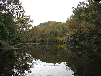
The Cacapon River looking south from the Cacapon River Rt 127 Bridge Public Access Site
|
|
|
Location of the mouth of the Cacapon River in West Virginia
|
|
| Country | United States |
| State | West Virginia |
| Counties | Hampshire, Hardy, Morgan |
| Physical characteristics | |
| Main source | Lost River Wardensville, Hardy County 39°04′52″N 78°38′10″W / 39.08111°N 78.63611°W |
| River mouth | Potomac River Great Cacapon, Morgan County 39°37′13″N 78°16′58″W / 39.62028°N 78.28278°W |
| Length | 81.0 mi (130.4 km) |
| Basin features | |
| Basin size | 680 sq mi (1,800 km2) |
The Cacapon River is a beautiful river in West Virginia. Its name means "Medicine Waters" in the Shawnee language. This river is about 81.0-mile-long (130.4 km). It's famous for fishing, boating, and its amazing scenery.
The Cacapon River is part of the larger Potomac River system. It's even recognized as an American Heritage River. This means it's special for its natural, cultural, and historical value.
The river's water comes from a huge area called a watershed. This watershed covers 680 square miles (1,800 km2). It includes smaller rivers like the Lost River and the North River. All these waters eventually flow into the Chesapeake Bay.
People are working to protect the Cacapon River. Groups like the Cacapon Institute help keep the river clean and healthy. They work to stop pollution from new buildings and farms.
Contents
The Cacapon River's Journey
From Hidden Springs to Hampshire County
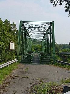
The Cacapon River starts in a cool way! It actually comes out from underground. This happens near Wardensville. It's really the Lost River reappearing after flowing through an underground channel.
From there, the river makes a big horseshoe shape. It flows east, then turns northeast. It winds through wide, open valleys. Many smaller streams join it along the way. These include Trout Run and Waites Run. Soon, the Cacapon River crosses into Hampshire County.
Through Hampshire County to Yellow Spring
As the river enters Hampshire County, it flows between mountains. The George Washington National Forest is on one side. Baker Mountain is on the other. You can even see parts of an old railroad track here.
The river keeps winding northeast. It passes small communities like Intermont. At Capon Lake, another stream called Capon Springs Run joins it. This spot is also home to the historic Capon Lake Whipple Truss Bridge. The river then flows past Yellow Spring.
From Yellow Spring to Kale Hollow
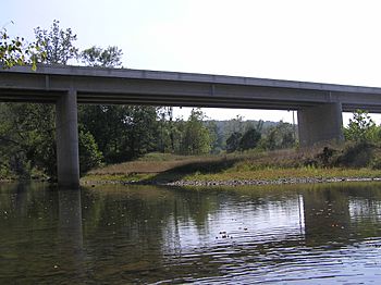
The Cacapon River continues north. It flows alongside Cacapon Mountain. You'll see fun places like Camps Rim Rock and White Mountain. The river makes another huge bend here.
It then passes through Hooks Mills and Bubbling Spring. Many people have summer camps along this part of the river. You can also spot old plantation houses, like the Captain David Pugh House.
From Kale Hollow to Cold Stream
North of Kale Hollow, the river flows near Dillons Mountain. An old church from the 1700s, Capon Chapel, is nearby. The Cacapon River then goes through the small town of Capon Bridge.
Here, Dillons Run joins the river. A bridge carrying U.S. Route 50 crosses the river here. This bridge is how Capon Bridge got its name! The river then meets Edwards Run and Cold Stream.
From Cold Stream to Largent
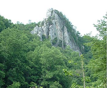
The river winds north through a very wild and forested area. There aren't many buildings here. You can see cool rock formations like Caudy's Castle on Castle Mountain.
Near Forks of Cacapon, West Virginia Route 127 crosses the river. This is also where the Cacapon River meets its largest helper, the North River. From Forks of Cacapon to Largent, the river makes many more bends. It flows between Sideling Hill and Little Mountain.
From Largent to Great Cacapon
The Cacapon River enters Morgan County at Largent. Here, West Virginia Route 9 crosses the river. The river continues to wind its way northeast. It flows between Sideling Hill and Little Mountain.
Finally, the Cacapon River reaches the town of Great Cacapon. After passing under a few more bridges, the Cacapon River joins the mighty Potomac.
River Names and Meanings
The name "Cacapon" comes from the Shawnee language. It means "medicine water." This suggests the river was important for healing or had special properties.
The official name, "Cacapon River," was decided in 1916. But over time, people used many different names for it. Here are some of them:
- Big Capon River
- Cacapehon Creek
- Cacapehon River
- Cacapon Creek
- Cacapon River
- Cackapehon River
- Cackapohon River
- Capcappin Creek
- Cape Capon River
- Capecapon River
- Capon River
- Great Cacapehon River
- Great Cacapon River
- Great Capon River
Bridges Across the Cacapon
Many bridges help people cross the Cacapon River. Here are some of the main ones:
| Bridge Name | Road or Railway | Location |
|---|---|---|
| Wardensville Bridge | State Route 259 (WV 259) | Wardensville |
| New Capon Lake Bridge | Capon Springs Road (CR 16) | Capon Lake |
| Whipple Truss Bridge | Pedestrian Walkway | Capon Lake |
| Kenneth Seldon Bridge | State Route 259 (WV 259) | Yellow Spring |
| Army Corporal Rex Marcel Sherman Memorial Bridge | Northwestern Turnpike (US 50) | Capon Bridge |
| Cacapon River Bridge | Bloomery Pike (WV 127) | Forks of Cacapon |
| Largent Bridge | Cacapon Road (WV 9) | Largent |
| Fisher's Bridge | Cacapon Road (WV 9) | North of Largent |
| Rockford Bridge | Rockford Road (CR 7) | Great Cacapon |
| Powerhouse Bridge | Powerhouse Road (CR 9/12) | Great Cacapon |
| Great Cacapon Bridge | Cacapon Road (WV 9) | Great Cacapon |
| Great Cacapon Railroad Bridge | Baltimore & Ohio Railroad | Great Cacapon |
Fun Float Trips
The Cacapon River is a great place for floating! You can go canoeing or kayaking. The West Virginia Division of Natural Resources has special public access spots. These spots are listed from south to north.
| Start Point | End Point | Distance |
|---|---|---|
| Wardensville Bridge | Capon Lake Bridge | 8.5 miles (13.7 km) |
| Capon Lake Bridge | Cold Stream | 19 miles (31 km) |
| Cold Stream | WV Route 127 Bridge | 7 miles (11 km) |
| WV Route 127 Bridge | Cacapon Crossings | 9 miles (14 km) |
| Cacapon Crossings | Largent, South | 6.7 miles (10.8 km) |
| Largent, South | Power Plant | 20 miles (32 km) |
| Power Plant | Great Cacapon WV Route 9 Bridge | 1.8 miles (2.9 km) |
Streams Joining the Cacapon
Many smaller streams flow into the Cacapon River. These are called tributaries. They are listed from south to north. The most important ones are in bold.
- Lost River
- Trout Run
- Waites Run
- Slate Rock Run
- Moores Run
- Sine Run
- Harness Run
- Hawk Run
- Capon Springs Run
- Himmelwright Run
- Dry Run
- Yellow Spring Run
- Falling Run
- Loman Branch
- Crooked Run
- Old Man Run
- Kale Hollow Run
- Mill Branch
- Dillons Run
- Gunbarrel Hollow Run
- Parks Hollow Run
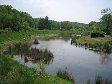
- Edwards Run and Edwards Run Lake
- Cold Stream
- Frog Hollow Run
- Bloomery Run
- Ivy Run
- North River
- Grassy Lick Run
- Tearcoat Creek
- Bearwallow Creek
- Bowers Run
- Wolf Hollow Run
- Critton Run
- Falling Spring Run
- Stony Creek
- Constant Run
- Whisners Run
- Connor Hollow Run
Towns Along the River
Many towns and communities are located along the Cacapon River. They are listed here:
- Bubbling Spring
- Capon Bridge
- Capon Lake
- Cold Stream
- Davis Ford
- Forks of Cacapon
- Great Cacapon
- Hooks Mills
- Intermont
- Largent
- Wardensville
- Yellow Spring
 | Precious Adams |
 | Lauren Anderson |
 | Janet Collins |


