
California Historical Landmarks in Kern County facts for kids
California is full of amazing historical places, and Kern County has many of them! These special spots are called California Historical Landmarks. They help us remember important events, people, and places that shaped California's past.
Imagine stepping back in time to learn about brave explorers, busy gold miners, and the start of California's oil industry. Each landmark tells a unique story about how people lived, worked, and traveled long ago.
Contents
Exploring Kern County's History
Kern County is a big place with a rich history. From the dry Mojave Desert to the green San Joaquin Valley, many important events happened here. Let's discover some of these cool landmarks!
Famous Explorers and Early Travelers
Long ago, before cars and highways, people traveled by foot, horse, or wagon. Some landmarks mark the paths of early explorers and important travel routes.
The Path of Padre Garcés

Padre Francisco Garcés was a Spanish explorer and missionary. He was one of the first Europeans to travel through this area in the 1770s. Several landmarks in Kern County remember his journeys:
- Garcés Baptismal Site (Landmark 631): This spot near Woody is where Padre Garcés held a special ceremony, baptizing Native Americans he met on his travels.
- Garcés Circle (Landmark 277): In Bakersfield, this circle honors Padre Garcés and his important role in exploring the region.
- Place where Francisco Garcés crossed the Kern River (Landmark 278): Near Bakersfield, this landmark shows where Garcés crossed the Kern River during his explorations.
- Outermost point in the South San Joaquin Valley visited by Padre Garcés in 1776 (Landmark 371): Located in Arvin, this marks the farthest point Garcés reached in the southern San Joaquin Valley.
Jedediah Smith Trail

Jedediah Smith was an American fur trapper and explorer. He was one of the first Americans to travel overland to California in the 1820s.
- Point on the Jedediah Smith Trail (Landmark 660): Near Edison, this landmark marks a spot along the trail Smith used. Imagine how tough it must have been to travel through unknown lands!
Edward M. Kern's Campsite

Edward M. Kern was a topographer, meaning he mapped the land. He was part of an expedition in 1845. Kern County is actually named after him!
- Campsite of Edward M. Kern (Landmark 742): This site near Lake Isabella marks where Kern and his group camped. His maps helped future settlers understand the area.
Historic Passes and Crossings
Travelers often used natural passes through mountains.
- Oak Creek Pass (Landmark 97): Near Tehachapi, this pass was an important route for early travelers.
- Walker's Pass (Landmark 99): Located near Onyx, this pass was discovered by explorer Joseph R. Walker in 1834. It was a key route through the Sierra Nevada mountains.
- Top of Grapevine Pass where Don Pedro Fages passed in 1772 (Landmark 283): This spot near Lebec marks where another early Spanish explorer, Don Pedro Fages, traveled.
Gold, Oil, and Industry
Kern County played a huge role in California's history of natural resources, especially with gold and oil.
Gold Mining Towns

- Havilah (Landmark 100): This town near Caliente was once the county seat of Kern County during the gold rush era. It was a bustling center for miners and settlers.
- Keysville (Landmark 98): Near Lake Isabella, Keysville was one of the earliest gold mining towns in Kern County, founded in 1853.
- Site of the town of Garlock (Landmark 671): Near Randsburg, Garlock was a supply town for the nearby mining districts. It was a busy place during the late 1800s gold and silver rushes.
- Rand Mining District (Landmark 938): Also near Randsburg, this district was famous for its gold and silver mines, especially the Yellow Aster Mine. It was a very important mining area in the late 19th century.
The Rise of Oil

Kern County is famous for its oil fields. These landmarks show how important oil became to the region.
- Discovery well of Kern River Oilfield (Landmark 290): Located in Bakersfield, this is the site of the first successful oil well in the huge Kern River Oilfield, discovered in 1899.
- California Standard Oil Well 1 (Landmark 376): In McKittrick, this marks the first oil well drilled by the Standard Oil Company in California.
- Buena Vista Refinery (Landmark 504): Also near McKittrick, this was an early oil refinery, processing the crude oil from the nearby fields.
- McKittrick Brea Pit (Landmark 498): These natural asphalt seeps near McKittrick have been around for thousands of years. Animals would get stuck in the sticky tar, and their fossils are found here, similar to the La Brea Tar Pits in Los Angeles.
- Lakeview Gusher (Landmark 485): Near Maricopa, this was the largest accidental oil spill in U.S. history! In 1910, an oil well erupted and flowed for 18 months, creating a massive "gusher" of oil.
- Well 2-6 (Landmark 581): In Fellows, this was another significant oil well in the Midway-Sunset Oil Field, one of the largest oil fields in the United States.
Borax Mining

Borax is a mineral used in many products, from cleaning supplies to cosmetics.
- 20 Mule Team Borax Terminus (Landmark 652): In Mojave, this was the end point for the famous "20 Mule Teams" that hauled borax out of Death Valley in the late 1800s. It was a tough journey!
Important Settlements and Stops
Many landmarks mark the locations of early towns, forts, and stagecoach stops that were vital for settlers and travelers.
Fort Tejon

- Fort Tejon (Landmark 129): Located near Lebec, this historic fort was established by the U.S. Army in 1854. It protected settlers and kept peace with Native American tribes. It was also a stop for the Butterfield Overland Mail stagecoach line. Today, it's a State Historic Park where you can learn about life at the fort.
Stagecoach Stops
The Butterfield Overland Mail was a famous stagecoach service that carried mail and passengers across the country in the 1850s.
- Kern River Slough Station (Landmark 588): Near Lamont, this was a stop on the Butterfield Overland Mail route.
- Mountain House (Landmark 589): Near Woody, this was another important stagecoach stop, providing fresh horses and a place for travelers to rest.
- Posey Creek Station of Butterfield Overland Mail Lines (Landmark 539): In Bakersfield, this was another stop on the famous Butterfield route.
- Rose Station (Landmark 300): Near Lebec, this was a well-known stagecoach station and a popular resting spot for travelers.
Early Towns and Settlements
- Caliente (Landmark 757): This town was an important railroad stop and a gateway to the Kern River Canyon.
- Indian Wells (Landmark 457): Near Inyokern, this was a vital watering hole for travelers crossing the desert.
- Kernville (Landmark 132): The original town of Kernville was flooded when Lake Isabella was created. This landmark marks the site of the old town, which was a mining and logging center.
- Old Town (Tehachapi) (Landmark 643): This marks the original site of Tehachapi, before the town moved to its current location.
- Willow Springs (Landmark 130): Near Rosamond, this was an important watering spot and stagecoach stop in the desert.
Unique and Interesting Landmarks
Some landmarks stand out for their unique stories or features.
The Buttonwillow Tree

- Buttonwillow Tree (Landmark 492): In Buttonwillow, this ancient California sycamore tree was a famous landmark for travelers for hundreds of years. It was a meeting place and a guidepost in the vast San Joaquin Valley.
The Tehachapi Loop

- Tehachapi Loop (Landmark 508): Near Tehachapi, this is an amazing engineering marvel! It's a spiral railroad track that helps trains climb a steep mountain. Trains actually pass over themselves as they go around the loop. It's a very popular spot for train enthusiasts.
The Gossamer Condor Flight Site
.jpg)
- Site of the flight of the Gossamer Condor (Landmark 923): At Shafter Airport in Shafter, this is where the Gossamer Condor made the first successful human-powered flight in 1977. It was a huge step forward in aviation history!
Shafter Cotton Research Station

- Shafter Cotton Research Station (Landmark 1022): In Shafter, this station has been important for developing new types of cotton and improving farming methods in California.
People of Kern County
Some landmarks honor important individuals who helped build Kern County.
Colonel Thomas Baker Memorial

- Colonel Thomas Baker Memorial (Landmark 382): Located at Bakersfield City Hall, this memorial honors Colonel Thomas Baker, who is considered the founder of Bakersfield. He helped plan and develop the city.
Alexis Godey and Elisha Stevens
- Site of the last home of Alexis Godey (Landmark 690): In Bakersfield, this marks the home of Alexis Godey, a mountain man and explorer who was a companion of John C. Frémont.
- Site of the home of Elisha Stevens (Landmark 732): Also in Bakersfield, this marks the home of Elisha Stevens, a pioneer who led one of the first wagon trains to California.
These California Historical Landmarks in Kern County offer a fascinating look into the past. They remind us of the challenges and triumphs of the people who came before us, shaping the land and communities we know today.
Images for kids
-
Bealville, a historic community.
-
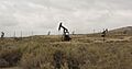
The Buena Vista Oil Field.
-
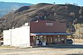
The post office in Caliente.
-
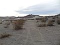
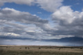
The Mojave Desert near Desert Spring.
-
An image related to the Fages-Zalvidea Crossing.
-
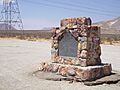
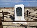
The monument at Freeman Junction.
-
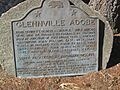
The Glennville Adobe historical marker.
-
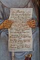
A drawing related to the Butterfield Overland Mail.
-
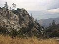
The Greenhorn Mountains near Keysville.
-
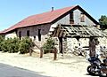
A ranch near the Sinks of Tejon.
-
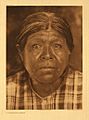
An image related to the Tulamniu Indian Site.
-
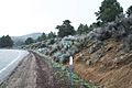
State Route 178 at 5000 feet elevation near Walker Pass.
-
The Midway Field Well 2-6, an early oil gusher.
-
Willow Springs, a historic desert stop.


.jpg)
