Cane Creek Mountains facts for kids
Quick facts for kids Cane Creek Mountains |
|
|---|---|
| Bass Mountains | |

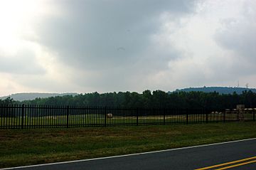
Bass Mountain (Left) and Cane Creek Mountain (Right), 2 of the highest peaks in the range.
|
|
| Highest point | |
| Peak | Cane Creek Mountain |
| Elevation | 301 m (988 ft) |
| Dimensions | |
| Length | 21.17 km (13.15 mi) SW |
| Width | 8.91 km (5.54 mi) SE |
| Geography | |

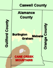
Location of Cane Creek Mountains in Alamance County in North Carolina
|
|
| Country | United States |
| State | North Carolina |
| Region | Alamance County |
| Geology | |
| Orogeny | Alleghenian orogeny |
The Cane Creek Mountains are a small mountain range in North Carolina, located south of Burlington, North Carolina. They stretch across parts of Alamance, Guilford, Randolph, and Chatham counties. These mountains might not be as tall as the Rockies, but they have a fascinating history and geology!
Contents
How Were the Cane Creek Mountains Formed?
The Cane Creek Mountains are part of the rolling hills you see in North Carolina's Piedmont region. They look similar to nearby ranges like the Caraway Mountains and Uwharrie Mountains.
Ancient Mountain Building: The Alleghenian Orogeny
Scientists believe the Cane Creek Mountains were once part of a much larger coastal mountain range. This ancient range, which included the Uwharries, formed about 300 to 350 million years ago. This happened during a huge event called the Alleghenian or Appalachian orogeny. It was a time when the supercontinent Pangaea was forming and breaking apart.
Back then, these mountains might have been incredibly tall, possibly over 20,000 feet (6,096 meters) high! That's as tall as some of the highest peaks in the Himalayas or the Andes today. However, over millions of years, erosion has worn them down. The tallest parts of this old range are now found in the Appalachian Mountains in North America and the Anti-Atlas Mountains in Morocco, Africa. The Cane Creek Mountains are what's left of this once-giant mountain chain.
What is the Geology of the Cane Creek Mountains?
The Cane Creek Mountains sit in an area called the Carolina Slate Belt. This belt is made of rocks that were once volcanic and sedimentary but have been heated and changed over time.
Gold Mining History in North Carolina
The Carolina Slate Belt is famous for its old, abandoned gold mines. For 50 years, from 1799 to 1849, North Carolina was the top gold-producing state in the U.S. This started when a huge 17-pound (7.7 kg) gold nugget was found at the Reed Gold Mine near Charlotte. This was before the big California Gold Rush of 1849!
Today, there's still some gold mining, but it's not as common. Instead, companies in the area mostly dig for crushed stone. This stone is used to build roads. They also mine for a mineral called pyrophyllite, which is used in factories for things like ceramics, paint, and even bug sprays.
Where are the Cane Creek Mountains Located?
The Cane Creek Mountains start near Graham, about 4 miles (6.4 km) south of Interstate 40. They begin on the south side of Great Alamance Creek. From there, they stretch southwest towards Liberty in Randolph County.
Highest Peaks in the Range
The range covers a large part of southwestern Alamance County. While many parts are rolling hills, there are several distinct peaks near Snow Camp. The highest point in the entire range, and in Alamance County, is Cane Creek Mountain itself. It stands about 987 feet (301 meters) tall.
Another well-known peak is Bass Mountain, which is about 902 feet (267 meters) high. Bass Mountain used to be famous for hosting an annual bluegrass music festival. Even though some people call the whole area the "Bass Mountains," Bass Mountain is not the highest peak.
What is the History of the Cane Creek Mountains?
The Cane Creek Mountains and Alamance County were once home to local Native American tribes, including the Sissipahaw.
Revolutionary War Events
This area was very important during the American Colonial and Revolutionary periods. Several battles took place in or near the mountains. These included Pyle's Massacre and the Battle of Alamance. Local historians think that small military groups might have used cave sites in the mountains to protect themselves during these times.
How are the Cane Creek Mountains Used Today?
Today, the Cane Creek Mountains are home to many families and farms. You'll also see television, radio, and cellular communication towers on the peaks. There's even an old fire tower on top of Cane Creek Mountain, but it's no longer safe to use.
Other Mountains Nearby
North Carolina's Piedmont region has several other small mountain ranges and unique hills called monadnocks. These include:
- Stony Creek Mountain – A monadnock in northern Alamance County, rising to 938 feet (288 meters).
- Caraway Mountains – A small range located southwest in Randolph County.
- Uwharrie Mountains – A larger range of mountains found southwest of the Cane Creeks, spanning four counties.
- Occoneechee Mountain – A monadnock near the Eno River in Orange County, to the east.
 | Kyle Baker |
 | Joseph Yoakum |
 | Laura Wheeler Waring |
 | Henry Ossawa Tanner |

