Cedartown, Georgia facts for kids
Quick facts for kids
Cedartown, Georgia
|
|
|---|---|
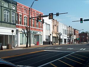
Cedartown Commercial Historic District in 2007
|
|
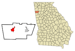
Location in Polk County in the state of Georgia
|
|
| Country | United States |
| State | Georgia |
| County | Polk |
| Government | |
| • Type | City Commission |
| Area | |
| • Total | 9.16 sq mi (23.72 km2) |
| • Land | 9.13 sq mi (23.65 km2) |
| • Water | 0.03 sq mi (0.08 km2) |
| Elevation | 840 ft (260 m) |
| Population
(2020)
|
|
| • Total | 10,190 |
| • Density | 1,116.22/sq mi (430.96/km2) |
| Time zone | UTC-5 (Eastern (EST)) |
| • Summer (DST) | UTC-4 (EDT) |
| ZIP code |
30125
|
| Area code(s) | 770/678/470/943 |
| FIPS code | 13-14500 |
| GNIS feature ID | 0312503 |
| Website | Cedartown, Georgia |
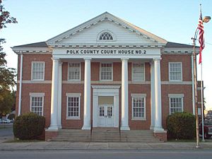
Cedartown is a city in Polk County, Georgia, United States. It is also the county seat, which means it is the main city where the county government is located. In 2020, about 10,190 people lived there. Cedartown is the main city in its own "micropolitan area," which is a smaller urban area. It is also part of the larger Metro Atlanta region.
Several historic areas in Cedartown are listed on the National Register of Historic Places. These include the Cedartown Commercial Historic District, the Cedartown Waterworks-Woman's Building-Big Spring Park Historic District, and others.
Contents
History of Cedartown
The area where Cedartown is now was first home to Cherokee and Creek Native American tribes. The Cherokee people had a village here in the 1830s. The town got its name from the many red cedar trees in the area.
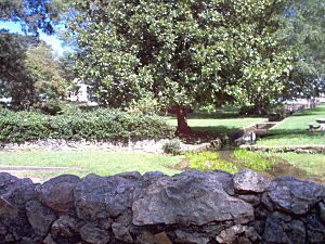
A local story says that the rights to Big Spring were won for white settlers by a local boy in a footrace against a Cherokee youth. Other versions of the story say the Cherokee people won the spring from the Creek people in a ball game. The settlement was officially named "Cedar Town" in 1852.
During the Civil War, most people left Cedar Town. In 1865, Union soldiers burned the city down, leaving only one mill standing.
In 1867, the state of Georgia officially re-established the town as Cedartown. New businesses, like fabric mills and iron works, helped the economy grow. Before this, the economy was mostly based on cotton.
In the early 1900s, railroad services for both goods and passengers came to Cedartown. Main Street became part of U.S. Route 27, a major road connecting Cedartown to bigger cities like Chattanooga, Tennessee and Columbus, Georgia. U.S. 27 also meets U.S. Route 278 in town, which links Cedartown to Atlanta.
The Goodyear Tire and Rubber Company built a large textile factory in Cedartown. They also built a neighborhood for their workers, which is now called the Goodyear Village.
More recently, old railroad lines have been turned into the Silver Comet Trail. This is a park that connects many cities in northwest Georgia. Cedartown's Main Street is recognized for its old buildings from the 1890s.
Geography and Climate
Cedartown covers about 6.9 square miles (17.9 square kilometers). Most of this area is land, with a small amount of water.
Several main roads go through Cedartown. These include U.S. Routes 27 and 278, and Georgia State Route 100. These roads connect Cedartown to nearby cities like Rome, Buchanan, Rockmart, and Cave Spring.
Cedartown's Weather
Cedartown has a humid subtropical climate. This means it has mild winters and hot, humid summers.
| Climate data for Cedartown, Georgia (1991-2020 normals, extremes 1896–present) | |||||||||||||
|---|---|---|---|---|---|---|---|---|---|---|---|---|---|
| Month | Jan | Feb | Mar | Apr | May | Jun | Jul | Aug | Sep | Oct | Nov | Dec | Year |
| Record high °F (°C) | 80 (27) |
83 (28) |
89 (32) |
94 (34) |
99 (37) |
102 (39) |
104 (40) |
105 (41) |
102 (39) |
98 (37) |
87 (31) |
80 (27) |
105 (41) |
| Mean daily maximum °F (°C) | 53.3 (11.8) |
57.5 (14.2) |
66.0 (18.9) |
74.8 (23.8) |
81.5 (27.5) |
88.1 (31.2) |
91.0 (32.8) |
90.5 (32.5) |
85.3 (29.6) |
75.3 (24.1) |
63.8 (17.7) |
55.7 (13.2) |
73.6 (23.1) |
| Mean daily minimum °F (°C) | 32.3 (0.2) |
35.2 (1.8) |
41.5 (5.3) |
49.4 (9.7) |
57.9 (14.4) |
66.7 (19.3) |
70.1 (21.2) |
69.4 (20.8) |
62.6 (17.0) |
50.3 (10.2) |
39.3 (4.1) |
35.0 (1.7) |
50.8 (10.5) |
| Record low °F (°C) | −9 (−23) |
−10 (−23) |
5 (−15) |
23 (−5) |
33 (1) |
39 (4) |
51 (11) |
48 (9) |
30 (−1) |
18 (−8) |
3 (−16) |
−1 (−18) |
−10 (−23) |
| Average rainfall inches (mm) | 4.90 (124) |
5.10 (130) |
5.27 (134) |
4.43 (113) |
4.02 (102) |
3.91 (99) |
4.93 (125) |
3.55 (90) |
3.73 (95) |
3.64 (92) |
4.40 (112) |
4.95 (126) |
52.83 (1,342) |
| Source: NOAA | |||||||||||||
Population Information
| Historical population | |||
|---|---|---|---|
| Census | Pop. | %± | |
| 1870 | 323 | — | |
| 1880 | 843 | 161.0% | |
| 1890 | 1,625 | 92.8% | |
| 1900 | 2,823 | 73.7% | |
| 1910 | 3,551 | 25.8% | |
| 1920 | 4,053 | 14.1% | |
| 1930 | 8,124 | 100.4% | |
| 1940 | 9,025 | 11.1% | |
| 1950 | 9,470 | 4.9% | |
| 1960 | 9,340 | −1.4% | |
| 1970 | 9,253 | −0.9% | |
| 1980 | 8,619 | −6.9% | |
| 1990 | 7,978 | −7.4% | |
| 2000 | 9,470 | 18.7% | |
| 2010 | 9,750 | 3.0% | |
| 2020 | 10,190 | 4.5% | |
| U.S. Decennial Census | |||
2020 Census Details
| Race | Num. | Perc. |
|---|---|---|
| White (non-Hispanic) | 4,557 | 44.72% |
| Black or African American (non-Hispanic) | 1,788 | 17.55% |
| Native American | 32 | 0.31% |
| Asian | 55 | 0.54% |
| Pacific Islander | 5 | 0.05% |
| Other/Mixed | 319 | 3.13% |
| Hispanic or Latino | 3,434 | 33.7% |
In 2020, the U.S. census showed that 10,190 people lived in Cedartown. There were 3,573 households and 1,915 families.
Cedartown's Economy
Cedartown's economy has changed over time. It used to rely a lot on farming and factories. When the Goodyear Tire and Rubber Company closed its factory, it was a big change for the city.
Today, Cedartown's economy depends on larger companies. These include big business centers, factories like The HON Company, and stores like Wal-Mart.
The Hon Company is the biggest private employer in Cedartown, with over 800 workers. They have even announced plans to grow more. Cedartown also has a technical support center for AT&T's wireless customers.
The Rome Plow Company is based in Cedartown. This company makes farming vehicles. It closed for a while but has since reopened and expanded.
Arts and Culture in Cedartown
Cedartown offers several places for arts and culture:
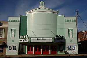
- Cedartown Performing Arts Center
- Cedartown Museum of Coca-Cola Memorabilia
- Doug Sanders Golf Museum
Historic places listed on the National Register of Historic Places include:
- Cedartown Commercial Historic District
- Cedartown Waterworks-Women's Building-Big Spring Park Historic District
- Hawkes Children's Library
- Northwest Cedartown Historic District
Parks and Outdoor Fun
- The Silver Comet Trail is a paved path for walking, biking, and rollerblading. It's free to use and is 61.5 miles long. It starts near Atlanta and ends near Cedartown at the Georgia/Alabama state line.
- Peeks Park is a city park in Cedartown. It has playgrounds, picnic areas, tennis courts, and walking paths. It's a great place for kids and pets.
- Hightower Falls opened to visitors in 1972. It has a history that goes back to the 1800s.
Education in Cedartown
The Polk County School District serves students from pre-school through twelfth grade. It has six elementary schools, two middle schools, and two high schools. The district has many teachers and over 7,000 students.
Getting Around Cedartown
It's easy to get to big cities like Atlanta, Birmingham, and Chattanooga from Cedartown. This is because U.S. Highway 27 has been expanded to four lanes. Soon, U.S. 27 will be four lanes all the way north to the Tennessee state line.
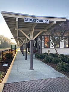
Passenger train service to Cedartown stopped in 1969. The old train station was torn down. However, the city built a replica of the historic depot. This new building now serves as a Welcome Center and the start of the Silver Comet Trail. Train tracks are still used in Cedartown today.
The city also has bus service with routes to nearby Rockmart. The closest major bus station is in Rome, Georgia, about 20 miles north.
The nearest big airport is Hartsfield-Jackson Atlanta International Airport in Atlanta, about 70 miles southeast. There are shuttle services available to get there.
Cedartown in Movies
- The movie Jayne Mansfield's Car (2012) was filmed in Cedartown. It shows the historic downtown area.
Famous People from Cedartown
- Ray Beck: A football player who played for Georgia Tech and professionally.
- Edgar Chandler: A football player for the University of Georgia and professional teams.
- Nick Chubb: A University of Georgia football player who now plays for the NFL Cleveland Browns.
- Ida Cox: A famous American singer known for her blues music. She was called "The Uncrowned Queen of the Blues" and lived in Cedartown as a child.
- Betty Reynolds Cobb: An author and activist. She was the first woman in Georgia to become a lawyer.
- Phil Douglas: A Major League Baseball player who played for the World Series Champion New York Giants.
- Korbin Forrister: A NASCAR driver.
- Ethel Harpst: The founder of the Harpst House.
- Agnes Ellen Harris: An important educator.
- Seale Harris: A physician and researcher known for his ideas about low blood sugar.
- Sterling Holloway: A stage and movie actor. He was famous for being the voice of Walt Disney's Winnie the Pooh. He was born and grew up in Cedartown.
- Jan Hooks: An actress and comedian, known for being on Saturday Night Live. She is buried in Cedartown.
- Sam Hunt: A popular American singer and songwriter.
- Lulu Hurst: Also known as the "Georgia Wonder," she was a stage magician born near Cedartown. She was known for showing amazing physical strength, but later said her acts were clever tricks.
- Doug Sanders: A professional golfer who won many tournaments.
See also
 In Spanish: Cedartown (Georgia) para niños
 | Emma Amos |
 | Edward Mitchell Bannister |
 | Larry D. Alexander |
 | Ernie Barnes |


