
Chino Creek facts for kids
Quick facts for kids Chino Creek |
|
|---|---|

View downstream from Central Avenue bridge in Chino Hills
|
|
| Country | United States |
| State | California |
| Counties | Los Angeles, San Bernardino, Riverside |
| District | Pomona Valley |
| Cities | Pomona, Chino, Chino Hills |
| Physical characteristics | |
| Main source | Southern Pomona Los Angeles County 780 ft (240 m) 34°02′12″N 117°45′29″W / 34.03667°N 117.75806°W |
| River mouth | Santa Ana River Riverside County 489 ft (149 m) 33°54′08″N 117°38′35″W / 33.90222°N 117.64306°W |
| Length | 12.7 mi (20.4 km), Southeast |
| Basin features | |
| River system | Santa Ana River basin |
| Basin size | 218 sq mi (560 km2) |
| Tributaries |
|
Chino Creek is an important stream in Southern California. It flows through the Pomona Valley and the western Inland Empire region. It's like a smaller river that flows into a bigger one, the Santa Ana River.
Contents
Chino Creek's Journey and Basin
Chino Creek might seem short, only about 12.7 miles (20.4 km) long. But it collects water from a very large area called a drainage basin or watershed. This basin covers about 218 square miles (560 km²). It stretches from the San Gabriel Mountains all the way to the Santa Ana River near Corona.
The creek's watershed spreads across three counties: Los Angeles, San Bernardino, and Riverside. It also touches parts of seven different cities.
Where Does Chino Creek Start and Flow?
Chino Creek begins underground in a storm drain channel in southern Pomona. This is in eastern Los Angeles County.
- The stream soon enters southwestern San Bernardino County.
- It flows generally southeast through the Chino Valley.
- It runs between the Chino Hills to the south and the city of Chino to the northeast.
- One of its main branches, San Antonio Creek, joins from the left. This happens about 2 miles (3.2 km) downstream from Pomona.
- San Antonio Creek starts in the San Gabriel Mountains. It drains the northern part of the Chino basin. It's actually longer than Chino Creek itself before they meet!
- From there, Chino Creek flows mostly alongside the Chino Valley Freeway (State Route 71). It goes through an area with many factories and farms in Chino.
- About 6 miles (9.7 km) before it reaches its end, the stream changes. It goes from a concrete channel to a natural dirt channel.
- The creek then enters the El Prado Golf Course and turns south.
- The last part of the creek is mostly marshland. This area is inside the Prado Flood Control Basin, behind the Prado Dam. Most of this section is in Riverside County.
- Another important branch, Mill Creek, joins from the left within the Prado Basin.
- Finally, Chino Creek flows south to meet the Santa Ana River. This meeting point is just north of the dam, about 2.5 miles (4.0 km) east-northeast of Corona.
Understanding the Chino Creek Watershed

The Chino Creek watershed covers 218 square miles (560 km²). Most of it is in southwestern San Bernardino County. This area includes the lower slopes of the San Gabriel Mountains and the flat plains south of them.
- Almost 55% of the basin is developed with homes and businesses. Big cities like Rancho Cucamonga, Ontario, Upland, Pomona, and Chino are in this area.
- About 20% of the watershed is wild land, mostly in the mountains within the Angeles National Forest.
- The remaining 25% in the south is used for farming, especially for raising livestock like cows.
The Chino Creek watershed is known for having a very high number of dairy farms in the United States. One study found that a 50 square mile (130 km²) farming area in the southern part of the basin had up to 400,000 cows! The waste from these farms has caused high levels of nitrates and salt in the creek.
To help clean the water, the Chino Creek Wetlands conservation area was created in 2008 near where the creek meets the Santa Ana River. This preserve is 22 acres (8.9 ha) and has special wetlands that help filter out pollutants from the stream.
Chino Creek Through Time
Chino Creek has a long history with people living in the area.
Early History and Farming
- From the 1770s to the 1830s, the land around Chino Creek was used for grazing animals by the Mission San Gabriel Arcángel.
- In 1841, a large part of the creek's path became part of Rancho Santa Ana del Chino. This was a Mexican land grant.
- In the late 1800s, American settlers arrived. They built small towns where the creek met the Santa Ana River, like Rincon (now called Prado).
- Farming grew a lot in the flat area between Chino Creek and the Santa Ana River, known as the Chino Basin. This was because the soil was rich, the land was flat, and there was plenty of water.
- Farmers grew crops like citrus fruits, alfalfa, and sugar beets.
- Dams were built on Chino Creek, and many miles of irrigation channels were dug. However, because the creek didn't always have a lot of water and could have sudden floods, this system wasn't always very effective.
Modern Changes and Flood Control
- As cities grew in the 20th century, more buildings meant more urban runoff (water flowing off paved areas). This increased the risk of flooding, causing more damage to properties near the streams.
- In the 1960s, parts of Chino Creek and most of its smaller streams were changed into concrete channels. This was done to make floodwaters flow away faster. However, this also greatly harmed the natural environment of the creek.
- Today, the channelized parts of lower Chino Creek can handle a lot of water during floods.
- The San Antonio Dam was built in 1956 by the United States Army Corps of Engineers to help control floods from the upper San Antonio Creek.
Where Chino Creek is Crossed
Here are some of the places where roads cross Chino Creek, listed from upstream (where it starts) to downstream (where it ends). We've also included where other streams join Chino Creek to help you understand the locations.
|
|
Images for kids
-
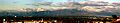
Panorama of the Chino Creek watershed looking from Chino towards the San Gabriel Mountains
