Coarsegold, California facts for kids
Quick facts for kids
Coarsegold
|
|
|---|---|

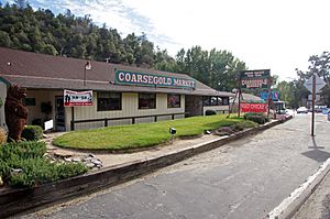
Coarsegold Market
|
|

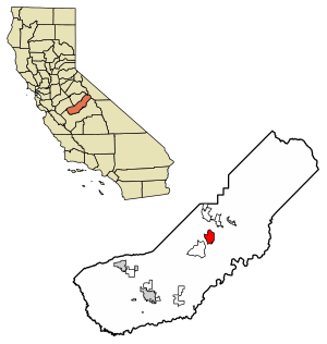
Location in Madera County, California
|
|
| Country | |
| State | |
| County | Madera |
| Area | |
| • Total | 17.29 sq mi (44.79 km2) |
| • Land | 17.23 sq mi (44.62 km2) |
| • Water | 0.07 sq mi (0.17 km2) 0% |
| Elevation | 2,218 ft (676 m) |
| Population
(2020)
|
|
| • Total | 4,144 |
| • Density | 240.54/sq mi (92.87/km2) |
| Time zone | UTC-8 (Pacific (PST)) |
| • Summer (DST) | UTC-7 (PDT) |
| ZIP Code |
93614
|
| GNIS feature IDs | 258494; 2628719 |
| FIPS code | 06-14288 |
Coarsegold is a small town in central California, located in Madera County. In 2020, about 4,144 people lived there. It is called a "census-designated place" because it is a community that the U.S. Census Bureau defines for statistical reasons.
Coarsegold is special because it is Madera County's last "gold town" from the old days. It also has a rich Native American history. It is the main home of the Picayune Rancheria of Chukchansi Indians, a tribe officially recognized by the government. The town celebrates its old "frontier" culture with fun events like the Coarsegold Rodeo and the Tarantula Awareness Festival. Coarsegold is found between the city of Fresno and Yosemite National Park. Its location along Highway 41 makes it a good place for people who are retired or who travel to work.
Contents
Human History
Native People
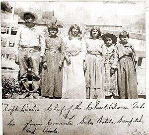
The Chukchansi people have lived in the Coarsegold area for more than 8,000 years. They are part of a larger group called the Yokuts. These groups are known for their similar languages and cultures. About 60 tribes in the Central Valley shared many traditions. However, each tribe also had its own unique way of speaking.
When gold was discovered, it brought big changes for the Chukchansi. They lost much of their land and many people got sick from new diseases. Their way of life was greatly disturbed. The government also forced some children to go to boarding schools. These events caused the number of native people to drop a lot.
Gold Rush
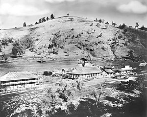
In 1849, gold was found in Coarsegold. Soon, miners spread out across the area, especially along the Fresno River. By 1852, a small town started to grow where the river could be crossed easily. John Ledford and George M. Carson built a trading post there. It was made of adobe and had a store, a saloon, and living spaces.
The trading post was later owned by J.L. Hunt and J.R. Roan. During this time, goods were hard to find and very expensive. Whiskey and flour cost a lot. The area was known as The Crossing. It was a rough place where miners often fought, and many were buried on a nearby hill.
The Crossing was also where the first tourists started their trip to Yosemite Valley. It was important for the community's history. The first private school in California was even located there. The area had problems like horse thefts and robberies at gold mines. Chinese people living there also faced theft. To deal with these problems, local people formed a vigilante group to keep order.
In 1856, Fresno County was created, and Coarsegold became part of it. The gold found here was very valuable. This led to building schools and more mines. Theodore Thure Strombeck was an early settler. He was part of the Mariposa Battalion and the local vigilante group.
Coarsegold has had many names over time. These include "Coarse Gold," "Gold Gulch," "Michaels," "Oro Grosso," and "Texas Flat." It was first called "Texas Flat" because miners from Texas found gold there in 1849. By 1874, it was called "Michaels" after a local store owner, Charles Michaels. A nearby mining camp where Mexican miners lived was called "Oro Grosso." This is Spanish for "coarse gold." The current name comes from the California Gold Rush in the mid-1800s. Prospectors found large, coarse pieces of gold in a nearby creek. At one point, dozens of gold mines were working in the area.
Stagecoach Era
By the 1860s, Coarsegold became a well-known stop for people going to the mountains. They went there for raising cattle, farming, and cutting lumber. The town became even more popular after a wagon road to Yosemite Valley was finished in 1876. This road brought tourists from all over the world. However, in the 1880s, Coarsegold saw less traffic. A new road was built that went directly from Yosemite to the mining areas in Grub Gulch and Ahwahnee.
The Coarse Gold Gulch post office opened in 1878. Its name changed to "Goldgulch" in 1895. Then, in 1899, it became "Coarsegold."
Picayune Rancheria
By the early 1900s, the number of Native Americans in California, including the Chukchansi, had greatly decreased. The U.S. government tried to help by creating "Rancherias" in 1902. These were smaller than reservations. They were meant to provide places for tribes to live and find food. The Rancheria at Picayune was given to the Chukchansi in 1912. This was a way for the government to officially recognize their land rights, even if it was a limited amount of land.
Geography
Coarsegold is located on Highway 41. It is between Fresno and the southern entrance to Yosemite National Park. The town is about 2,218 feet (676 meters) above sea level. Fresno is about 38 miles (61 km) to the south. The south entrance of Yosemite is about 23 miles (37 km) to the north.
Nearby towns include Oakhurst, which is 8 miles (13 km) north. Yosemite Lakes Park is 8 miles (13 km) to the southwest. Indian Lakes Estates is 5 miles (8 km) southeast of Coarsegold's center.
The area of Coarsegold is about 17.3 square miles (44.8 km²). Only a tiny part, about 0.1 square miles (0.3 km²), is water. Coarse Gold Creek flows through the area. It is a small stream that flows south into the Fresno River.
Climate
Coarsegold has a Mediterranean climate. This means it has hot, dry summers and cool, wet winters. The average rainfall each year is about 27.29 inches (69.3 cm). The area is in hardiness zone 8b, which tells you what plants can grow there.
| Weather chart for Coarsegold | |||||||||||||||||||||||||||||||||||||||||||||||
|---|---|---|---|---|---|---|---|---|---|---|---|---|---|---|---|---|---|---|---|---|---|---|---|---|---|---|---|---|---|---|---|---|---|---|---|---|---|---|---|---|---|---|---|---|---|---|---|
| J | F | M | A | M | J | J | A | S | O | N | D | ||||||||||||||||||||||||||||||||||||
|
5.2
54
36
|
4.8
57
39
|
4.3
61
41
|
2
67
45
|
1
78
52
|
0.3
87
60
|
0.1
93
67
|
0.1
92
66
|
0.4
86
61
|
1.5
75
52
|
2.6
61
42
|
4.2
54
36
|
||||||||||||||||||||||||||||||||||||
| temperatures in °F precipitation totals in inches source: Weather.com |
|||||||||||||||||||||||||||||||||||||||||||||||
|
Metric conversion
|
|||||||||||||||||||||||||||||||||||||||||||||||
Demographics
| Historical population | |||
|---|---|---|---|
| Census | Pop. | %± | |
| 2010 | 1,840 | — | |
| 2020 | 4,144 | 125.2% | |
| U.S. Decennial Census | |||
The 2020 United States Census showed that Coarsegold had a population of 4,144 people.
Coarsegold is different from the rest of California in a few ways. The average age in Coarsegold is 40.5 years, which is older than the state average of 37.9. A large number of homes, 90%, are owned by the people who live in them. This is much higher than California's average of 55.8%. Also, fewer people in Coarsegold speak a language other than English at home (7.1%) compared to the state (44.4%).
The average household income in Coarsegold is $81,814. This is a bit lower than California's average of $91,551. However, fewer people live in poverty in Coarsegold (8.2%) than in California (12.2%). The town's employment rate is 49.8%, which is less than the state's 60.0%. Also, 22.7% of residents have a bachelor's degree or higher, which is less than the state's 37.0%.
Coarsegold has fewer people who were born outside the U.S. (3.9%) and fewer non-English speakers than California overall. But it has a high number of veterans (17.8%). It also has many older people, with 27.0% of residents being over 65. This is higher than the state's 15.8%.
Finally, people in Coarsegold spend more time traveling to work. Their average commute is 41.7 minutes. This is longer than the state average of 28.3 minutes.
Culture
Since 2008, classes to learn the Chukchansi language have been offered at the local elementary school in Coarsegold. By 2012, these classes were also open to adults.
The Coarsegold Rodeo started in 1953 to celebrate the town's 100th birthday. It is now an annual tradition. The rodeo happens every year on the first weekend of May.
Also, the Tarantula Awareness Festival is held every year in Coarsegold. This event takes place when local tarantulas are looking for mates. It also marks the start of cooler weather and autumn rains. It is a chance to learn about and see these spiders in their natural home.
Notable residents
- Creed Bratton, actor and musician; grew up in Coarsegold
- Richard Kiel, actor; lived in Coarsegold from 1980 to 2002
- Lee Newton, actress; grew up in Coarsegold
- Anthony Ruiz, mixed martial artist
- Grace Lee Whitney, actress; lived in Coarsegold from 1993 until her death in 2015
Media
The 1993 adventure game Freddy Pharkas: Frontier Pharmacist is set in a made-up Coarsegold from the 1880s. It was made by Sierra On-Line, which was based in nearby Oakhurst. The company also released Cranston Manor in 1981, another game set in Coarsegold.
The Coarsegold mining site is where the stars Joel McCrea and Randolph Scott go in the 1962 film Ride the High Country.
See also
 In Spanish: Coarsegold (California) para niños
 | Toni Morrison |
 | Barack Obama |
 | Martin Luther King Jr. |
 | Ralph Bunche |


